
|


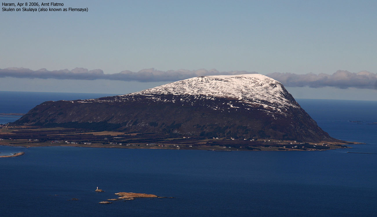
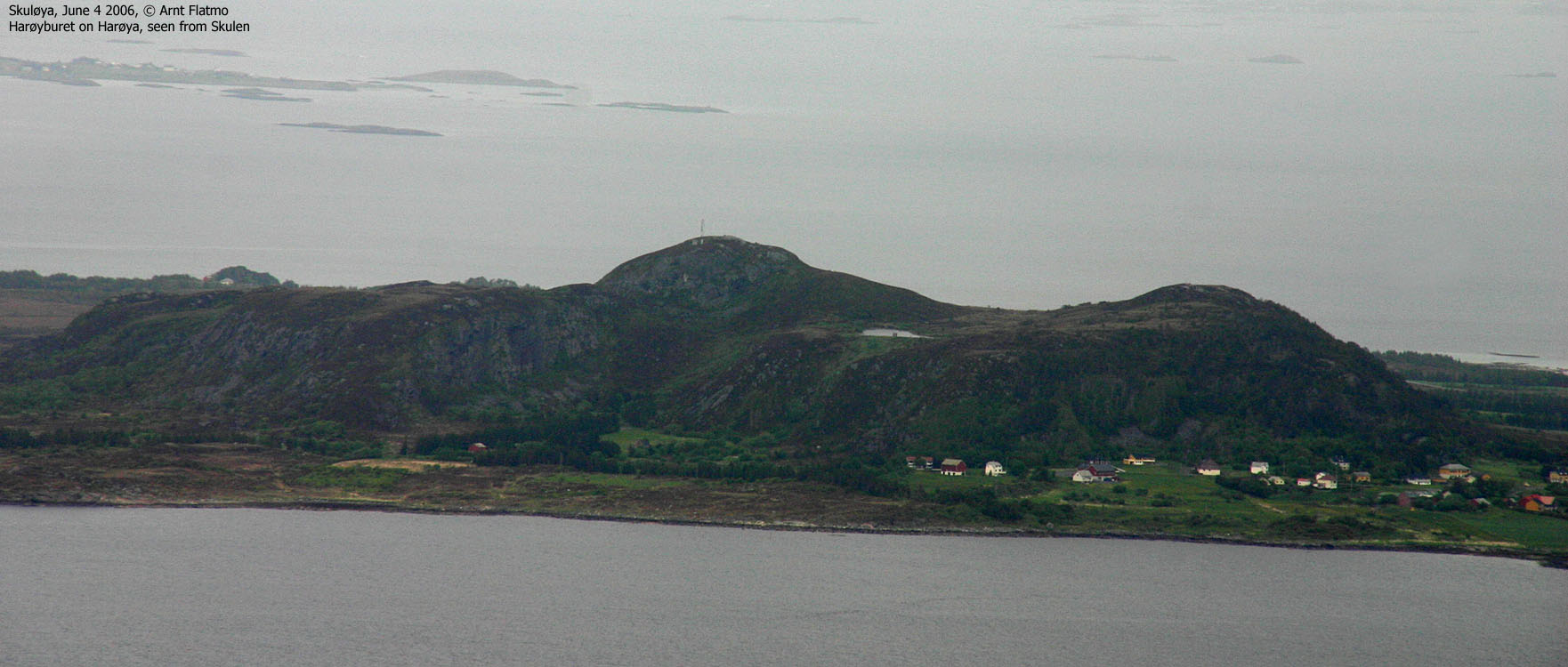
Nordøyane (The northern islands) is a group of islands located northwest of the place Brattvåg in Haram kommune. The island group span Løvsøya (Lepsøya), Haramsøya, Skuløya (Flemsøya), Fjørtofta and Harøya. Skulen (493m) on Skuløya is the highest top on these islands, 3m higher than Goaldet on Løvsøya.
Several paths run from (close to) sea level up to the top of Skulen, but the route described on this page has a high start (220m elev.) because of a forest road that runs high up on the northwest side of the island.
The island is commonly refered to as Skuløya/Flemsøya. A fairly normal scenario is that the name of a mountain vary depending on who you talk to. In this case, the mountain name (Skulen) is agreed upon, but not the name of the island.
Put the name issues aside and come out to enjoy the beautiful views from this top, and the beautiful northern coastline on the island. In order to get to Skuløya/Flems&søya, you have to take a ferry from Skjeltane between Søvik and Brattvåg. Depending on the ferry, you may have to stop by Løvsøya/Lepsøya before it continues towards Haramsøya. From Haramsøya, a bridge takes you over to Skuløya/Flemsøya. Passenger vessels can also help you go "island hopping" using your bike. Visit fjord1.no for schedules and options.
Skulen (M711: 493m, Ø.K.: 492,59, UTM 32 V 362402 6952345) has a primary factor of 493m, being the island high point.
My GPS reported 495m (on the ground) as average over a 5-minute period.
Notes: Class ratings are in reference to YDS. Click here for more information.
The trails described below are not necessarily the *easiest* trails to this mountain.
|
Bergedalen - Skulen (summer/autumn)
|
|

Access
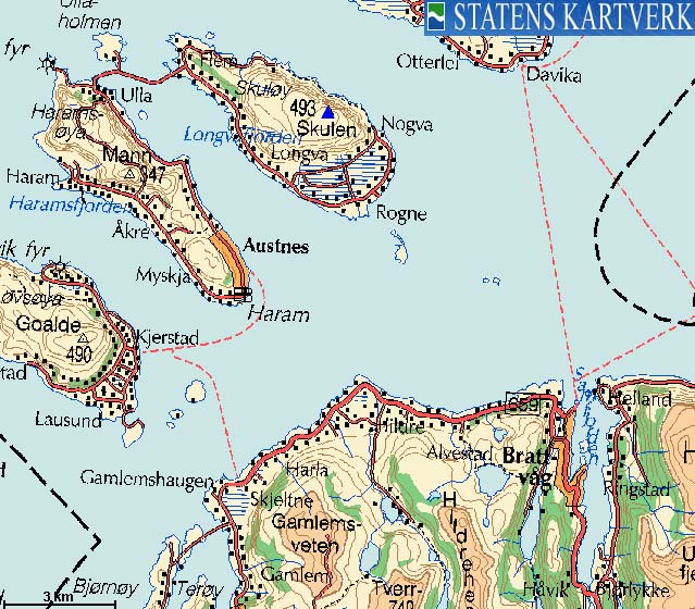
From Ålesund, follow highway E136->E39 towards Åndalsnes. From the E136/E39/Olsvika roundabout near Breivka, follow E39 approx. 13,3Km. Turn left onto highway RV661 (Skodje/Brattvåg/Vatne). After 1,5Km, pay toll at an unmanned toll booth (coins + credit cards + AutoPass). Approx. 9,7Km after you left E39, you reach the RV659 (Brattvåg)/661(Vatne) junction. Turn left here.
You have two options; a) either drive to Skjeltene via Brattvåg (23,3Km) or b) via Søvik (24,1Km). Take the Skjeltene - Haramsøya ferry (which may run via Løvsøya).
On Haramøya, drive up to the road junction, turn right and drive 9,5 to the Rogne/Austnes junction. Turn right (Rogne) and drive 1Km. Turn left onto a paved road. Take the first road to the left after 100m and follow the (now gravel) road all the way up the parking area in Bergedalen, next to the "Skulen" trailsign.
The route
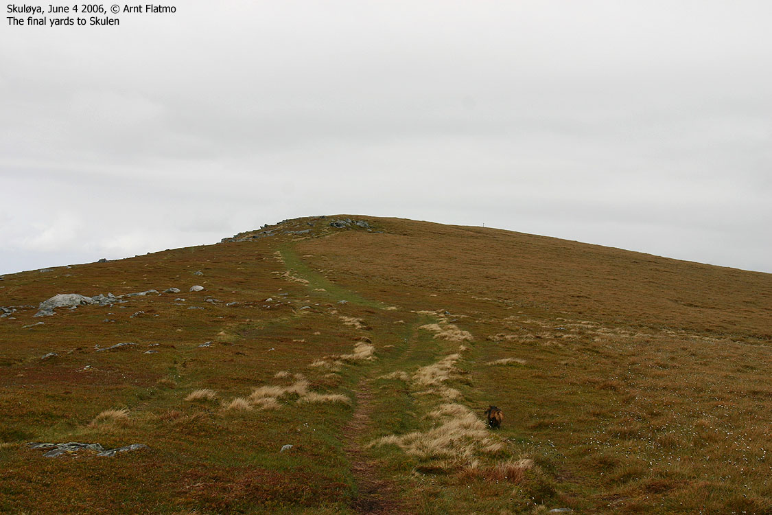
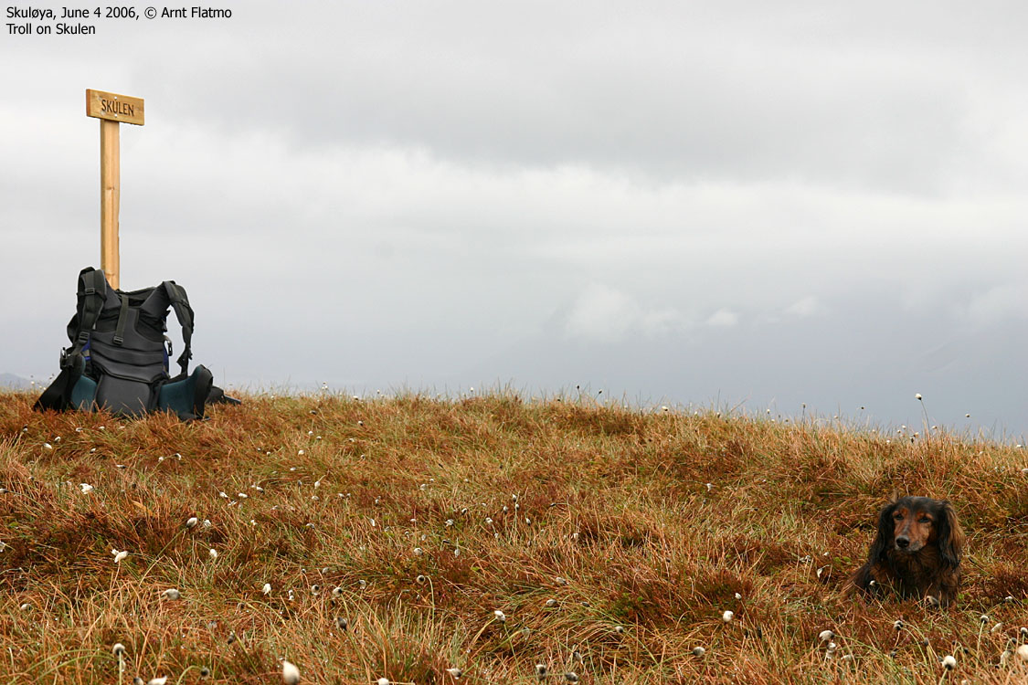
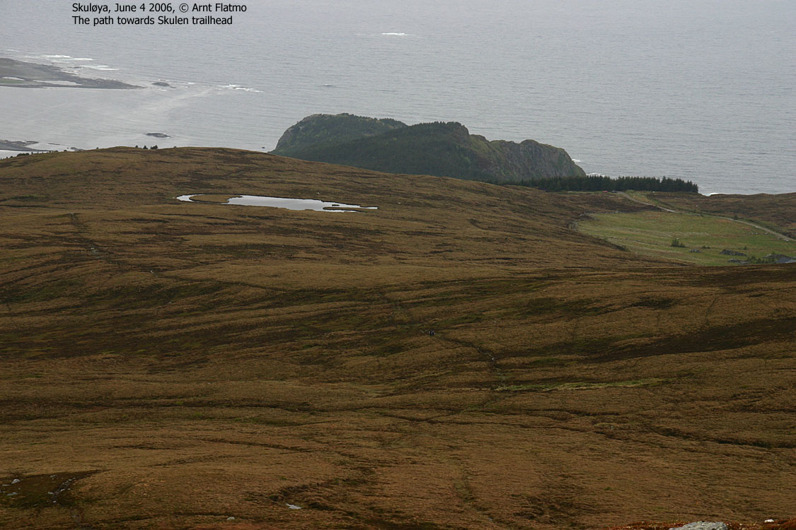
From the "Skulen" trailsign, follow path across the long meadow before entering Skulen's southwest shoulder (Skulesida). The summit is marked by a "Skulen" sign on a wooden pole.


This was a tremendously miserable Sunday morning. In Ålesund, it was raining, and the fog was covering the local tops. I had only two tops left to visit in Haram kommune - Skulen and Mannen (Haramsøya). I packed the raingear in the backpack and prepared myself for a rainy and wet day on the Nordøyane islands.
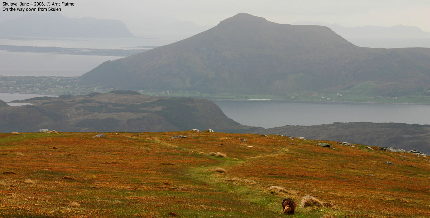
I drove to Skjeltane and had to wait half an hour for the ferry. That gave me time to think back on the last time I was here. It was raining back then also, and I walked through fog until I reached the top of Goaldet. Then it cleared up, and everything was suddenly quite alright. Perhaps this would happen today also? Or perhaps not. I could barely see the contours of Skulen across the fjord.
Lo and behold, it stopped raining as I drove onto Skuløya/Flemsøya. I asked a couple about the best route, and they sent me up a forest road which took me above the forest, 2,1Km west of Skulen. I took a look at the boggy meadow between myself and the mountain, and knew immediately that I would have to carry the dog today (also). However, once I let him out of the car, he was on the path and there was no stopping him. This good fortune had a name - a she-dog named Laika, seemingly smelling quite alright. We later met Laika high on Skulen.
We left the trailhead 14:05PM, and Troll "plowed" through the bog and waterpits like never before. Good to see that his instincts are intact. I feel bad about the fact that he never got around to "do it". Not that he never had opportunities. A few years ago, I drove from Bergen up to Dalsbygda in Sogn and Fjordane. The purpose of the trip was to mix Troll and a local bitch, hoping cute puppies would be the outcome. Instead of doing "his thing", he ran around the entire farm, marking every possible spot. Once done, he was tired and the bitch had lost interest. I never took the trip again.
We reached the top of Skulen 14:45PM. The weather was only getting better, although it was still a grey day. The north shore looked nice, and I made a mental note about coming back here one day. We turned around after 10 minutes and were back at the trailhead 15:35 after spending 15-20 minutes talking to hikers on the way up. Next stop: Mannen on Haramsøya.
To Skulen


Wide-angle view from Skulen

Other pictures from Skulen


Descent


No Javascript:
1 2 3 4 5 6 7 8 9 10 11 12 13 14 15 16 17
 westcoastpeaks.com
Other Møre & Romsdal mountains
Other Norwegian mountains
westcoastpeaks.com
Other Møre & Romsdal mountains
Other Norwegian mountains

