
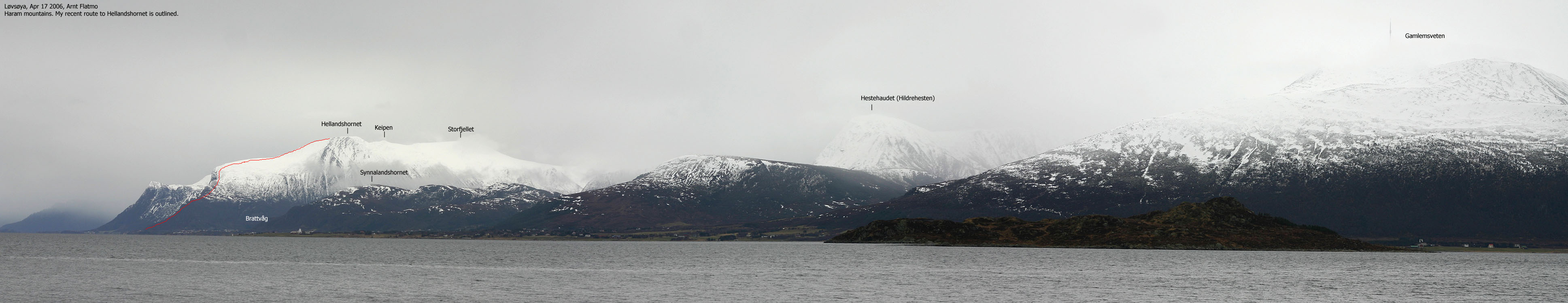
|


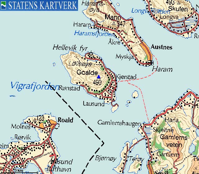
Goaldet (also known as Goalden, Goalde, Gohaldet, Gohalden, etc..) is the high point on Løvsøya island (also known as Lepsøya, one of four islands known as "Nordøyene" - the northern islands). The island is located approx. 14Km N-NE of the city of Ålesund, but the drive is substantially longer. You have to take the Skjeltene - Lepsøya ferry in order to get there by car. Note that the correct name for this island is "Lepsøya" (as of 1991), but I always refer the current map on this site.
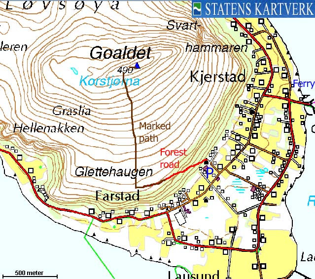
There are several paths that leads to the summit. This page describes a route that runs up the south side of Goaldet, but you can get to the northern trailhead by driving 3Km from the Rønstad/Hellevik junction 400m from the ferry. The path up the south side should fit everyone.
Goaldet (M711: 490m, Ø.K.: 490,11m, UTM 32 V 355852 6946300) has a primary factor of 490m, being the island high point.
My GPS reported 496m (top of cairn) as average over a 5-minute period.
Notes: Class ratings are in reference to YDS. Click here for more information.
The trails described below are not necessarily the *easiest* trails to this mountain.
|
Sanitetshuset - Goaldet (summer/autumn)
|
|


Access
From Ålesund, follow highway E136->E39 towards Åndalsnes. From the E136/E39/Olsvika roundabout near Breivka, follow E39 approx. 13,3Km. Turn left onto highway RV661 (Skodje/Brattvåg/Vatne). After 1,5Km, pay toll at an unmanned toll booth (coins + credit cards + AutoPass). Approx. 9,7Km after you left E39, you reach the RV659 (Brattvåg)/661(Vatne) junction. Turn left here.
You have two options; a) either drive to Skjeltene via Brattvåg (23,3Km) or b) via Søvik (24,1Km). Take the Skjeltene - Løvsøya ferry. On Løvsøya, drive 400m up to the Rønstad/Hellevik junction and turn left. Drive 800m and turn right (marked "Fjellvei"). Drive 100m up to the parking in front of the NKS building.
The route
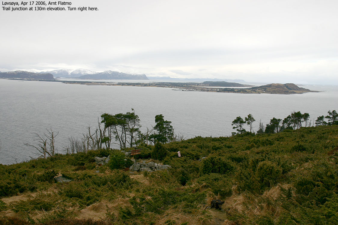
Pass the NKS building on the right-hand side and follow the forest road up to 130m elevation. Continue on marked path to 150m elevation where the path turns sharp to the right (north). Follow this path to the summit, marked by a cairn and a broken trig. point.


Two days at home with a bad back was more than I could handle. It was the last day of Easter, and since I had the full day available to me, I decided to drive to Haramsøya and Skuløya to visit Mannen and Skulen. The weather wasn't good at all, and while waiting for the ferry at Skjeltene in pouring rain, I changed my mind and settled on Løvsøya instead.
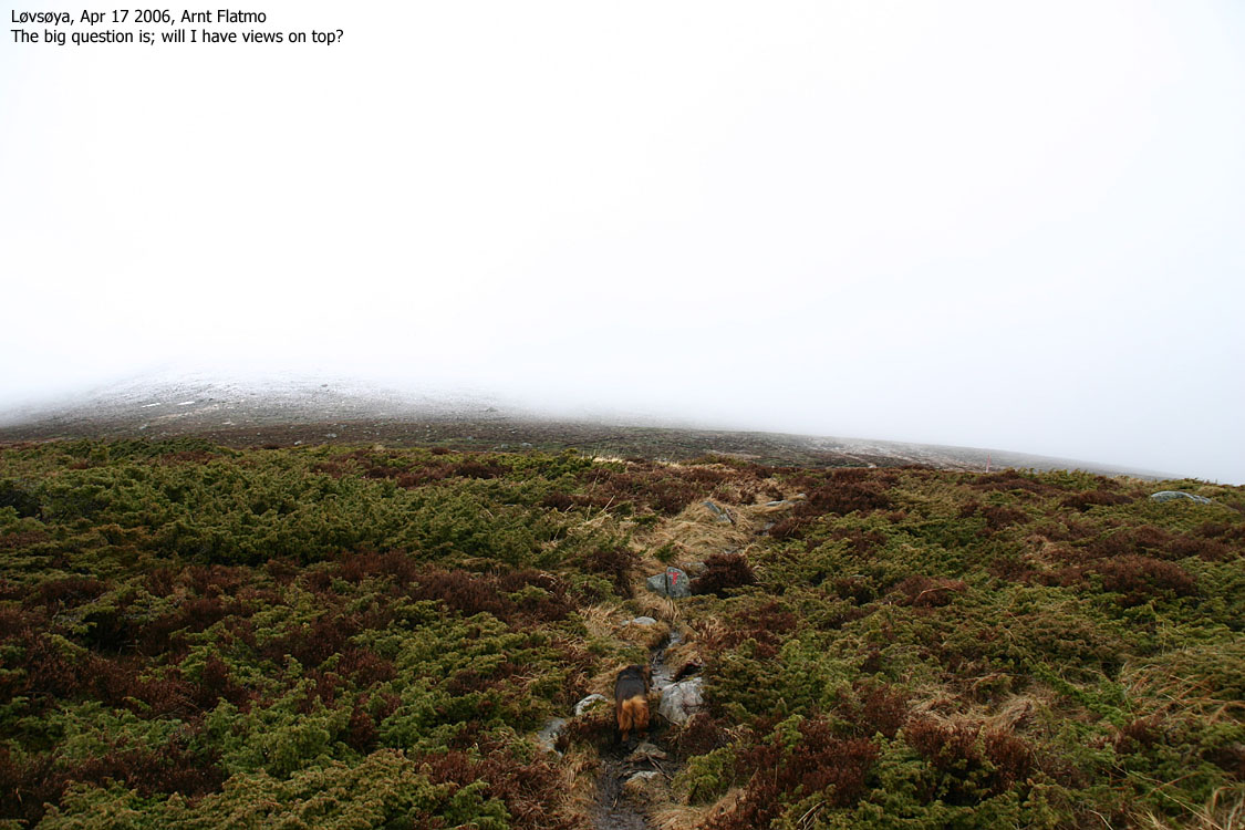
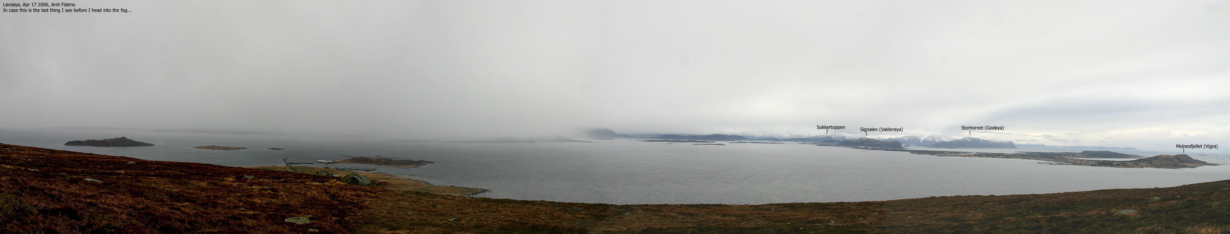
The question "what am I doing here?" came to mind several times when I looked towards Goaldet. The fog hung low, down to 200m elevation. There were dozens of tops further inland, that had sunshine. But an "inner voice" told me to "hang in there" and I decided to follow this voice. Just as I drove onto Løvsøya, it stopped raining and the fog started to lift. I found the trailhead right away, thanks to signs. My dog "Troll" and I left the trailhead 11:30AM and had a nice walk up the forest road. I chatted with a couple of hikers coming down the mountain, and was told the snow-depth was insignificant. My back was aching, but only in a given position. Leaning forwards was OK.
On the wet path up the mountain side, the dog slowly lost his motivation, and I had to convince him that there was a pot of bones at the top. This worked, and he slowly increased pace and soon took the lead. 100m below the summit, the fog lifted, and I knew that I would have views on top. Inner voice - thank you!
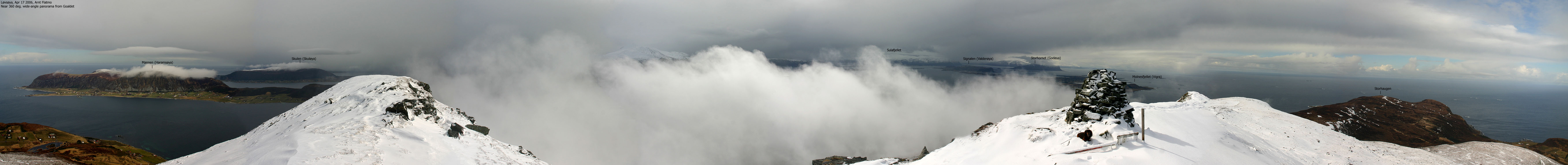
We reached the top 12:30PM and I managed to capture a panorama onto disk before the fog closed in again. It was lovely to be up there. The light was immensly bright, and the fresh snow made a brilliant contrast to the spring a few hundred below the top. We left the top after a few minutes, and Troll quickly led the way. I had to run to keep up with him, which was insanely painful on my back. I had a faint hope that this bumpy ride down the mountain would do some good, but of course it didn't.
We were back at the trailhead 13:00PM, and I saw the ferry leaving. Oh well, it is still a fine day, and I decided to take a drive to the north side of the island. I was back at the ferry 13:21PM, only to see that the 13:20PM ferry to Haramsøya left. By taking this ferry, I would have been on the mainland 30 minutes before the 14:35PM ferry that I now had to wait for. I took a drive to the west side of the island before spending an hour waiting for the ferry. I arrived the house nearly 6 hours after leaving it, which is a long time considering the 1,5 hour hike...
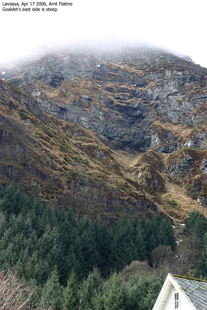
To Goaldet


Near 360 deg. wide-angle panorama

Post-hike pictures


No Javascript:
1 2 3 4 5 6 7 8 9 10 11 12 13 14 15 16 17 18 19 20 21
 westcoastpeaks.com
Other Møre & Romsdal mountains
Other Norwegian mountains
westcoastpeaks.com
Other Møre & Romsdal mountains
Other Norwegian mountains

