European Mountains,
Bulgaria
Cherni Vrah on Vitosha, 2290m (Черни
връх /Витоша)
Ushite Peak, 1906m (Връх
Ушите)
Kamen Del, 1861m (Камен дел)
| Maps : | GPS: bgmountains.org | ||||
| Primary factor : |
Cherni Vrah: approx. 1260m Ushite Peak: 96m Kamen Del: 12m |
||||
| Hiked : | July 2011 | ||||
| See also : |
| ||||
| See also : | Other European mountains on westcoastpeaks.com |
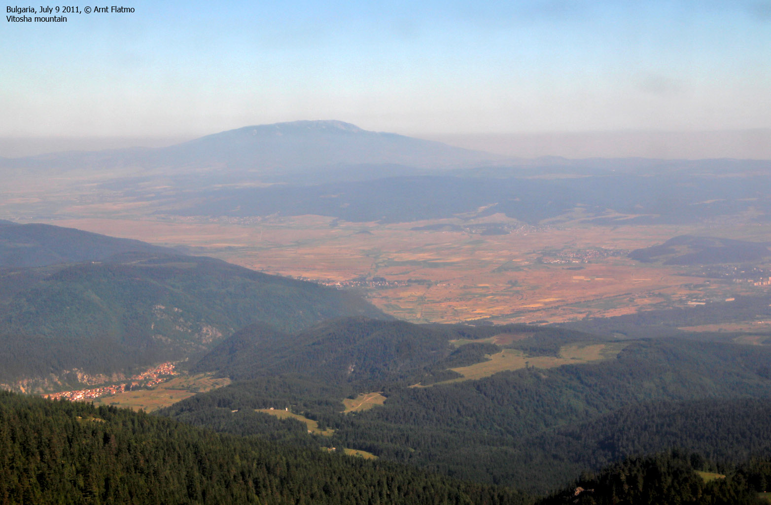
Vitosha mountain seen from gondola above Borovets

(Click for larger image)
Introduction
Vitosha is a large mountain, located immediately south of Sofia - the capital of Bulgaria. Cherni Vrah (the Black Peak) is the highest point on this mountain. The normal starting point is Aleko (1800 meters). You can get here by a gondola lift from Simeonovo or by car - up a long and winding road. The route from Aleko to the summit follows a well-worn trail being located so close to Sofia - the mountain is immensely popular.
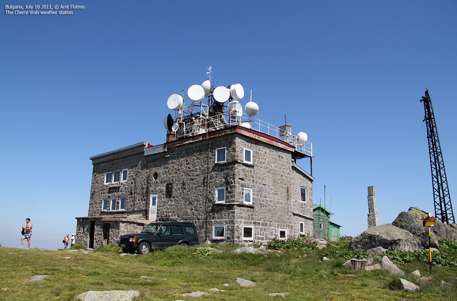
Cherni Vrah has a weather station (building) on the summit. The high point is a pointy rock in a boulder area 100 meters southeast of the summit building. Not everyone will feel comfortable when climbing up on this rock. There are additional buildings (including a radar station) 500-600 meters east of the summit. The radar dome is visible from miles and miles away...
Cherni Vrah

(Click for larger image)
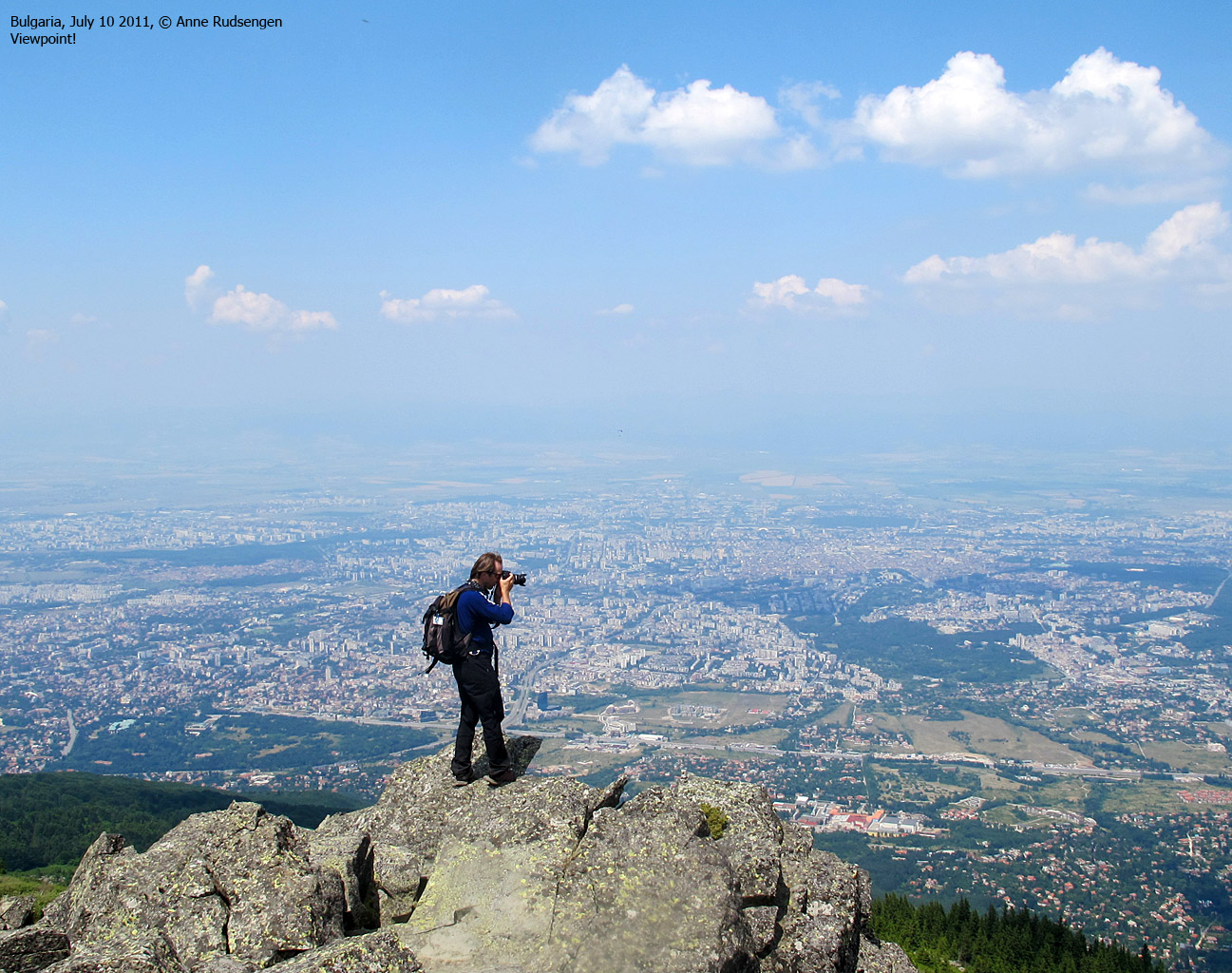
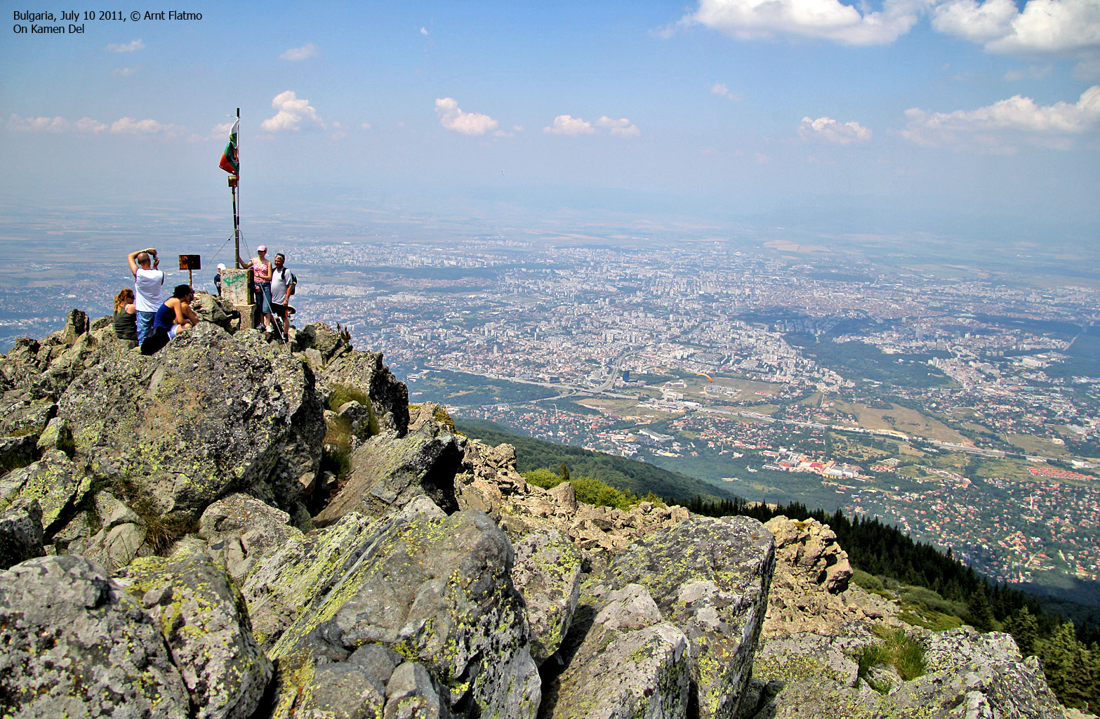
Kamen Del is a popular viewpoint, located approx. 5,4km north of Cherni Vrah. The distance from Aleko to Ushite is roughly the same as to Cherni Vrah, and many choose to hike the well-worn trail to Kamen Del instead. The view towards Sofia is second to none!
Ushite peak is an anonymous top, located 0,6km south of Kamen Del. There is no pronounced path to the summit, and if you'd like some solitude - chances are that you can find it here. Getting to the highest point requires some minor scrambling.
Sofia view from Kamen Del

(Click for larger image)
Primary factor:
Cherni Vrah (2290m, N42.56312 E23.27915) has a primary factor of 1260m according to information I have obtained.
Based on the GPS track log - and the GPS map, I have set the following (rounded) primary factor for Ushite Peak (1906m, N42.60689 E23.27446); 96m. Kamen Del's primary factor is insignificant...

Google map
Google's interactive map. You can zoom, pan and click on the markers.
|
|
|
Trail descriptions
| This disclaimer is regarding all of the literature and instructional guides posted on the westcoastpeaks.com website. These instructions are guidelines only, and should not be used in lieu of common sense or judgement when attempting any of the actions involved or instructed. Westcoastpeaks nor myself will not be liable nor will it indemnify any form of compensation to anyone who has injured, harmed or even killed themselves or others while following any of the instructions written within the website. It should be noted by any persons willing to undertake any of the instructions provided that mountains offer varying levels of risk, regardless of size or incline. Risks to be considered are as follows but not limited to: wild animals, weather, the terrain, bad judgement, inappropriate or insufficient equipment, improper training or experience and of course, bad luck... |
The route descriptions are valid per
July
2011.
|
Route 1: Aleko - Cherni Vrah (summer/autumn)
|
|
Access
(all distances are approx. distances)
The starting point for this route description is the town of Simoneovo. Use Google Maps to get the road description from Sofia Airport, Sofia, Bulgaria (if this is your starting point) to ul. Mishova ornitsa, Sofia, Bulgaria.
Locate the gondola lift (N42.61704 E23.34898). The gondola will take you 6,1km from approx. 490 meters to 1800 meters - at Aleko (N42.58318 E23.29226). You can also drive to Aleko, but the car road is not documented on this page.
Make sure you learn when the last gondola for the day leaves Aleko. It may be earlier than you think...
The route - To Cherni Vrah

From Aleko, follow a well-worn path that switchbacks upwards to the southwest. You walk along a lift that could take you even higher, but then there would hardly be hiking left to do. After 1,3km, the switchbacks end, and the route to Cherni Vrah follows a direct southwest course (see the above picture). Signposts will confirm that you are on the right track.
The summit point (N42.56312 E23.27915) is found 100 meters southeast of the summit building (weather station). Some will perceive the high point as airy and difficult. However, holding your hand on top should definitely qualify as a summit ascent...
|
Route 2: Aleko - Kamen Del & Ushite Peak (summer/autumn)
|
|
Access
(all distances are approx. distances)
The starting point for this route description is Aleko. See route #1 for further description.
The route - To Kamen Del and Ushite Peak
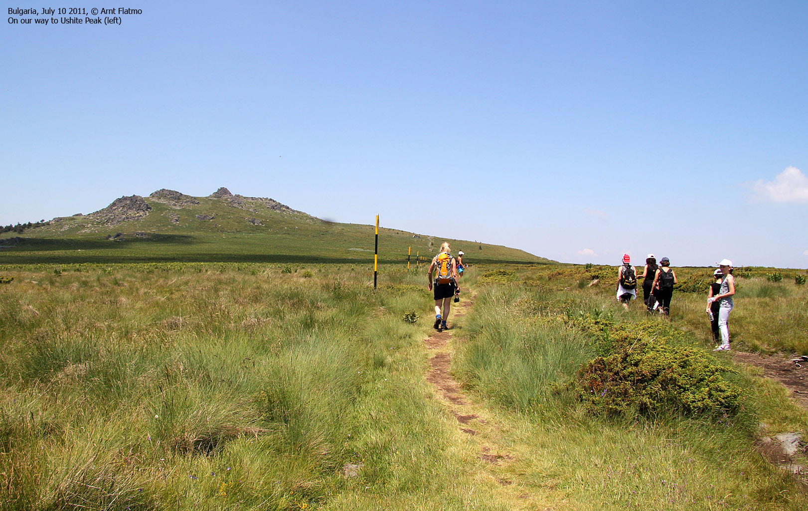
From Aleko, follow the Dragalevtsi-H.Aleko trail 0,1km to the west, then follow it for another 0,1km to the northwest before you leave this trail and follow the path that runs northeast towards Kamen Del. There are a number of paths of trail in this area, but your main objective should be to head north - across the Peat reserve.
Kamen Del (N42.61183 E23.27669) is a superb viewpoint above Sofia, and it's absolutely worth the visit. 0,6km south/southwest of Kamen Del is Ushite Peak (N42.60689 E23.27446). There is no distinct path leading to this summit, but the boulder won't give you too much trouble. Getting to the summit involves some minor scrambling.
Pictures and Trip reports:
- Cherni Vrah, Ushite Peak & Kamen Del, July 10 2011
 westcoastpeaks.com
 Other European mountains
 Other Norwegian mountains

