
Norwegian Mountains, Møre og RomsdalSylvkallen, 1310m (Sølvkallen)

Sylvkallen seen from the fjord
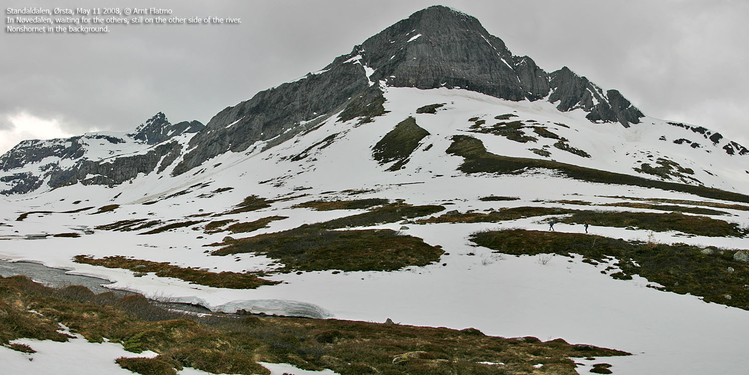
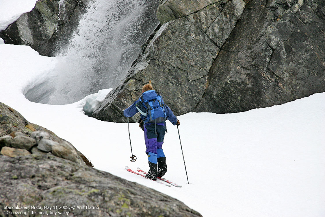
IntroductionSylvkallen (also known as Sølvkallen) rises directly up from Hjørundfjorden and is easy to identify due the distinct bowl facing north. The peak is part of a massif where Dalegubben (1344m) is the highest peak. Dalegubben is also the highest peak in the mountain range defined by Åmdalen, Standalen, Bondalen and Hjørundfjorden. Under good conditions, summer and winter, Sylvkallen is a fairly easy top to reach. Challenges may be an exposed entry into Nøvedalen (also known as Aklestaddalen) when the snow is hard (crampons may be required), and a river crossing when the river is large and all the snow bridges have melted. In case of a large river, crossing may (guesswork) be possible higher up in the valley. A "safer" approach may be to hike off-trail from Store Standal and stay east of the river all the way. While the snow on Sylvkallen's west ridge can melt early in spring, the snow will remain longer in the valley between Sylvkallen and point 1306m. As the pictures from the May 11 2008 trip report will show, it was possible to ski from the summit and "almost" all the way down to the road. Avalanche March 4 2007, a skier died in an avalanche near the normal route to Sylvkallen. Apparently, the skier had been skiing further south than what is considered to be the safe route, in the valley between Sylvkallen and point 1306m (the ridge from point 1306m towards Dalegubben is called Lemeneggene). Pictures from the rescue operation can be found on Ørsta's Red Cross site. 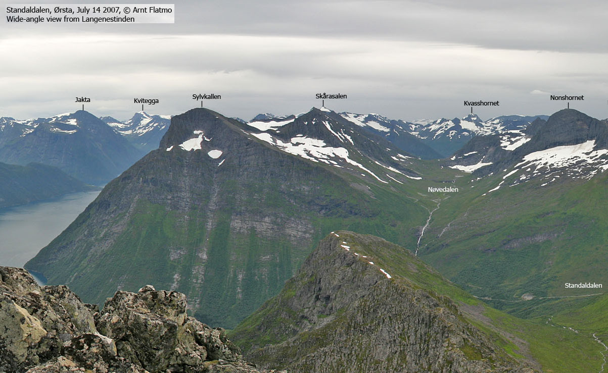
Sylvkallen seen from Langenestinden
Primary factor:Sylvkallen (Norge 1:50,000: 1310m, Økonomisk Kartverk: 1309,95m, UTM 32 V 366924 6904363) has a primary factor of 180m towards the higher parent mountain Dalegubben (1344m). The defining saddle (approx. UTM 32 V 366667 6903731) is found on the ridge towards Dalegubben. Ref. Norge 1:50,000 (20m contours), the saddle is within the contours 1120-1140m, interpolated to 1130m.
Sylvkallen seen from the air
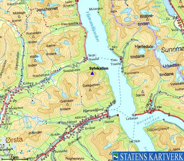
Google map
Google's interactive map. You can zoom, pan and click on the markers.
Trail descriptions
Notes: Class ratings are in reference to YDS. Click here for more information.
The trails described below are not necessarily the *easiest* trails to this mountain.
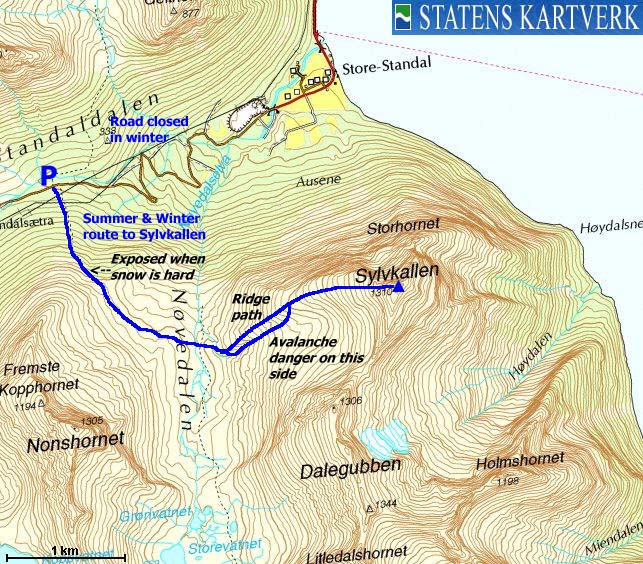
Access (all distances are approx. distances) From Ålesund, follow highway E39 towards Bergen/Volda to the ferry at Solavågen. Take the ferry over to Festøya. Turn left in the direction of Standal and follow the road 19,3Km (passing Store Standal along the way)Locate a small parking area (UTM 32 V 363908 6905187) on the right-hand side of the road. The road between Store Standal and Follestaddalen has traditionally been closed during winter, but according to standalalpesenter.no, the road is now open all year around (one of the pictures in the trip report says the road is closed in winter, but this is incorrect). Per May 2008, the road is not a toll road. The route From the parking, head straight upwards in the direction of Nonshornet. Stay right of some slabs and look for red ribbons which will guide you onto the path into Nøvedalen. Follow the Nøvedalen path until you're at the foot of Sylvkallen. Cross the river (the difficulty depends on the amount of water) and locate a marked path on the other side of the river. You'll cross a morraine and a dry river bed before you begin the proper ascent. Follow Sylvkallen's west ridge to the summit, marked by several cairns. The high point (N62.24730 E6.43792) should be obvious. In winter, you should cross into Nøvedalen as high as 630-640m elevation. A
short section is exposed, and becomes dangerous when the snow is hard or icy. In
this case, crampons are needed. Expect to find snow bridges
as you cross Nøvedalselva. If not, seek for a place to cross higher up in the
valley. Either follow the ridge all the way to the top, or if the snow
permits - ski into a small valley (Svartdalen
- more
of a corridor) south of the Sylvallen's west ridge and enter the
ridge halfway up the mountain. Keep your distance from the
cornices facing north.
Pictures and Trip reports:
|


