Asian Mountains, Bali
Gunung Agung (Mount Agung), 3031m - High point Bali,
Nov 13 2012
To the main Agung page (route descriptions and maps)
Gunung Agung (background)

(Click for larger image)
Bali?
This November, my girlfriend Anne turned ... eherrrrm .. was it thirty? Can't remember. And as a birthday present, I gave her/us a 2-week trip to Bali, Indonesia. I wasn't really too keen on such a long trip, but couldn't find many other good candidates. I wanted to do both hiking and snorkeling, but the Mediterranean didn't stand out as a very exotic region any more, especially since we had already been to Spain and Montenegro earlier in the year. I thought about the middle east, the Caribbean, and a few other places but ended up with Bali. I didn't know much about the island, other than it sounded quite exotic. And Anne took the news quite well...
Anne got hold of Bali maps and books, and we started looking for things to do there, including hiking. We knew that this was jungle terrain all over the island and that we would be dependent of guides. And there seemed to be quite a few volcanoes on the island! The only problem was that the guide books stated that the volcanoes were "closed" (due to landslides) in the rainy season. At first, we thought about postponing the trip, but then we agreed to put our faith in that the guide books were wrong, like they had been so many times before...
Getting there (Nov 8-10)
I flew from Ålesund to Oslo on Nov 8th and spent the night at an airport hotel. Anne came in from Trondheim by train the next morning and our flight to Stockholm left at 12:30pm. From Stockholm, we flew to Doha (Qatar) and then to Singapore where we had to leave the plane because of a crew change. We were guided out of - and back into the plane and had to show our boarding passes 4 times on this small detour. Quite amazing. It was tempting to express that this level of security seemed quite excessive - given the enclosed area, but decided - for good measures - to keep my mouth shut. Eventually, we continued to Denpasar (Bali) where we were picked up by a driver on mission for Apollo.
We checked into Hotel Sanur Beach at approx. 8pm. The hotel seemed very nice, and the beach was just beyond the beautiful garden. The room wasn't the finest I've seen, but there was nothing to complain about either. I might have to make an exception for mosquitoes, but hotel staff came in and sprayed the room in the evenings. It didn't seem to help much. At the airport, we took out 3,000,000 IDR from the ATM and had really no clue how far this amount of money would carry us.

Checking in

(Click for larger image)
Planning for Gunung Agung (Nov 11)
The next morning, we had a nice swim in the ocean (snorkeling), followed by a lovely breakfast. The rest of the day was spent in becoming familiar with the local region, the food, currency and more. The taxi drivers (if that's what they were) outside the hotel were constantly trying to sell us a ride. It was a bit aggravating in the end...
In the afternoon, we made contact with Gung Bawa - a mountain guide who leads treks up to Gunung Agung - the highest mountain on Bali. He said that he could take us up the mounting, including arranging transport from and to the hotel. His price seemed quite reasonable - 700,000 IDR per person (a little more than 70 dollars) compared to other guided treks we joined during our stay.
I emailed him and asked him about the weather forecast. Which day would be the best? He replied "It depends on your smile", and I assumed that it was silly to ask about the weather. It was probably gorgeous all the time. That was however not what Gung Bawa meant, but more about that later. He then proposed that we would go up the next evening and that he would arrange for someone to pick us up at 9:30pm the next day. Apparently, Mt. Agung was hiked during the night and sunrise was the big reward.
I had left Norway in the middle of go-live of a project I had been working on most of the year. That was as far from ideal as it gets, but this holiday had been planned for a long time and I assumed I would be able to stay semi-online. But just after realizing that the hotel WIFi had serious capacity issues, my cell-phone broke down. There was little left to do than simply have a holiday and have faith in my colleagues and my own deliverables.

Preparing for Gunung Agung (Nov 12)
The next day was spent at the hotel, and the day included snorkeling, badminton and basketball in the swimming pool. And good food too, of course! In the evening, a driver came into the lobby on-time and called our names. The quest for Mt. Agung was on!

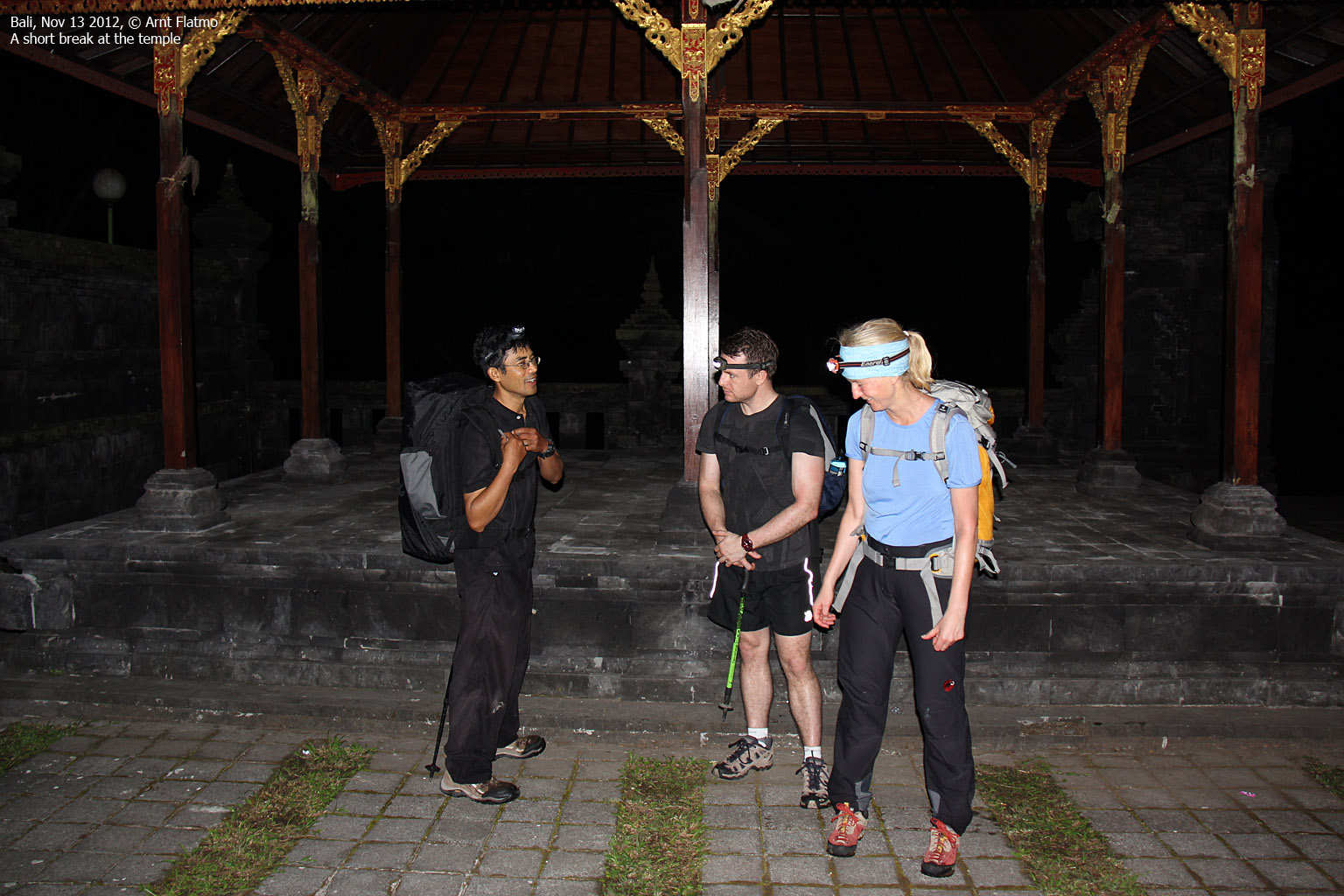
The driver drove to the town Obud where we picked up Richard Morgan - the 3rd client (in addition to Anne and me). Then we drove to a village near Selat, where we met up with Gung Bawa - our guide. After a little while, we drove to the trailhead by the Mother Temple of Besakih. The time was 11:40pm when we headed out into the night. 2100 vertical meters - here we come...
Heading out
Gung led us through the temple corridors and once we were on the other side I concluded that this would have been a quite difficult walk to do without a guide. We went into the forest and followed a trail up to a second temple - where we met another guide and two clients from Slovenia. They left as we came in.

For the next hours, the following occurred; we caught up with the other team, then we stopped for snacks, kept on walking, caught up with the others, more stops for snacks, etc. Gung's backpack seemed heavy and he kept on pulling goodies out from it. I wanted to overtake the other team as they were walking slower than us and eventually (!!) we found a place to pass.
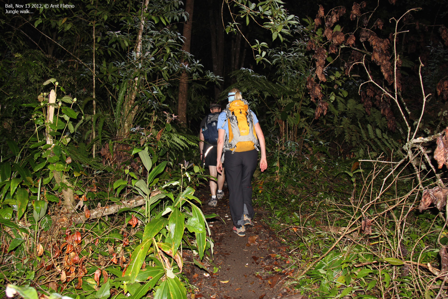
The forest trail got steeper and steeper and roots got bigger and the steps got higher. I was glad we walked in the cool night and not under the burning sun. Every time we stopped, we cherished the progress we had made. Gung was always 100 vertical meters off, compared to my GPS. I trusted the GPS, but I was curious what it would read on top...
On the forest trail

(Click for larger image)
Failure is not an option...
The thought of NOT making it to the top had not for a second crossed my mind. Not even when we felt raindrops as the night gradually turned into day. But all of a sudden, the wind picked up, the rain increased and there was lightning and thunder in the sky. I felt a need to discuss the "depends on your smile" answer from Gung Bawa upon my question about the weather forecast. After he had answered my question, I still didn't fully understand what he meant, but one thing was sure - if we demanded a weather guarantee, we should come back next year instead. Fair enough. After all, the rainy season had begun.
Then it suddenly struck me - Gung wanted to turn back! We had reached 2600 meters and had only a little more than 400 vertical meters left to do. And now he wanted to turn around? Because of a little lightning in the sky? Gung explained the weather system and said the clouds and rain and the lightning would stick to the summitWell, that's why we have a guide. To tell us things like this, whether we like it or not.
Anne seemed to be OK with Gung's decision, but Richard wasn't happy. And neither was I, so we asked Gung to wait a while and see if the weather improved. Gung granted us our wish, but didn't seem to have any high hopes. But after one hour, the weather cleared up and Gung took off in rocket speed. Whether he wanted to reach the top before sunrise or that he feared the lightning would return, I don't know. All I know is that this man is fast on the trail, even with a fully loaded backpack! Richard and I sent each other a "Yes!" look. The summit definitely seemed within reach now!
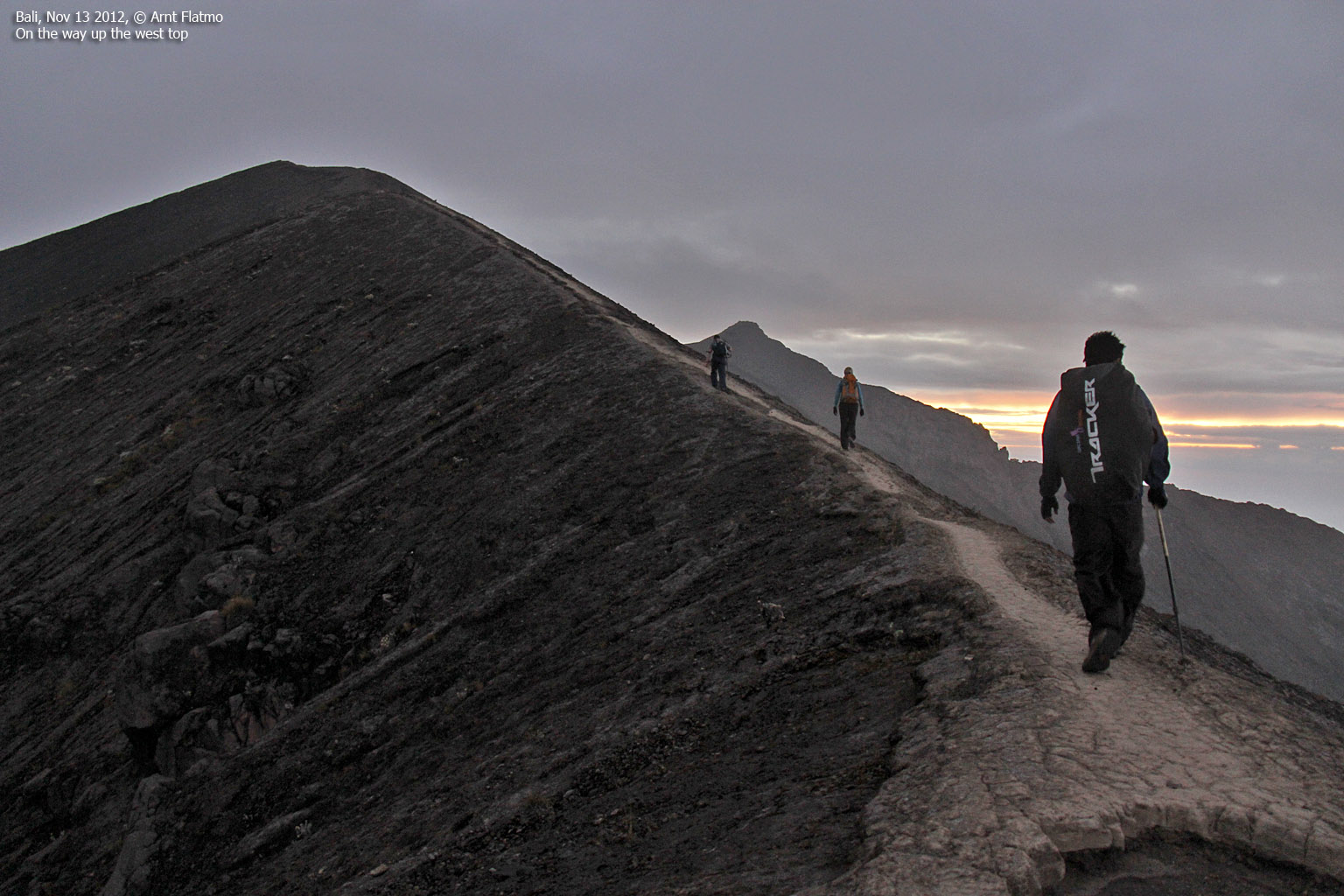
Up the west ridge

(Click for larger image)
The west top!
We reached the west top 05:49am - 4 minutes (or thereabouts) after sunrise. It was a little more than 6 hours since we left Besakih, but we had also waited in one spot for an hour. Gung said this was the high point, and this was the first of many episodes which taught me to never fully trust anything I was told, regardless of the good intentions...
We celebrated the west top (thinking it was the summit) and the victory over the lightning. We were happy!
On the west summit

(Click for larger image)
I don't have a reputation for handling altitude very well and today was no exception. I felt the headache come hard and strong and took 4mg of the dexamethasone that I had costed me more than USD 170 a year ago. Just in case I went to a high altitude summit again. I think I would have survived without the medicine, but it sure felt good to get something in return for the the money...
Gung said we should proceed over to the crater point. My head preferred a rapid descent, but I told it to be patient until the drugs kicked in. If the drugs are used by brain surgeons, they should at least carry me to the crater and back. But I started to feel a bit dizzy and Anne became worried when I proved unable to change batteries in my GPS.
The volcano crest wasn't particularly wide and Anne wasn't all too happy about seeing her dizzy (and confused) boyfriend carelessly walk in front of her on the narrow crest, without a single worry in the world.
To the crater (and the high point)

(Click for larger image)
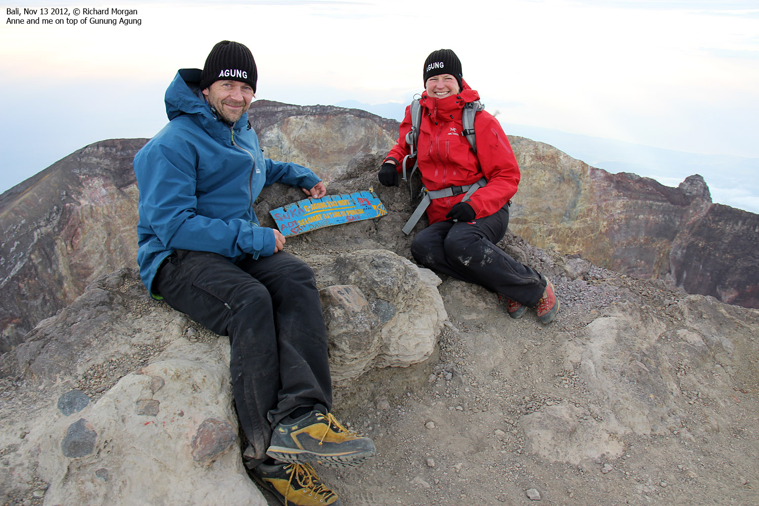
The summit!
We reached the summit of Mt. Agung at 6:17am, and we had enjoyed a fantastic sunrise on our way across. my GPS showed 3030m on the west top and 3039m on the summit. These readings are probably 10m too high, as the GPS reported 10m at sea level. But as the official height is 3031m, it wasn't too far off. Besides, there was a signpost that suggested that we were on the summit point...

The other team followed shortly after. They had also decided to wait to see if the weather improved. From the top, we could also see people on their way up from the south. They had still a long way to go. We didn't stick around for too long and agreed to have breakfast down in the forest, in shelter of the wind. I was more than ready to get to lower altitude!

Descending Mt. Agung

(Click for larger image)
Descent
On the way down the west ridge, Richard had a bad fall which could have gone much worse. Anne patched him up and Richard was in good shape to continue...
We stopped for breakfast below the tree line. The drugs hadn't killed the headache and now I was in a rather bad shape. I always "get it" on the way down. There's just no cheatin' mother Nature, it seems. Hit-and-run doesn't work.
Gung noticed that I didn't feel good, and squeezed a nerve in my hand. It was quite painful and Gung said that this why I felt bad. If I just gave this point a good massage, all my problems would be over.
When it comes to these matters, I am a sceptic. So I rubbed my hand when no one else saw it....
In any case, Gung served a nice breakfast, which included pancakes! And through Gung, we got some insight into some of the Balinese culture and way of thinking. We were only scratching the surface of course, but definitely took away some key points. The smile was certainly one of those points.

With a splitting headache, the journey down the forest was long. But eventually, we made it back to the temple 11:39am - almost exactly 12 hours after heading out. The headache finally let go and I could start enjoying being alive again.
The driver was waiting for us and we drove back to Gung's village where we parted with Richard - heading towards new adventures. We also parted with Gung and his driver took us back to Sanur Beach. In addition to having a serious jet-leg, we had lost one whole night of sleep. I don't remember last time I fell asleep sitting, but it happened at least 6 times during the 1,5-2 hour car trip...
It was nice to get back to the hotel, to a large bed and a cool room. Before I fell to sleep (afternoon nap), I managed to treasure the sensation of having been to Bali's highest mountain. Right there and then, it felt like ages ago. And then I fell to sleep. Hard...


