
|

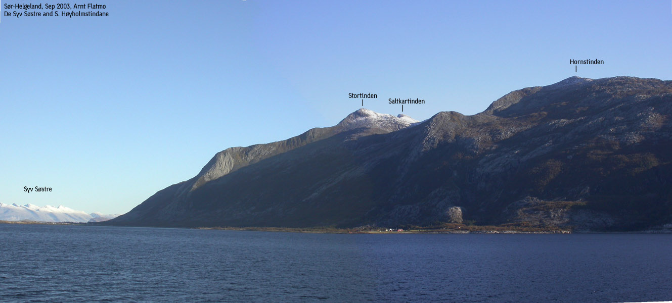
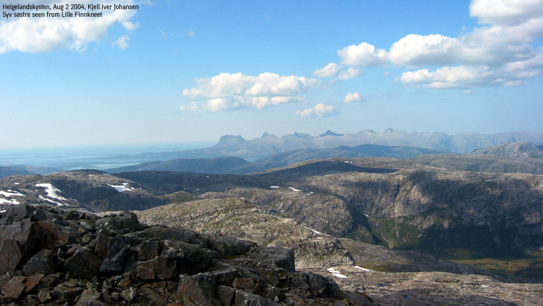
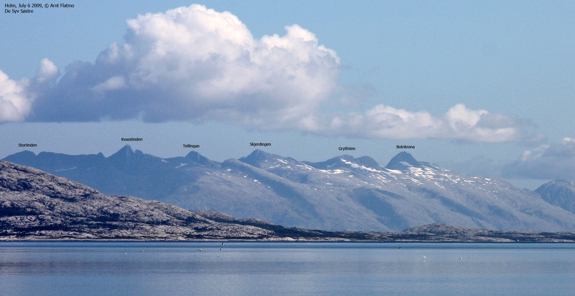
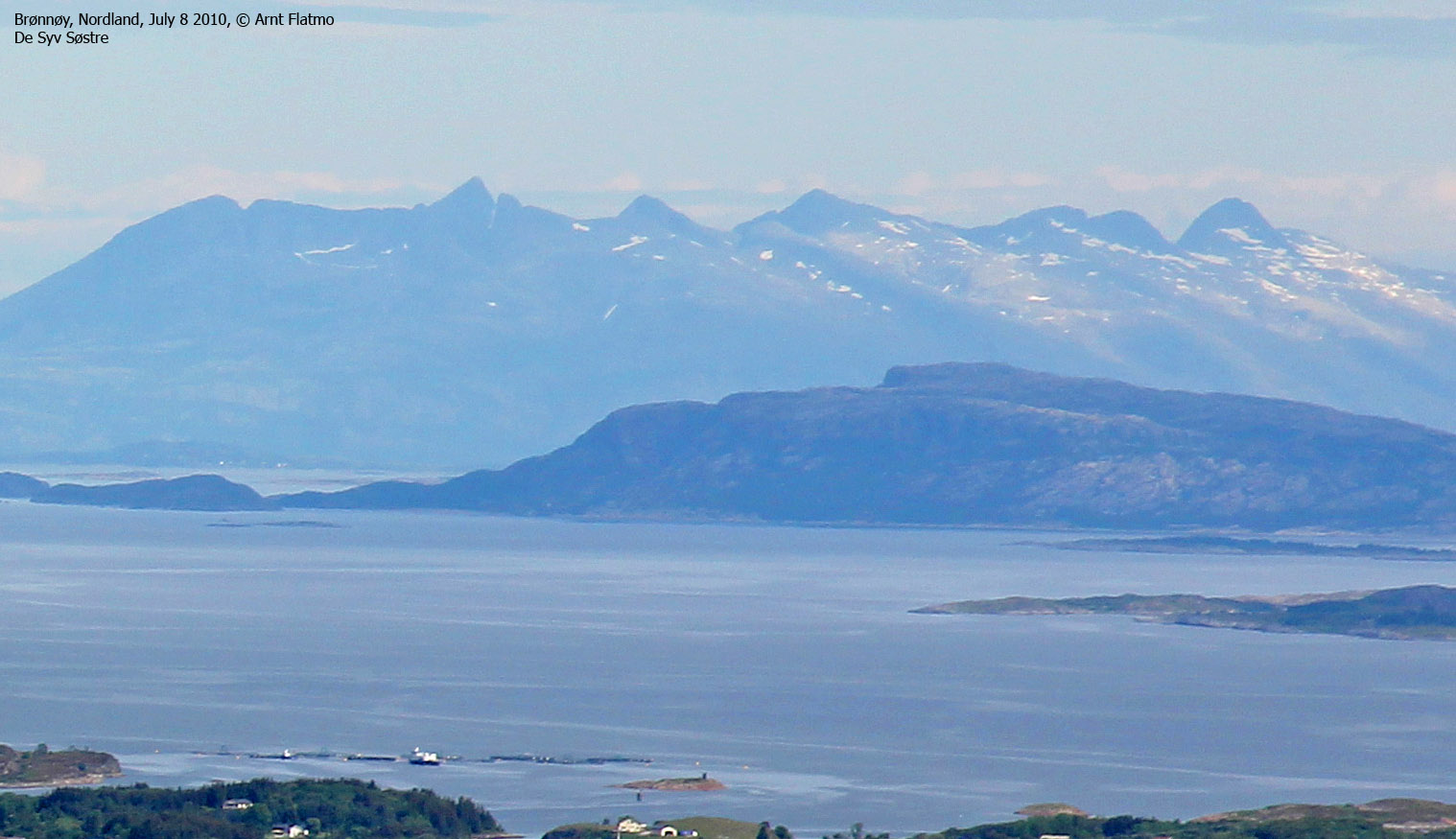
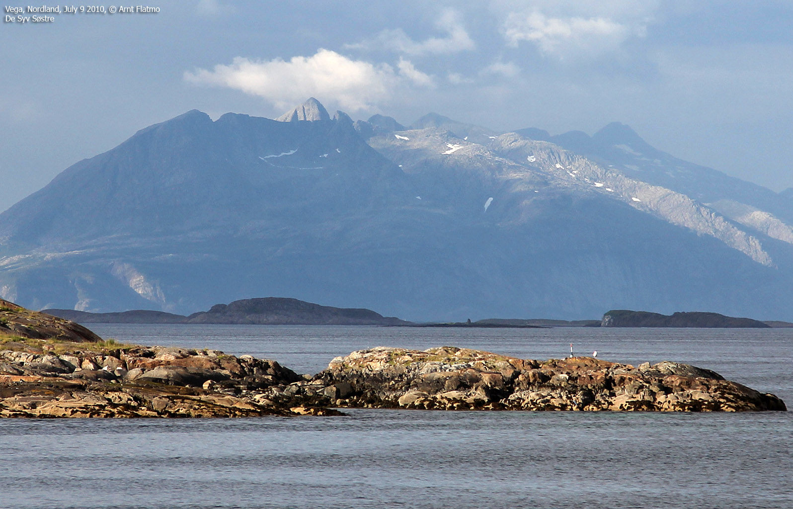
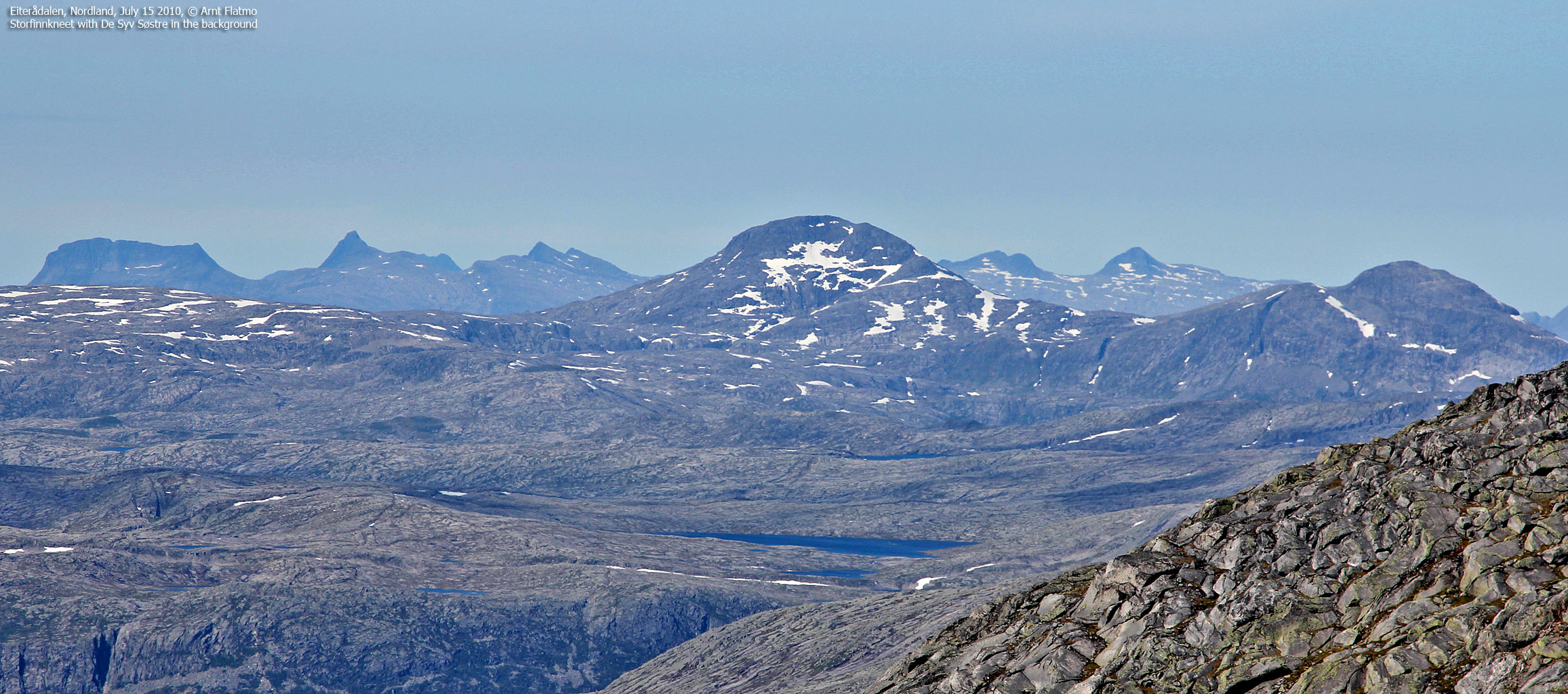
Syv Søstre seen from the south |
The Helgeland coastline has many prominent landmarks. The seven sisters (De Syv Søstre) is perhaps the most prominent of them all, rising wild and high on the Alsten island. These magnificient sisters inspired Petter Dass (1647-1707), a Norwegian poet and vicar of Alstahaug. From the famous "The Trumpet of Nordland", Petter Dass dedicated the following poetry to the seven mountains:
|
"Ved Alsterhougs Præstegaard findes at see, Syv Søstre,som fletter sin' Lokker i snee Syv Damer, og alle saa viide, Hvoraf i Land-Carterne meget gaaer Rye, Hvis Toppe opstiger ansseeig i Skye, Og sees i havet saa vide." |
All of the sisters can be reached on individual routes, but the high route traverse is the classic hike. None of the mountains require any technical equipment in good and dry conditions. In winter, axe and crampons may be required, dependent of ice and snow conditions. A map with all routes can be purchased from the local tourist office. You may also have the map sent to you from Sandnessjøen Bok & Papirhandel. Following is a short introduction to 5 of the 7 mountains:
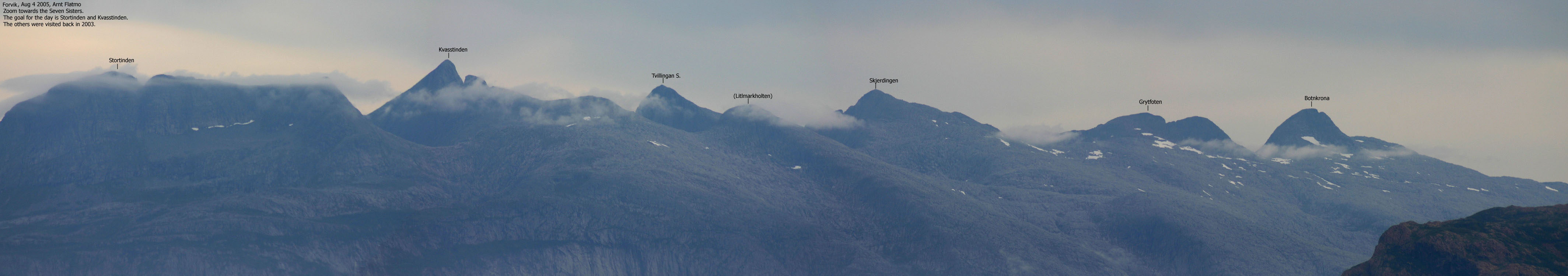
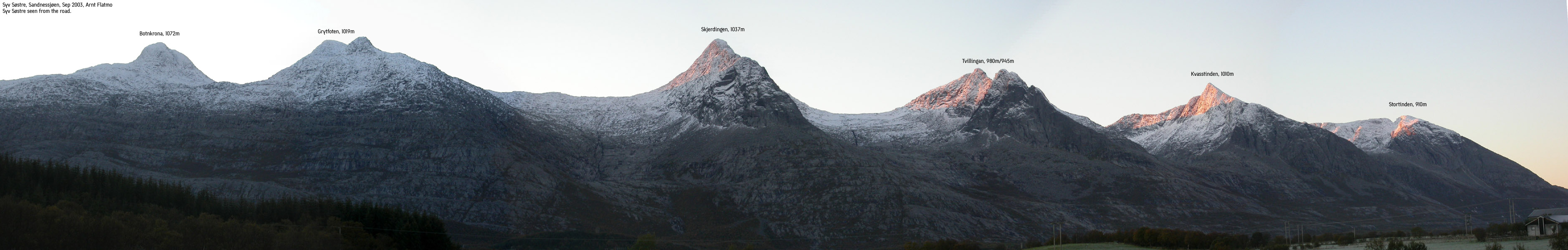
Botnkrona
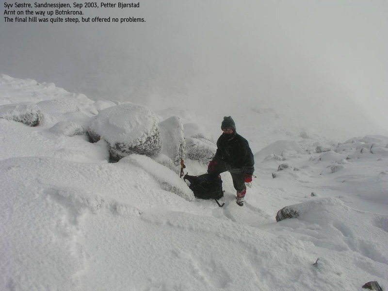
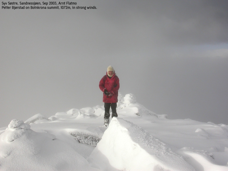
Botnakrona is the highest and northernmost of the 7 sisters, but Finnkneet (1162m) is the highest in Alstahaug kommune. The local tourist map says this is the most difficult of the seven mountains. The climb from 970m to 1072m is surely steep, but scrambling is only required just before the summit ridge. There is some exposure on the upper part, but in general the mountain is fairly easy to ascend.
Grytfoten
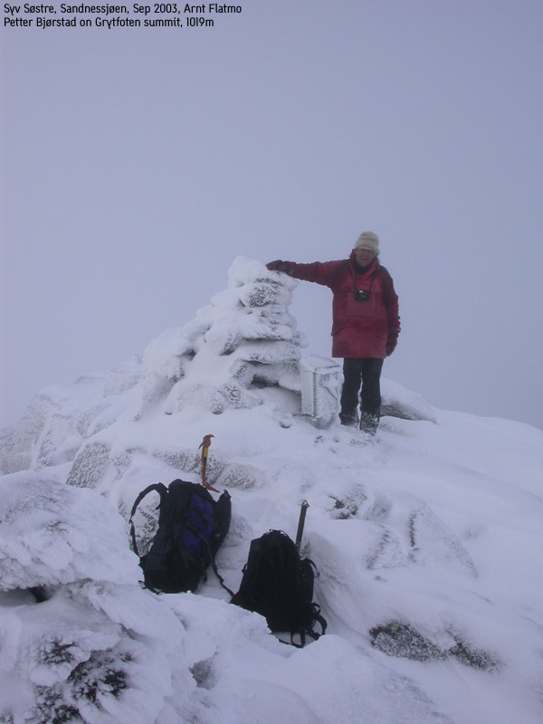
Grytfoten is the 3rd highest and the 2nd northernmost of the 7 sisters. Ascending Grytfoten is easy. Access via the south-west ridge, and no scrambling is required. From the summit, the eastern (unnamed) spur looks steep and serious. Viewed from the south, this spur does not look equally intimidating.
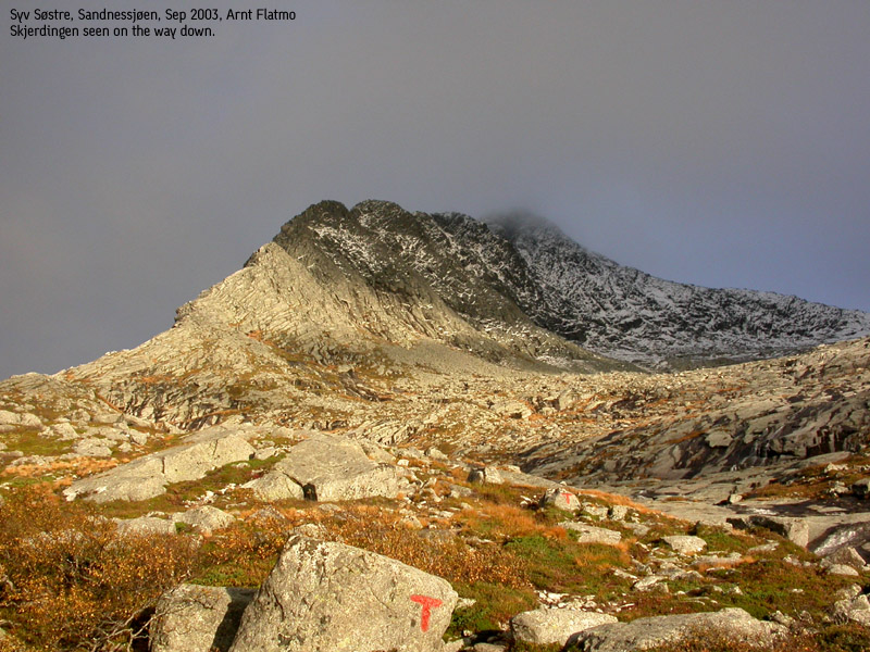
Skjerdingen
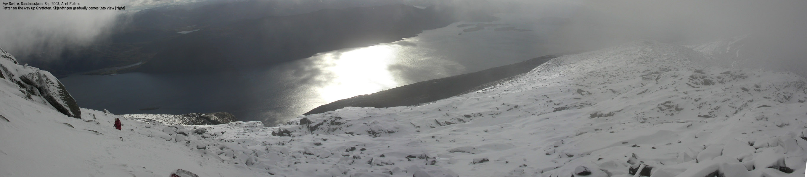
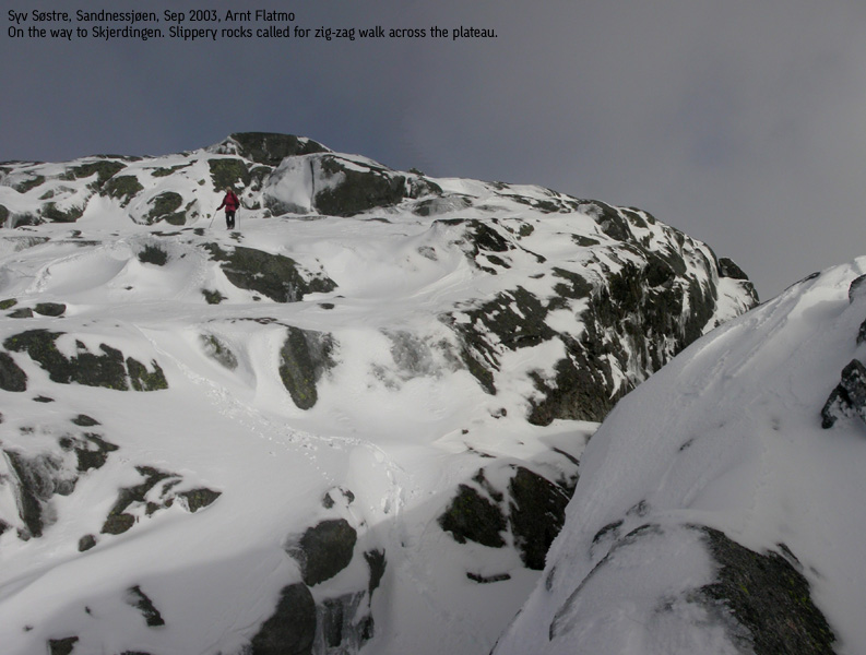
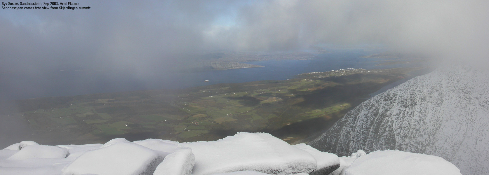
Skjerdingen is the 2nd highest and the 3rd northernmost of the 7 sisters. In terms of steepness, this is a fairly easy mountain to ascend, and the only peak where you will traverse the summit. Access is via the east and south ridges. The east ridge consists of slick rock that can get real slippery when wet or icy. In winter conditions, crampons may be very useful here.
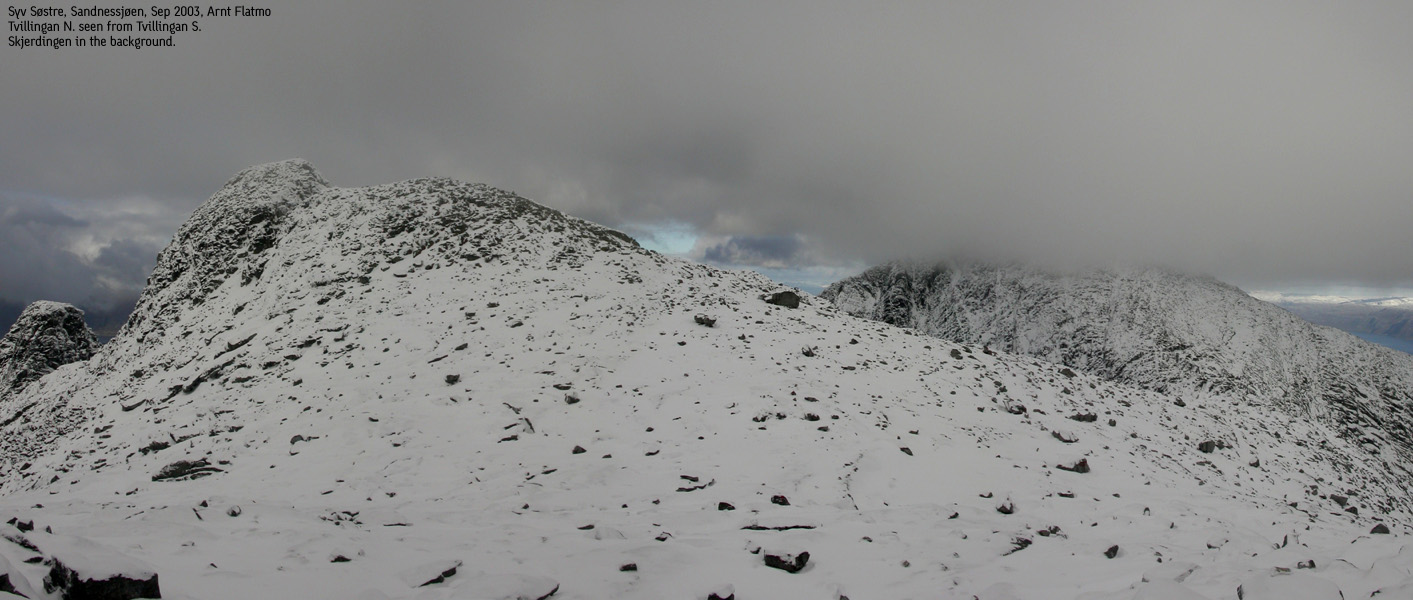
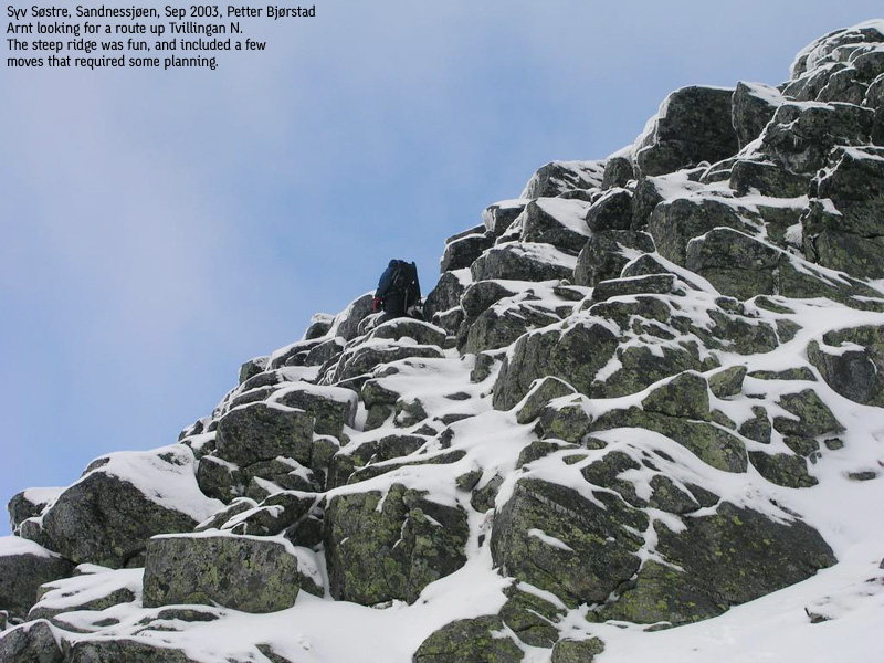
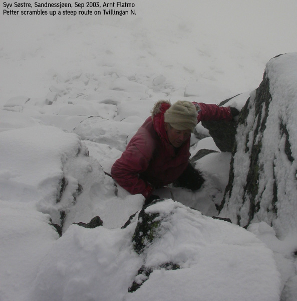
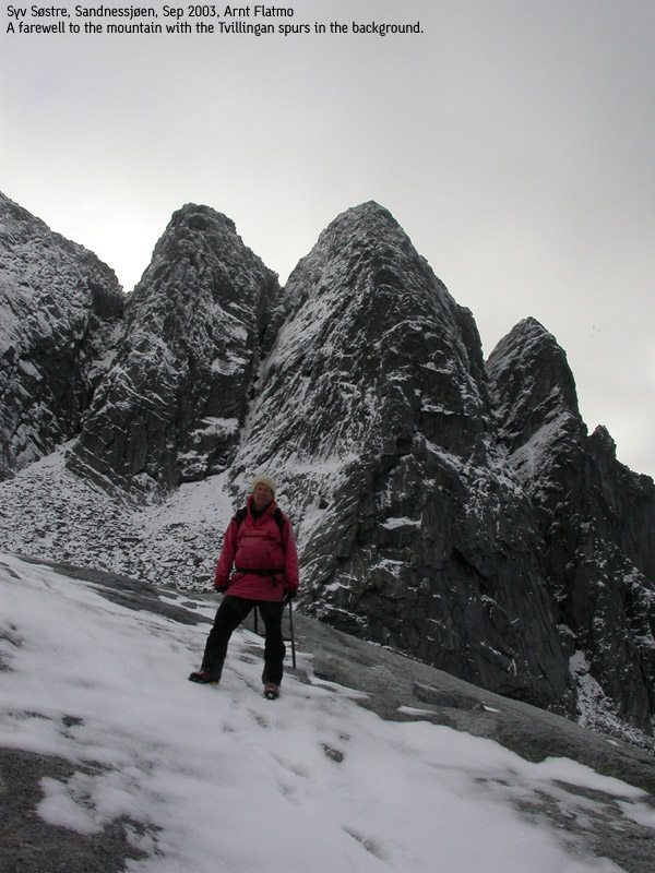
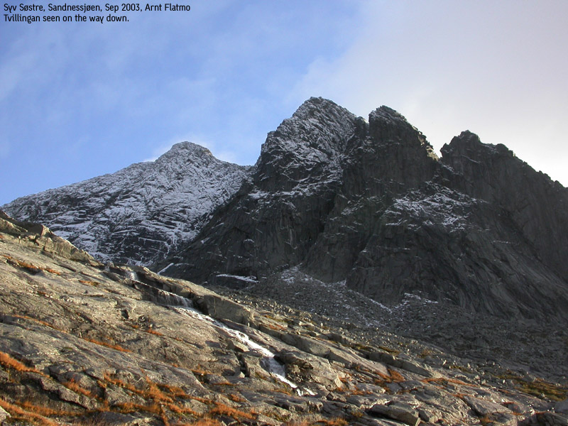
Tvillingan N.
Tvillingan N. is the lowest of the two peaks that goes under the name of Tvillingan (The twins). I do not consider this peak an independent peak, given the low primary factor (55m). This is also the lowest of the 7 peaks and the 4th northernmost of the 7 sisters. Of the 5 northern mountains, Tvillingan N. is probably the most challenging ascent. This peak is separated from an unnamed point below the summit through a deep pass. A mailbox is located at the unnamed point, suggesting that the average hiker stops here. A traverse of all the sisters must surely include a visit of the true high point.
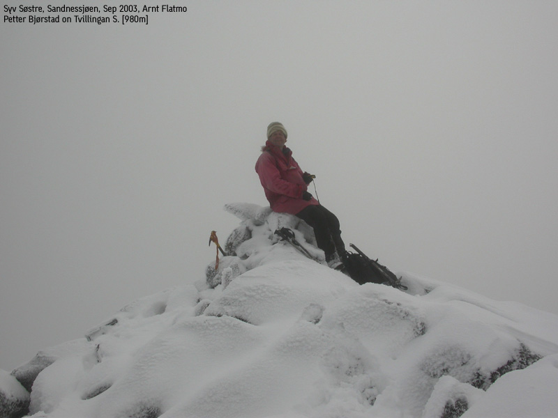
Tvillingan S.
Tvillingan S. is the 5th highest and the 5th northernmost of the 7 sisters. The ascent from the north includes some very light scrambling to gain the pass between Tvillingan. Ascending Tvillingan N. is a fairly easy hike up from the pass.
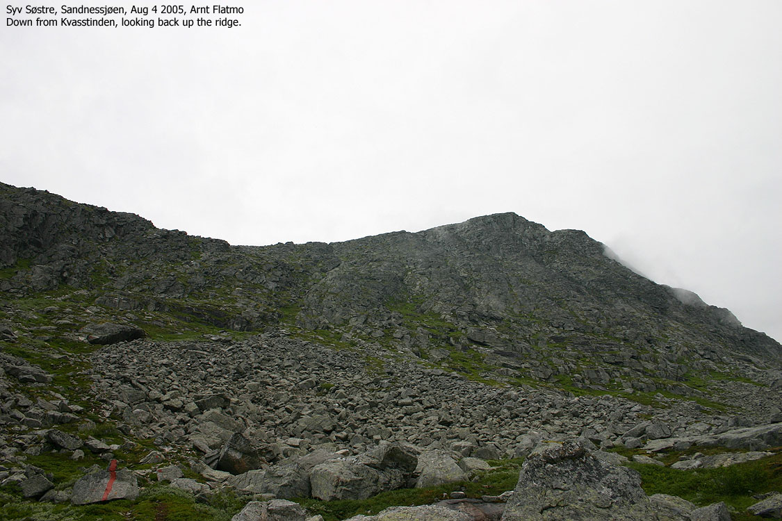
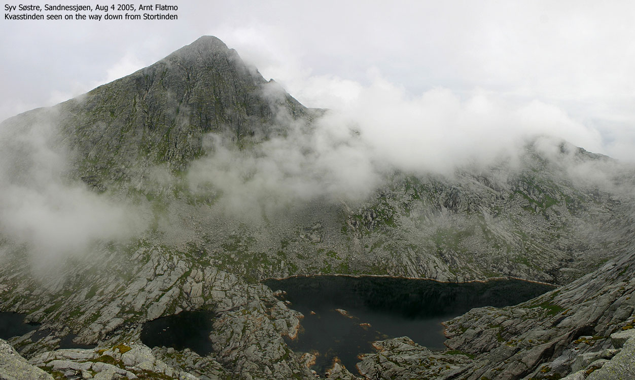
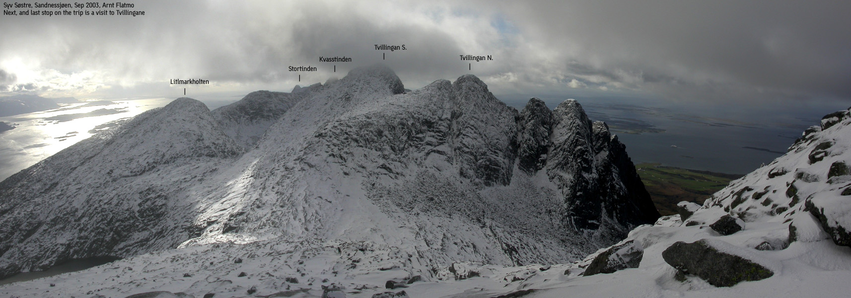
Kvasstinden
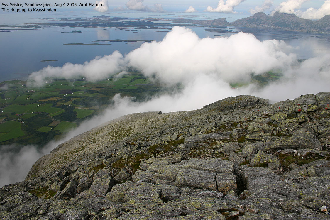
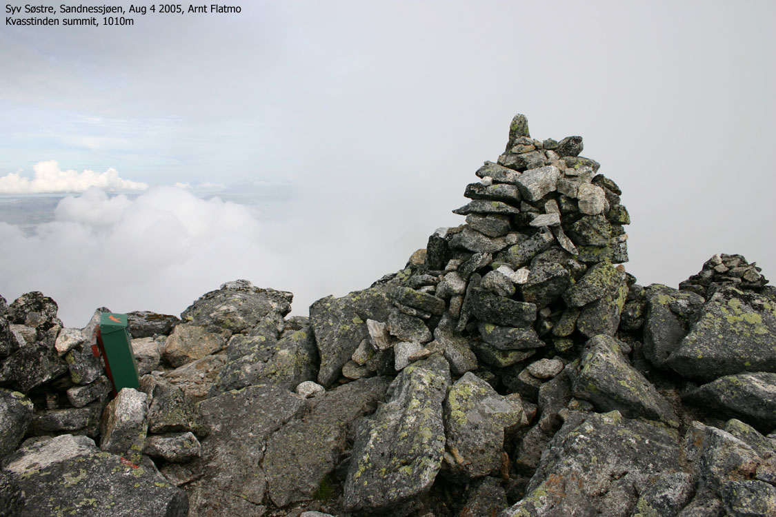
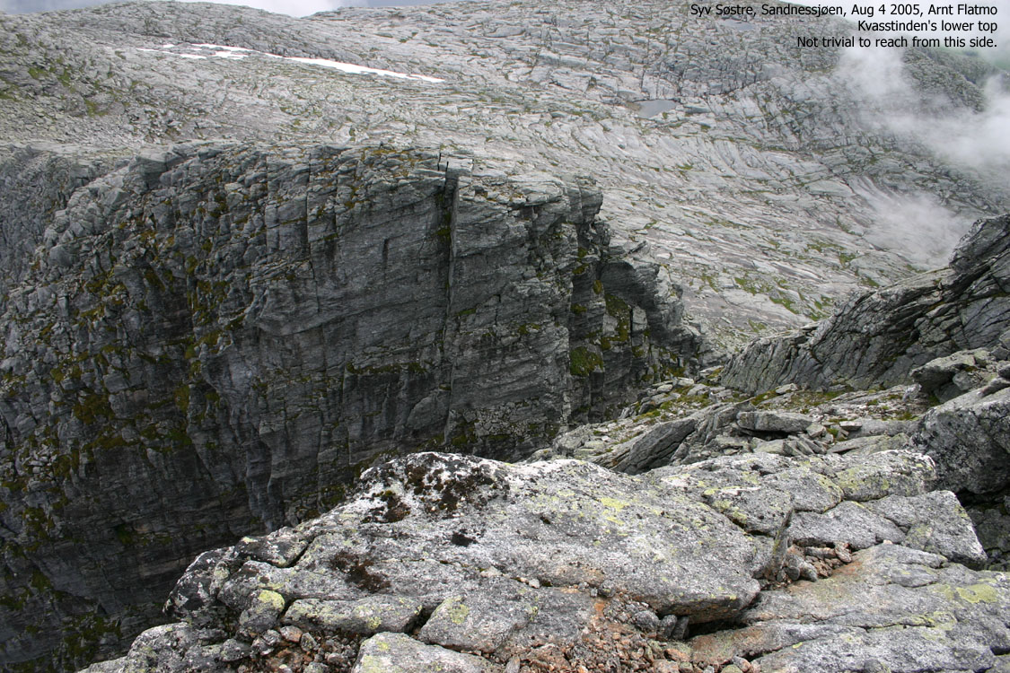
Kvasstinden is the 4th highest and the 6th northernmost of the 7 sisters. Access via the north ridge. Kvasstinden is perhaps the most characteristic of all the sisters, given the sharp main peak and the sharp sub-peak. Despite the sharp appearance, the route to the top is quite easy.
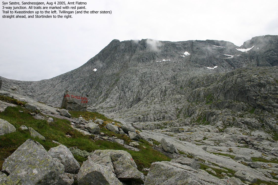
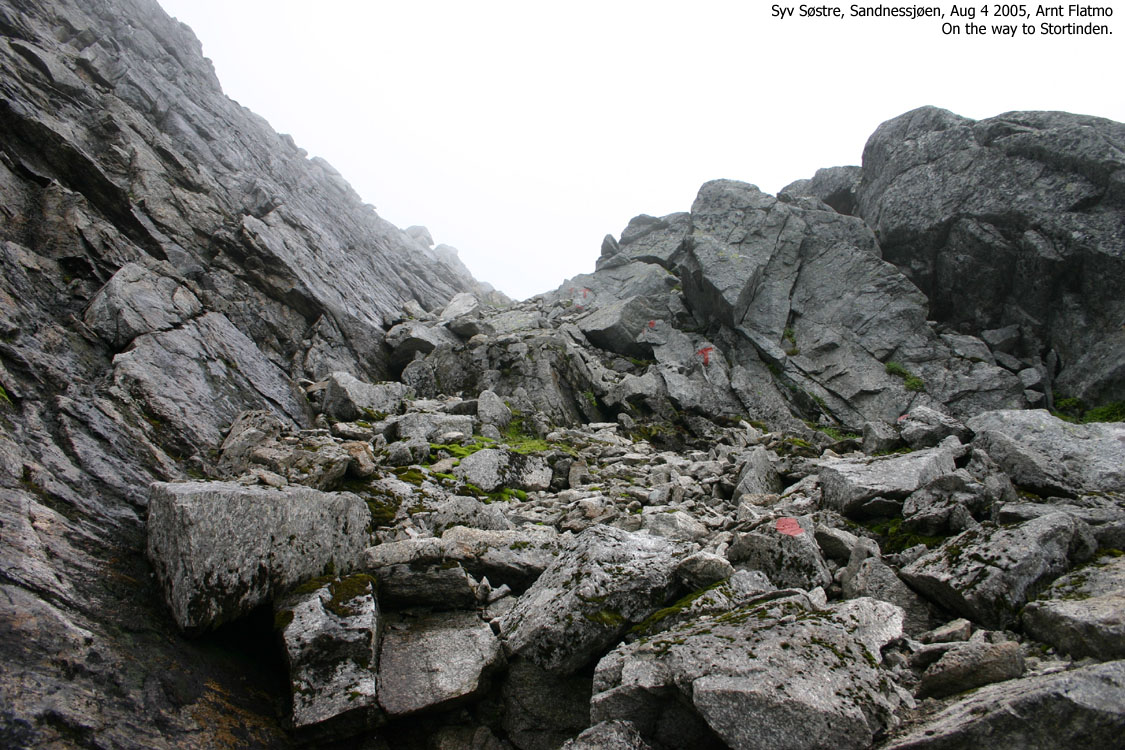
Stortinden (also called Breidtinden)
This is the southernmost mountain on the 7 sisters range. Access from the northeast, from the same point where you ascend Kvasstinden.
Litlmarkholten
Not part of the 7 sisters group, but is an independent mountain (899m) and you cross this mountain on the 7 sisters traverse. The primary factor is 129m and the mountain is located on the ridge between Kvasstinden and Tvillingan.
Botnkrona has a primary factor of 1072m, which is the height of the mountain. As Alsten is an island, the saddle is the sea level.
Grytfoten has a primary factor of 149m towards Botnkrona. The 880m contours meet on the ridge between the mountains, and the saddle height is interpolated to 870m.
Skjerdingen has a primary factor of 207m towards Botnkrona. The saddle is found between Skjerdingen and Grytfoten and the 840m contours meet here. The saddle is interpolated to 830m.
Tvillingan N. has a primary factor of 55m towards Tvillingan S. The saddle is found between the two peaks and the 900m contours meet here. The saddle is interpolated to 890m.
Tvillingan S. has a primary factor of 220m towards Skjerdingen. The saddle is found between Skjerdingen and Tvillingan, and the 760m contours meet here. The contours are so close that no interpolation is required.
Kvasstinden has a primary factor of 280m towards Skjerdingen. The saddle is found between Litlmarkholten and Tvillingan, and the 740m contours meet here. The saddle height is interpolated to 730m.
Stortinden has a primary factor of 240m towards Kvasstinden. The saddle is found on the ridge between the two mountains. The 680m contours meet here. The saddle height is interpolated to 670m.

Note: Class ratings are in reference to YDS (Yosemite Decimal System).
|
5 northern sisters traverse (late autumn, snow conditions)
|
|
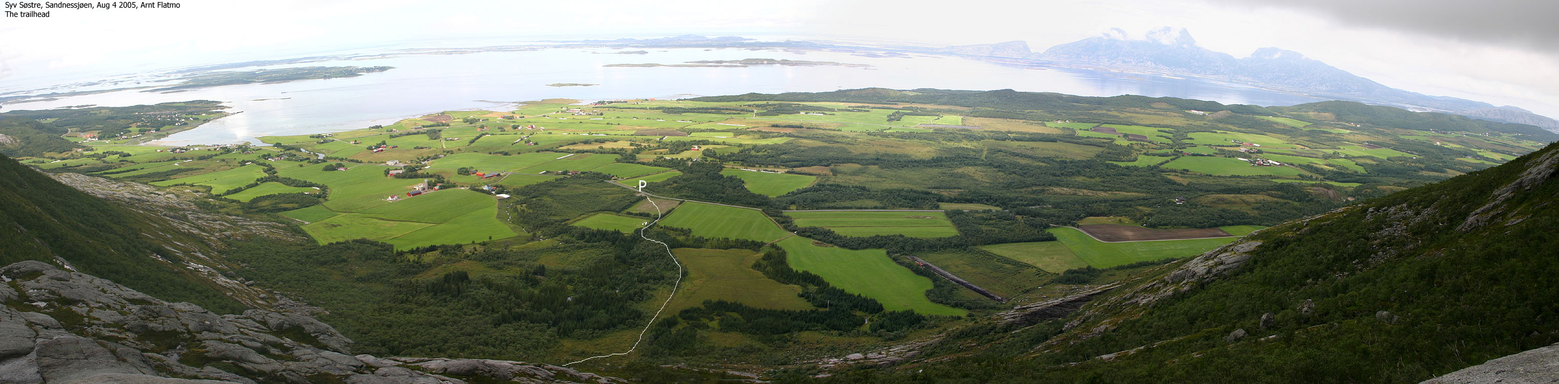
Access
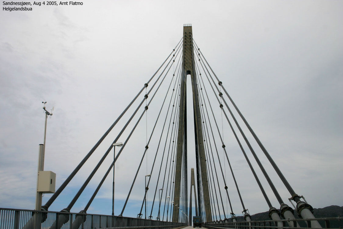
If you approach Sandnessjøen from the north on highway 17, you must cross the Helgelandsbrua bridge. The toll fare for passenger cars per Sep. 2003 is NOK 82,-. Arriving from the south (for instance Brønnøysund) on highway 17, involves two ferries (Horn - Andalsvågen and Forvik - Tjøtta). Use 177nordland.com for planning ferry routes.
A few Km south of Sandnessjøen, exit eastbound on a paved road marked "Breidmo". Continue on this road until you see a parking sign for "Syv Søstre" (the road turns to gravel just after this sign). Turn left onto a small gravel road leading to a power plant. Park here.
The route
The traverse is described north to south.
Botnkrona
Facing the power plant, go left by the fence and follow the trail around the plant. This trail connects to the trail from/to Grytingen. Turn left at this junction. Walk north-east on a ridge towards lake Fjellåsdammen. On the far end of the lake, you see a plastic water pipe coming down on the far end of the stream. For the first half of the hike, the trail climbs near this pipe. The trail is marked with red paint and starts by ascending a piece of slick rock through a rope. The trail climbs gradually towards a hut just south-west of point 419m. From here, the terrain gets more serious and steep. Hands may be used for balance in places. There is some exposure here and there, but limited to the terrain just below you.
Higher on the mountain, the trail vanishes and you must rely on the red markings. The route continues on the north side of lake Breidmovatnet (700m) before it climbs up to a saddle at approx. 950m north-east of Botnakrona summit. From the high saddle point, descend slightly and locate a less complex boulder field (gully in winter) that takes you directly to the saddle between the summit and an unnamed spur south-east of the summit. Do not go all the way up to the saddle. Instead, turn gradually right and follow a sensible route in order to gain the summit ridge if you are not able to see the red paint. Once on the summit ridge, the hike up to the summit cairn is trivial.
The only point that puts the brain to work is when you exit the gully and aim for the summit ridge. There is some exposure, but a good route do exist.
Grytfoten
From Botnkrona, head back to the saddle at 950m. Descend to approx. 900m on the south side of Botnkrona and follow this elevation until you are south of Grytfoten summit. Then head north-west below the mountain until you hit the south-west ridge that takes you directly to the summit.

Skjerdingen
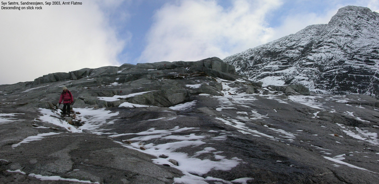
From Grytfoten, descend the south-west ridge and pass over point 909m and follow the ridge route to the foot of Skjerdingen. You must pass a crossing gully that is best crossed to your right. On your way up Skjerdingen you will encounter a slick rock area which can be somewhat tricky when icy or slippery. Crampons may come in handy here.
Tvillingan S.
From Skjerdingen summit, descend your ascent route for a short distance. Then continue down the south ridge to the pass between Skjerdingen and Tvillingan. This pass is also the descending point for the route described in this document. The route up to the pass between Tvillingan is well marked and care must be shown in a couple of places where the terrain does not provide safety. From the pass between Tvillingan, hike up the boulderfield to the 980m summit.
Tvillingan N.
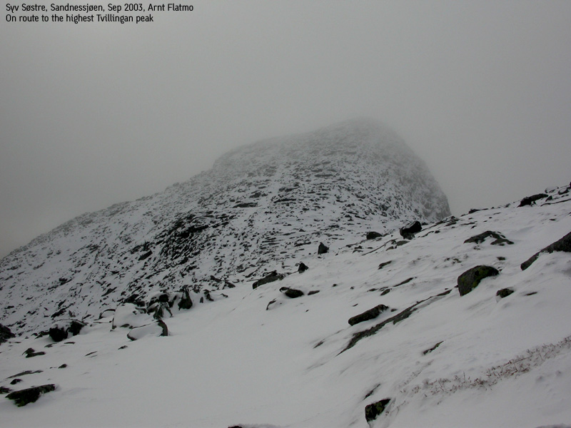
From Tvillingan N., hike back down to the saddle. Instead of hiking up the obvious ridge on the other side, set the course north-west and hike below Tvillingan S. until you reach a gully that separates the true high point from an unnamed point just east of the high point. Hike up this gully until you reach two large rocks that nearly blocks the gully. Climb up on the ridge to your left and continue upwards to the 945m summit. This ascent requires a short section of scrambling, class 3 (US). Take time to find the best route. The most difficult point suggests that downclimbing face in is the best option. Descend your ascent route back to the pass between Tvillingan.
Return to trailhead after 5 mountains:
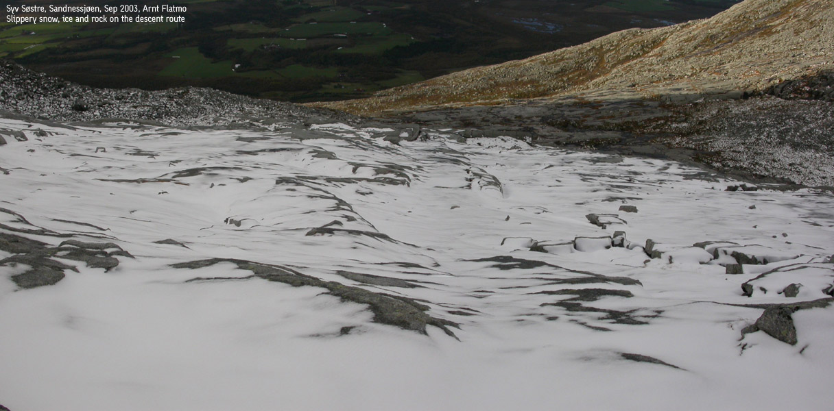
From the Skjerdingen/Tvillingan pass, locate the "T" trail that takes you down the large slick rock area. When icy, caution must be shown here. The terrain is not steep, but you can slide a bit if you fall. In dry conditions, the descent is trivial. Halfway down the mountain, the trail becomes visible and you follow this trail down to Markvoll. Once back on the road, turn right and follow it back to the power plant.
Kvasstinden
Note! I have not hiked the part between Tvillingan and Kvasstinden.
From Tvillingan, descend to the Tvillingan - Litlmarkholten saddle. Proceed across Litlmarkholten and head down to Lake Helknavatnet between Kvasstinden and Storhornet. Follow the lake northbound to approx. 490m and follow the T-trail up to the right. This route meets Kvasstinden's north ridge. Followed marked trail all the way to the summit cairn and the mailbox.
Stortinden
Head back down to 490m and head straight the valley. Locate the T-trail that follows an obvious ridge which leads up to a bowl below the summit. From this bowl, there are two routes. Follow the leftmost route that will take you directly up to the summit. Both routes have some rough terrain, but there are no difficulties.
Descent
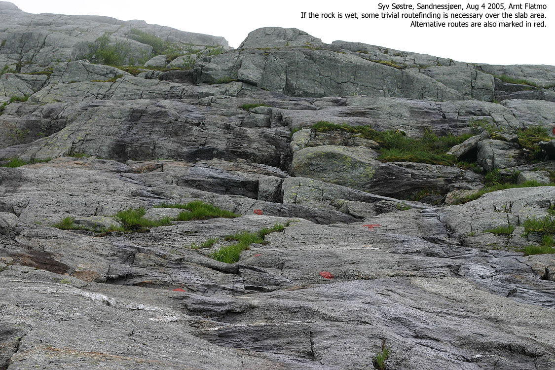
Head back to 490m and the drain from Lake Helknavatnet. Follow T-trail on the north side of the stream across slabs where you have to choose between several routes depending if the slabs are wet or dry. When down from the mountain, follow the trail that runs close to a fence and after a short forest section and a gravel road, you are back on the road. You pass a soccer field as you walk the gravel road. The Kvasstinden trailhead is on the far end of this soccer field, 1,4Km from RV17 junction which is marked "Markvoll/De Syv Søstre".
You now have approx. 4,7Km of walking back to the trailhead below Botnkrona.

|
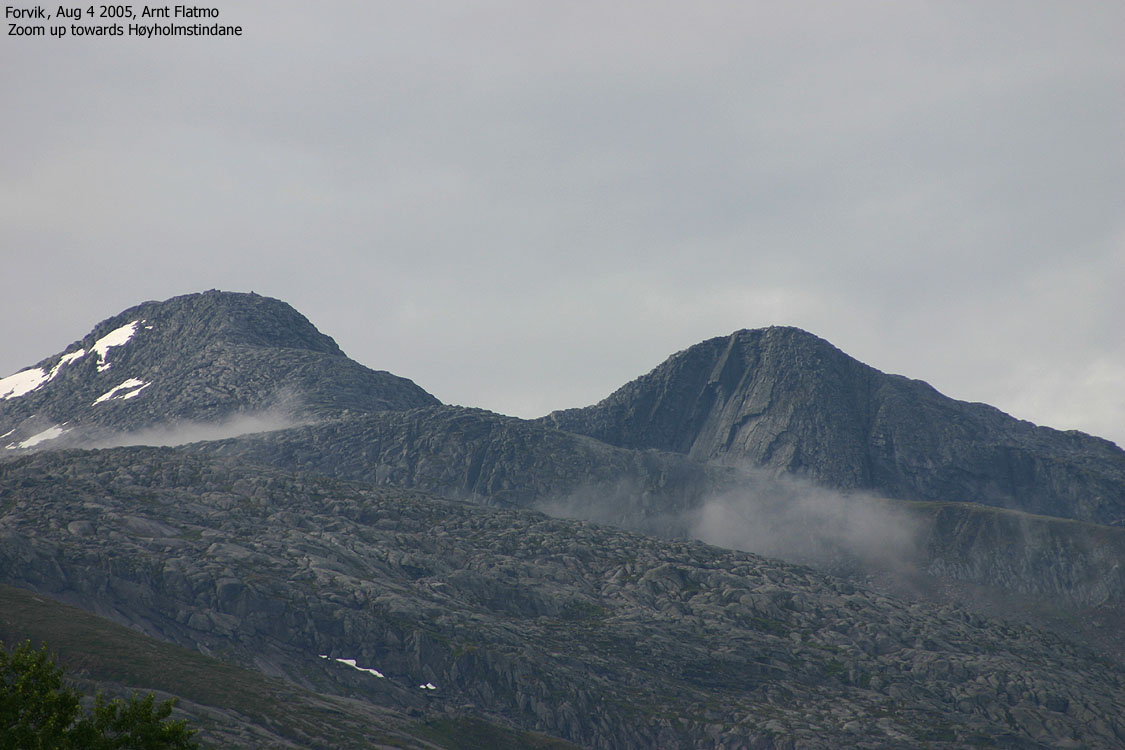
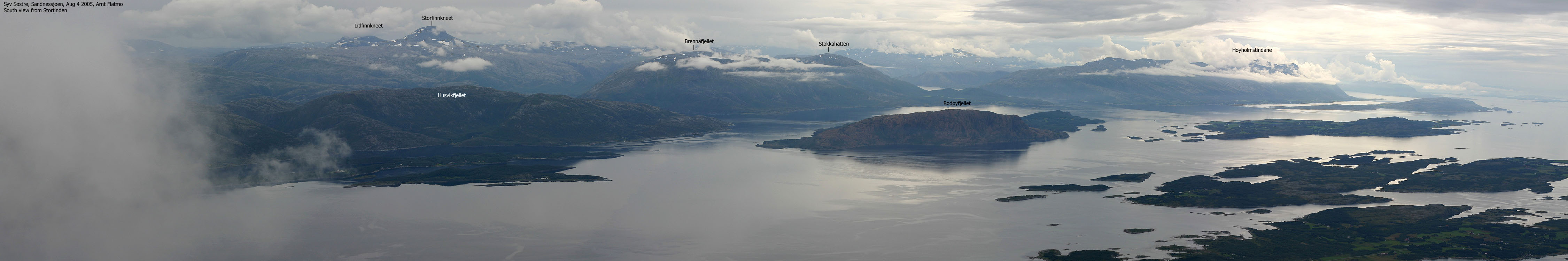
Close to two years after traversing 5 of the sisters with my friend Petter Bjørstad, it was time to "collect" the remaining two. I had driven up to Brønnøysund where Troll would stay throughout August, and the weather allowed me to stay a whole week in northern Norway. And this Thursday was dedicated to visiting the sisters in Sandnessjøen. The plan was to spend the night in Sandnessjøen, but it turned out to be a long day-hike. I left our house (approx. 40Km outside Brønnøysund) very early in the morning to reach the first (06:00AM) ferry from Horn to Andalsvågen. I could see the 7 sisters in the distance, free of clouds. This looked promising. After a short drive to Forvik, I expected a smooth ferry connection, but was quite stunned when I realized that the next ferry didn't leave until 09:35AM. I was stuck at Forvik for two hours and could only watch the clouds slowly embrace the sisters as the morning turned into day. My mood only got "better" when I - as the first car on the ferry, almost was the last one allowed out. The good thing about a small car in the city is that it is easy to find parking. But on a ferry, I always get tucked away in a side pocket, locked in by the other cars. I found the trailhead right away and was ready to go 10:55AM. The fog now hung low down the mountains, but I hoped that I could get a couple of views now and then. The forest and the morning dew had made me soaking wet by the time I reached the mountain. I had 1450m vertical ahead of me (Kvasstinden and Stortinden) and figured the day couldn't get much worse. Some parts in the slab area were a bit awkward. I noticed that I could bypass these problems, but being stubborn as a goat, I scrambled up the wet and slippery slabs. I entered the basin between Kvasstinden and Stortinden and noticed that the T-trail led me up to the left - towards Kvasstinden. I suddenly struck me that if the route to Stortinden was not marked, I would have a slight problem. I could only sense the mountain that towered more than 400m above me. And I knew it was steep. Should I take on this mountain in thick fog? Perhaps if I only got a glimpse of it... I got my glimpse of Stortinden halfway up Kvasstinden. The route was quite obvious, in the sense that there was only one route that was doable. But would I be able to find it in the fog? I decided to deal with this later, as I was now quite high on Kvasstinden, and that I should enjoy the hike. I felt a deja-vu during ascent, but it turned out that I was thinking about my hike to Fannaråken. A very steep hill, lots of boulder and fog. This could of course be the majority of Norwegian mountains, but still... I reached the summit 12:40PM and had very limited views from the summit. I had actually brought along some food, and had lunch on the top while dreaming about the views I didn't get. I descended towards the south to have a better look at the front peak, but found that finding a route would take longer time. It wasn't all that important and I headed back up again. I descended down to the basin and noticed the big rock with "Tvillingene" written all over it. So this was the trail junction, but was there a route towards Stortinden? Yes, there was, and I was happy. The fog was so thick that it would have been very time consuming finding the narrow passage up the steepest part. The narrow passage had very loose rock and one should make sure to avoid rockfall if there are other hikers on the route. I entered a bowl below the summit where I stayed right of a snowfield. The trail marking started to fade while the terrain got increasingly more rough. I wondered about this and could only conclude that the rocks with the paint must have fallen. I arrived the north ridge and was at the summit 14:05PM. I got some views towards Tjøtta before I headed eastbound to see if there was a route to the top just east of the summit. There wasn't and I headed back to the summit. I noticed that the trail ran down a col east of the summit and I followed this trail down to the snowfield. The route has obviously changed over the years. As I was sliding down the snowfield, I noticed that the route up to the top east of the summit (and the ridge route all the way to the easternmost top) ran up from here. But now all the sisters had been visited, and I headed back down. I was back at the trailhead 15:10PM. It had taken me 4 hours, 15 minutes to hike these two mountains. The average walker should plan up to 6 hours for this round trip. Back at the trailhead, I decided I should head back home. Taking the ferry was out of the question and I took the long way home - across Helgelandsbrua, to Mosjøen and then to Velfjord via Tosentunnelen. The 7 sisters are wonderful mountains. The traverse would have been great fun, but only if I am guaranteed good weather.
|
Move cursor to read notes, and click on the images to see full version.
Some of the thumbnails may have been cropped to fit the format.
Pictures are presented in the order they were taken.
Towards the trailhead


To Kvasstinden


To Stortinden


Heading home


No Javascript:
1 2 3 4 5 6 7 8 9 10 11 12 13 14 15 16 17 18 19 20 21 22 23 24 25 26 27 28 29 30 31 32 33 34 35 36 37 38 39 40 41
|
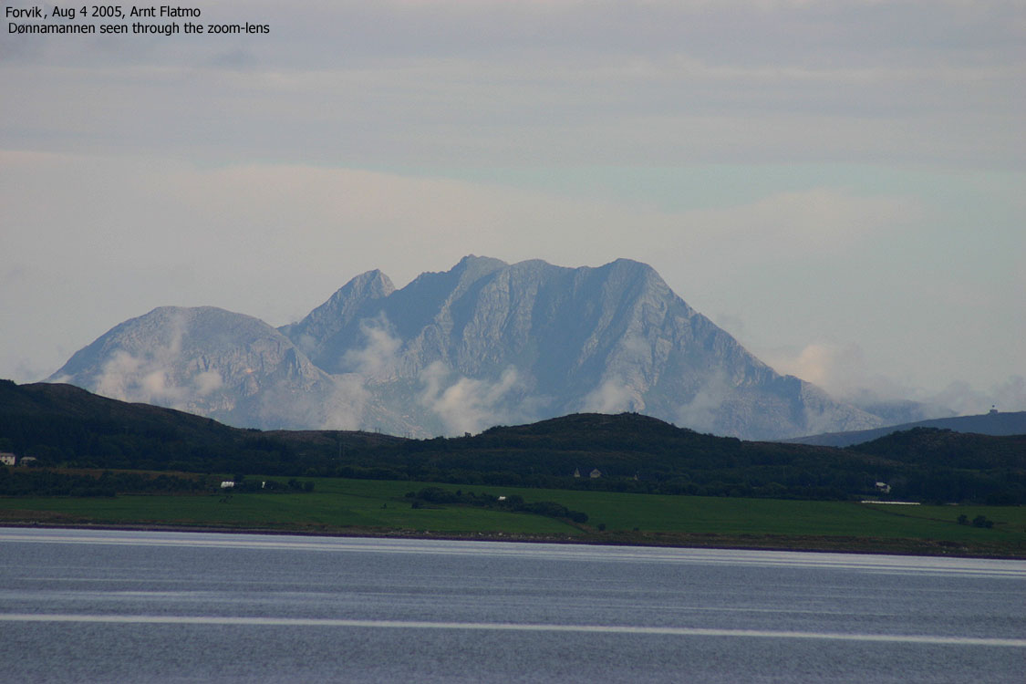
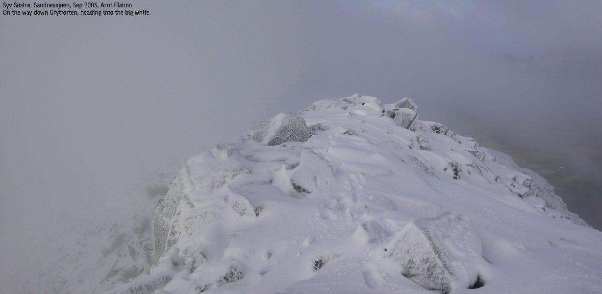
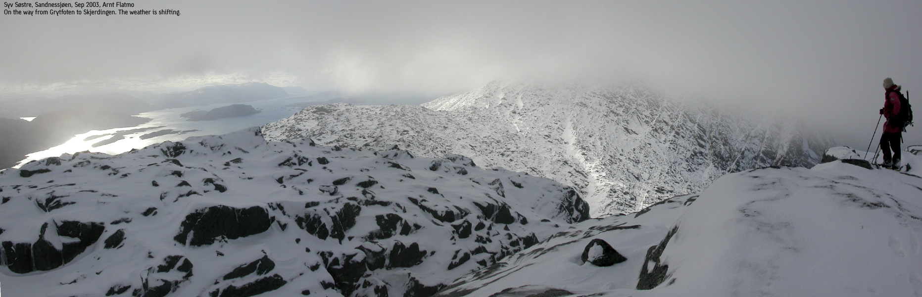
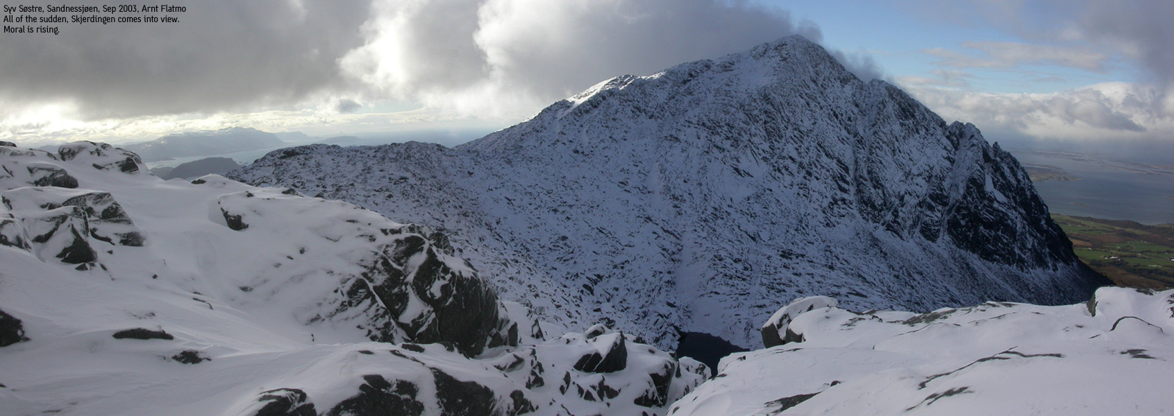
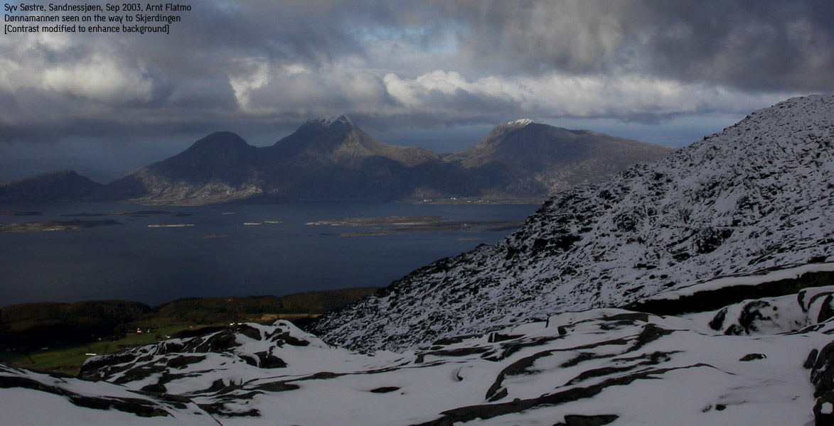
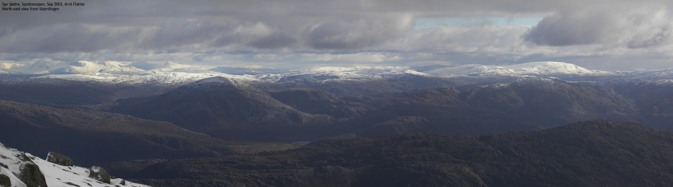
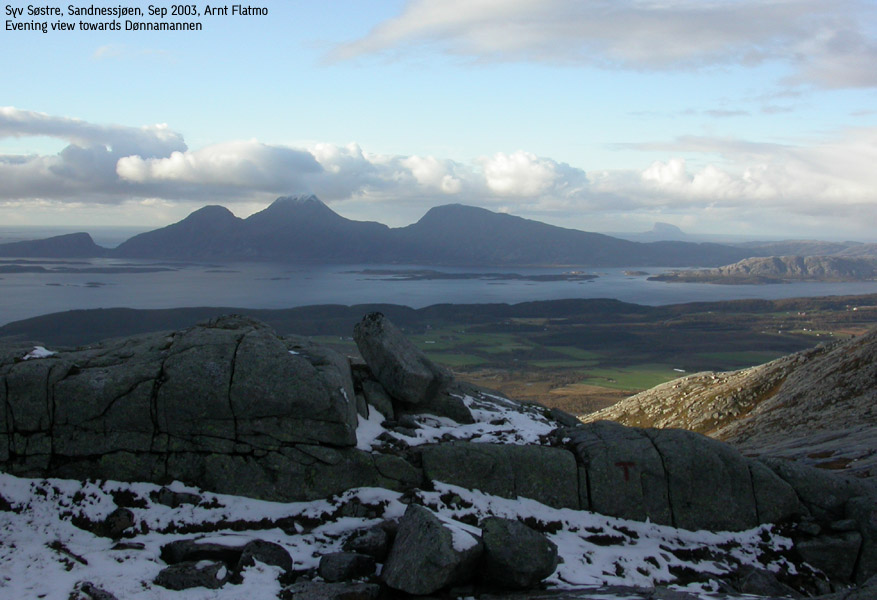
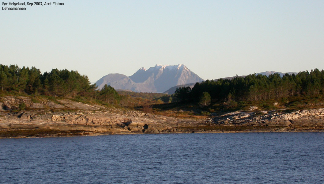
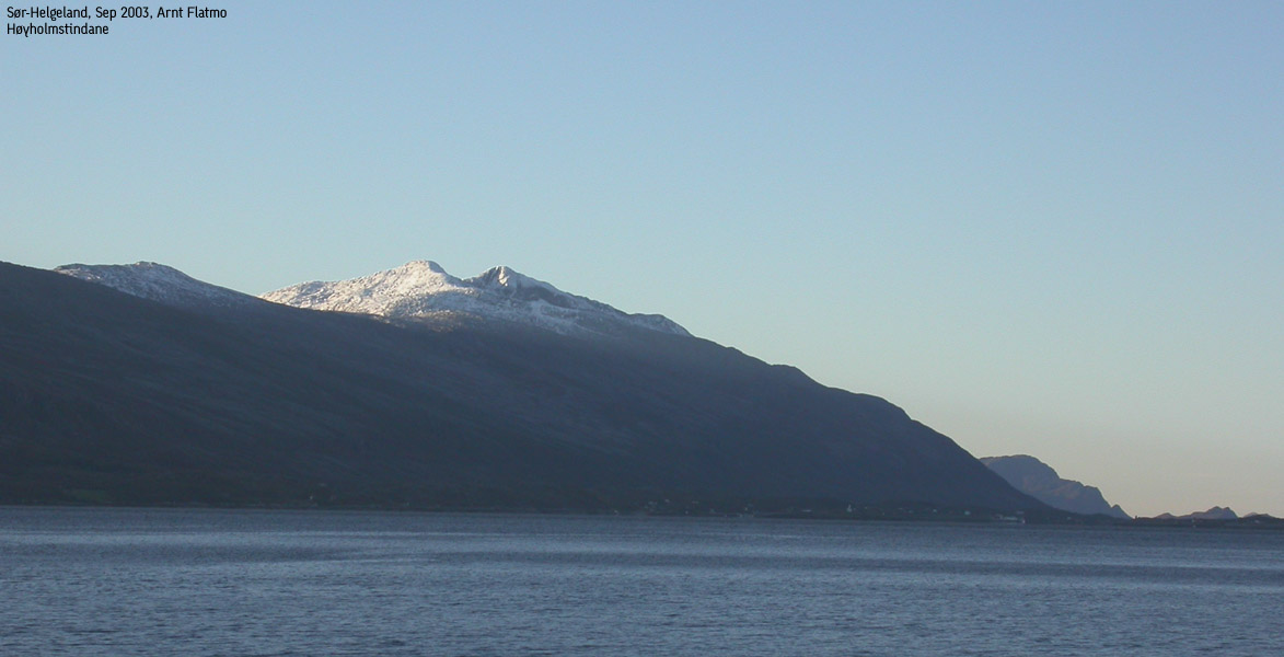
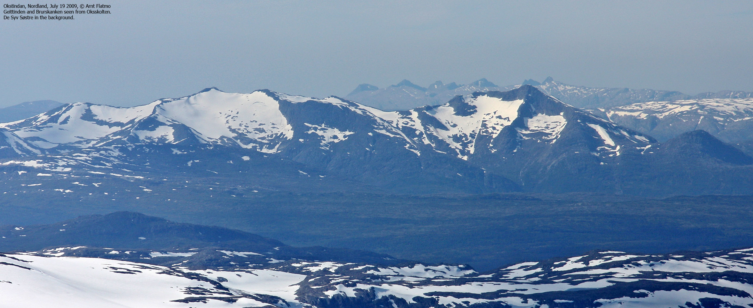
After successful climbs to Heilhornet and Blåfjellet, the day for the big hike finally appeared. We got up 05:00AM and drove to the trailhead next to the power plant. After a quick breakfast in the car, we were on our way 05:55AM. Day was dawning and I had very little use for my headlights. We had waited out a rainshower in the car, and was somewhat curious about the weather conditions on the mountain. The weather forecast for the next day was very good, and we hoped we would enjoy the weather transition during the hike. The hike started interesting as we had to use a fixed rope to advance a piece of slick rock. This was supposed to be an easy route. "What's ahead?" was the logical question. We had some initial problems sticking to the red marking, even if the lower sections of the mountain was snow-free. But from the hut near point 419m, we were able to stick with the red paint all the way to lake Breidmovatnet. We entered snow above 500m and the weather was significantly worse than in the lowlands. Pace decreased as the snow was quite deep in places (knee height). On our climb up towards the lake I slipped and took a bad hit in a hand which was already in poor condition from a fall a couple of months ago. Screaming pain rushed through my body, and I started to freeze. Suddenly, the will to hike was gone. The howling winds and the low visibility made moral sink deeper than deep. Petter was optimistic as always, promising sunshine on top. With a quiet "yeah, right" attitude I continued upwards. We shifted on breaking trail, and gradually advanced up the mountain. Above lake Breidmovatnet, we all in all managed to stick to the route even if the red paint was difficult to follow due to the snow. Long at last, we arrived the 950m saddle below Botnkrona, and we followed the red paint up a near rock-free corridor of snow up the mountain. We lost sight of the paint along the way and continued all the way to the top of the hill. In front of us was a hilarious drop and we knew we had gone too far. We descended while steering towards the left. When we found a good place to ascend, we were on the summit ridge in no time. The summit was just as cold and evil as I had anticipated, but suddenly I saw the ocean for a split second. Holy crap! A strike of fortune. Moral was increasing. We arrived the Botnkrona summit 09:40AM, which meant it had taken us more than 3,5 hours to the top. With this pace, it was clear that we could kiss the traverse goodbye. The new plan was to just keep on walking, and see how far we could get. I suffered from fatigue as we headed towards Grytfoten. Petter kindly broke the trail as we passed below Botnkrona. He then guided us onto a ledge which looked highly suspect. One slip, and there would be an unpleasant fall far down to the plateau below. I did agree that this had to be the route, but realized it probably looked a whole lot different in summer conditions. We made it across the ledge, and had a rest for food below the steep south face of Grytfoten. I felt the moral and strength come back after this rest, and broke trail up to Grytfoten. The weather was still in the "shitty" category, but now and then we could see the ocean, and the weather was clearly shifting towards better. We reached Grytfoten 12:00PM and turned around after a quick round of pictures. The walk from Grytfoten towards Skjerdingen was long, but when Skjerdingen became cloud-free for a minute or two, the hike was now fully enjoyable. Strengths were back at the normal level, but we realized that we would only get Skjerdingen and Tvillingan unless we wanted to hike after dark. 5 out of 7 ain't bad given these conditions, and we were satisified with the outlook. I struggled on the ridge to Skjerdingen. The ridge was icy and I had to crawl in places, utilizing all fingers and toes to stay on the mountain. Petter had chosen a different route which must have been better, as he went out of sight. We reached Skjerdingen summit 13:40PM and had only a vague view towards Tvillingan. But after just a few minutes, the clouds disappeared and we had the rest of the route in clear view. From this point, we had "endless" views in all directions. Dønnamannen on Dønna was a sight for sore eyes, and I knew I would hike this mountain one day. In the north-east, we saw the Okstindan mountains and further south, mountains in the Hattfjelldal region. In the south, Høyholmstindane north of Brønnøysund were easy to identify, and Lovund north-west of Dønna was also a landmark that was easy to recognize. These views fulfilled the meaning of this hike. From Skjerdingen, I thought the route up to Tvillingan looked somewhat narrow and dangerous. But these direct views can be deceiving and I decided to worry about that later. On the way across the saddle we found the descend route that we had agreed on earlier. The route up towards Tvillingan was much better than I had anticipated. A lot of safety was found in the terrain. Only a few places we had to step careful due to the slippery ice and snow. We reached the first of the twin summits 15:10PM. We turned around shortly after and headed down towards the pass between the twin peaks. We then hiked up the ridge towards the southern peak and found access to the high point blocked by a deep pass. We did a few attempts to find a route down, but the icy mountain made this dangerous. We ended up with scrambling down the south side until we could get access to the pass. Then we hiked up in the pass until we could climb onto the summit ridge. The initial scrambling here was the most difficult part of the route, but lasted only for a very short distance. Finally, we could stand by the 5th cairn for the day, at 16:00PM. It was time to go home. Back in the Skjerdingen-Tvillingan saddle, we began the descent. Several hundred meters of slick rock, partly covered with wet snow and ice didn't look promising, but the "T" trail brought us safely down to the lowlands. After a quick hike along the road we reached the car 18:10PM. A 12 hour hike was over, and it all felt worth while. Counting Heilhornet and Blåfjellet, we had done 7 mountains in 3 days. And now we could focus on the *real* mission for the trip - to bring the dog back to Bergen.
|
Move cursor to read notes, and click on the images to see full version.
Some of the thumbnails may have been cropped to fit the format.
Pictures are presented in the order they were taken.
Botnkrona and Grytfoten


Skjerdingen


Tvillingan


Descent


Other pictures from the trip


No Javascript:
1 2 3 4 5 6 7 8 9 10 11 12 13 14 15 16 17 18 19 20 21 22 23 24 25 26 27 28 29 30 31 32 33 34 35 36 37 38 39 40 41 42 43 44 45 46 47 48 49 50 51 52 53 54 55


No Javascript:
1 2 3 4 5 6 7 8 9 10 11 12 13 14
 Other hordaland mountains
Other Norwegian mountains
westcoastpeaks.com
Other hordaland mountains
Other Norwegian mountains
westcoastpeaks.com

