
Norwegian Mountains, Møre og RomsdalStorevasshornet, 479m (Vasshornet)
|
| Fylke/Kommune : | Møre og Romsdal/Sande | ||||||||
| Maps : | 1119-III Vanylven (Statens Kartverk, Norge 1:50 000) | ||||||||
| Primary factor : |
Storevasshornet: 56m Fyre: 66m |
||||||||
| Hiked : | Feb 2009 | ||||||||
| See also : |
| ||||||||
| See also : | Other Sande and Herøy mountains |
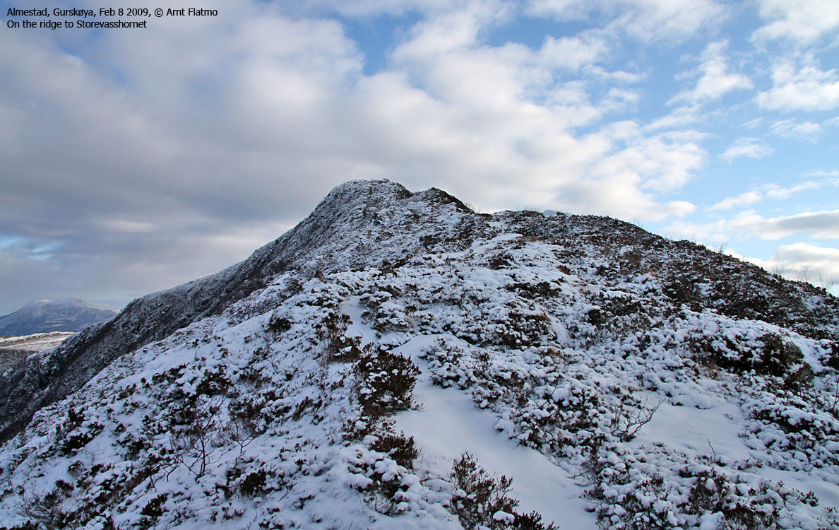
On the ridge to Storevasshornet
(Click for larger image)
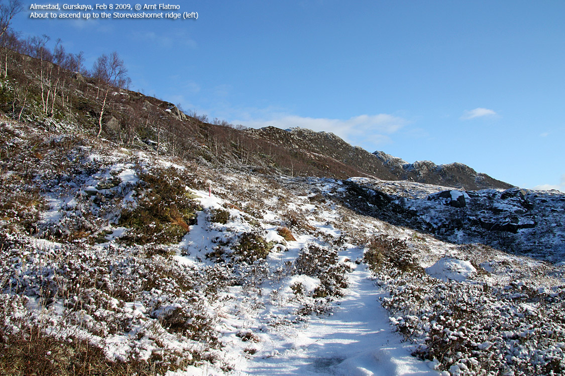
Storevasshornet (Vasshornet on the 1:50,000 map) and Fyre (Fyret) are two fun tops on the mountain ridge stretching between Laupsnipa (above Voldnes/Vålnes) and Drageskaret, on the south side of Gurskøya island. The most recommended route is the 13km trip (mostly on a visible path) between Drageskaret and Voldnes, but the transport logistics might be an issue. As an alternative, this page describes routes to Storevasshornet and Fyre, beginning near Almestad.
From (near) Almestad, a path runs all the way to Storevasshornet, and when you get on the summit ridge, you'll have a tremendous view towards the Gursken fjord. From the top, you could consider visiting Laupsnipa too, only 2,5km to the east. It is probably best to descend on your ascent route, but you could also descend north to Skogevatnet and follow the north shore towards highway RV61.
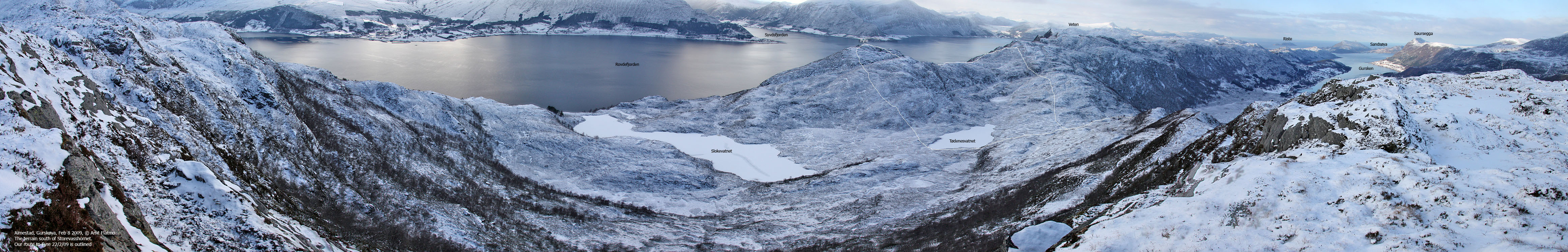
Fyre involves more off-trail walking, although a vague path runs across the ridge. From Fyre, you'll have a great view towards Rovdefjorden.
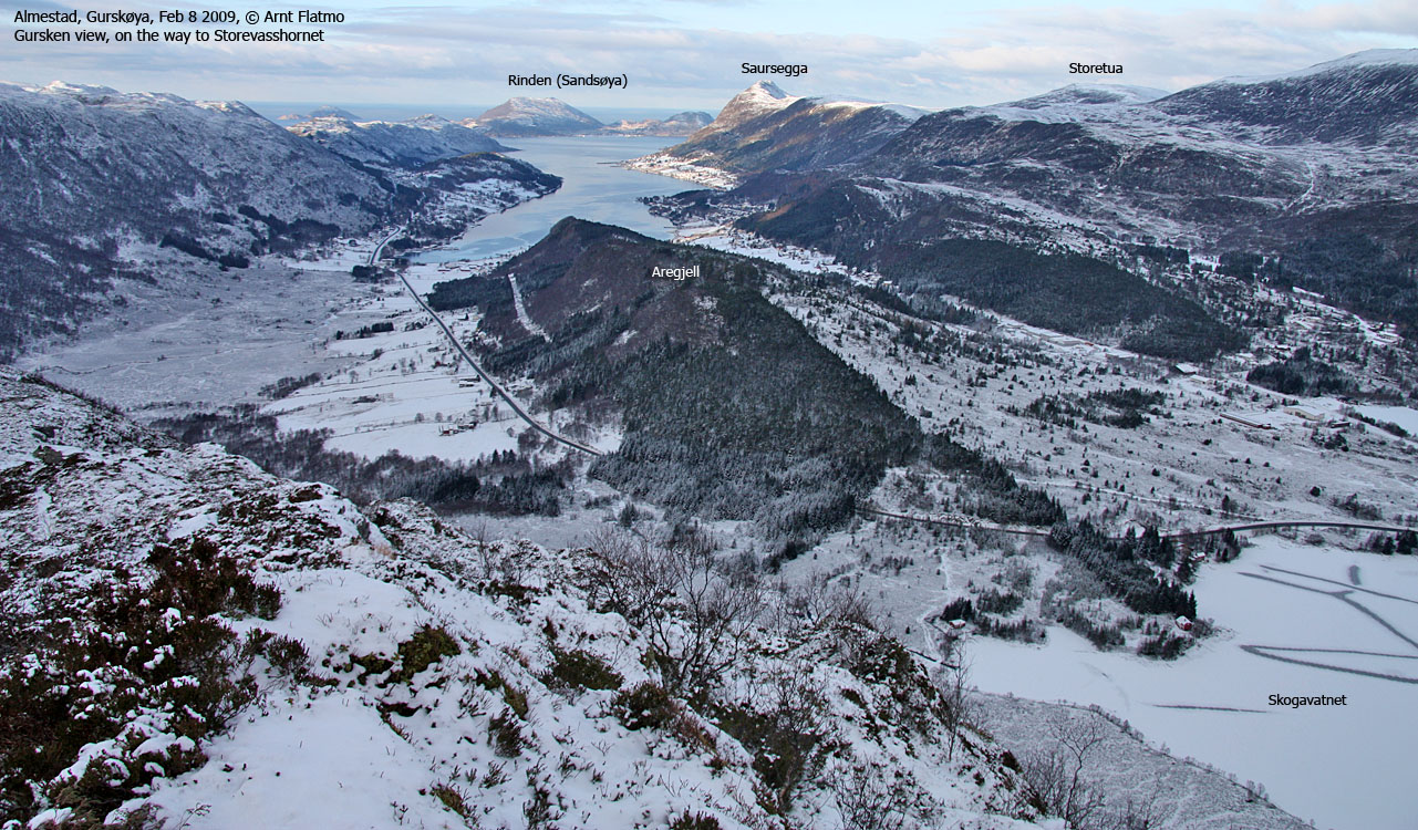
Gursken view from Storevasshornet
(Click for larger image)
Storevasshornet (Norge 1:50,000: Highest contour is 480m, Økonomisk Kartverk: 479m, UTM 32 V 329126 6902099) has a primary factor of 56m towards the higher parent Laupsnipa (558m). The defining saddle (approx. UTM 32 V 329716 6901765) is found south of Lake 419m. Ref. Økonomisk Kartverk (5m contours), the saddle is with the range 420-425m, interpolated to 423m.
GPS measurement read 480m (on the summit cairn, 1-1,5m high), averaged over a 5-minute period (error margin +/- 2,6m). Note that the high point is found 130m east of the trigonometric point.
Fyre (Norge 1:50,000: Highest contour is 380m, Økonomisk Kartverk: 389m, UTM 32 V 328405 6901310) has a primary factor of 66m towards the higher parent Keipen (413m). The defining saddle (approx. UTM 32 V 327974 6901321) is found 430m west of Fyre, and is, ref. Økonomisk Kartverk (5m contours), within the range 320-325m, interpolated to 323m.
GPS measurement read 388m (on the ground), averaged over a 2-minute period (error margin not recorded).
Google's interactive map. You can zoom, pan and click on the markers.
|
|
|
|
Route 1: Almestad - Storevasshornet (summer/autumn)
|
|
Access
(all distances are approx. distances)
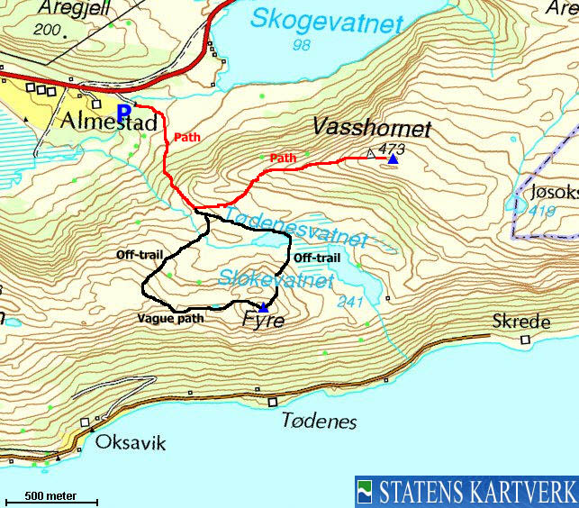
The nearest larger city is Ålesund. From Ålesund, follow highway E39 towards Bergen, and then RV61 towards Hareid. Take the Sulesund - Hareid ferry, and from the roundabout in Hareid, follow RV61 19,8Km to the RV61/RV654 junction 1Km after the Dragsundet bridge. You pass Ulsteinvik and make a sharp right turn (Måløy) along the way.
From the RV61/RV654 junction, follow RV61 and drive 10,7Km. You've now crossed Leikongeidet and you're on your way down to the Gursken fjord. Locate a narrow forest road on your left-hand side (it's difficult to see). Drive down this road, cross the river from Skogevatnet across a bridge and find parking by a building at the end of the road.
The route

Storevasshornet seen from the road
(Click for larger image)
Follow a forest path that runs southeast through a small forest. Once out of this forest, cross a creek and head towards the mountain ridge. The path runs up through a nice birch forest before you enter the valley between Storevasshornet and Fyre. Pay attention to when the path forks. The path you're on will continue into the valley, while the path to Storevasshornet ascends the ridge up to your left. You'll pass a trigonometric point before you reach the summit cairn, 130m further east.
|
Route 2: Almestad - Fyre (round trip, summer/autumn)
|
|
Access
Same as for Storevasshornet. See above.
The route
Fyre round trip route
(Click for larger image)
Follow a forest path that runs southeast through a small forest. Once out of this forest, cross a creek and head towards the mountain ridge. The path runs up through a nice birch forest before you enter the valley between Storevasshornet and Fyre. As you enter the valley, head (off-trail) towards the north side of Lake Tødenesvatnet. Once past this lake, turn south and ascend directly up Fyre. It is a bit steep, but not directly exposed. The high point is easy to find, although it is not marked.
From the high point, head west, but soon descend into a small valley down on your right-hand side. Aim for a small lake, which you pass on the south side. Get up on the closest ridge, where you'll find a path. You're now on the main ridge path. Follow it up to 370m elevation (Kringstadnakken on ØK), where you turn north and look for a good route down to the valley. This route is best suited for those who enjoy seeking outside the established trails...
 westcoastpeaks.com
Other Møre & Romsdal mountains
Other Norwegian mountains
westcoastpeaks.com
Other Møre & Romsdal mountains
Other Norwegian mountains


