
Norwegian Mountains, Møre og RomsdalAregjell, 200m
Aregjell & Gursken area
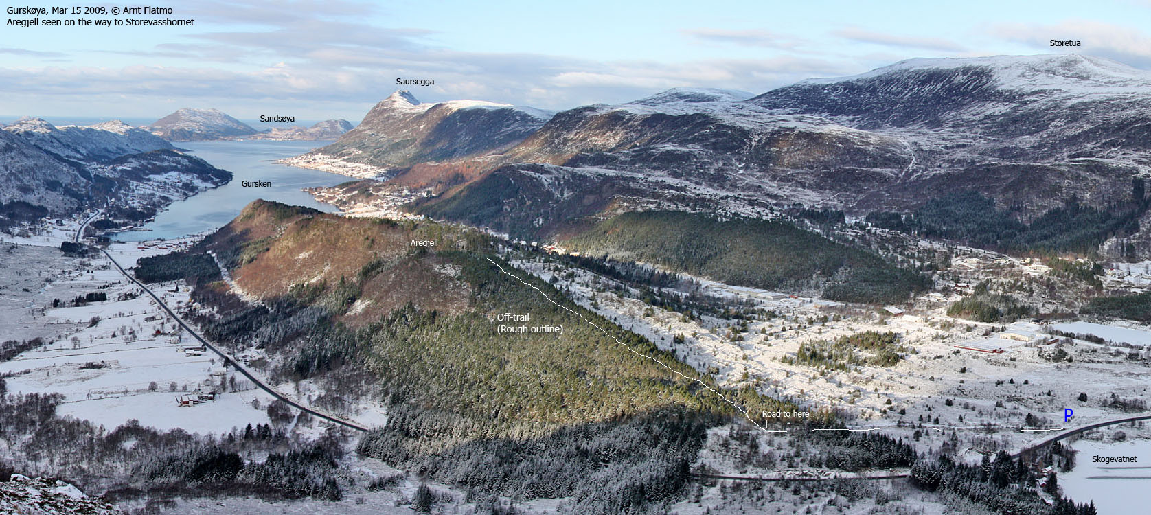
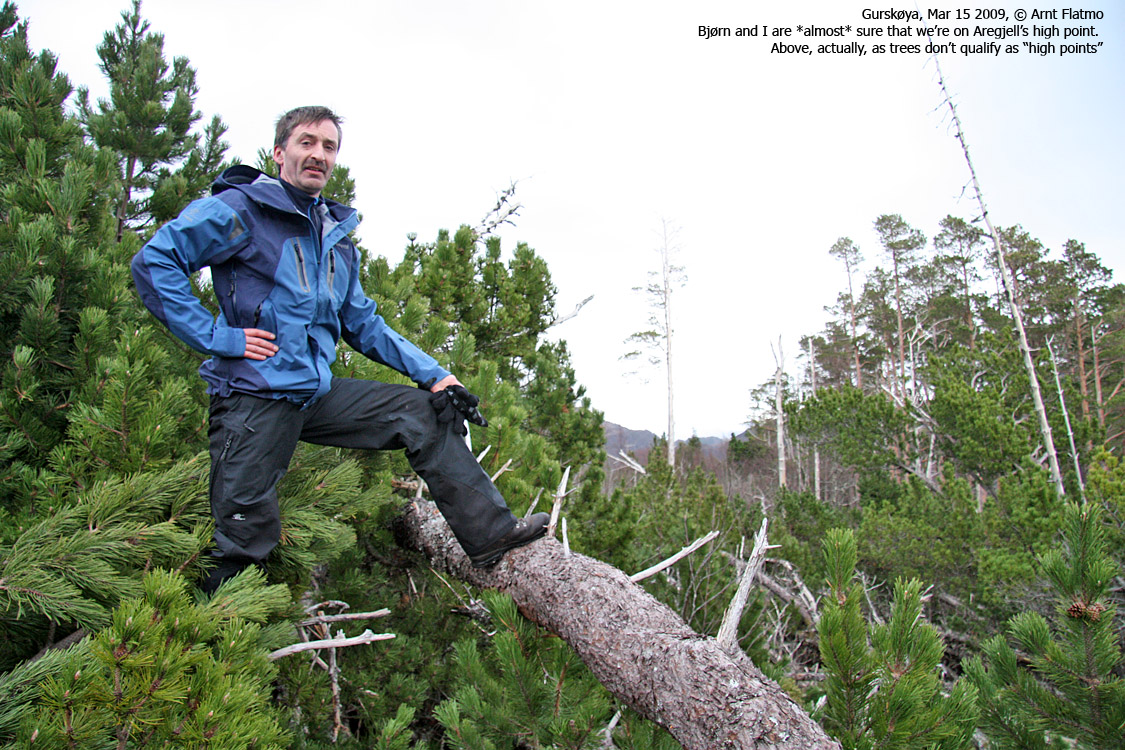
IntroductionAregjell (Arehjellen) is the high point on a forest ridge that stretches between Lake Skogevatnet and the Gursken fjord. Locally, this forest ridge is also called Litlefjellet, even if Litlefjellet on the map is located a bit west of Aregjell. There is no distinct path across this ridge. A few forest roads lead up to the forest ridge, and there is a marked path from Gursken Skole to a popular meeting point west of Litlefjellet. The Jan 1 1992 hurricane (Nyttårsorkanen - external link [pdf]) left a massive footprint on Aregjell. At Svinøy Fyr (25km NW of Aregjell) the highest average wind speed was 46 m/s. The strongest gusts measured 62 m/s. Parts of the ridge are "catastrophe areas", and one can simply not walk through these parts. Those who enjoy challenges may set out to pinpoint the exact position of Aregjell's high point. Good luck... 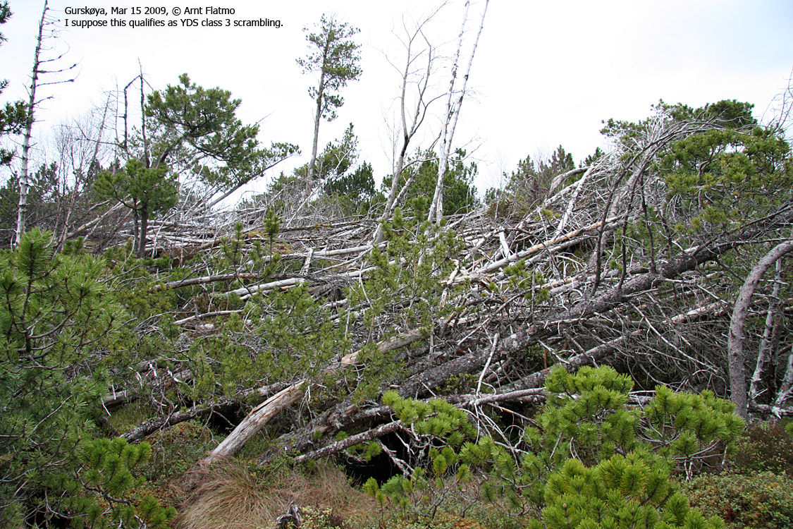
Armageddon on Aregjell
The forest ridge can be accessed from almost anywhere, except for via the steep cliffs rising above highway RV61. This page describes a short off-trail route to the near-enough high point via Halsane near Skogevatnet. Primary factor:Aregjell (Norge 1:50,000: 200m, Økonomisk Kartverk: highest contour is 195m, UTM 32 V 327325 6902769) has a primary factor of 97m towards the higher parent Røddalshorn (563m). The defining saddle (approx. UTM 32 V 316269 6892031) is found between these two tops, near the road from Skogevatnet to Gursken. Ref. Økonomisk Kartverk (5m contours), the saddle is within the range 100-105m, interpolated to 103m. GPS measurement read 198m (on a fallen tree, somewhere near the high point), averaged over a 1-minute period (error margin 3-4m).
Google map
Google's interactive map. You can zoom, pan and click on the markers.
Trail descriptions
|
|
Route 1: Halsane - Aregjell (summer/autumn)
|
|
Access
(all distances are approx. distances)
The nearest larger city is Ålesund. From Ålesund, follow highway E39 towards Bergen, and then RV61 towards Hareid. Take the Sulesund - Hareid ferry, and from the roundabout in Hareid, follow RV61 19,8Km to the RV61/RV654 junction at Myrvåg - 1Km after the Dragsundet bridge. You pass Ulsteinvik and make a 90 deg. right turn (Måløy) along the way.
From the RV61/RV654 junction at Myrvåg, turn 90 deg. to the left, and follow RV61 for 10Km. You see a forest road on your right-hand side, and you've passed the Haugsbygda/Gursken junction (300m). See also picture on top of this page. Park on the forest road, or at the junction 300m up the road.
The route
Follow the forest road 250m, then turn right, leave the road and head into the forest. Follow the ridge upwards. 550m after you left the forest road, you run into a small meadow and the power lines cross here. Continue on the ridge, but stay left when you run into clusters of fallen trees. The (assumed) high point is approx. 100m west of the power line.
Descend your ascent route, or continue west along the ridge. Litlefjellet is located approx. 600m west of Aregjell, and you'll run into another forest road along the ridge. You can return via this forest road and the road along Myklebustelva back to Skogevatnet.
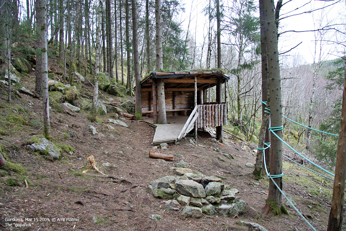
At approx. UTM 32 V 326415 6903018, approx. 1km west of Aregjell, there is a forest meeting point with a gapahuk and ropes that kids (adults too..) can climb. A marked path runs down to Gursken skole.

Forest activities
(Click for larger image)
 westcoastpeaks.com
Other Møre & Romsdal mountains
Other Norwegian mountains
westcoastpeaks.com
Other Møre & Romsdal mountains
Other Norwegian mountains


