
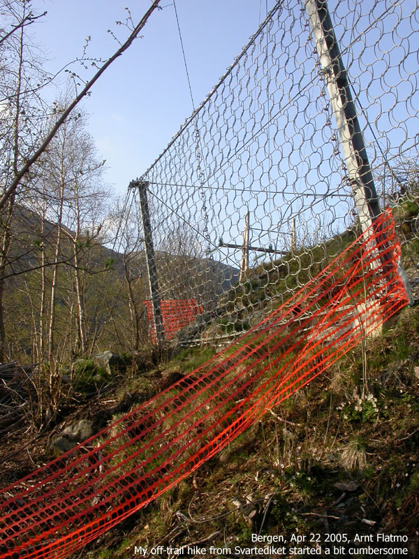
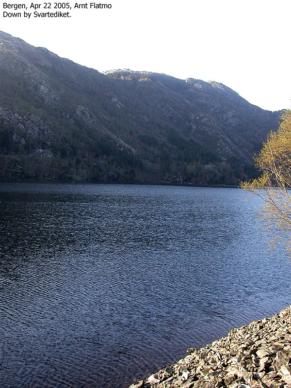
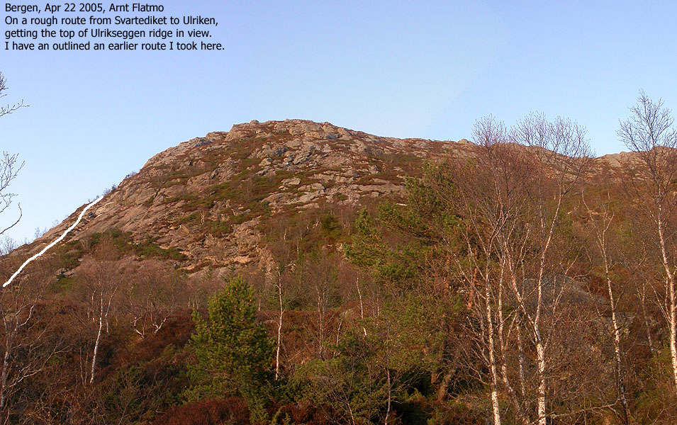
The purpose of this trip was to find a route from Svartediket to the lower part of the Ulrikseggen ridge. The ridge is a fun route (path), but I am not crazy about walking around the dam just to get onto this path. From Svartediket, I had to cross a closed zone (construction area) before I was able to descend down to a boulder field by Svartediket. From here, I could see that there was no way of walking further along the dam. As I started to ascend, I noticed I was on the same route as back in March 2004, when I followed a steep and exposed route (off-trail) directly up to the top of Ulrikseggen. That route is described here.
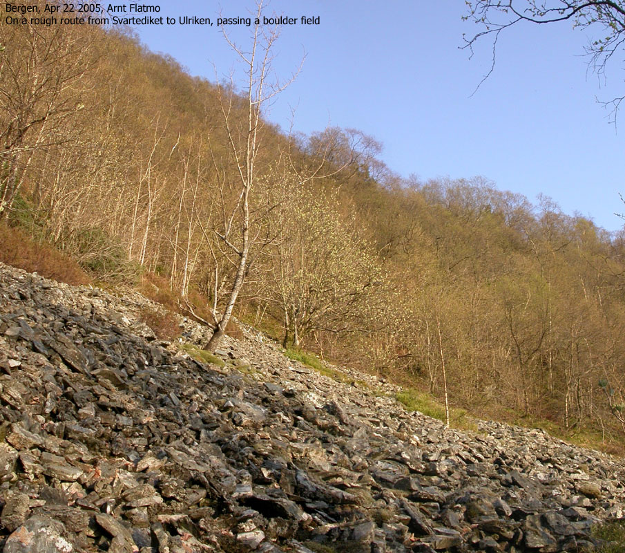
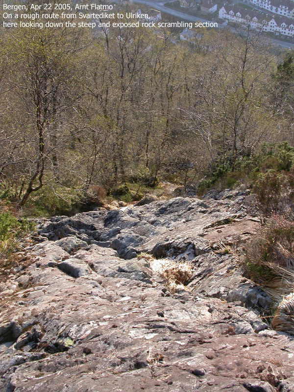
Instead of following the same route, I decided to follow a straight line which would lead me closer to the tower. The lower forest is steep, but not very exposed. It's difficult to pinpoint the route exactly on a picture, but I crossed a large boulder field, free of trees. I had view towards the city here. After this boulder field, I stumbled onto a narrow gully which turned into a wall of slabs with steps. As I was carrying my dachshund Troll, I did not have the required balance to climb directly on the slabs. Instead I used the ice-axe to climb up the grass next to the slabs. It was equally steep, but I got better grips with the ice-axe. Without the axe, the route would have been very difficult.
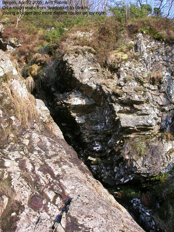
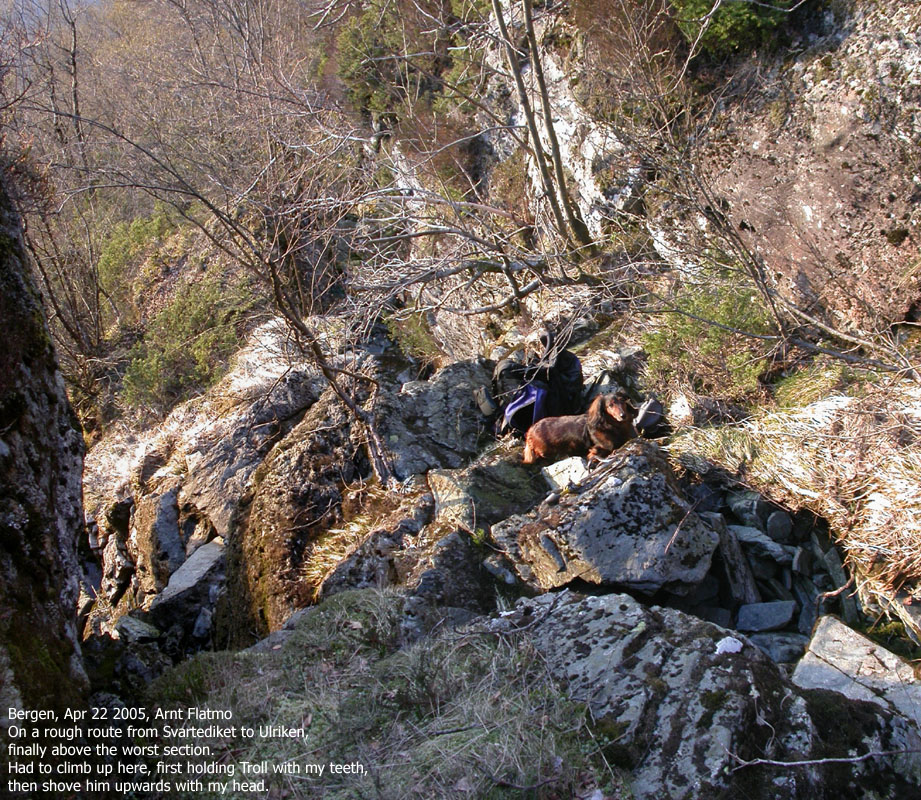
The terrain got steeper by the minute and after a while I joined a distinct couloir that stretches a few hundred vertical meters (and is easily seen from the city). My route and the couloir merged and I was forced into a narrow corridor which had a dead end. For a small person, it might be possible to "escape" through a hole between some huge, slippery rocks. A better alternative is to climb a step to the left. This step is exposed, but technically easy (US class 3). I did not risk climbing with the dog in the backpack (he might have fallen out) and wasn't able to perform the usual "get a grip with the left hand and swing him across with the right", so I had to shove him up using a combination of teeth, head and hands. The dog has great patience, and isn't a stranger when it comes to awkward situations.
With the dog, this was a "one-way" route, and I climbed it in advance to be sure there weren't any further problems. Before we reached Hestedalen valley below the Ulrikseggen ridge, we topped out over the large couloir on a very narrow ridge. Very cool terrain. The rest of the route up to the ridge was trivial. We then hiked back down to Svartediket via Bjørndalen - this time on a trail where normal people walk...


No Javascript:
1 2 3 4 5 6 7 8 9 10 11 12 13 14 15 16 17 18 19 20
 Other hordaland mountains
Other Bergen K. mountains
Ulriken main page
westcoastpeaks.com
Other hordaland mountains
Other Bergen K. mountains
Ulriken main page
westcoastpeaks.com