
|

Toro(No Javascript) |
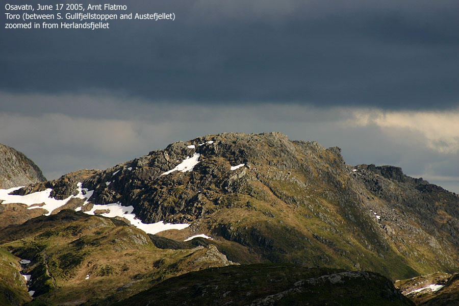
Toro is a small hump located a the bottom of "Korketrekkeren", along the standard route from Redningshytten to Gullfjellet. Due the low primary factor, Toro is not considered as an independent mountain on this web-site, but since I have followed an amusing route to the summit, I expected there could be some interest out there.
Toro is however very easy to ascend from Korketrekkeren, and a well traveled trail passes its summit and climbs down a ridge towards Brekkedalen. The route described on this page runs up Hau(g)sdalen, climbs steep up Hestabotn in a couloir, climbs the Toro NW ridge and descends down the Toro south ridge.
The map states that the valley name is Hausdalen, but I have received very strong suggestions that the name should be Haugsdalen. Normally I always follow what the map says, but since came from a friend, and because it says so on a roadsign, I have put the 'g' in brackets of pure good will.
Primary Factor:
Toro has a primary factor of 45m towards the higher S. Gullfjellstoppen. The saddle is just 190m east of the summit, and the adjacent contours on the Norgesglasset 5m map are 690m. The saddle height is interpolated to 688m.
Note: Class ratings are in reference to YDS (Yosemite Decimal System).
Note: The trail described below is not necessarily the easiest trail to this mountain.
|
Hau[g]sdalen - Hestabotn - Toro - Brekkedalen (spring)
|
|
Access
From Bergen, follow highway E39 towards Stavanger. Near lake Kalandseidvatnet, exit left approx "Haugsdal". Follow this road until road end (approx. 10Km). Do not park where the bus turns around. The public parking is on the other side of a gate (which may be open when cattle is not present).
The route
Hau[g]sdalen
Just before a bridge near the parking, follow the leftmost trail. The rightmost trail (gravel road to be precise) that crosses the bridge runs up Brekkedalen valley. Continue upwards Hau[g]sdalen valley. The trail is well worn, although parts can be quite boggy after rain. Hike nearly to the end of the valley. When you reach the boulderfield on top of the valley, look up to your right, and you will see a distinct couloir. Most likely, there will be a stream coming down from a lake north of Toro. This area is known as Hestabotn.
The route up the couloir in Hestabotn
The suggested route is to follow the stream all the way to top. The entire route is in general steep hill walking and minor scrambling. The presence of snow will cover details in the terrain, and there is less scrambling. Near halfway up the couloir you encounter the crux of the route. There are actually two. You have a waterfall before you, and it is much steeper and deeper than you would think from looking at it from below. You can climb up on either side of the waterfall and reach the top. Climbing up on either side is the tricky part. We followed a route to the right of the waterfall, and probably easier access via a snowbridge (giving us considerable height above the stream). Without snow, it may be best to attempt the left hand side of the waterfall.
Back to the right hand side - getting off the snowbridge and onto the mountain is not quite trivial, clearly a class 4 move. Then climb up a narrow ledge until you are level with top of the waterfall. You are now only two long steps from easier terrain, but this is where you face the second class 4 crux, and with far more exposure (my estimate is 6m down to the stream). You have to traverse sideways, face in and with scarce handholds. No shame in pulling some safety devices up from the backpack.
Once you are back in the stream, you have some easy scrambling before you enter the upper terrain, which is just a steep hillwalk. On top, you will see the cairn trail from Redningshytten towards Gullfjellet.
Toro via the NW ridge
Continue south towards Toro. Toro has a distinct NW ridge with Hau[g]sdalen down on your right. On snow, this is a fairly easy (but steep) walk on snow. Ice axe should be brought along, and crampons are necessary if the snow is hard. Without snow, this ridge a fairly easy scramble route.
Descent
From the Toro summit, head south until you reach the cairn trail down the Toro ridge. Follow this path until it makes a very sharp turn to the left at approx. 320m elevation. Instead of following the trail down to Brekkedalen (going in the wrong direction for quite a stretch), locate a trail to your right. Follow this path (more vague in places) down the ridge. Eventually, this trail also makes a left turn and takes you down to the Brekkedalen road. Follow this road back to the trailhead.
The weather was still sensational. A high pressure had blessed the country since the beginning of the week. Clearly, one had to spend the afternoon in the mountains. Torstein Skage asked me if I knew the Hestabotn route. As I did not, and he did not, it was obvious that we had to check it out. I had really no clue about the route, beside the fact that I expected it to be steep (otherwise Torstein would not have asked).
We met at the Hau[g]sdal trailhead and left the car approx. 17:00PM. We came fairly good prepared for this hike - slings, axes, rope, snow flukes, crampons - the works. We chatted our way up the valley and "soon" arrived Hestabotn. My first impression was that this was an easy route. Child's play. But I know from experience how angles and distance play games with one's mind, and I decided to be "mindful" about it. We decided to stick with the couloir and scrambled whatever obstacle that was in our way. For fun and show.
Below the ugly waterfall, we hit a less trustworthy snow bridge covering the stream below. The snow (barely) held when we sought out on the sides. For sure, it didn't hold in the center. When we reached the waterfall, the terrain was now downright nasty. I was on the left hand side of the stream, while Torstein was on the other. I tried to figure out a route on my side, but Torstein had already started climbing up to the right. Torstein is an experienced climber, while I'm not. I watched his efforts with a grin on my face. Not only would I have to cross the rotten snow, but I couldn't quite figure out how to approach this problem. I thought I had figured out a combination of moves, but this wishful thinking fell into pieces when Torstein told me "one step further and you will be falling through..."
Eventually I got up, and felt that "let's not go down this way" sensation just as I hauled myself up the cliff. We were now in a narrow spot, on level with the top of the waterfall. We were just a few meters away from safer ground, but it looked far from easy getting there. I was looking at some good opportunities for handhold, and thought I had figured out the sequence of handholds. Then Torstein ran his ice axe into the mountain and piece by piece crashed down into the waterfall. "Great, if you keep on, you'll chop away the mountain, providing an excellent crossing", I told him.
Torstein was determined to get across and did some more handywork before he set across. Face in, gravity out. When he was safely across, I decided that this was just a bit too awkward for a rookie class 3 climber. This stuff required some degree of mental comfort, and Torstein threw over a sling which I twisted around my arm. I guess the notion of hanging by one arm in the waterfall made me very determined to get across. I didn't figure out his sequence of handholds, and tried to remain very calm by locating grips I could trust. This clearly felt better, but got me nowhere. After a sequence that I felt less good about, considering I was leaning backwards above the 6-7m deep waterfall, I finally made it across. The sense of relief is highly underrated.
The rest of the walk upwards was trivial. Steep, yes, but at least I wouldn't fall anywhere. The soft snow would probably have prevented me from sliding anywhere even if I had given it a hard try. Once on top of this couloir, we decided to climb Toro via the northwest ridge. Torstein mentioned something that I interpreted as hitting Toro straight on. I looked at the cornices on top, and all the rocks that I would become familiar with in the event of a fall. He must have noticed my twisted face and didn't pursue the matter. We headed up the NW ridge.
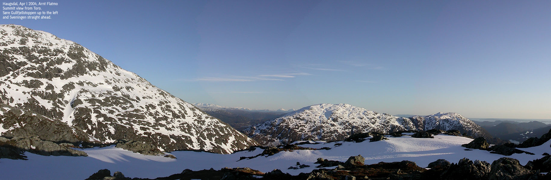
This was terrain that I most likely wouldn't have considered as a solo walk. I watched Hau[g]sdalen far down on my right, and reflected on that falling down into it would be a very bad thing. The ridge was however not as steep as I had anticipated, and it was a very pleasant hike upwards. From the summit, which I guess we reached approx. 19:00PM (I didn't make a note of the time), we had a clear view towards Ænes, Rosendal and Uskedalen mountains, in addition to the mountain range from Tveitakvitingen to Gjønakvitingen. The weather was just too good to be true. It was a most excellent afternoon. We followed the Toro ridge back down and returned to the car just after 20:00PM.
Move cursor to read notes, and click on the images to see full version.
Some of the thumbnails may have been cropped to fit the format.
Pictures are presented in the order they were taken.

![2. Vallatraeet in Hau[g]sdalen (129KB)](../thumb/toro_03valleyHT.jpg)


No Javascript:
1 2 3 4 5 6 7 8 9 10 11 12 13 14 15 16 17 18 19 20 21 22 23 24 25 26 27 28

No Javascript:
 Other hordaland mountains
Other mountains in this area
westcoastpeaks.com
Other hordaland mountains
Other mountains in this area
westcoastpeaks.com

