
For Information, maps, trailhead and route descriptions, click HERE.
I had absolutely no idea about where I would end up, when I headed out from Ålesund this rainy Saturday in November. Due to the bad weather, I had almost given up on the idea of hiking, but at noon, I had a need to go .. somewhere.
While driving Brusdalen, I wondered if I should hike Grøtfjellet in Vestnes. This plan was canceled as I hit a MASSIVE rainshower by Eidet. Besides, the mountains were fogged in above 300m. I decided to visit Bjørnøyfjellet and Terøyfjellet instead. At least there would not be fog on the tops.
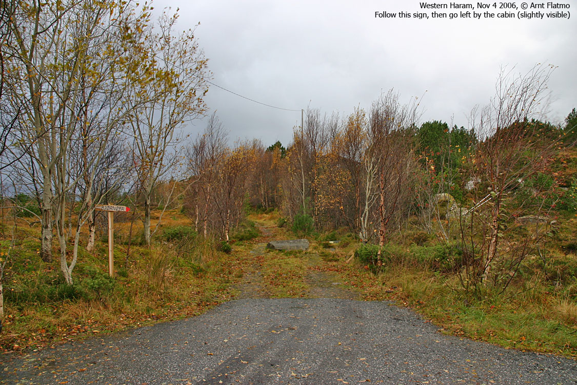
Bjørnøyfjellet
I drove to Bjørnøya first, followed the road almost to its end and noticed the "Bjørnøya" trailsign. I figured this was a good place to start as any, and the dog ("Troll") and I left the car 13:16PM.
The wind came out of nowhere and changed the hike from trivial to hard. The gusts had to be of storms' strength, and I had problems ascending slab rocks halfway up the hillside. I was concerned about the dog, as the wind moved him around. But I couldn't keep him in the backpack either. It was raining (horisontally), and the raindrops felt like small rocks when they hit. Troll would be more sheltered from the wind down on the path, even if the terrain was very cumbersome for him.
The winds and the rain decreased when we reached the top 13:35PM, and I was able to get a couple of (steady) pictures. I noticed that I was soaking wet and wondered if I should skip Terøyfjellet. We followed the same route back down and were back at the car 13:55PM.
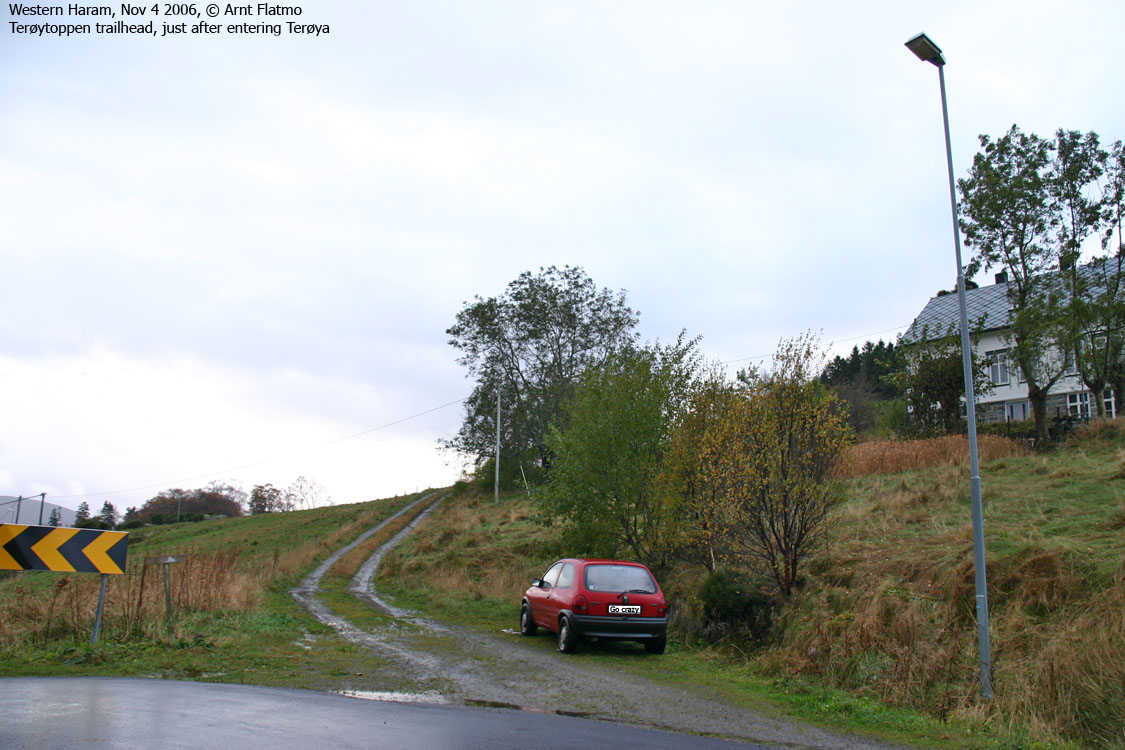
Terøyfjellet
On the way from Bjørnøya, the weather got gradually better, and I decided to stop by Terøya too. I noticed the "Terøytoppen" trailsign just after entering the island. These trailsigns along the road are VERY CONVENIENT, but they are (sigh..) just too few.
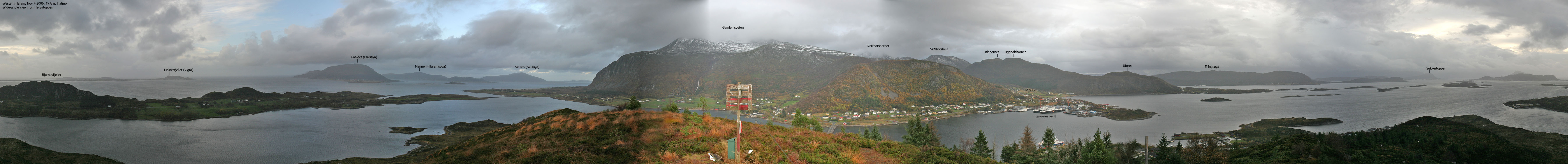
I left Troll in the car. He seemed so comfortable, wrapped in a fleeze blanket, and I would only be gone a few minutes. I left the car 14:10PM and reached the top 14:25PM after a nice and steep forest walk. Just as I came out of the forest, an eagle passed across the top. What a brilliant sight! The elegance ...
The weather was FAR better now, and after taking pictures from the top, I headed back down and was back at the car 14:32PM. No "typo" here, it took just 5 minutes down the forest.
Bjørnøyfjellet


Terøyfjellet / Terøytoppen


No Javascript:
1 2 3 4 5 6 7 8 9 10 11 12 13 14 15 16 17
 westcoastpeaks.com
Other Møre & Romsdal mountains
Other Norwegian mountains
westcoastpeaks.com
Other Møre & Romsdal mountains
Other Norwegian mountains