
|

A ridge route to the top(No Javascript) |
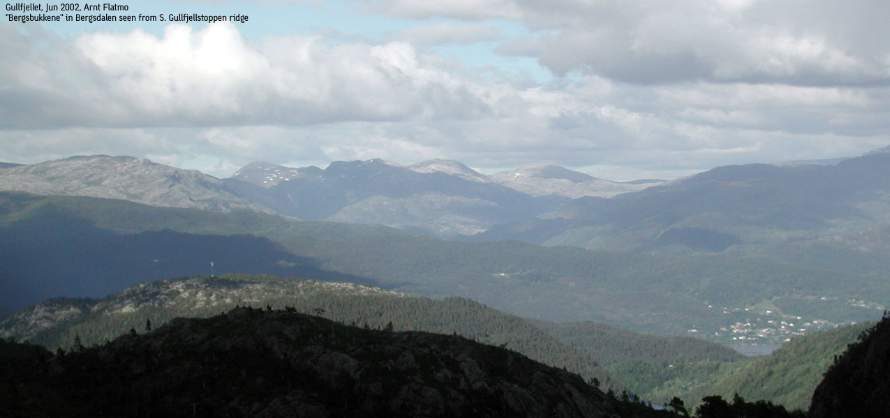
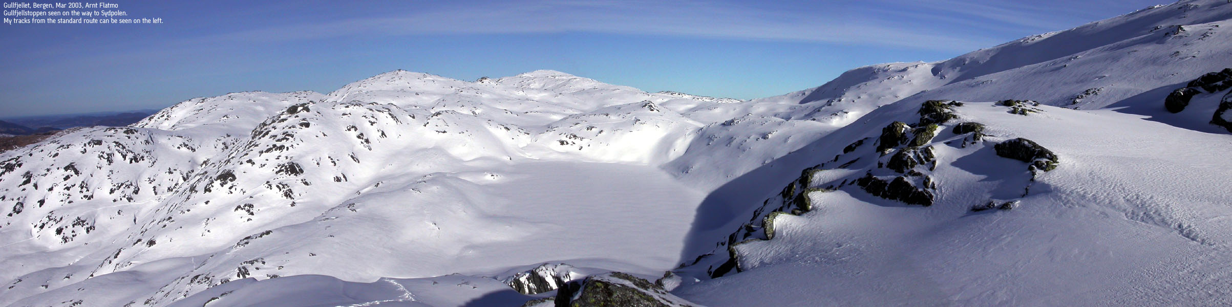
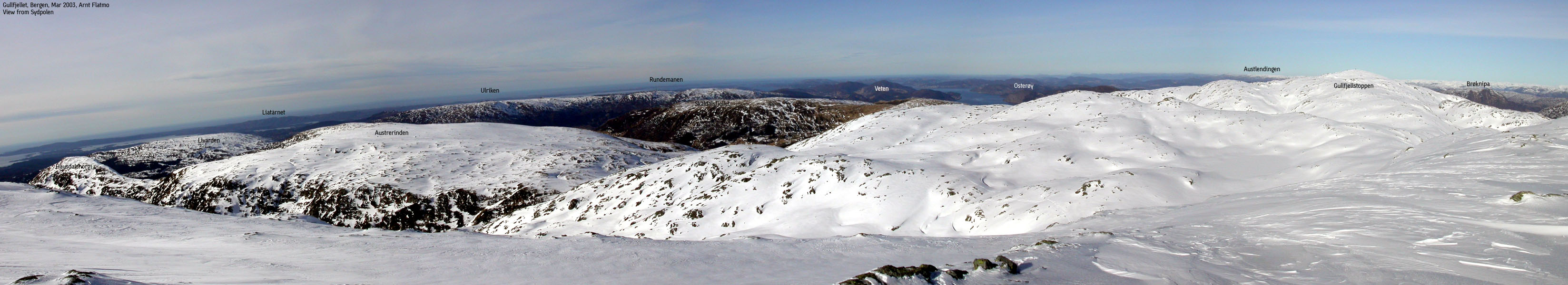
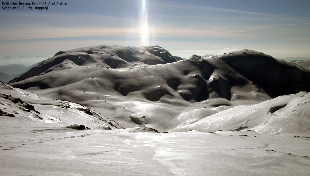
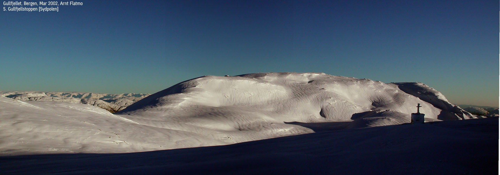
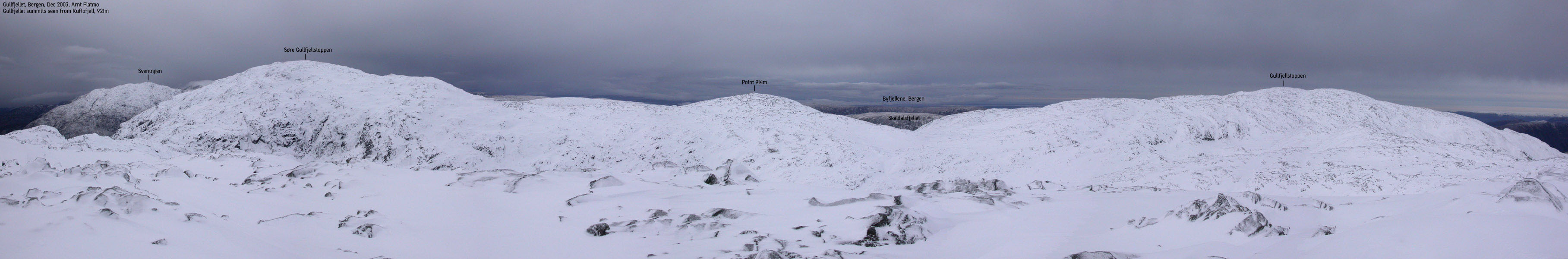
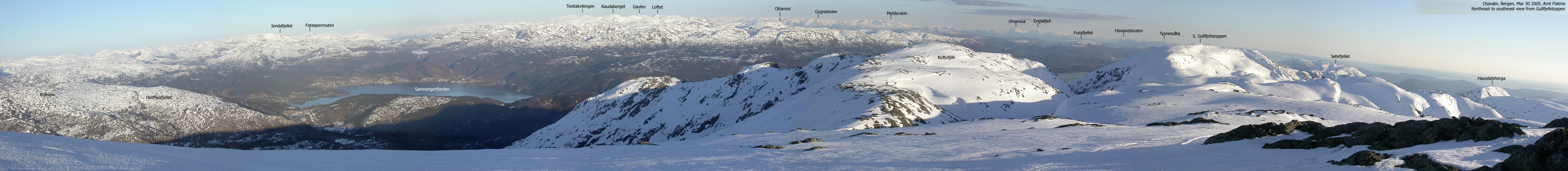
S. Gullfjellstoppen, also called "Sydpolen" among those familar with Gullfjellet, is the second highest peak on the Gullfjellet massif. Gullfjellstoppen, the highest point at 987m is also the highest point in Bergen Kommune. The massif is located just outside the city of Bergen, and is easily accessible from the lake Osavatnet, Gullbotn and Brekkedalen trailheads, a.o.
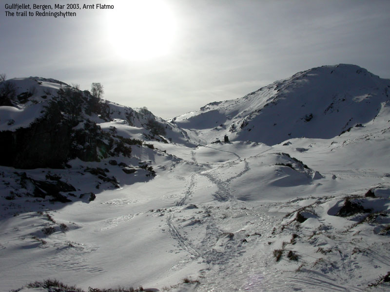
In less than half an hour, Bergen citiziens can experience a wild landscape, often in severe weather. Most popular is the lake Osavatnet - Redningshytten hike. The hike takes normally just about one hour, and takes you to the foothills of the Gullfjellet summits. From Redningshytten, a number of trails fork in different directions, including the cairn trail to Gullfjellstoppen, the highest point on the massif, at 987m. Along the way to Gullfjellstoppen, one can leave the cairn trail at point 914m and head south towards S. Gullfjellstoppen.
In addition to the regular route, I have provided descriptions of additional ridge routes from Brekkedalen and lake Osavatnet. None of the routes are technical and can easily be followed by those used to walk about in the mountains.
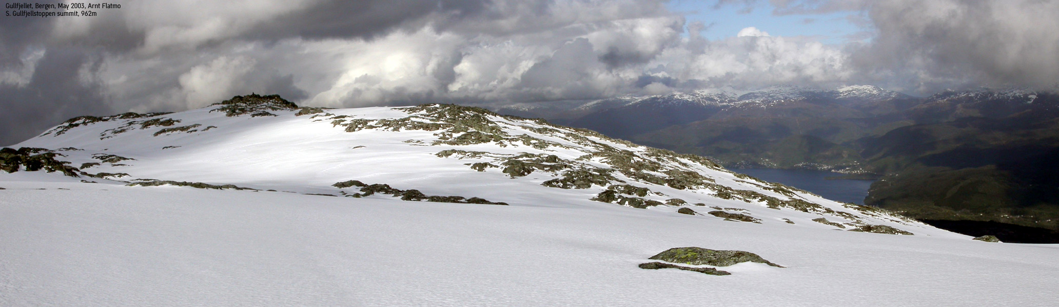
S. Gullfjellstoppen (M711: 962m, Ø.K: -) has a primary factor of 124 towards the higher Gullfjellstoppen (987m). The saddle is found between the two tops. Ref. Økonomisk Kartverk (5m contours), the saddle is within the range 835-840m, interpolated to 838m.
Note: Class ratings are in reference to YDS (Yosemite Decimal System).
Note: The trail described below is not necessarily the easiest trail to this mountain.
|
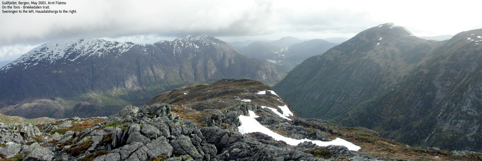
Route 1: SE ridge from Brekkedalen. Descent via Hausdalen (summer/autumn)
|
|
Access
From Bergen, follow highway E39 south towards Stavanger. Pass Nesttun and lake Kalandseidvatnet. Exit right at the roadsign "Hausdal, 10". Continue all the way to the end of the road at Hausdal. Find parking in the outer lane of the bus-area. Make sure you don't block for the bus, which needs to turn around here. If the outer lane is full, you may drive through the gate to a second parking area. Make sure you lock the gate, as there is sheep and cattle within.
The route
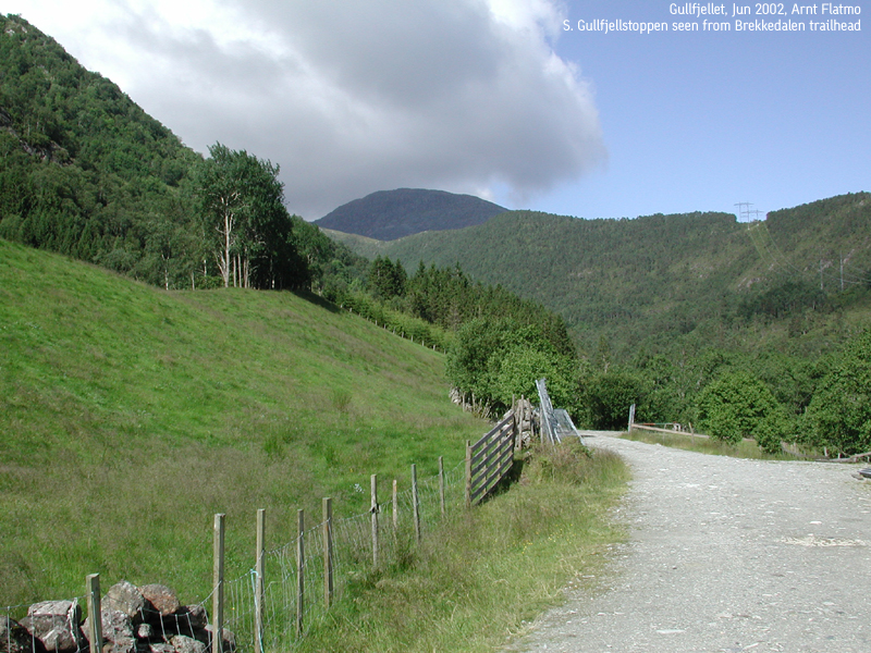
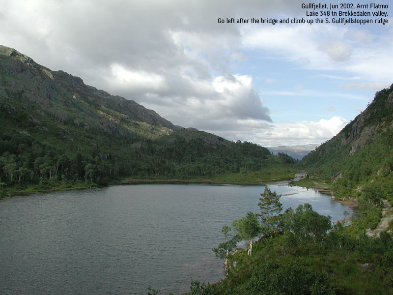
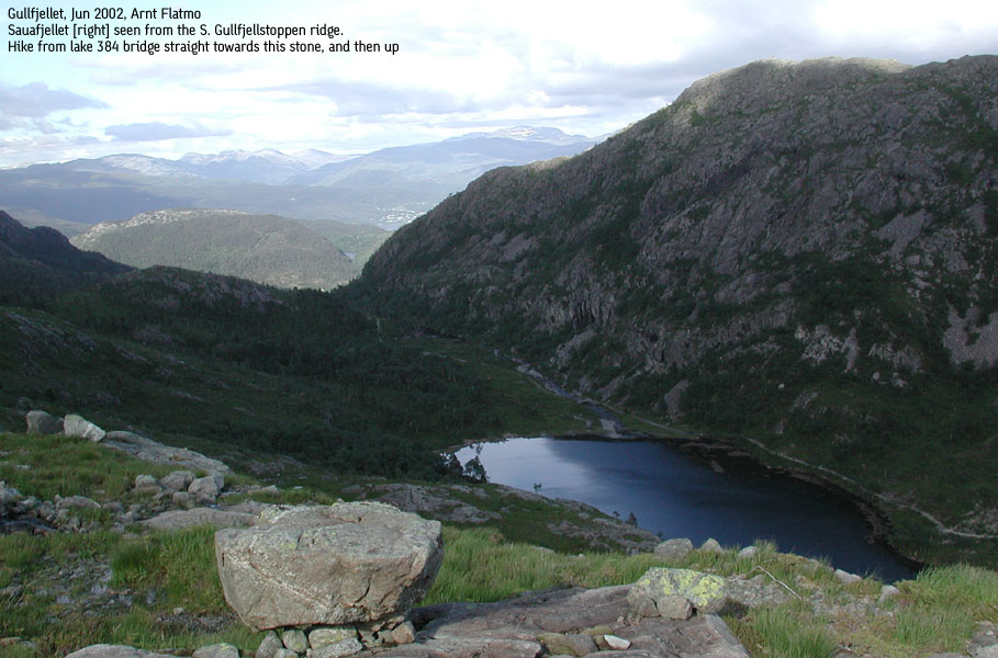
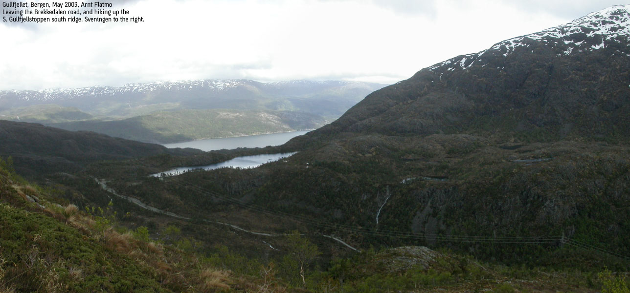
Follow the gravel road for a few meters, and when the road forks, go right over the bridge. Follow the gravel road for about one hour (steady rhythm) up the Brekkedalen valley. When you reach the highest point, there is a gravel road going up to your left. Follow this road, and pass three cabins. The "road" now turns into a trail and heads towards lake 384m. Continue to the NE end of the lake, cross the bridge, and leave the trail.
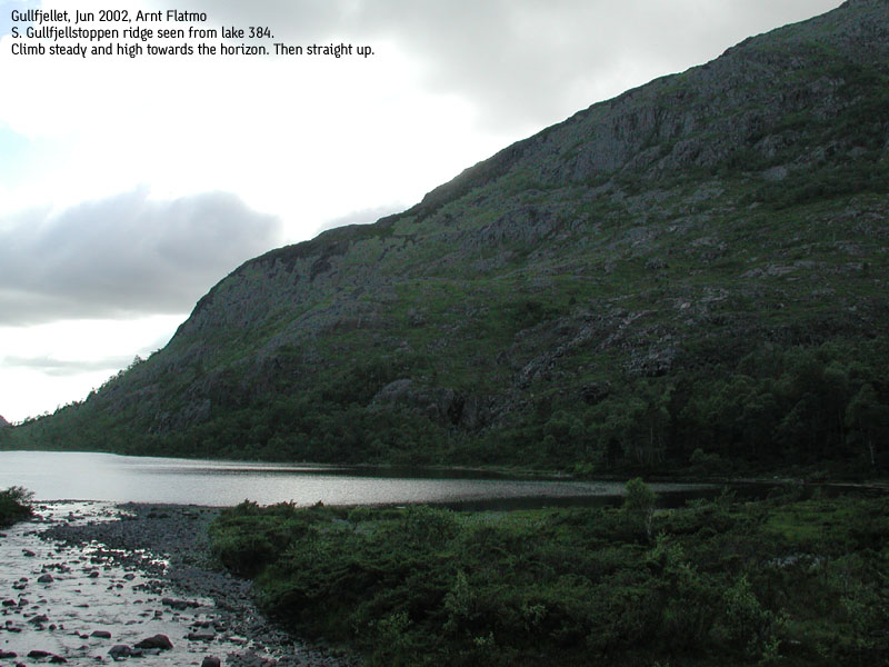
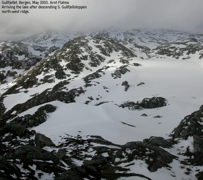
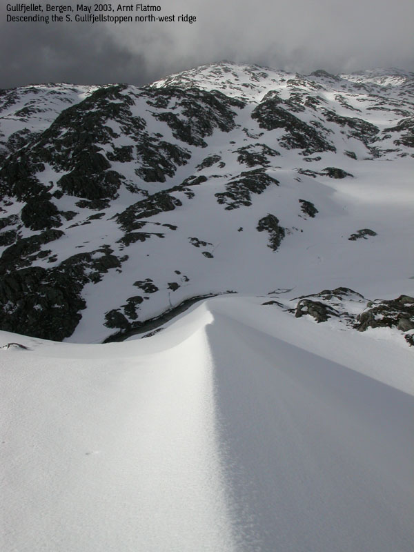
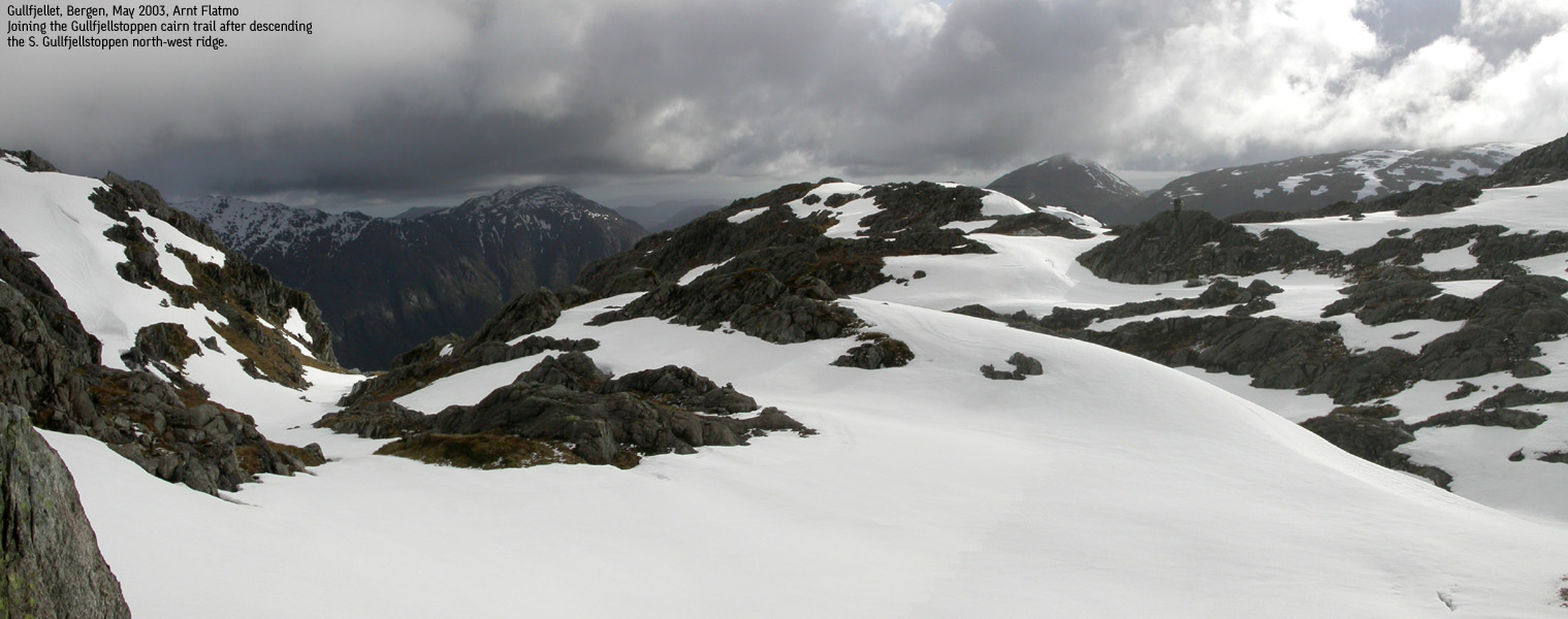
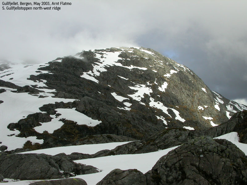
If you look back the way you the came, and then further right, you see a distinct rock towards the horizon, up on the S. Gullfjellstoppen ridge. Head west, gain some height and maintain the western direction towards this rock, while gaining altitude as you go. Once at the rock, turn north/north-west and follow the ridge all the way up to the S. Gullfjellstoppen summit.
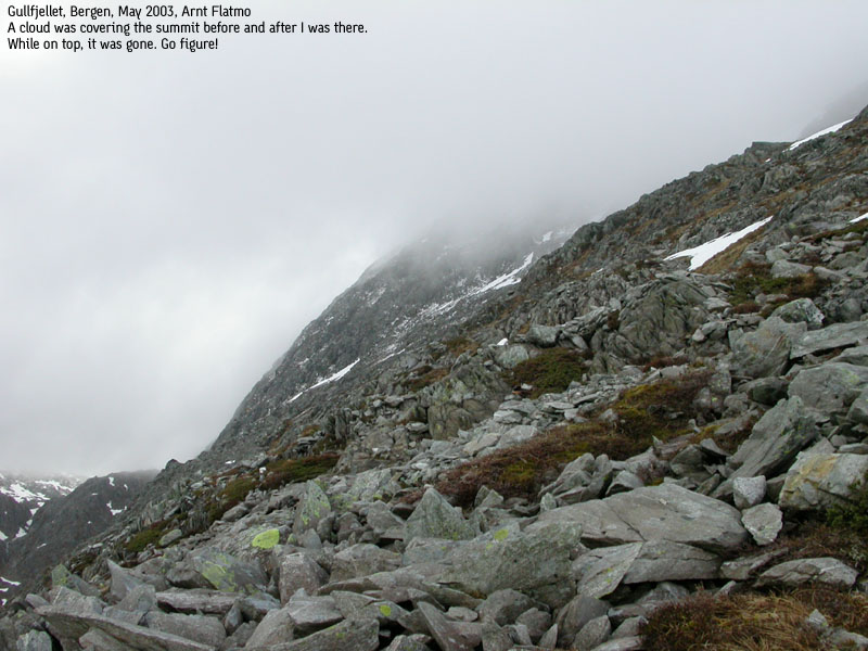
The terrain is not difficult. Almost no handhold is required. If you stay close to the gully on your left hand side, you will run into steeper terrain at approx. 700m. The steepest part can be avoided by taking a detour towards your right. However, the scramble up the short section is only fun, and not dangerous. Once above this point, the route again turns into grassy slopes and modest grade. If you head straigth north, you will run into a cairn that probably marks the ridge, as the ridge also as a few smaller cairns. The summit is a little further to the NE.
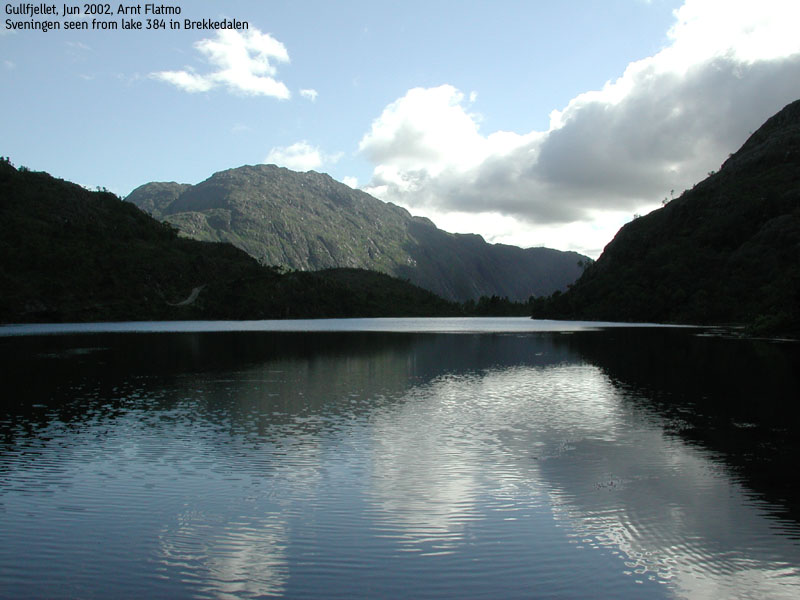
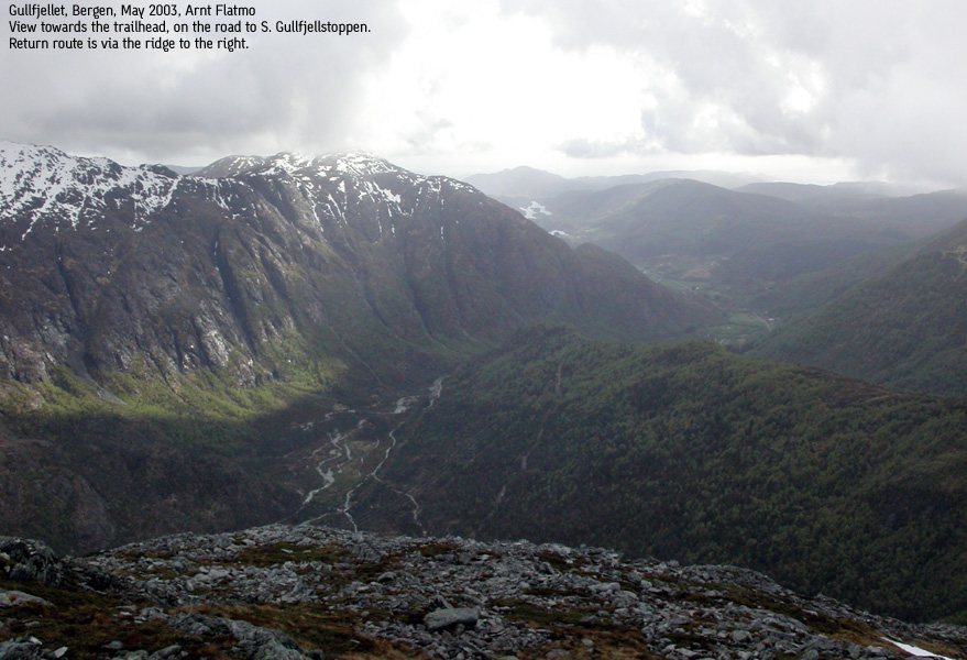
From the summit, you can head SW towards point 953, which is the more prominent point, due to the view. Returning, you should head north between lakes 803 and 831, then west until you rech the cairn trail between Redningshytten and Gullfjellstoppen, and at Redningshytten, go south (left) down the Hausdalen valley. This will take you directly to the Hausdal trailhead. Alternatively, go left of the Toro summit, and follow another ridge trail back towards Brekkedalen valley. The Hausdalen valley trail can be muddy at times, but is a scenic hike.
Two times in the last month, I had been asked about the ridge routes up to S. Gullfjellstoppen. In agony, I had to explain that I hadn't done any, but this Friday afternoon I decided to mend the "problem".
After work, I quickly headed to Hausdal and sat course for lake 384 and the SE ridge. Troll sensed the hurry and responded with an immediate sit-down. I didn't bother getting into any lengthy and useless discussions with the dog and just stuffed him in the backpack. I noticed the surprise in his eyes, as there's typically some negotiation taking place.
I had a few goosebumps, as the ridge looked mighty steep from distance. When I got to the top of Brekkedalen, I noticed that a steep start of the ridge would force me to fight some bush wars if I went straight up. I decided to follow the trail all the way to lake 384 and follow a parallel route back towards a higher point on the ridge. Once up on this point, the ridge upwards looked messy, but by no means steep. The hike all the way to the top was easy in terms of terrain, but very strenuous due to the grade and the dog in the backpack. I assumed the protest was over, but I decided to keep him there, as the terrain got a little too steep for him at about 700m.
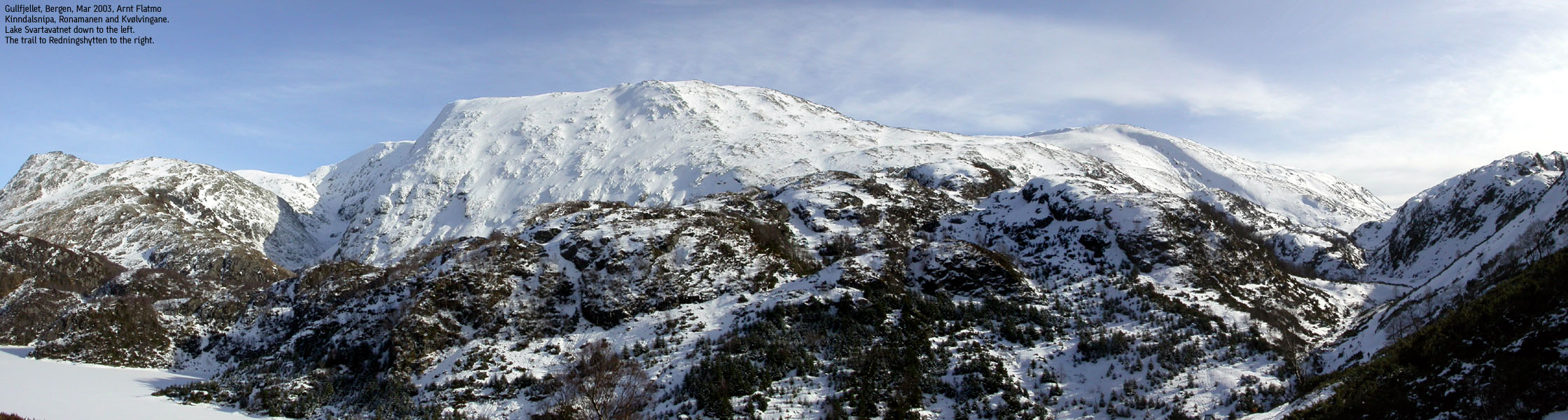
Reaching 900m, we ran into dense fog, which was quite unbelievable, compared with the wonderful weather below. We reached a cairn, which I thought was the summit. But I had to seek further right in order to locate the summit. Then I took course towards the cairn trail between Redningshytten and Gullfjellstoppen. At Redningshytten, I let the dog out and we hiked back through Hausdalen valley. Sheep everywhere.
Move cursor to read notes, and click on the images to see full version.
Some of the thumbnails may have been cropped to fit the format.
Pictures are presented in the order they were taken.


No Javascript:
1 2 3 4 5 6 7 8 9 10 11 12 13 14 15 16 17 18 19 20 21
|
Route 2: NW ridge from Osavatnet (winter)
|
|
Access
From Bergen, follow E16 towards Oslo. At the second roundabout at Indre Arna, follow highway 580 towards Flesland. Follow this road until you see the Unneland/Bjørndalen sign. Exit left onto this road, and follow it all the way to lake Osavatnet. On sunny week-ends, there is a NOK 20,- parking fee.
The route
The cairn trail from lake Osavatnet to Redningshytten is easy to follow. It takes you about an hour or less to reach the hut. Make sure you go left in the first trail junction near lake Osavatnet. The trail straight ahead doesn't take you anywhere. From Redningshytten, follow the main cairn trail towards Gullfjellstoppen. From Redningshytten, this trail follows a ridge before it turns left and climbs steep up the "Korketrekkeren" hill. On top of this hill, you get a clear view of Sydpolen (S. Gullfjellstoppen), and just after heading down a little bit, is where you leave the cairn trail.
Climb steep up a ridge that will take you to the south end of lake 803. Both ice axe and crampons are required here if the snow is hard. Cross the drain from the lake and get on the ridge that will take you all the way to the 953m cairn. If you feel the ridge is exposed, then an alternative is to hike up the narrow valley to the left of the ridge.
Technically, this ridge is very easy, except for one point where scrambling may be required. The obstacle is roughly 4m high, and can possibly be bypassed on the right hand side. This bypass is however exposed, so the best advice is to climb straight up the obstacle. There is a cliff below that will stop you from falling off the mountain, if you should lose the grip while climbing up. Once above this obstacle, the rest of the route is easy. In summer, this obstacle is a no-brainer.
Inspired by the fun traverse of Hausdalshorgi the day before, it was time to take on this ridge that had looked intimidating for so long. With the ill dog back at the house, I still had to concentrate on the local mountains, even if I had done them all before. But finding new routes is always fun.
Well equipped with axe and crampons in the backpack I quickly hiked from lake Osavatnet at 11:00AM. I reached Redningshytten at 11:40AM, and just couldn't believe the weather. The crowds still hadn't found their way up, so I was nearly alone at the hut. I put the crampons on and got ready for the challenge. An older skier had the same destination as me, but he was going the standard route. We separated on top of Korketrekkeren, and I felt the heartbeats by looking up the steep ridge ahead of me.
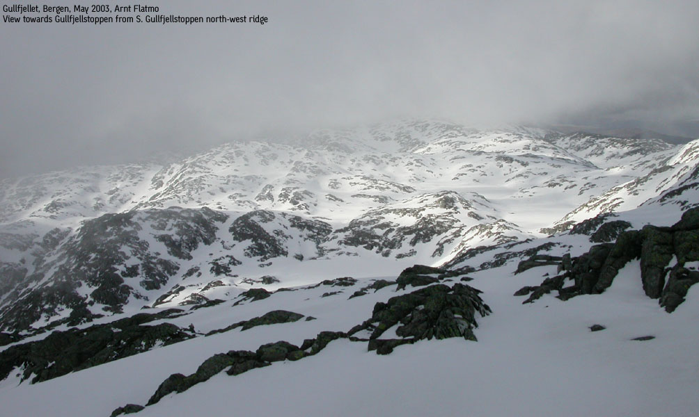
After climbing up to lake 803, I was already "acclimated", as the first part was steep enough. I followed the ridges that looked natural and advanced quickly on the ridge. The views were astounding, and I looked really forward to reach the summit. Then I ran into a wall of snow, several meters higher than me. Some naked rocks to the right looked like a possibility, but the insane drop down to Hausdalsgullbotnet made me chicken out. I looked for a way around to the left, but by now, the drop to the inner valley was considerable. I decided to climb the wall head on. After all, this was what the equipment was for. After a short "advance-and-don't-look-back" scramble, I was on top of the wall, and had an easy ride all the way to the 953m cairn.
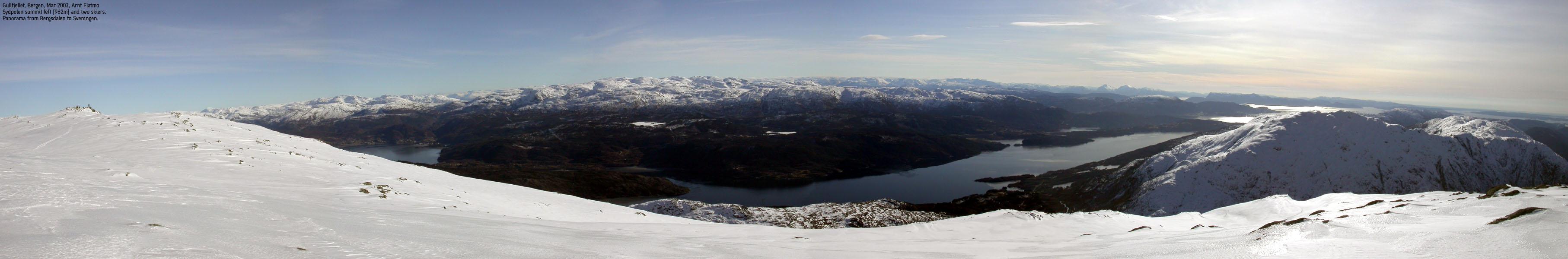
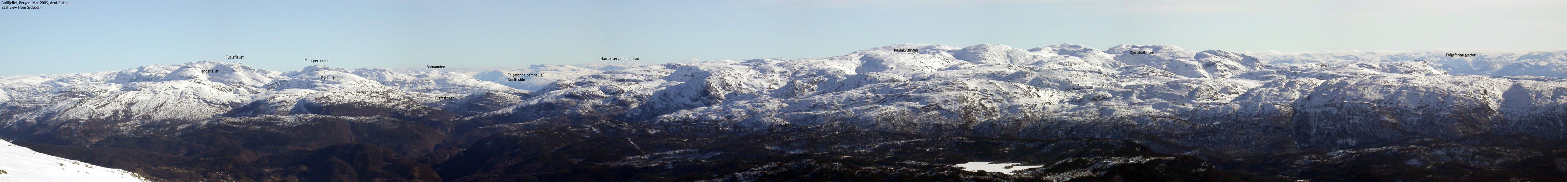
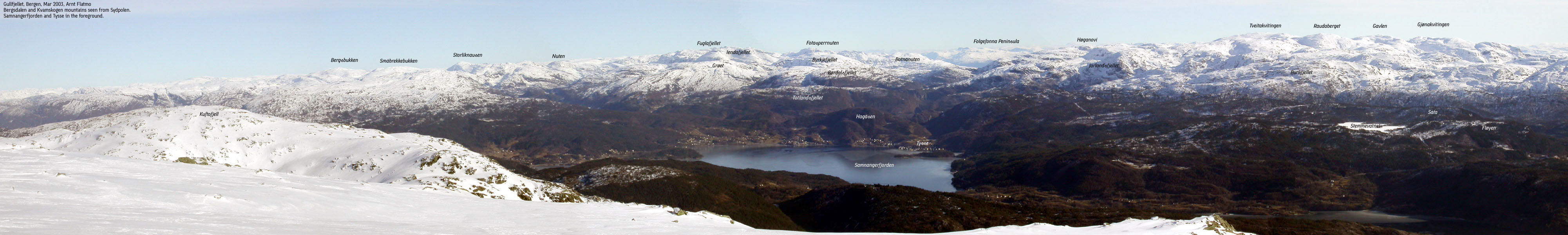
Two skiers was already on top, and later I learned that they had spent the night up there. I reached the main summit (962m) at 12:45PM, so it had only taken me one hour from Redningshytten. That time included a number of photo sessions. The horizon was quite clear, and I could even see the north edge of the Hardangervidda plateau. But it was time to get back, so I decided to shortcut down to the lake. I saw the older skier sitting below me, and I headed steep down in his direction. I heard a strange sound, and noticed that the snow was cracking up around me. I didn't expect any large avalance, but then again, I wasn't sure what would happen. I carefully backtracked, and found another way down. Instead of heading to the top of the inner valley (next to my ridge route), I was looking for a way straight down to the lake. It was quite steep, and I had to go all the way to the north end of the lake in order to find a doable route down. Then I headed for the south end and backtracked to Redningshytten.
By now, Redningshytten was overcrowded, and I felt the looks of everyone when I arrived with axe and crampons. I decided not to feel silly about it. After all, I had done a cool route to a high mountain. The dog was standing at the door when I came back to the house, and every inch of his body expressed hate towards the "lie-still-and-your-back-will-get-better" life. I decided to give him some fresh air, put him in the backpack and then hiked up to Ulriken. On top we celebrated a good mountain day with hot waffles with cream and jam. While wondering if life gets better than this .....


No Javascript:
1 2 3 4 5 6 7 8 9 10 11 12 13 14
|
Route 3: South ridge from Brekkedalen. Descent via Toro (summer/autumn)
|
|
Access
From Bergen, follow highway E39 south towards Stavanger. Pass Nesttun and lake Kalandseidvatnet. Exit right at the roadsign "Hausdal, 10". Continue all the way to the end of the road at Hausdal. Find parking in the outer lane of the bus-area. Make sure you don't block for the bus, which needs to turn around here. If the outer lane is full, you may drive through the gate to a second parking area. Make sure you lock the gate, as there is sheep and cattle within.
The route
Follow the gravel road for a few meters, and when the road forks, go right over the bridge. Follow the gravel road for about one hour (steady rhythm) up the Brekkedalen valley. As the road begins to ascend, notice a road forking off to the left. You will be coming down this way. Further ahead, on your left, you see the the south ridge. Continue on the road until you find the beginning of the ridge (approx. 1Km from the road fork to the start of the ridge). Then follow the high ridge across bush terrain until terrain gets rocky at 300m elevation. The rest of the route is quite easy. Follow the ridge to the southern viewpoint cairn, and then walk the 600m to the 962m summit. The south ridge offers no difficulties, but it gets quite strenuous along the way.
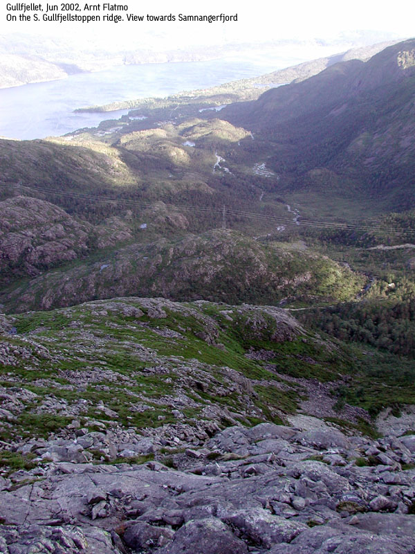
From the summit, follow the regular route (not described in this document) northbound to north of lake 831m and join the cairn trail to Redningshytten, or descend via the NW ridge (see route 2 above). Once you reach the cairn trail, the general direction is SW. When you reach the bottom of Korketrekkeren (a small lake), the route to Redningshytten runs to the NW (right). Instead of going to Redningshytten (see route 1 above), continue SW and head up to a pass between Sydpolen and Toro (733m). Here you will find another cairned (smaller cairns) trail that runs down the Toro SW ridge and which is named "Hausdalsåsen" further down. Just after a cabin, the trail turns into a forest road and makes a sharp turn to the left (northeast). Follow the road downwards and you will join the Brekkedalen road.


No Javascript:
1 2 3 4 5 6 7 8 9 10 11 12 13 14 15 16 17 18 19 20 21
|
Route 4: Purkedalsgjelet from Brekkedalen (all seasons) Coming soon. See trip report here |
|
Route 5: Hausdalsgullbotnen from Brekkedalen (all seasons) Coming soon. See trip report here |


No Javascript:
 Other hordaland mountains
Other mountains in this area
westcoastpeaks.com
Other hordaland mountains
Other mountains in this area
westcoastpeaks.com
