
|

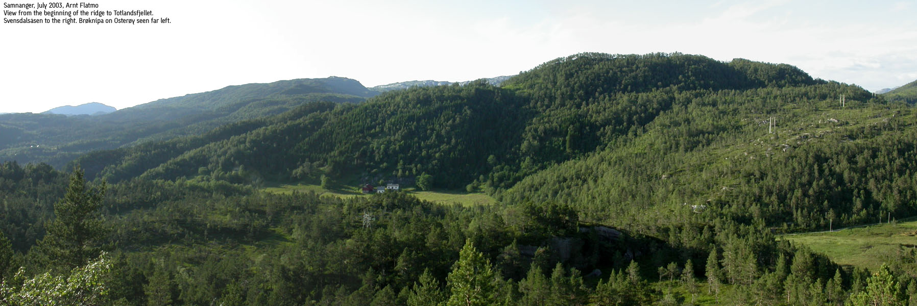
Svensdalsåsen seen from Totlandsfjellet(No Javascript) |
A forest ridge begins by Frøland, by highway RV7, and stretches across the Totlandsfjellet and Svendalsåsen hills before rising towards Flæfjellet and the Kvamskogen region. There are several trails leading to these hills, but most are only known by the local population. When going off-trail, it is convenient to start from the road to Svensdalen. The normal route runs from Høysæter, and follows a road towards Helgeland before you have to turn westbound in order to get to Svensdalsåsen. The hike via Helgeland is not described on this page.
Althought higher Kvamskogen mountains block the eastern views, these mountains are quite a view in their own rights. Especially the west side of Børdalsfjellet is very impressive. Svensdalsåsen and Totlandsfjellet are *almost* enclosed by roads. RV7 in the south, the road to Kvitingen in the west and the north. The road from RV7 to Høysæter ends at Høysæter.
Height:
On the map, Svensdalsåsen's height is set to 500m elev. My GPS indicated 502m, and the trig. point is (for some odd reason) located approx. 2m lower than the true high point. I have chosen to stick with the map height, but mention that there is a possibility that Svensdalsåsen is a couple of meters higher.
Svensdalsåsen (M711: 500m, Ø.K: 500,21m) has a primary factor of 92m towards the higher Flæfjellet (938m). The saddle is found NE of Høysæter. Ref. Økonomisk Kartverk (5m contours), you cross the 410m contours on the high route, but not 405m. The saddle height has been interpolated to 408m. Totlandsfjellet (538m) is also higher than Svensdalsåsen, but this involves descending to 313m elevation. It is the *highest* route that defines the primary factor.
Notes: Class ratings are in reference to YDS. Click here for more information.
The trails described below are not necessarily the *easiest* trails to this mountain.
|
S of Høysæter - Svensdalsåsen (winter)
|
|
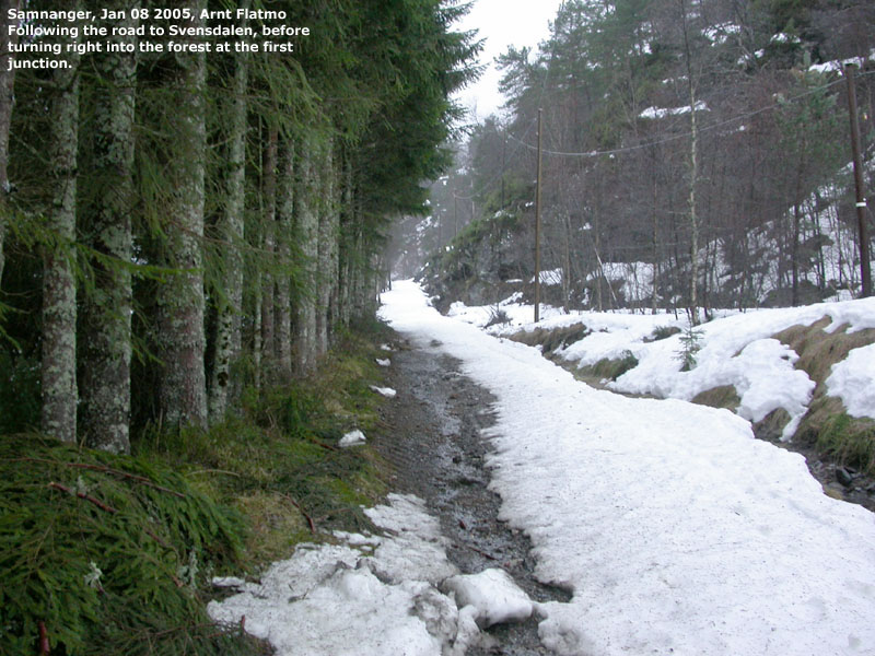
From Bergen, follow highway E16 towards Oslo. At Trengereid, turn right onto highway RV7 (Oslo) and continue down to Samnangerfjorden. From the Statoil station at Bjørkheim, follow RV7 approx. 8,7Km. You will go through two tunnels, pass the Tysse exit and go through Liaros tunnel on the ascent towards Kvamskogen. After 8,7Km (from Bjørkheim), turn left towards "Høysæter". Follow a narrow, paved road upwards for approx. 2,7-2,8Km. There is a road forking to your left. This road may not be plowed. Since the hike is short anyway, you might as well park down by the lake.
Follow the road upwards, in the direction of Svensdalen (not Høysæter) After approx. 350-400m, you arrive a junction. Turn right, leave the road and follow a minor valley with some steep cliffs up to your left. When practical, move left and get on top of these cliffs. You should soon have a small lake in front of you, with view towards a steep forest hill ahead of you.
Move towards the forest hill, and seek to the right. Find a practical route up through the forest. On top, you will have Svensdalsåsen in view. A meadow and a small lake is between you and Svensdalsåsen. Seek left of this lake, head towards the steep cliffs below Svensdalsåsen and then seek a bit right to find a good route up through the forest.
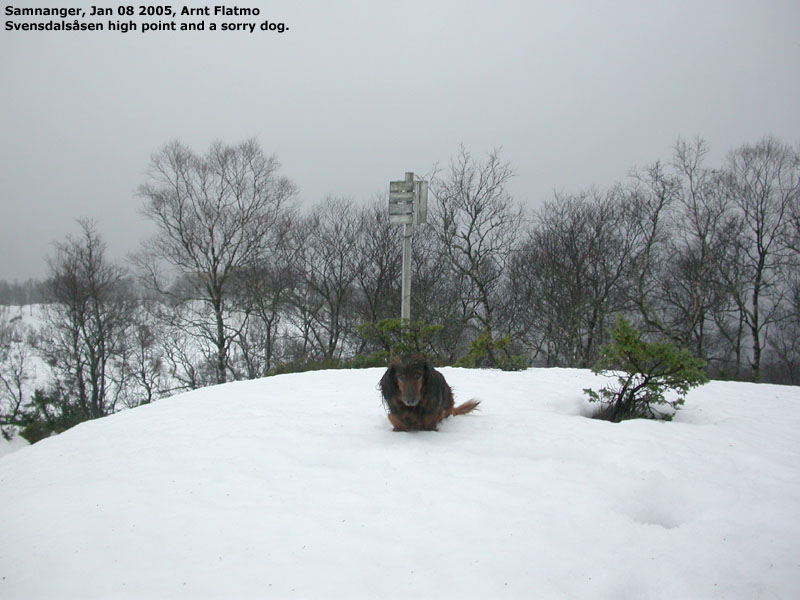
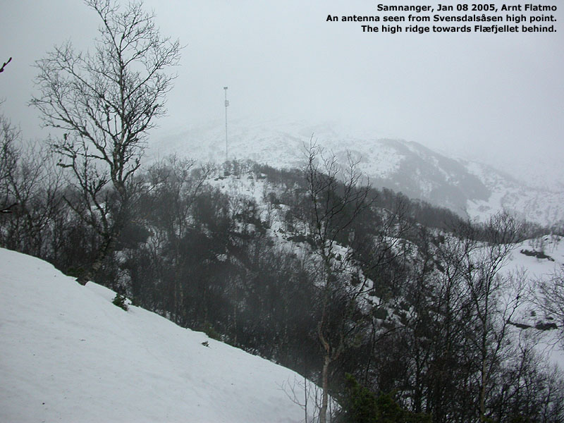
On the top, you will see a trig. point, a bit lower than the true high point. 310m northeast of the top, you will see a mast, which may be a transmitter for a cell phone network. I'm not sure. There is also a possibility that the trail from Høysæter and Helgeland runs by this mast. My suggestion is that you descend this way.
|
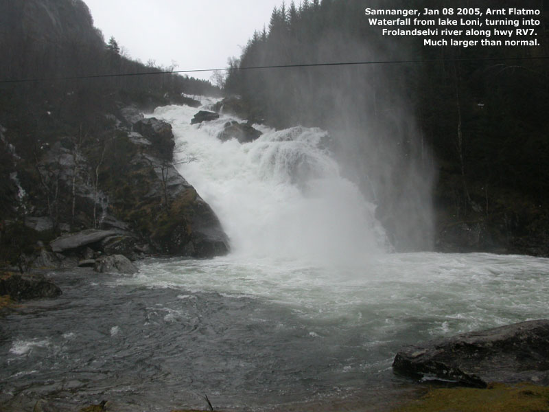
Trip report Jan 8 2005After a week with incredibly shitty weather that included snowfall, rain, snowmelt and storm in the mountains, the weather forecast for the week-end was ... worse. I was told that the precipitation record for Bergen in January that was already beaten. The storm "Gudrun" was beating on our coastline, with hurricane-speed winds, 20m high waves in the north sea, and the ocean 1m higher than normal.My impression of the forecast was that the bad weather would come during the day, and I set the alarm for 07:00AM this Saturday morning. But I woke up 05:00AM with the rain hammering on the roof. It's hard to look forward to a hike on a day like this, so I decided to visit Svensdalsåsen, which was a short hike from the trailhead, and a fairly short drive from Bergen. There was hardly any signs of snow on Mt. Ulriken (642m) when I left Bergen, but while passing Indre Arna, I could see the back side of the massif had amounts of snow. I prepared for a hike in deep snow. It was pouring down on the way down to Samnangerfjorden, and I already started to look forward to getting back home. But first I would collect a new hill. I parked the car near Høysæter, close to where the road to Svensdalen forked. I had been to this area before, as my Ketil Vevle and I hiked Totlandsfjellet from this road. I put Troll in the backpack and left the car 10:45. I headed up the road for a few hundred meters before I headed into the forest. The snow was rather deep, in average up to my knees. I tried to maintain a direct route, which meant I had climbed the first forest hill head on. This was extremely tiresome, as this hill was steep. We reached the top of Svensdalsåsen 11:30PM, after a steep climb up to the summit. I had to plow this steep hill with my knees and chest, and even if the distance was short, it was a good work-out. I let Troll out of the backpack, and while he was looking around, I tried to measure the top point with my GPS. The reading was 502m elevation. I noticed that the trig. point was a couple of meters lower than the top, and wondered which height the map referred to. I decided to stick with the map height and concluded that this hill lacked 8 meters on the primary factor from making it on the list of independent Hordaland mountains. We headed down 10 minutes later. I considered hiking down to Høysæter, but the snow depth took away the enthusiasm. I decided instead to follow my own tracks back to the car. Back on the road to Svensdalen, I ran into a couple that owned a house or cabin in Svensdalen. They knew about my web-site, and we had a nice chat. The chat came to an end when Troll, who had walked down the Svensdalen road, wery jumping up and down, yelling to me that he wanted to get back to the car. His wish came true at 12:10PM. I was happy to return from the land of deep snow, but knew that I would head up to Ulriken later in the evening. Only 200m of vertical gain was too little for a Saturday, and by 18:15PM, I was on top of Ulriken. The conditions were difficult. It was actually clear after all-day rain, but the mountain was covered by fresh wet snow, which was now freezing. The mountain was incredibly slippery. I met one guy who had turned around halfway. It helps to know the trail well. Every rock, so to speak.
Pictures from the Jan 08 2005 hike
Move cursor to read notes, and click on the images to see full version.
No Javascript:
|
Other hordaland mountains
 Other Samnanger K. mountains
westcoastpeaks.com
Other Samnanger K. mountains
westcoastpeaks.com


