
Click here for the main Sulafjellet page.
This Sunday started out rainy and cloudy, but it cleared up in the afternoon. I decided to visit S. Smørhylla on Ørskogfjellet, but when I got to Spjelkavik, I noticed that the clouds still hung low on Ørskogfjellet. However, Sula island was all sunny, Sulafjellet was a nice mountain and it was a short drive. After 3 loops in a roundabout, I made up my mind and headed towards Sula.
I had no clue about any trails on this side of the mountain. I stopped by a gas station and asked the girl behind the counter. She was just rolling her eyes, but one of the customers wanted to help out. He volunteered to drive in front and show me the way to the trailhead. Excellent hospitality!
My small dog "Troll" had some tough walks recently, and I was prepared to carry him to the top. But there was obviously a lot of interesting scents on the trail, and the dog was leading up the forest path. Higher up, the path got a bit more rocky. His slightly prolaptic back forced him to climb (one leg there, one leg there, etc.) instead of jumping between the rocks. It looked like hard work, but he was a loyal hero and kept on walking.
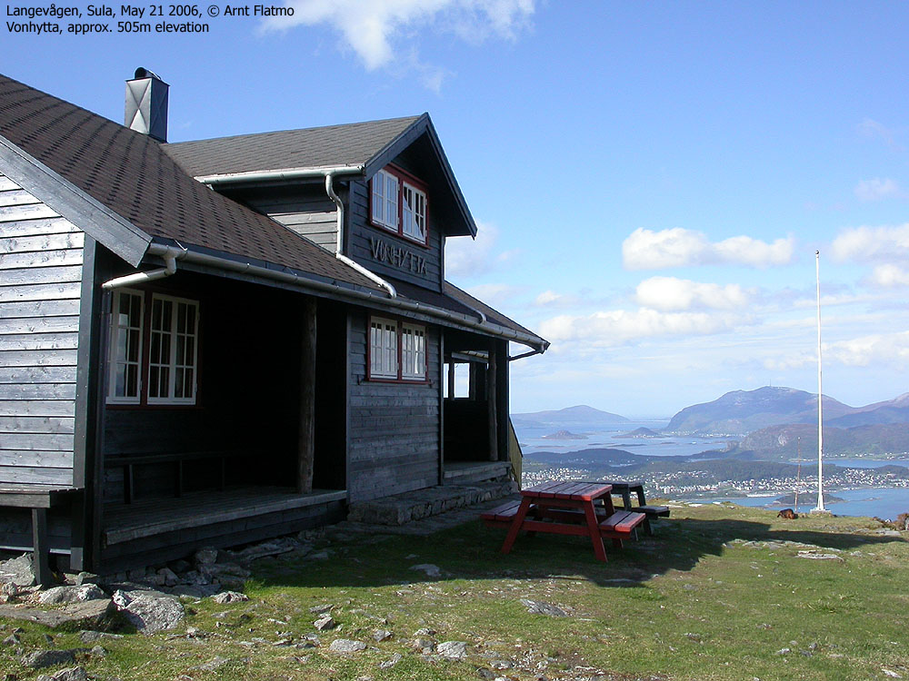
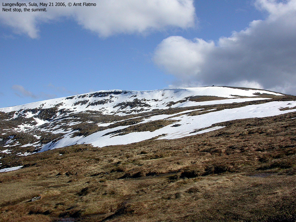
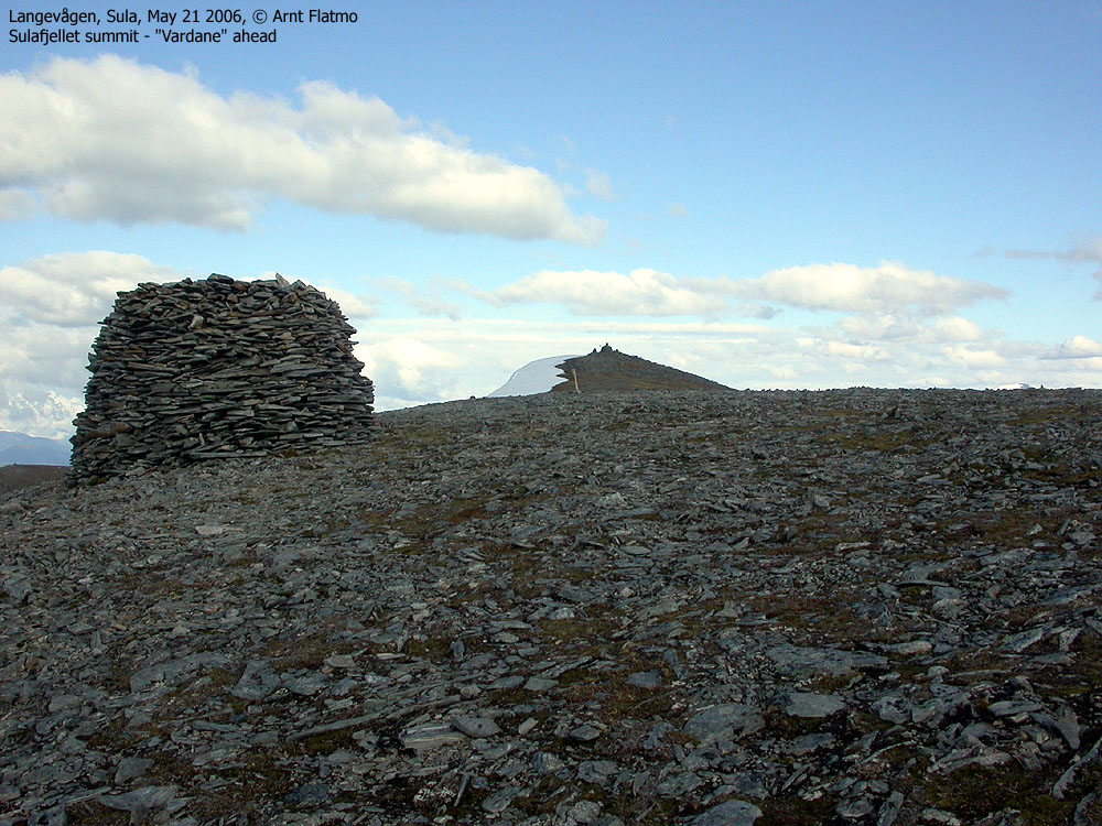
His moral decreased noteably on the boggy ground above Vonhytta. And in the steep snowfield below the summit plateau, I could see him consider if this was what he really wanted to do in life. But when he got his eyes on the cairns, his spirit was lifted tenfolds. Lunch was within reach!
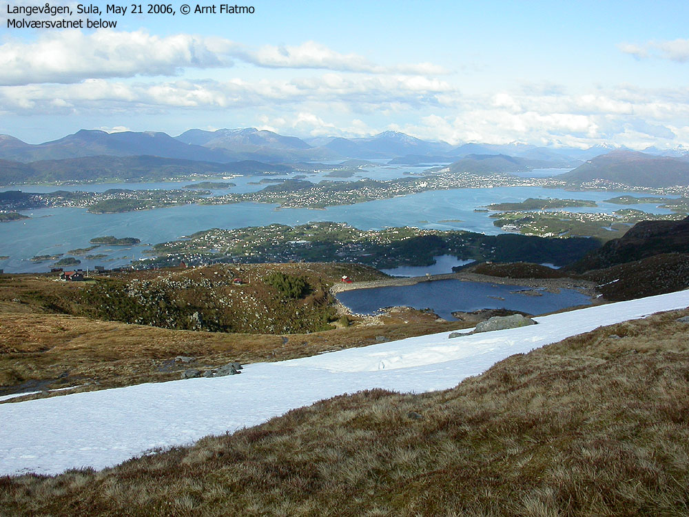
We had left the trailhead 16:30PM and reached the top 17:55PM. I had started out wearing a sweater, added a gore-tex jacket at Vonhytta, but had to put on a fleeze sweater at the summit. It was absolutely freezing cold! I have only been this cold at one occasion, since I arrived Ålesund. And that was on Sulafjellet too, Dec 28 2005. I have also heard others say that this is quite a chilly place, so bring an extra sweater if you plan to visit Sulafjellet!
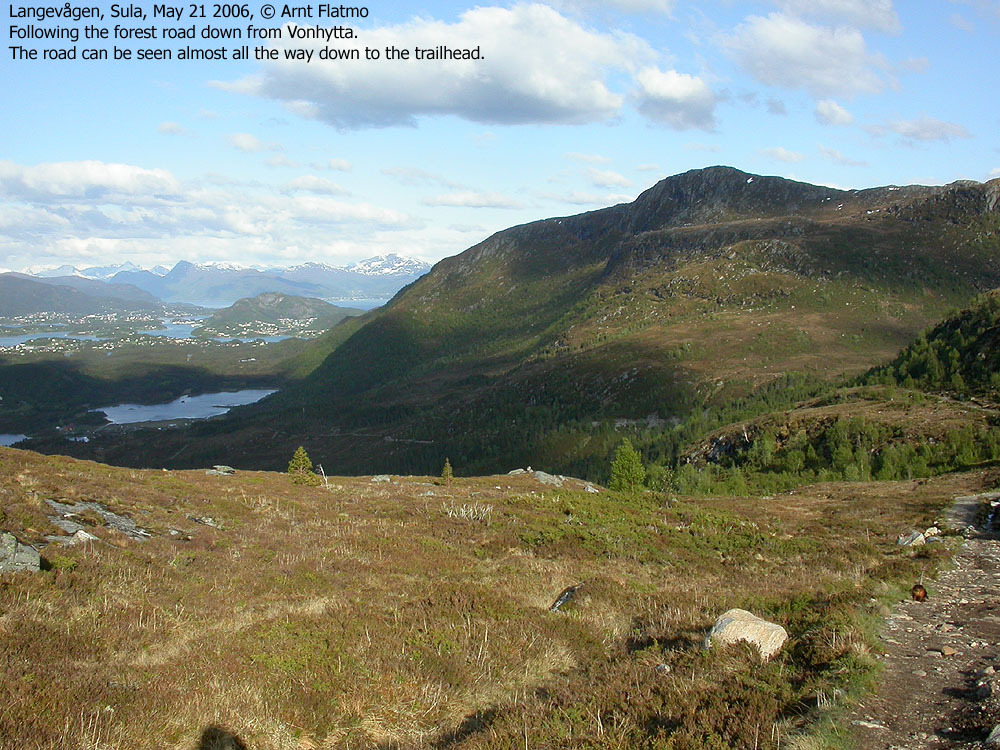
I chatted with a few other hikers before it got too cold. When we arrived Vonhytta, the gore-tex jacket and the fleeze sweater had to come off. How's that for contrasts? We followed the western part of the forest road from Vonhytta, before joining the path along the pipeline. We were back at the trailhead 19:10PN after a beautiful day on Sula.
Note: Apologies for the poor picture quality. My camera was at the repair shop, and I had to bring along the 4-year old Nikon Coolpix 4500.
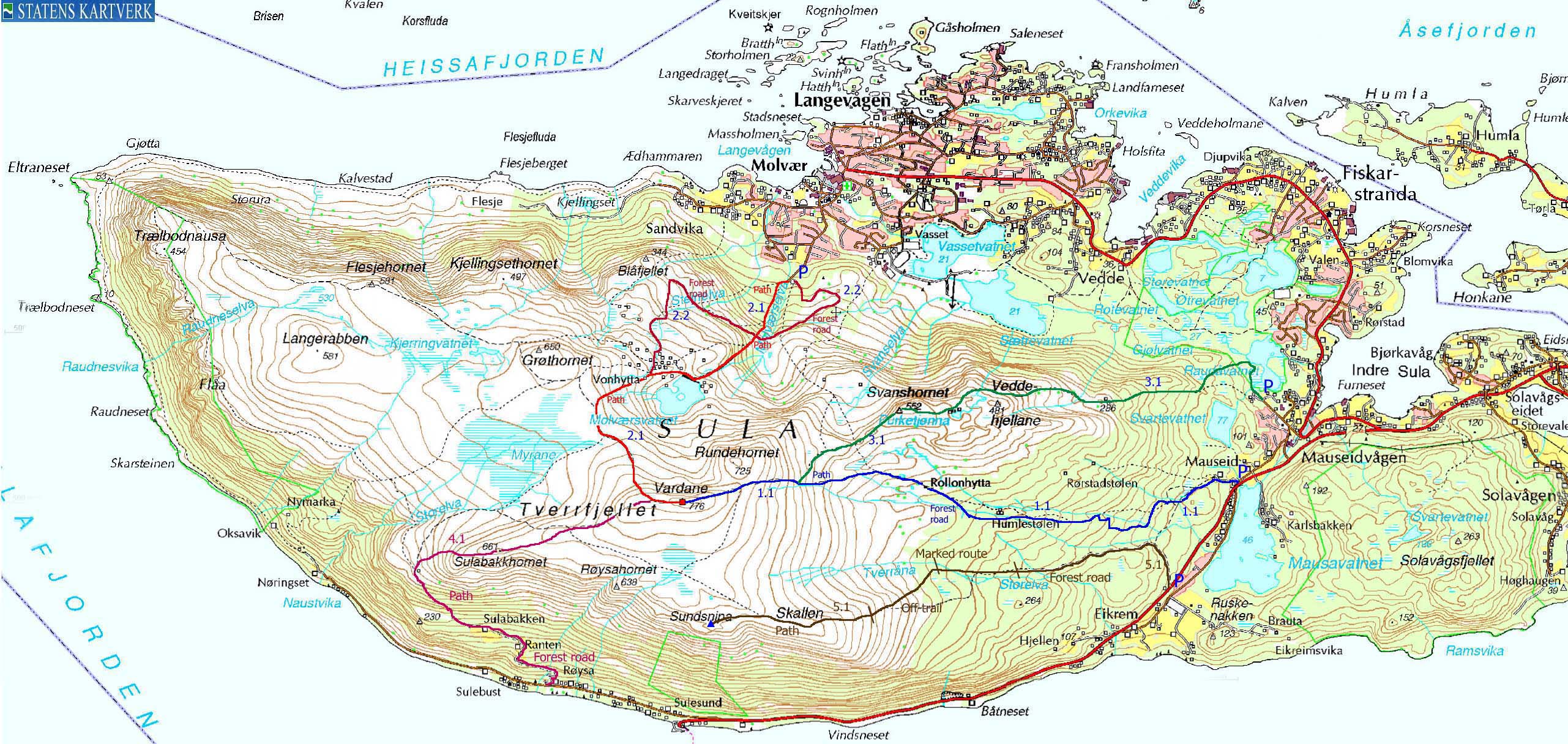
Map: I followed route 2.1 (and 2.2) on this trip

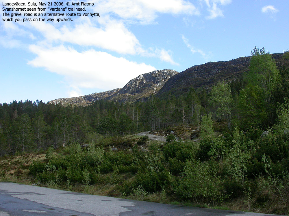
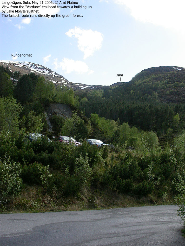
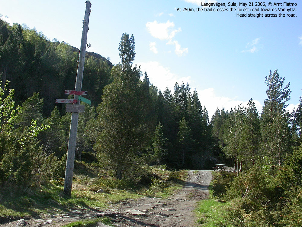
To Vardane


360 deg. wide-angle panorama from the top

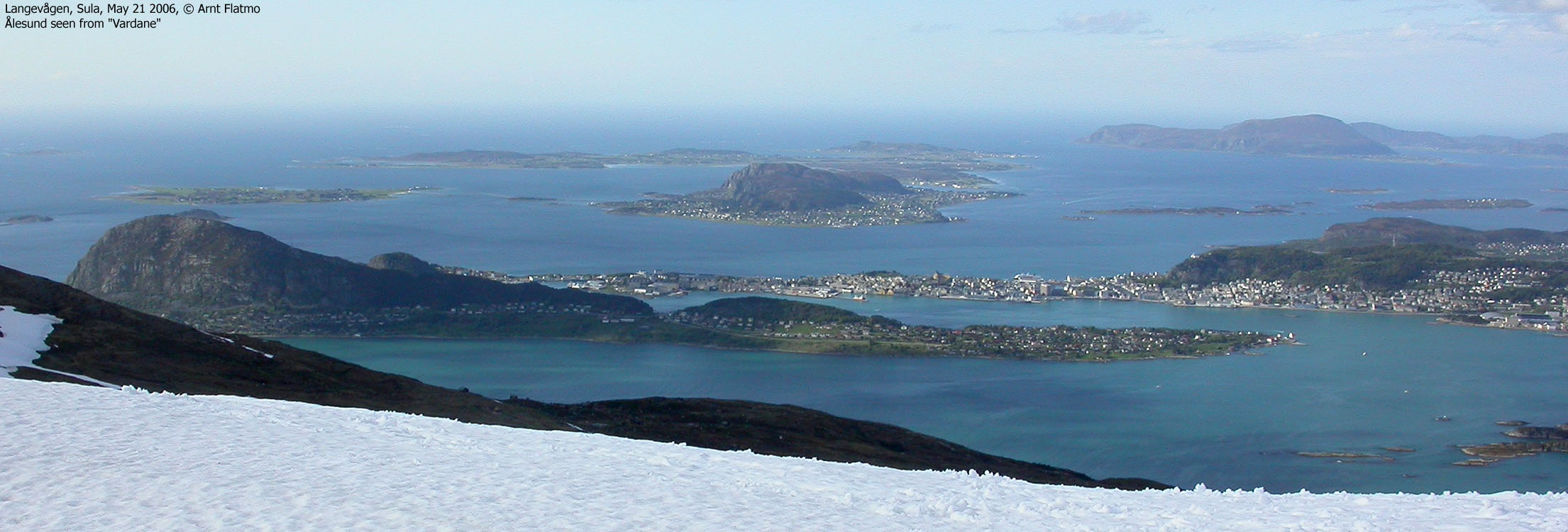
Other pictures from Vardane


Descent


No Javascript:
0 1 2 3 4 5 6 7 8 9 10 11 12 13 14 15 16 17 18
 westcoastpeaks.com
Other Møre & Romsdal mountains
Other Norwegian mountains
westcoastpeaks.com
Other Møre & Romsdal mountains
Other Norwegian mountains