
Norwegian Mountains, Møre og RomsdalSukkertoppen, 314m (Heissaklimpen)
|
| Fylke/Kommune : | Møre og Romsdal/Ålesund |
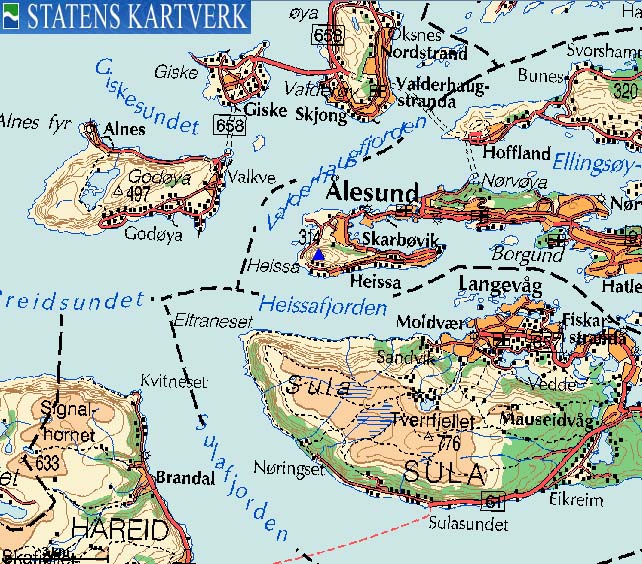
| Maps : | 1119-I Ålesund (Statens Kartverk, Norge 1:50 000) |
| Primary factor : | 314m |
| Hiked : | Many times since Jan 2005 |
| See also : | Aksla |
| See also : | Sulafjellet |
| See also : | Trollråsa on fjellinordvest.net |
| See also : | Other Ålesund mountains |
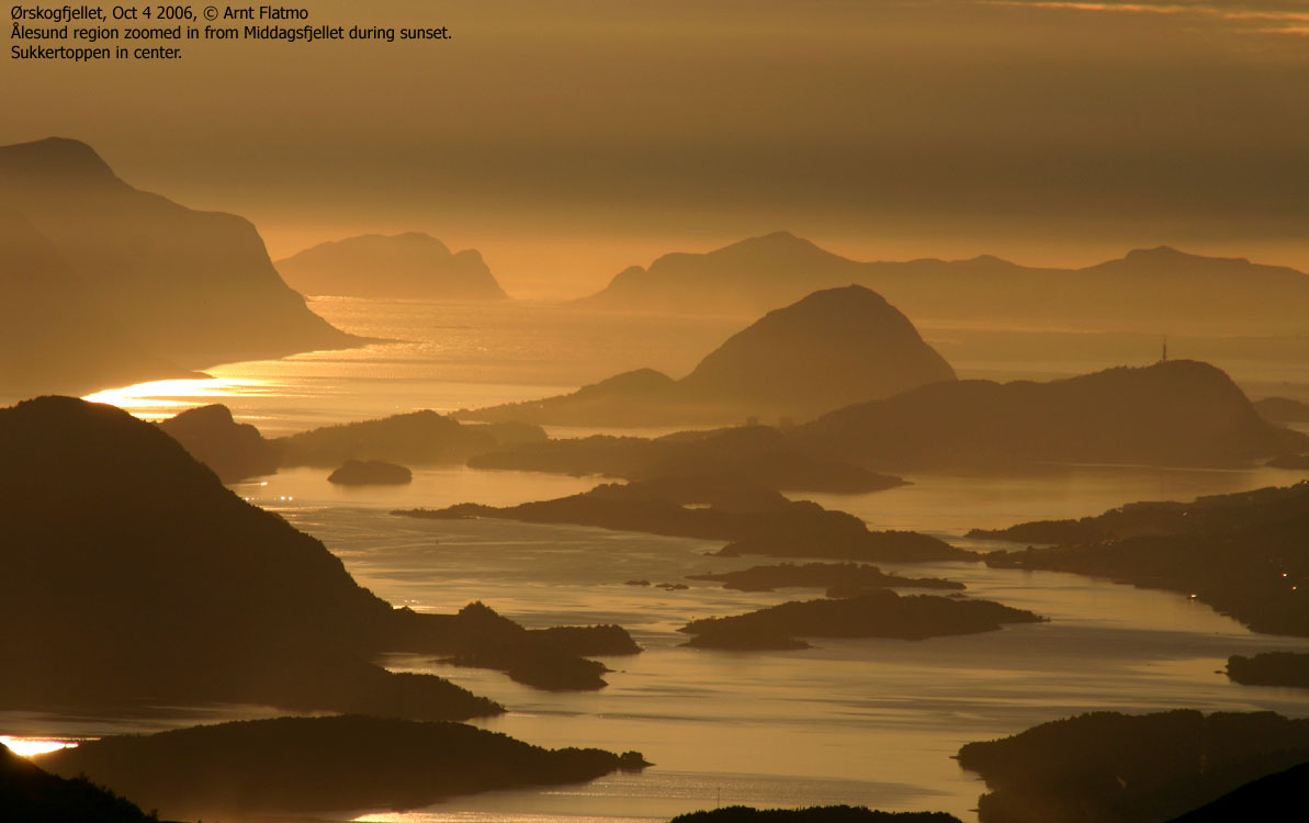
Sukkertoppen in center
(Click for larger image)
Sukkertoppen (Sugar Loaf Top) is, bar none, Ålesund's most popular mountain. The top is located on the island Hessa, which together with the islands Aspøya and Nørvøya defines the heart of Ålesund - the largest city in Møre og Romsdal county.
Although lower, the mountain resembles in many ways Lyderhorn outside Bergen. Without having checked the historic facts, it is reasonable to assume that Sukkertoppen was part of the coastal defense (the signal-fires) initiated back in the Viking age. The views from the top are extensive, and Ålesund is "blessed" having such a viewpoint just outside its city center.
There are several climbing and scrambling routes around mountain (see separate section below), but the normal (and very popular) trail runs up the east ridge. Sukkertoppen has thousands (and thousands) visitors every year.
Sukkertoppen (Norge 1:50,000: -, Ø.K.: highest contour is 310m, UTM 32 V 350413 6928718) has a primary factor of 314m, being the high point on Hessa island.

Sukkertoppen

Google's interactive map. You can zoom, pan and click on the markers.
|
|

Norge i 3D Click on image (Java required) |
Notes: Class ratings are in reference to YDS. Click here for more information.
The trails described below are not necessarily the *easiest* trails to this mountain.

Normal route to Sukkertoppen
(Click for larger image)
|
Hessa Skole - Sukkertoppen
|
|
Access
(all distances are approx. distances)
From Ålesund, follow signs towards "Aspøya/Hessa". You may also follow the "Akvarium" signs for a while, if you're not on the main road towards Hessa. When you reach the "Sevollen/Slinningen" junction on Hessa, turn right and then immediately left and find parking outside Hessa Skole (school).
The route
From Hessa Skole, follow the main road 150m westbound to the first road fork. Turn right and follow "Sukkertoppvegen" road 140m before you turn sharp right onto a (signed) forest path between houses. In short, follow this path all the way to Sukkertoppen summit, which is marked by a trig. point and circular viewfinder which identifies the many peaks in the horizon.
Note that once on the ridge proper, the trail breaks out into several smaller paths. They all lead the same way. The path(s) to Sukkertoppen can be extremely wet and boggy after rain. The view from the top is first class, and many good moments (people, weather, animals, etc.) can be found up on this mountain.
Important notice: All routes described below involve various levels of risks. The routes are steep, exposed and dangerous unless you know what you're doing. In addition, rockfall from the mountain can be a theoretic risk. This web site does NOT encourage you to seek this type of terrain unless you feel compentent to do so.

Advanced routes on Sukkertoppen.
(Click for larger image)
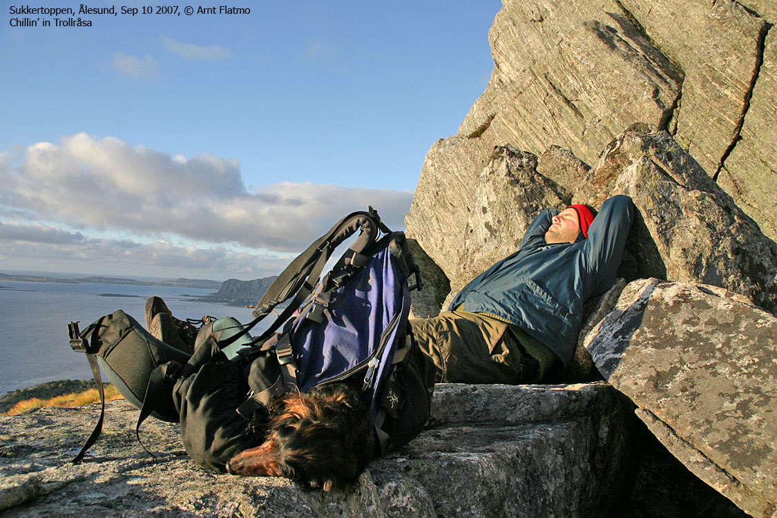
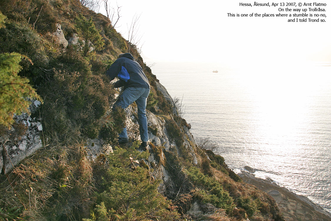
Trollråsa (YDS class 3)
"Trollråsa" is a route that runs from the road between Hessa Stadion and Akvariet (the Aquarium) and all the way to the summit. The route might be marked all the way, and the path might be more or less visible. This depends on the annual traffic. The route is named after a mountain dog named Troll. An alias for this route is Via Trolloråsa. A number of dogs have done this route, although some with a little help from their owners. Experienced hikers with a head for height should enjoy this route. Great caution must be advised in the exposed sections.
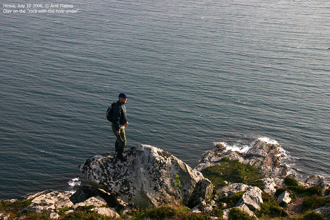
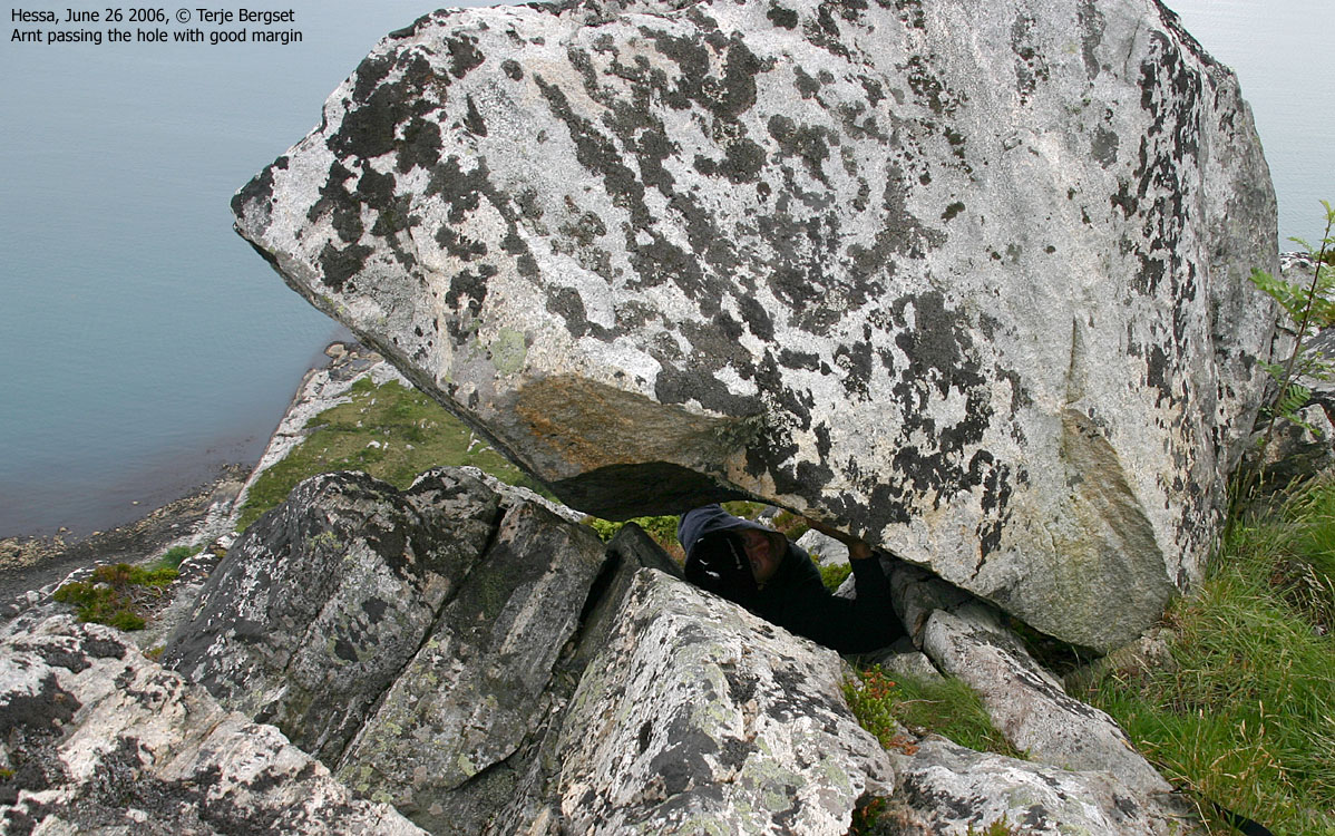
Descent: From Sukkertoppen, follow the path 250m westbound until you see the rock-with-the-hole-under (approx. 240m elevation). Climbing under the rock gives you extra credit. Claim double credit for walking on top of it, without using your hands. (The extra credit is of course meant as a joke).
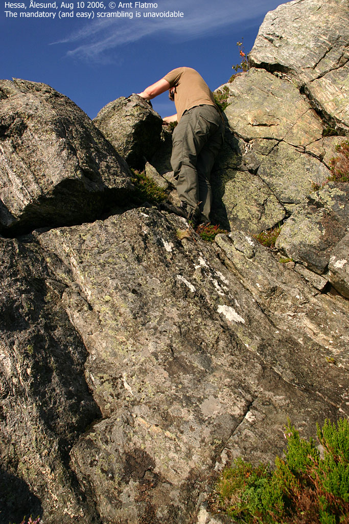
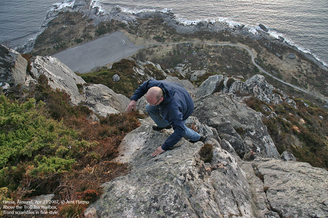
From this rock, turn right, walk approx. 20m and locate a small gully (not exposed) where use of hands is required. Shortly after, another small gully (not exposed) also require the use of hands. Soon, you'll face an obstacle where you need to cross over a slab rock. Below you is a mailbox (approx. 200m elevation). You can either climb directly down, or followed the marked route which takes a small detour. Do sign into the visitor register, enjoy the Trollråsa chair and chill out.
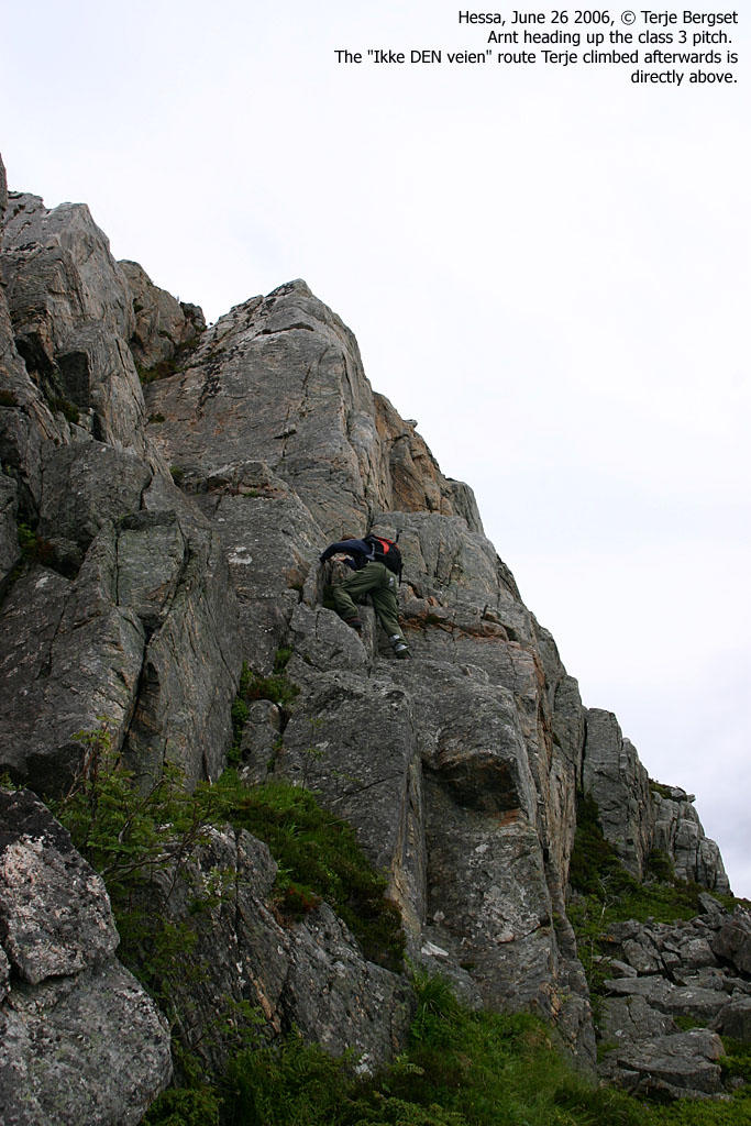
There are numerous scrambling opportunities in this area. By the mailbox, you can climb the cliff and proceed directly onto the Ikke Den Veien route.
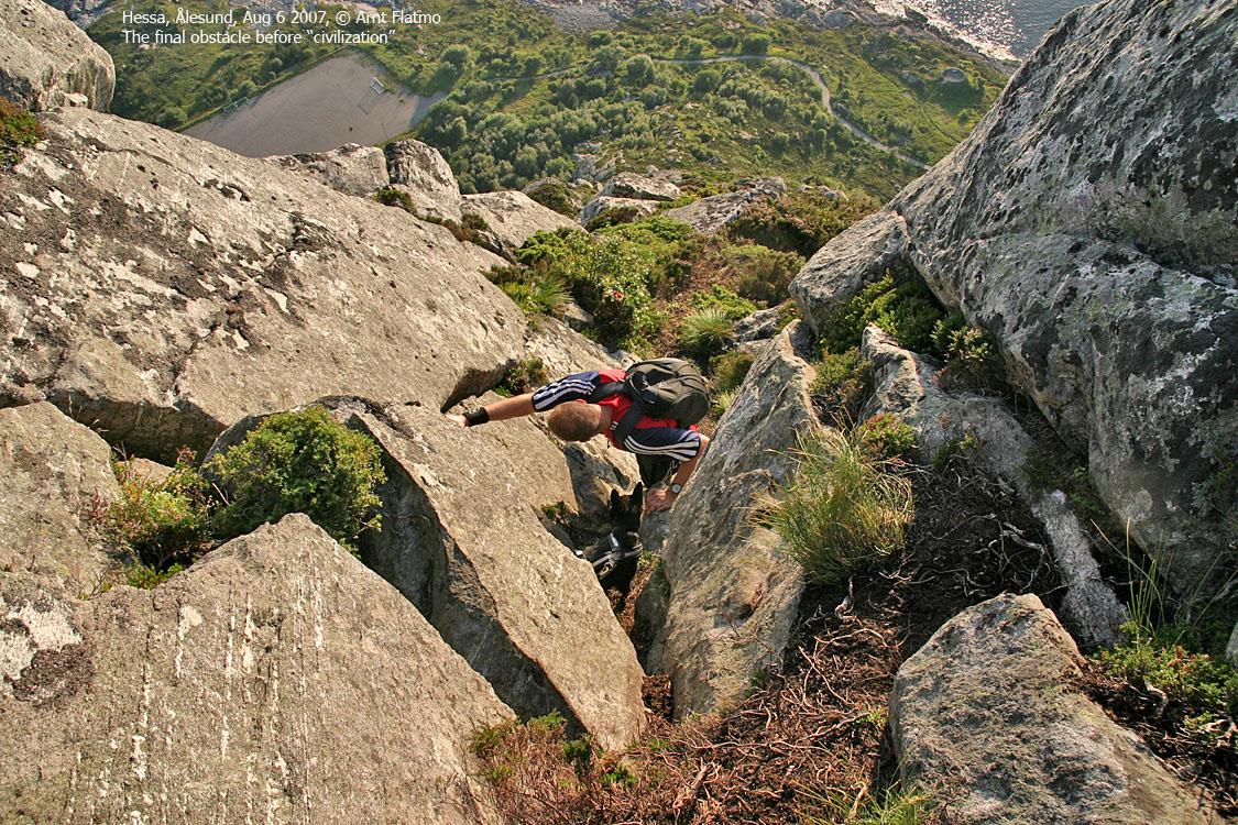
Follow the path/marked route downwards. The route turns northbound and takes you down to the road. Be careful with steep sections with slippery grass. There is one point which is a bit awkward and will require the use of hands. The trip report section below has numerous pictures from the Trollråsa route.
Ascent: Approx. 600m from Hessa Stadion and approx. 600m from the Aquarium parking, you will see a large rock (and possibly a bench) on the north side of the road. Turn south and aim for a boulder field. The path begins above the boulder field, and this is where the marking begins.
See links below for many pictures of this route.
Tusseråsa (YDS class 2)
"Tusseråsa" is a route that runs between the Trollråsa mailbox and the distinct rock near Sukkertoppen summit. This route is seldom used, but provides an easier route from the summit and down to the mailbox. The route was marked with blue ribbons in 2006, but the ribbons suffer hard from the weather and gradually fade away.
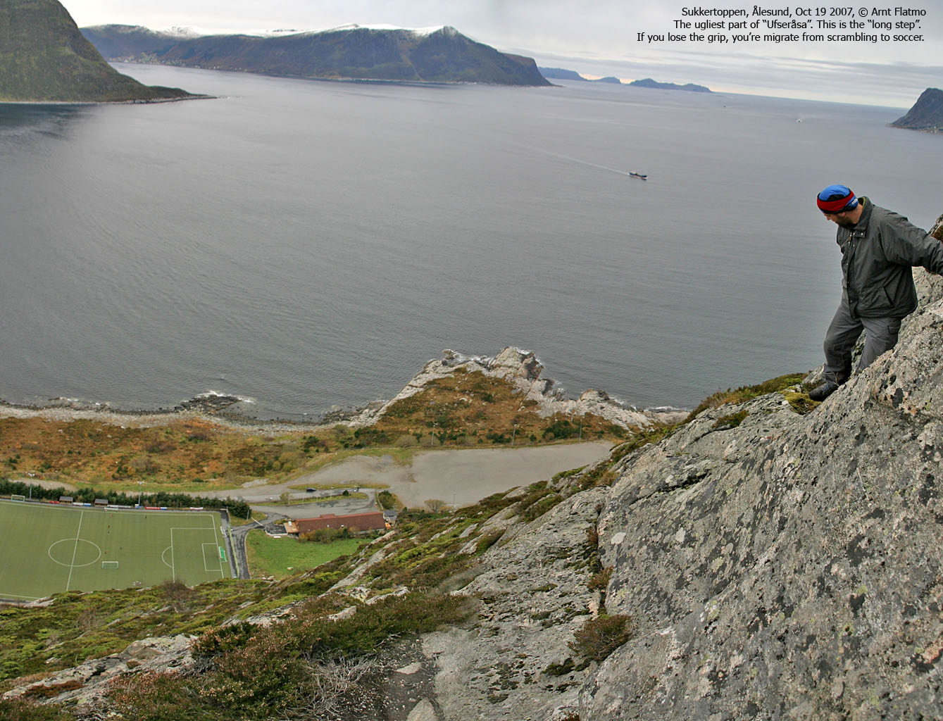
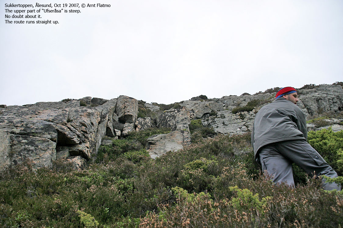
Ufseråsa (YDS class 3)
"Ufseråsa" begins by the Trollråsa mailbox and runs southbound until you see directly down to the road to Hessabanen. In short, it climbs the Sukkertoppen's south side and tops out by the rock-with-the-hole-under. There is no path, and the crux is a bit awkward. The route from the crux and upwards is quite steep. This route is more exposed than Trollråsa. Don't get involved in this route, unless you know what you're doing.
Pictures from Ufseråsa can be found here and here.
Tyskerstien (YDS class 3)
|
"Tyskerstien" (The German Path) begins by Hessa Stadion, climbs up a large boulder field and follows a distinct gully up to a plateau below the Trollråsa mailbox. During WW2, the Germans used the plateau as a look-out point, and there was a ladder. Today, the ladder is gone, but you can see where the ladder was attached to the mountain. In the boulder field, head up to an overgrown forest section. Seek to the right and you'll see a hole/small cave. Climb in there and you'll top out above. Head up another forest forest section until you reach steep cliffs ahead. You'll see a distinct crack that runs a long way up. Seek right and climb up (using roots and bush) to a point where you can traverse (on a narrow ledge) back into the crack, which is now wider. Avoid a loose rock in this crack. Proceed using roots and bush as handholds. Higher up, there is a chain that may be of some help. As an alternative to the hole/cave: Move to the left and let a short, but exposed climb/scramble take you up to the next forest section. From the plateau above, it is only a short distance up to the marked Trollråsa (see above) route. Pictures from Tyskerstien can be found here, here, here and here. |
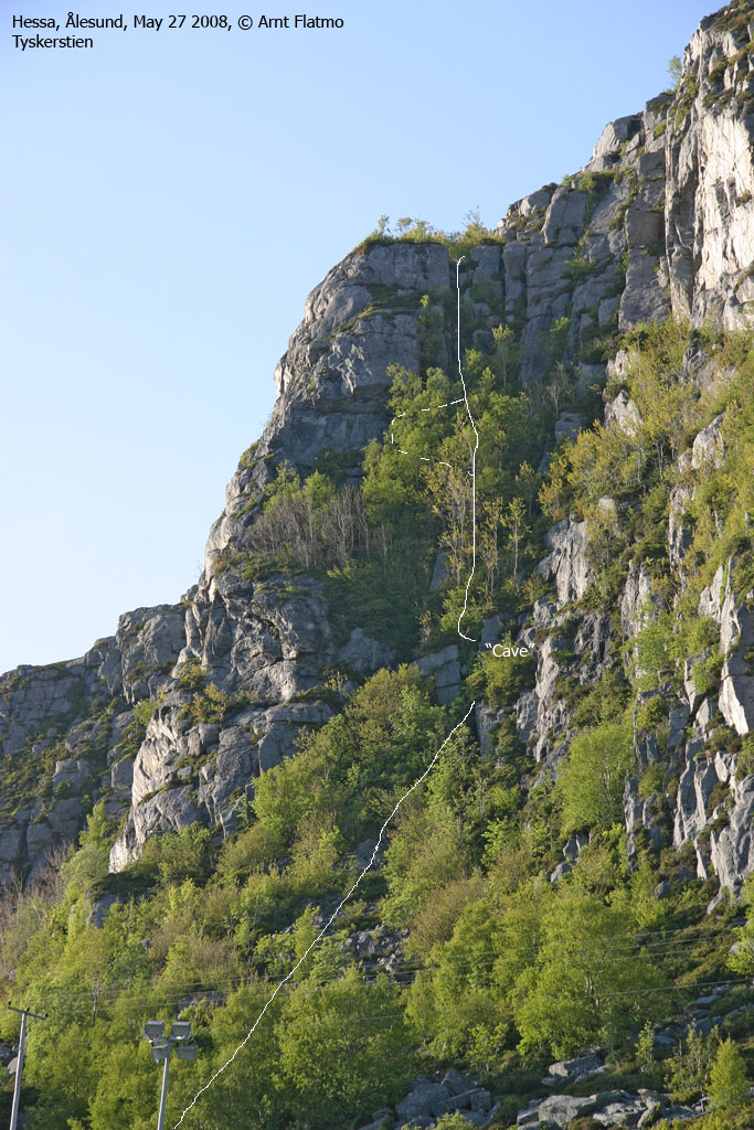
Tyskerstien
|
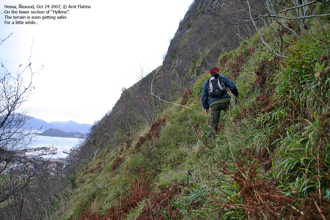
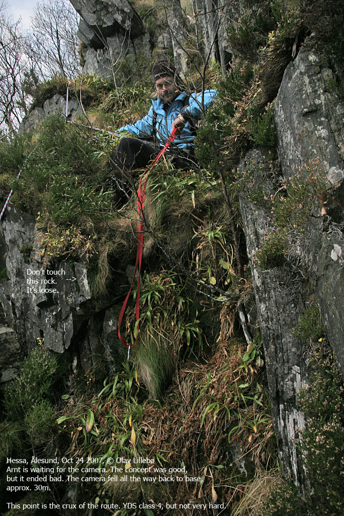
Hyllene (YDS class 4)
"Hyllene" can be thought of as a gallery in the middle of the steepest north face. The route is not marked, is overall steep, and with exposure here and there.
The entry point is 100m northwest of the Trollråsa entry point (in the direction of the Aquarium). The route ascends west of the gallery, then traverses eastbound across the gallery until it climbs a very steep forest section where the trees are a vital part of the climb. A rope is recommended unless you are familiar with the terrain. Then follows a 3 meter climb (the class 4 move) up to a small ridge which provides access to higher ground. Proceed in bush terrain (continuous steep terrain) up to the summit.
Pictures from Hyllene can be found here, here and here.
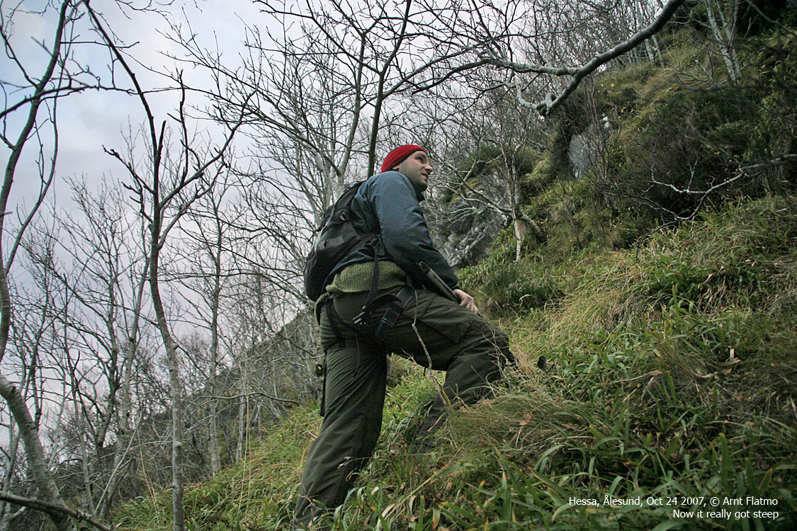
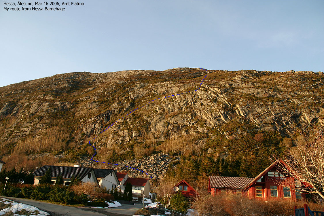
From Hessa Barnehage (Kindergarten) (YDS class 2+)
You can scramble from Hessa Barnehage. A distinct gully takes you up in the mountainside, and from there on, you can scramble steep or safe towards the summit. It is not a very enjoyable or challenging route. Pictures can be seen here. This route is not outlined on the overview picture (above).
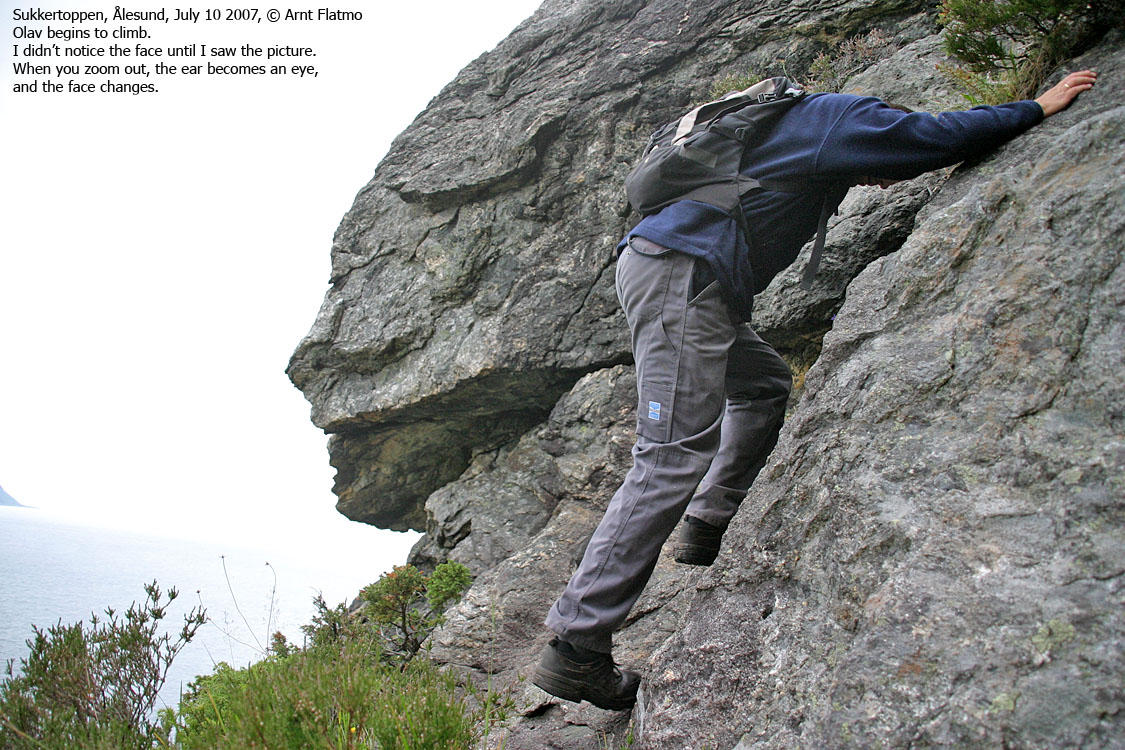
Climbing routes, west face
Please refer to Klatreklubben Ålesund's page (external link).

Ålesund seen from Sukkertoppen, after dark

 westcoastpeaks.com
Other Møre & Romsdal mountains
Other Norwegian mountains
westcoastpeaks.com
Other Møre & Romsdal mountains
Other Norwegian mountains


