
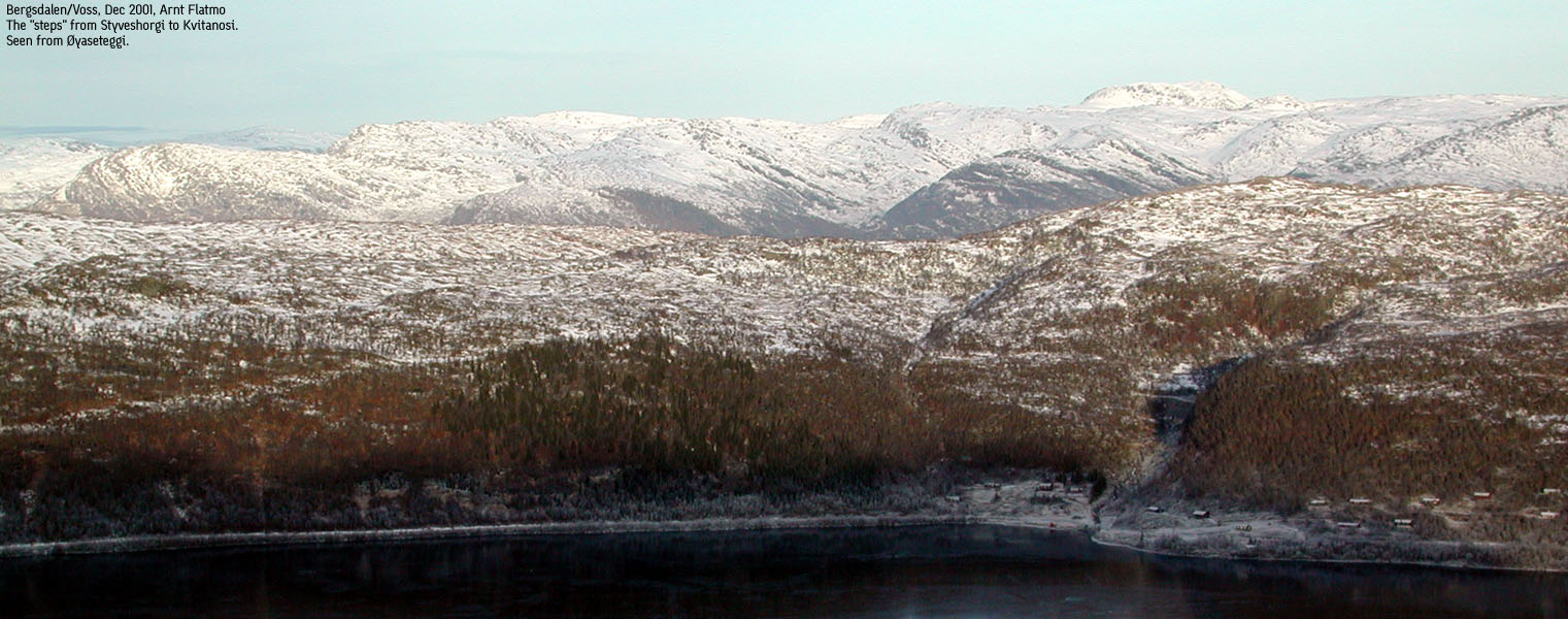
Styveshorgi, 988mMountain area: Střlsheimen, Hordaland Map: 1216 II Evanger (Statens Kartverk, Norge 1:50 000) GPS: |
 Lake Evangervatnet
|
Access:
Approx. 19 km west of Voss on highway E16, take the Evanger exit, and turn
immediately to the right towards Bjřrgĺs.
Follow this road, pass a new settlement of houses. At the first junction where
a forest road goes straight ahead, turn right and stay on the same road
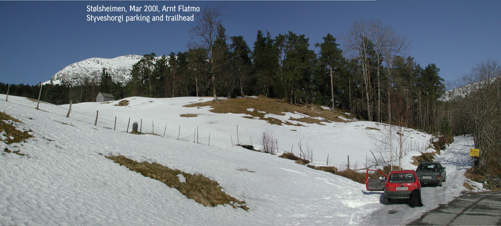
until you reach the second forest road junction at Elge (see picture below).
Find parking somewhere. There's not too much space for parking up there.
The trail: (click on the image for a larger view)
|
Follow the forest road upwards. After a while, the trail makes a sharp left turn. Continue until you reach a bridge. Then exit right and pick up a forest trail which will take you to a hut. Go right beyond the hut and continue up a pass until you see the Elgestřlen cabins. From this point you can turn left and climb Styveshorgi straight up. |

|
Notes:
I followed the forest road all the way up to 750m, but decided not climb
the south side of the mountain due to many small avalanches. Besides, it's pretty
steep. Instead, I made descent straight down to the hut described above.
Including following the mountain road too long, I was back at the parking 3,5 hours
after I started.
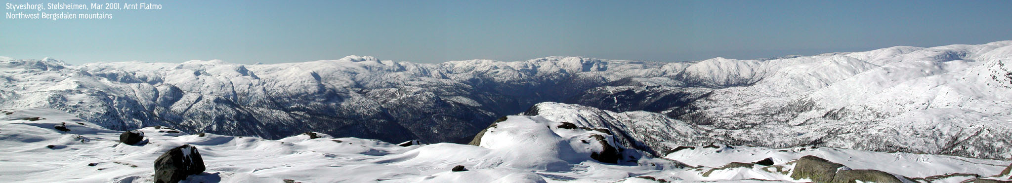
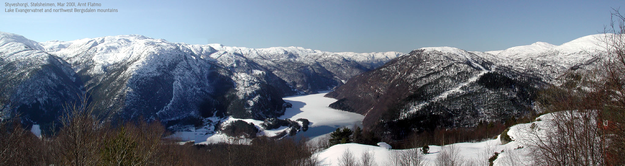
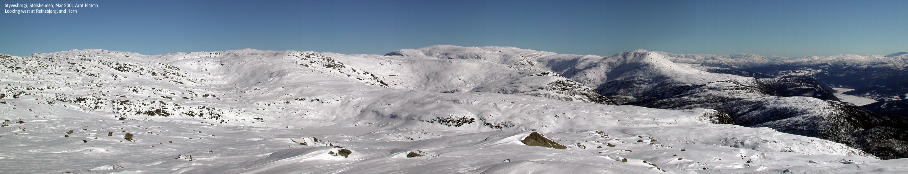
Pictures: (move cursor to read notes, and click on the images to see full version)


Pictures from other hikes


Other trail descriptions for this region: