
Norwegian Mountains, Møre og Romsdal
Dravlausegga round trip, Aug 10 2008
To the main Straumshornet & Dravlausegga page (maps, route descriptions, etc.)

Part of the route
(Click for larger image)
Coins and such...
The only reason why I hadn't already been on this fine ridge, was because of the toll roads. I never carry NOK 2x20,- in small coins. I would like to take this opportunity to thank the fine people behind the toll road to Bøstølen (Innfjorden), who give you the option to pick up an invoice and pay later. But on this very morning, I went to the local gas/petrol station (a small gesture to the American and English readers) and acquired NOK 40 in coins. Because today, I would be visiting Dravlausegga.
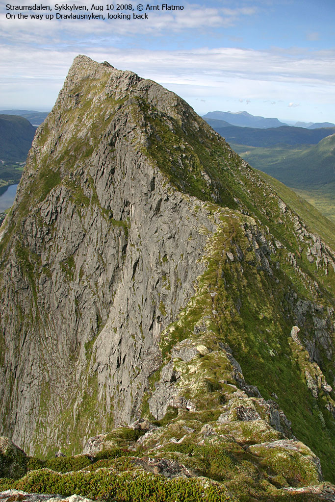
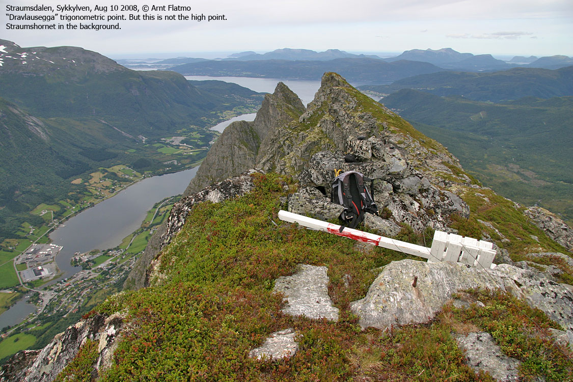
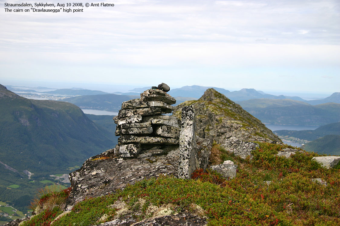
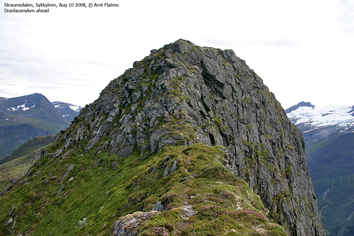
Dravlausegga is not an official name, but it denotes the mountain ridge (above the place Dravlaus), which features the top Dravlausnyken, which in turn is not the ridge high point. The maps indicate that Dravlauysnyken is the high point, but it's not. Neither is the 1056m trigonometric point the highest point. But this is nerd stuff (although it matters). The important thing is that this ridge offers a splendid walk, and probably a very nice ski-trip too.
Moving up in the world...
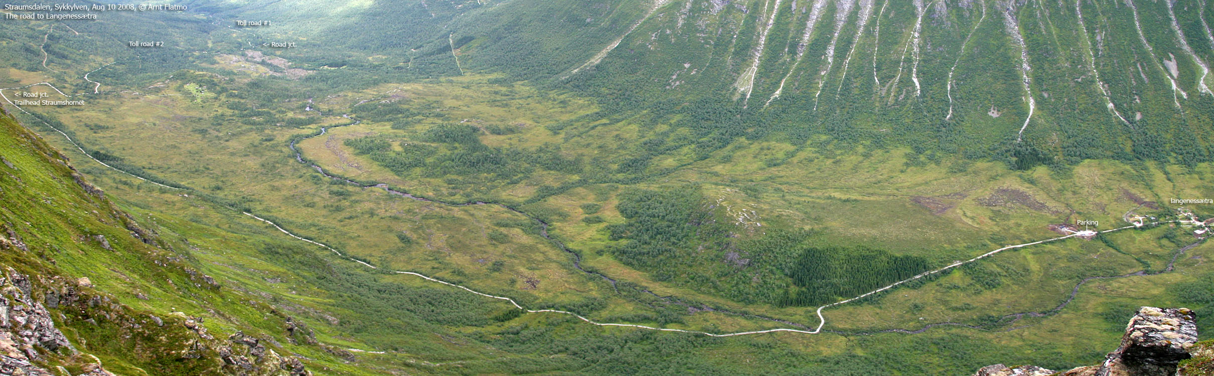
I decided to ascend the ridge (almost) directly from Langenessætra, traverse the ridge, descend to Koppen pass and return along Lake Langenesvatnet's east bank. I arrived at the Langenessætra trailhead in my convertible Tiger, and played loud music with explicit lyrics. Numerous people picking berries along the road sent me the what-the-h...- just-entered-town? look. It was just a rebel in a small, but cool car.
I left the trailhead (380m) 1:22pm. A fairly late start, but I was on vacation, and I wasn't kicking in as early as I normally do. I had not checked the weather forecast, and was sort of prepared for anything. I didn't have a detailed ascent plan, but after walking along the west bank for 600m, I decided to leave the path and head upwards. After a short forest encounter, I was on the flank, in open terrain.
2:34pm, I arrived at the 1056m trig. point, being under the impression that this was the high point. Looking southeast, my doubt grew. But before commencing the round trip walk, I wanted to have a closer look at the ridge towards Straumshornet. This ridge turned airy rather quickly, and one ugly point had to be bypassed down on the hillside. After 300m, I ran into a point which was double-ugly, and I concluded that I should get on with my round trip.

Turnaround point on the north ridge
(Click for larger image)
The ridge..
I went back to the trig. point and moved on to what I perceived to be the unnamed and unmarked high point. The GPS stated that I was at 1065m, with only a couple of meters error margin. I moved on, with Dravlausnyken and Tretindane in the horizon. I enjoyed the day very much. A crow cra-cra'ed past me, before two eagles came dancing along. A broken fence made me wonder if it was to prevent sheep from free-falling into Velledalen. If yes, the landowner ought to mend it. If no, the landowner ought to remove it, litter as it is now.
Everytime I looked back on the ridge, it impressed me more and more. Perhaps coming the other way would have been better. Dravlausnyken could probably make 1 out of 20 a bit uncomfortable, but there's really nothing difficult about this top. I passed the high point 3:47pm and had only Tretindane to go before descending to the lake.
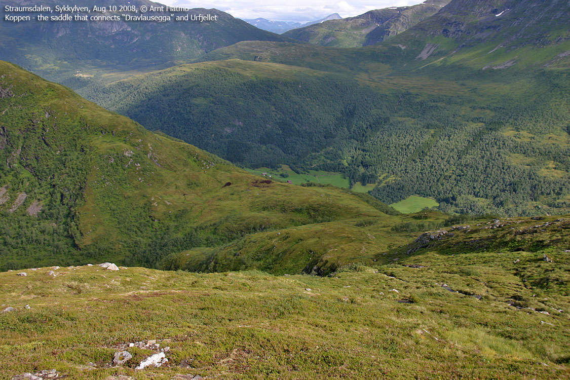
I tried to figure out why they call it Tretindane (Three peaks). A couple of couloirs could very well be the explanation, making the top look like three peaks when seen from Velledalen. Once past Tretindane, I began my descent towards Koppen and Langenesvatnet, scaring up a flock of grouse along the way. A herd of sheep took interest in me, but on closer inspection, I just didn't seem to carry the goods. Whatever the goods might be...
Looking back on the ridge
(Click for larger image)
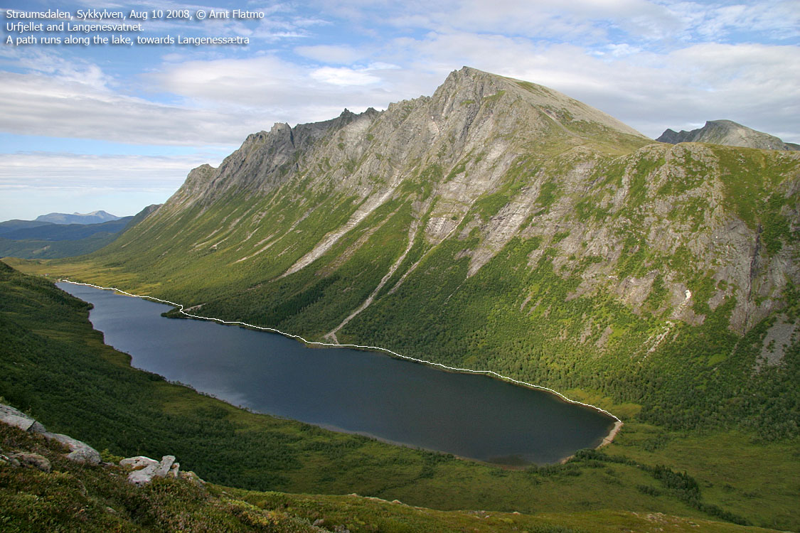
The lake..
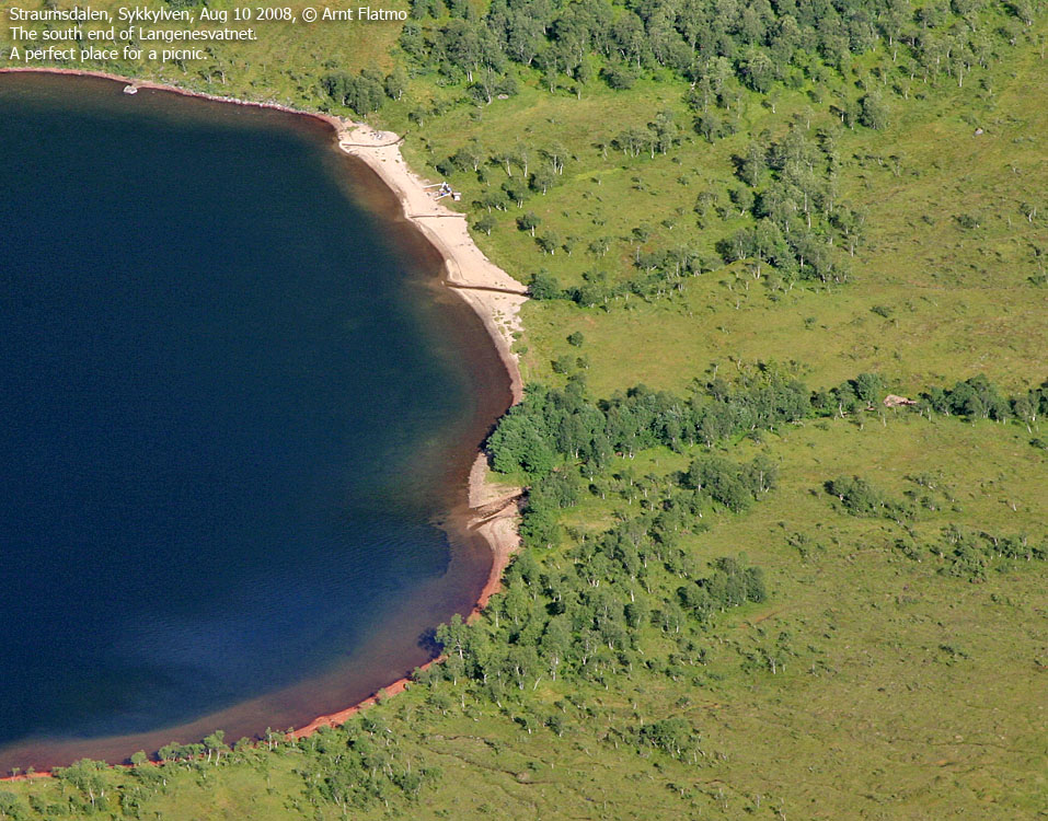
A family was having a picnic down by the south end of the lake. They seemed surprised to see someone come walking down from Koppen. We chatted for a while before I got on the path towards Langenessætra. I walked rather quickly and failed to see a rock hidden behind a bush. I smacked my knee into this rock and after the immediate feeling of being sick, I could focus on the language. I didn't swear, which would have been natural for rebels like me. It was more like Joe Pesci, the Home Alone movie guy. You know, the guy who falls down ladders, get paint buckets in his face, fall on spikes and gets his head torched. Guddymuddybibblibabblidohmoh .. words like that.
After having recovered from the rock encounter, I moved on. When I reached the cabins, I was a bit surprised from seeing a 4WD vehicle next to a cabin, without a road leading to it. But with shallow water, this car needed no road. Call me old school if you will, but driving a car into freshwater does not impress me much.
I was back at the trailhead 5:37pm, after a 10,2Km nice round trip, having been on the move 4h:20m. It was a very enjoyable walk indeed. And I recommend it to everyone who has the opportunity.


