
|

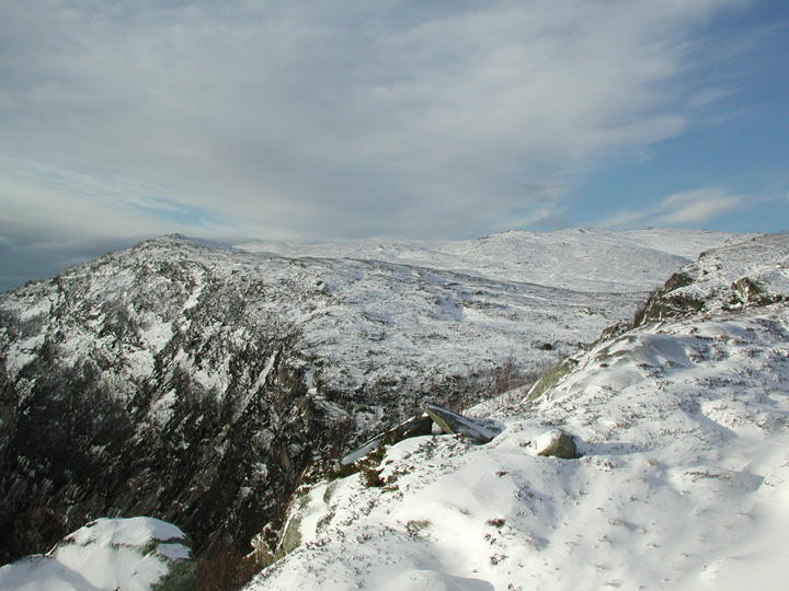
Storfjelli seen from Kvamsnovi(No Javascript) |
Storfjelli (Big mountain) is a ... big mountain, located in the southwestern outskirts of the Stølsheimen mountain range. The mountains in the southwest region (enclosed by highway E16, Teigdalen, Eksingadalen and Indre Osterfjorden) form a horseshoe with Storfjelli in the west and Blåvasshorgi in the east. Øvstedalen valley lies between these two mountains. So, despite the fact that the Storfjelli elevation (1115m) is not among the highest in Stølsheimen, Storfjelli is still a dominating mountain for its region.
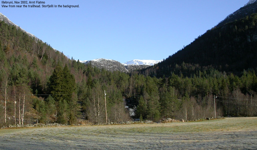
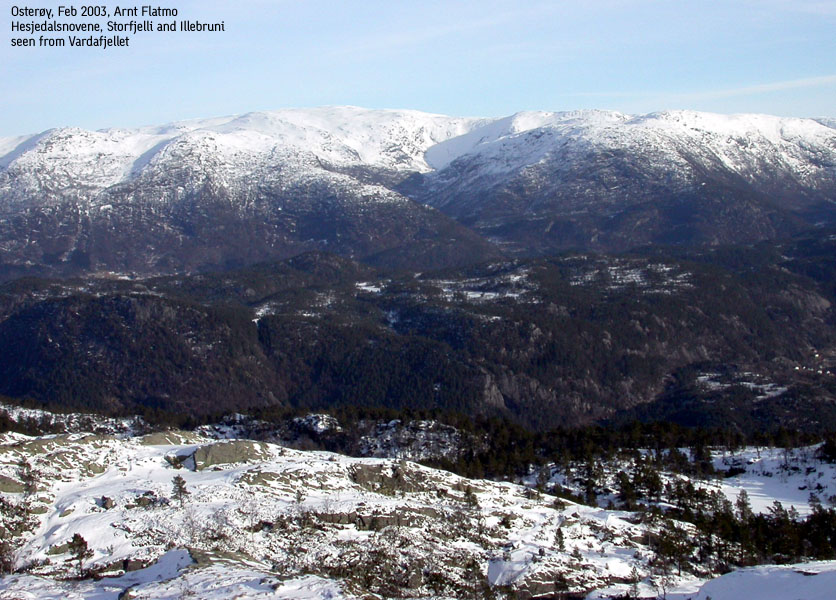
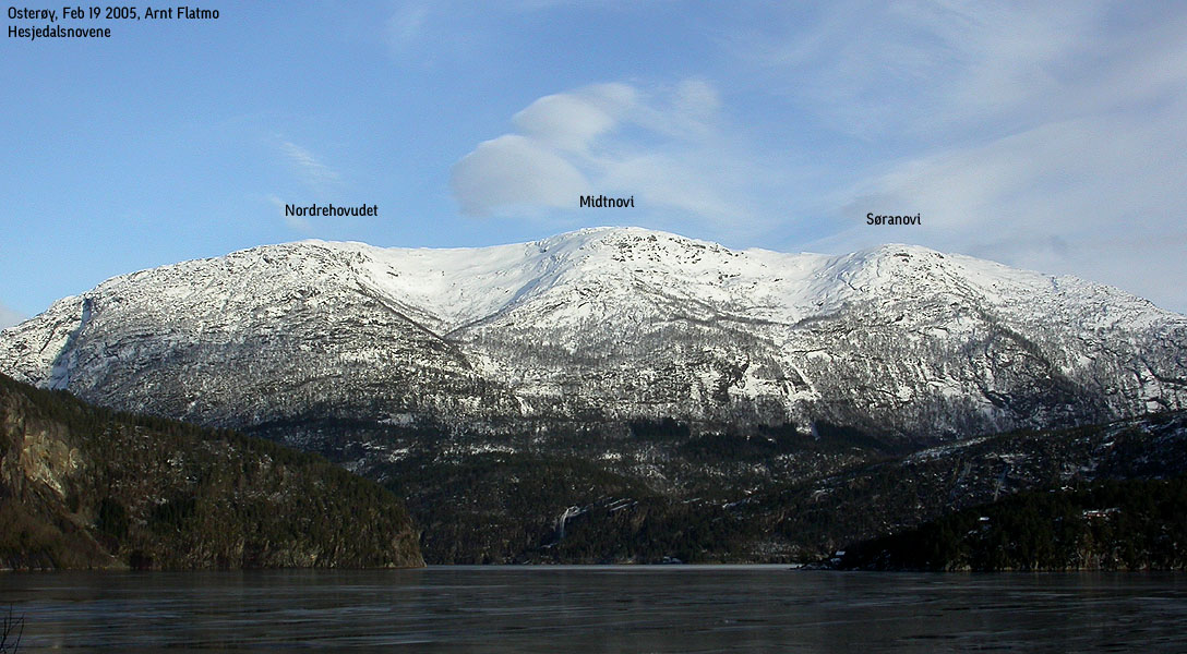
Brattanakken (often called Illebruni), Geitafjelli and Midtnovi (along with Nordrehovudet and Søranovi, referred to as Hesjedalsnovene) are lower, independent mountains, located west to southwest of Storfjelli. Access to these mountains is easy from Hesjedalen, and this is why I have grouped them on one page. Storfjelli can also be reached from Øvstedalen in the east and from Eksingadalen->Sørdalen in the north. Illebruni may additionally be reached from Straume via Straumsdalen valley. I will however recommend Hesjedalen as the best starting point.
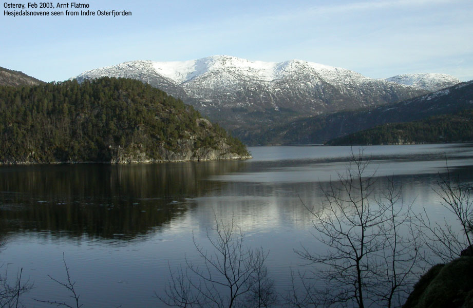
All my visits (4 in total) to this region has happened in the November - April timeframe, where there was still snow in the high mountains. I find these mountains exceptionally beautiful in winter. On my way from Bergen, I look forward to turning onto the Romarheim/Mo road after Dale, and watch the Illebruni massif rise from Indre Osterfjorden up to above 800m elevation. Soon, Hesjedalsnovene comes into view, and the landscape looks even more dramatic. After walking from Hesjedalen, up through Øyadalen, you arrive lake Gavvatnet, where Storfjelli rise majesticly in front of you. From the lake, you can either head towards Illebruni, Hesjedalsnovene, or set course for Geitafjelli/Storfjelli.
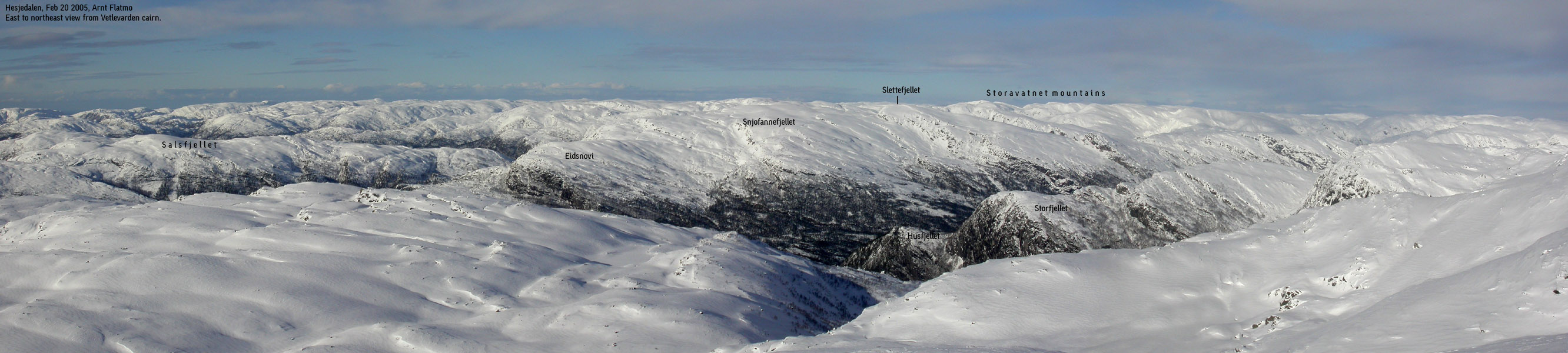
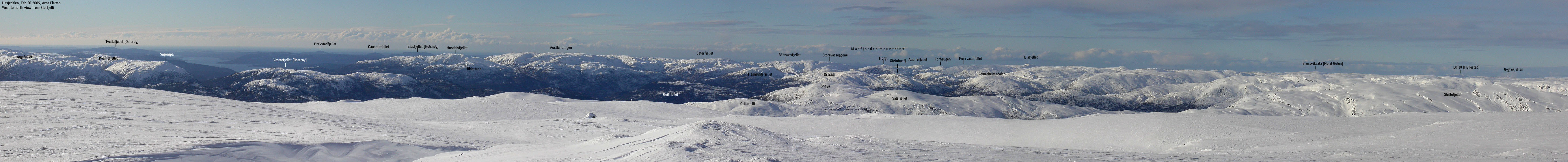
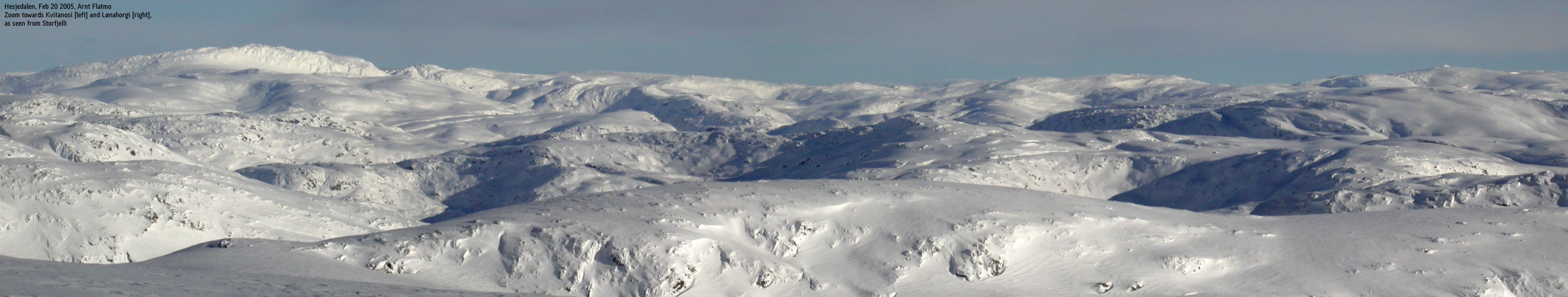
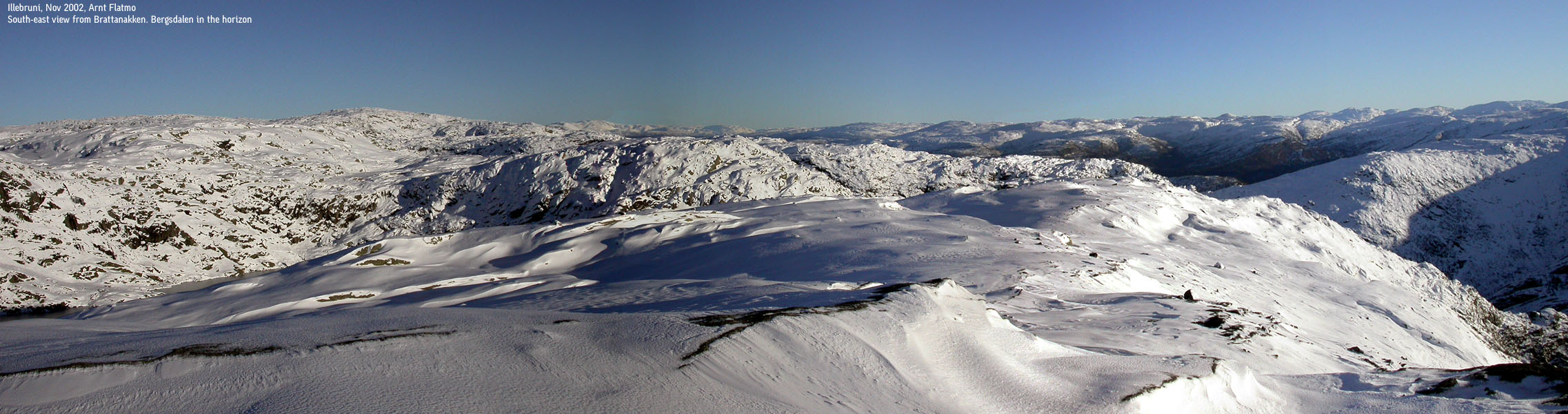
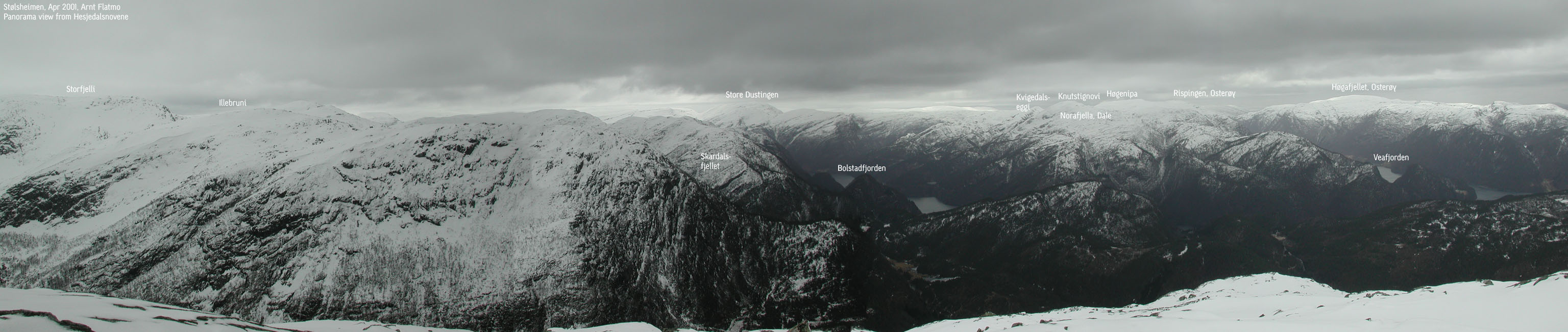
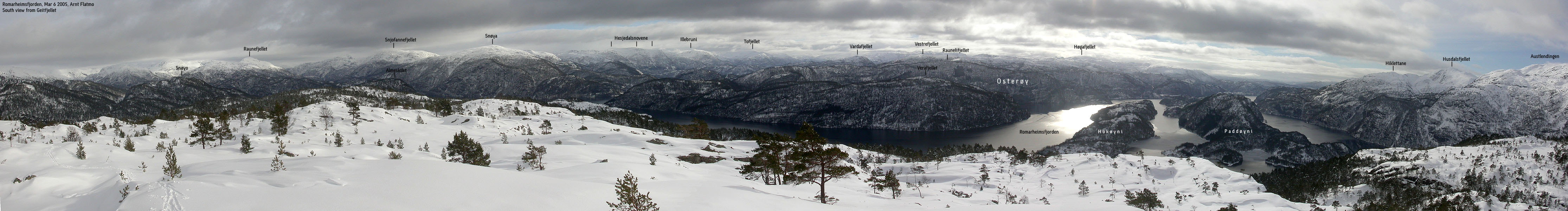
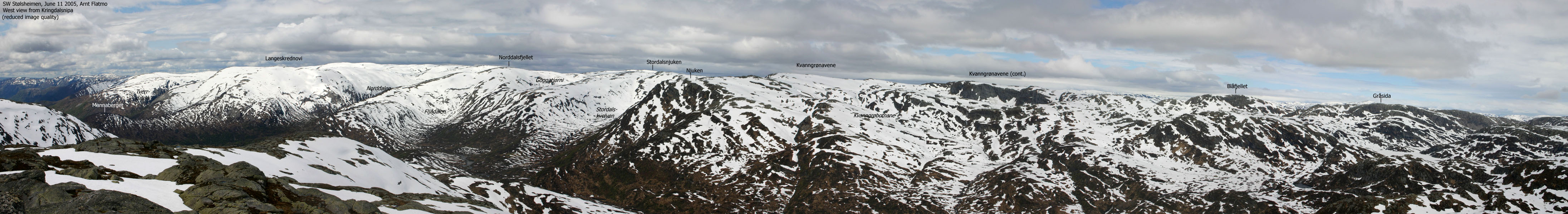
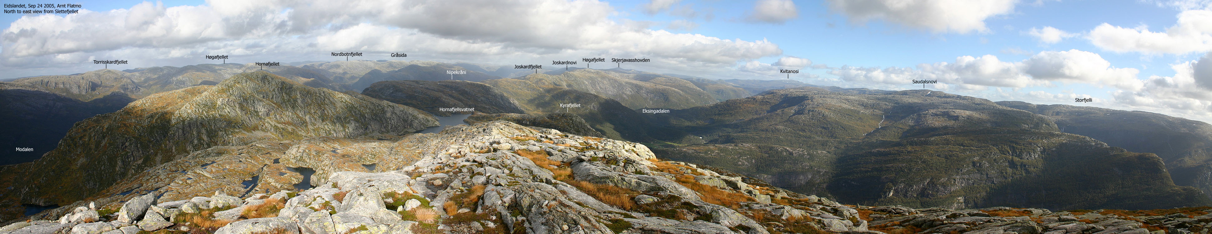
The views from Storfjelli are astounding. You have an unbroken panorama from Kvitanosi (highest in Stølsheimen) in the west, via the Voss and Bergsdalen mountains, to the mountain range starting from Austlendingen, and all the way to Sognefjorden. The northern views are limited, due to the north side of Storfjelli, that has almost the same elevation as the summit cairn.
These mountains are popular by the people living in the region, although you will never experience any crowds up here. When everyone else travel to Voss, Bergsdalen, Kvamskogen or Gullfjellet, Storfjelli is an excellent alternative, only an hour drive from Bergen.

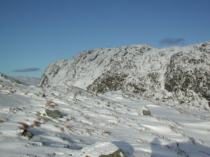
Storfjelli seen from Hatlekinnet (No Javascript)
Storfjelli (M711: 1115m, Ø.K: -) has a primary factor of 304m towards the higher Blåvasshorgi (1133m) The saddle is found SE of lake 789m (Kyrkjevatnet), north of Blåvasshorgi. The high route towards Blåvasshorgi takes a long detour around a number of other tops. Ref. the M711 map (20m contours), you cross the 820m contours on the high route, but not 800m. The saddle height has been interpolated to 810m. Storfjelli's height on the 1216-II Evanger 1986 edition is 1115m. Norgesglasset states presently (Feb 2005) that the height is 1114m.
Geitafjelli (M711: 812m, Ø.K: -) has a primary factor of 102m towards the higher Midtnovi (831m) The saddle is east of Midtrinden. Ref. the M711 map (20m contours), you cross the 720m contours on the high route, but not 800m. The saddle height has been interpolated to 710m.
Midtnovi (M711: 831m, Ø.K: -) has a primary factor of 141m towards the higher Storfjelli (1115m) The saddle is found SW of Kragesteinsborgi. Ref. the M711 map (20m contours), you cross the 700m contours on the high route, but not 680m. The saddle height has been interpolated to 690m.
Brattanakken (Illebruni) (M711: 864m, Ø.K: -) has a primary factor of 114m towards the higher Storfjelli (1115m) The saddle is found S of Illebruvatnet. Ref. the M711 map (20m contours), you cross the 760m contours on the high route, but not 740m. The saddle height has been interpolated to 750m.
Notes: Class ratings are in reference to YDS. Click here for more information.
The trails described below are not necessarily the *easiest* trails to this mountain.
|
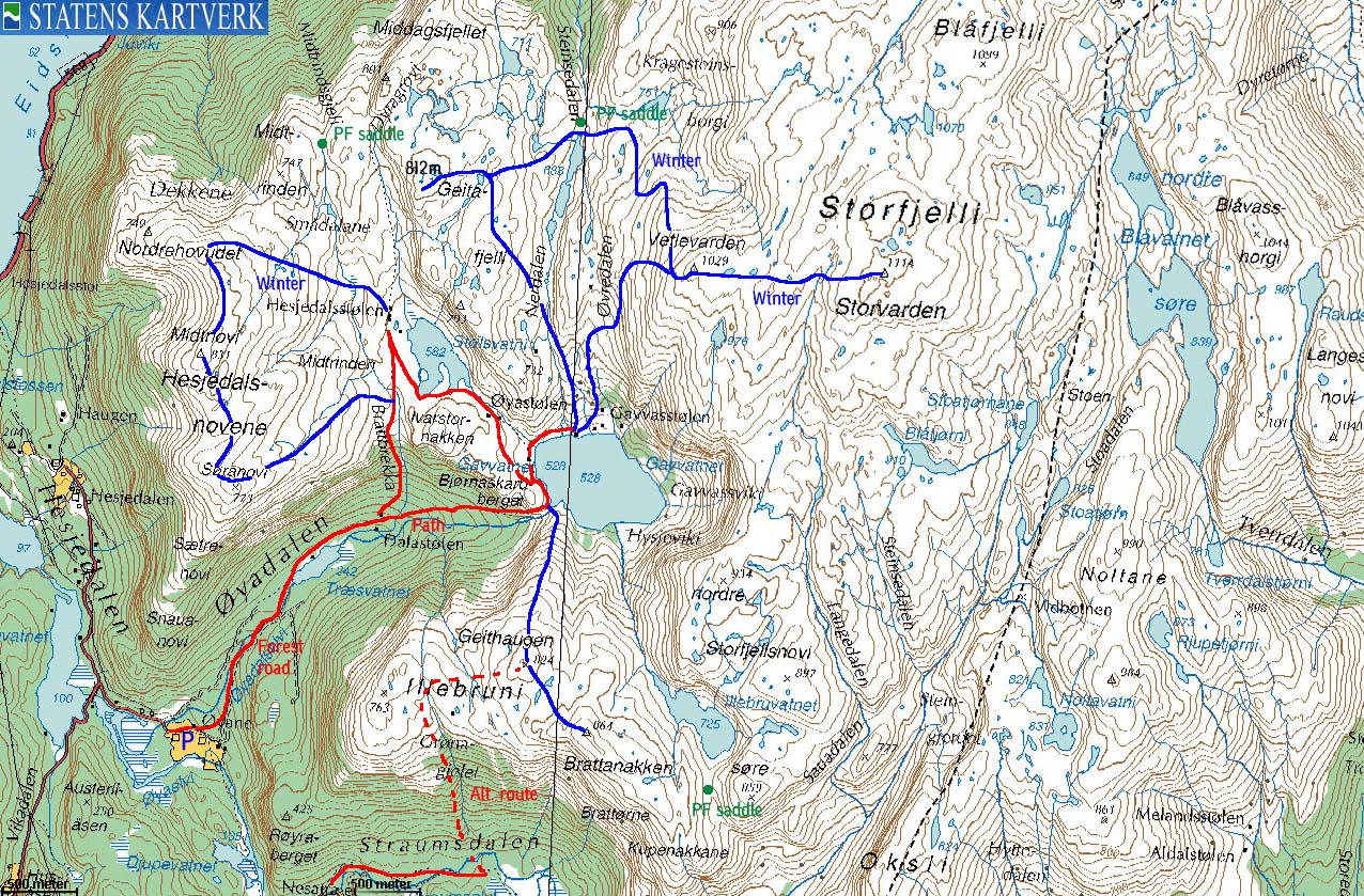
Hesjedalen - All summits (winter)
|
|
From Bergen, follow highway E16 towards Oslo and Voss. Pass Dale (approx. 50Km from Bergen), and 2,7Km after Dale, turn left towards Romarheim/Mo. Follow this road for approx. 7,7KM. Turn right towards Hesjedalen. Follow this road for approx. 2,7Km and turn right when you see the "Kanoutleige" sign. Drive 400m until you reached the parking area (signed)
Note that the road towards Romarheim/Mo is narrow and curved. Show caution. The road up to Hesjedalen is steep. Bring chains if you suspect icy roads.
To Dalastølen in Øyadalen
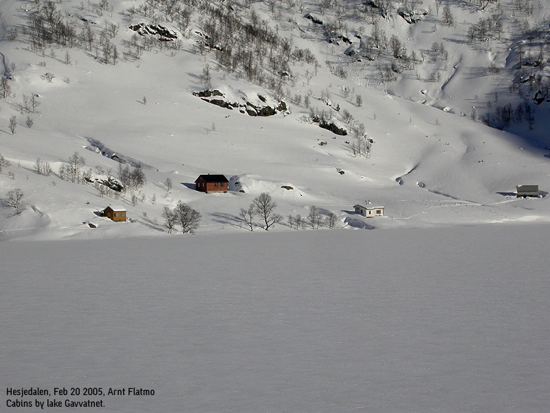
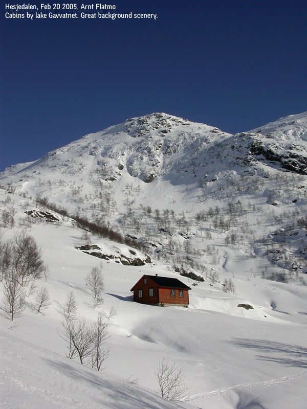
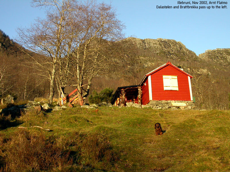
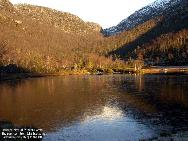
From the parking, follow the road 350m until your reach a trailsign with several names. "Stølsveg" is one of them. This is a 300m forest shortcut to the easternmost forest road up to Øyadalen. Follow the forest road upwards for approx. 650m. Turn left when you see another "Stølsveg" sign. Cross the river Øyadalselvi on a bridge, pass lake Træsvatnet and a couple of cabins by the lake, before you reach the Dalastølen cabin. A single cabin with a spectactular background, in form of the Søranovi and Ivarstornakken faces. From here, you can either follow the path to lake Gavvatnet, or turn left and follow a path up to lake Stølsvatnet (Stølsvotni) Expect 45-60 minutes from the parking to this cabin (no pause included in this, and the following time estimates)
To Hesjedalsnovene
If your goal is Hesjedalsnovene, turn left by Dalastølen and follow a path up to lake Stølsvatnet (582m) The path is vague, but there should be no problems in summer. The route gives it self, and you will see there is only one natural way upwards. From the lake, you have now an excellent base for hiking or skiing the Hesjedalsnovene mountains, being right at their base. The forest route up to lake Stølsvatnet is better for hiking. You need a lot of snow before skiing seems natural here. When Hesjedalsnovene have been collected, either descend your ascent route, or take the trip down to lake Gavvatnet via Øyastølen.
To lake Gavvatnet and the rest of the mountains
From Dalastølen, follow a forest path eastbound. Just before the lake, the terrain gets steeper, and has one spot which can be incredibly tricky if there is nothing but ice. If this is so, the only workaround would be to cross the river and continue on the other side. As long as there is snow, or summer conditions, there should be no problems. This spot is not directly exposed. It can just be problematic to advance upwards. As for the forest mentioned above, this forest isn't exactly skiing heaven, and a lot of snow is needed for effective skiing here.
To Illebruni
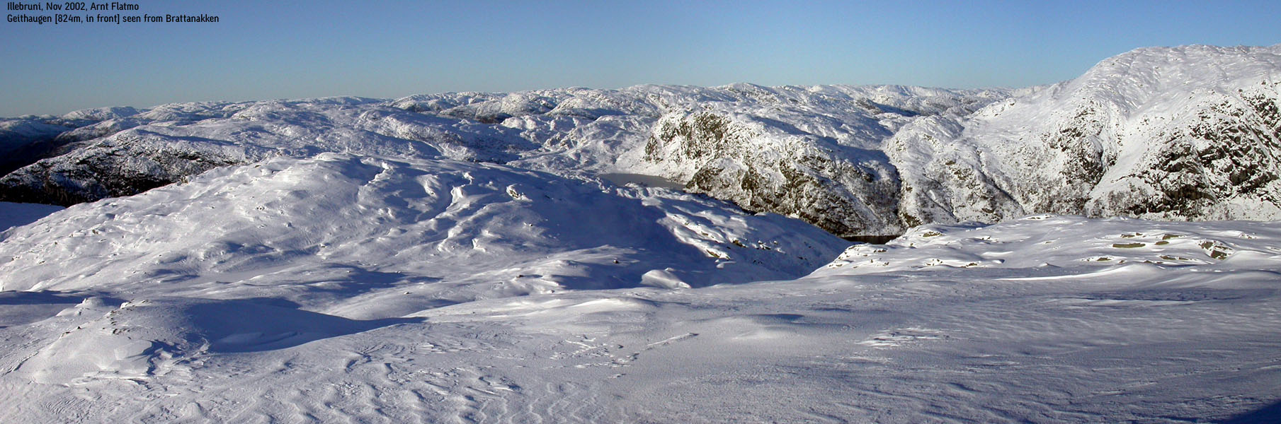
In order to reach Illebruni, you have to cross the lake from lake Gavvatnet. This can be everything from easy to quite problematic. In worst case, fording the drain may be the only way. Once on the other side, head straight up Geithaugen's north ridge, and continue southeast to the high point (Brattanakken) The distance from lake Gavvatnet to Brattanakken is approx. 1,8Km, and you should be able to reach the top within an hour or so. If Geithaugen's north ridge consists of hard snow/ice, you might be better off finding a route up to lake Illebruvatnet and then proceed directly to Brattanakken. Return your ascent route.
To Geitafjelli and Storafjelli
This is a nice round-trip. Proceed to the cabins at the north side of lake Gavvatnet (Gavasstølen) Although there is a ridge that takes you directly up to point 793m on the Geitafjelli massif, I suggest you follow another ridge directly up (northbound) from the cabins. At approx. 660m elevation, turn slightly northwest and then set a direct course for the Geitafjelli high terrain. When you reach 780m elevation, you will be forced to take a short detour to avoid some cliffs. The distance is approx. 2,4Km from Gavvasstølen to Geitafjellet high point (812m) Expect an hour if you are skiing. There is no cairn on the high point, but although the are contains many humps, there is no doubt which is the higher.
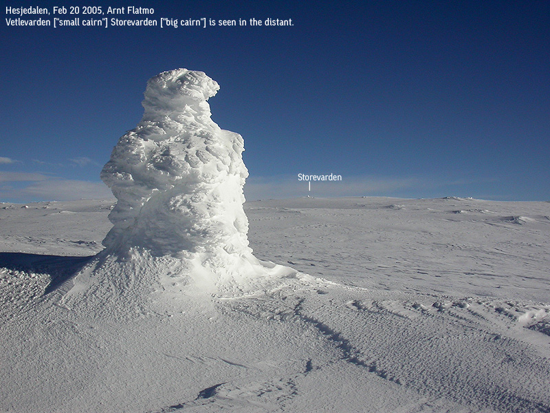
Proceed to Storfjelli; head to the north end of lake 688. After some switchbacks, you are on a distinct ridge that leads you all the way to the Vetlevarden cairn (1029m) From Vetlevarden, you see Storevarden cairn in clear weather, 1,26Km further east. The skiing distance will be a little longer. The skiing distance from Geitafjelli to Storevarden is approx. 5Km, and expect 1,5-2 hours on this distance.
Upon descent; Ski back to Vetlevarden, and follow your ascent route along the ridge to approx. 900m elevation. Then turn southwest and ski down to a cairn at approx. 840m. Ski down here (consider avalanche danger) or find another route down to the northwest. It is not trivial getting back to the ridge you followed towards Geitafjelli, so continue on the ridge you are on, all the way down to Gavasstølen. This terrain is not good for skiers who like long turns. Back at the lake, descend your ascent route.

Storfjelli seen from Steinhusfjellet (No Javascript)
|
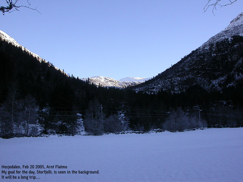
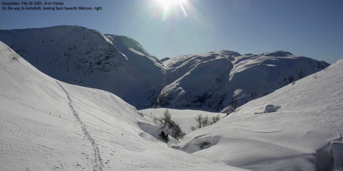
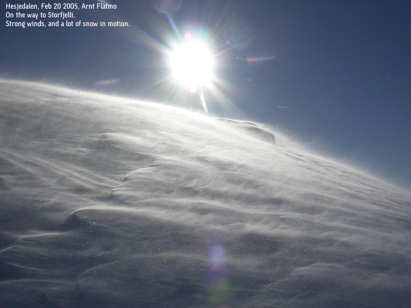
Trip report Geitafjelli/Storfjelli Feb 20 2005What a wonderful day this turned out be! After the Verafjellet ordeal the day before, I was going for a nice ski-trip this Sunday. The only question was where? I had passed Hesjedalen the day before, and made a mental note that Storfjelli was on the to-do list. I also noted that the road up to Hesjedalen looked very icy, and that I didn't really want to start at the sea level, should I go for Storfjelli. There was not much snow below 500-600m, which meant that Kvamskogen and Bergsdalen would have been the best starting points for a ski-trip. But the winter holiday was coming along, and I expected these areas to be crowded. When I left Bergen early Sunday morning, I had brought along maps covering the entire territory between highway E16 and Sognefjorden. I was going skiing for sure. Somewhere. Troll was with friends, and I could spend the day not having to worry about a cold dog. When I reached Hesjedalen, the road upwards was dry. I uttered a silent scream and knew that Storfjelli would be "in the bag" later in the day. This was my fourth visit to Hesjedalen. All visits were in the November - April timeframe, and everytime I was stomping in snow. There was obviously something about winter in these mountains that attracted me. As I didn't really need a fifth visit to this area, I decided to include Geitafjelli on today's trip. This mountain had a primary factor of only 102m, just enough to get on my list. I left the Hesjedalen trailhead 09:40AM, with the skis on my back. I kept a quick pace up to lake Træsvatnet, where I put the skis on. I was skiing on a minimal level of snow, but at least I maintained progress. At Dalastølen, the skis had to come off again, and this on-and-off procedure was repeated at least three times until I reached lake Gavvatnet 11:10AM. I have always enjoyed watching Storfjelli from this angle. It is majestic and impressive, and this time, I would be on it. I think Storfjelli always was my primary target, but I always ended up on the other mountains. I had been skiing with skins up to now. Climbing rocks with skis is better with skins. At the lake, skins came off and vax came on. I finally had snow under my feet. The real part of the trip could begin. Yes! I skied towards the cabins at the far end of the lake. Although someone had been sking here recently, there was not a soul around today. I found an inviting ridge that I switchbacked upwards, not really sure where it led. The ridge was in the middle of two maps, and I didn't bother taking the time to fold them properly. After a while, I had to get off the ridge and set a course towards Geitafjelli high terrain. This was easy skiing, and by 12:20PM, I was on the high point. The views were quite impressive. Especially westbound. This spot also gave me a good view towards the west slopes on Storfjelli. It became apparent which route I should follow. I skied down to the pass between the mountains and started the ascent. The hill was long, and I was bugged by a nasty, cold wind. The aggressive snowdrift covered the ground totally. Even with the sun in my face, it was cold. I reached Vetlevarden cairn 13:30PM, and saw my main goal for the day, a bit further to the east. The winds were much calmer on the plateau, and the snowdrift had ceased. After taking pictures on Vetlevarden, I reached Storevarden 13:55PM. I found total shelter from the remaining winds behind the summit cairn, and could peel an orange with the gloves off. Very practical. The views were just insane. I had a near 360 degree view. Only the north part of the Storfjelli plateau obscured the northern views. I had been keeping a good pace since 09:40AM, ascended 1150 vertical meters, and despite the strenuous hike to Verafjellet the day before (1050 vertical meters), I was not at all tired. I considered going for Saudalsnovi, but concluded that enough was enough. I had another long ski-trip coming up in a couple of days, so it was probably best to save the strengths. I took a fairly direct route back to lake Gavvatnet. I had been very focused of staying in safe terrain, but eventually decided to cross a slope that looked like a potential slab avalanche hazard. There were of course a number of considerations, but my inner voice told me this decision would work. And it did. I have begun to trust this inner voice more and more. The rest of the descent was a true nightmare for a skier not comfortable with sharp turns. But I reached the lake in once piece. On the way down the forest, the skis came off and on a number of times. Skiing here was not fun at all. When I finally made it back to the forest road, skiing was even worse. There were two tracks, both frozen. The frozen snow inbetween was at least 30cm high, which made reducing speed incredibly difficult. There was no way I would let the skis run free on this steep road. Falling on this hard snow would have consequences. In one piece, I reached the trailhead 15:50PM. It had taken me approx. 4 hours up the mountain, and 2 hours down. It's a typical ratio, I believe. The total distance was 20,5Km. Very happy about the achievements of the day, I returned to Bergen, enjoying the brilliant weather that was here to stay for a while.
Pictures from the Feb 20 2005 hike
Move cursor to read notes, and click on the images to see full version.
No Javascript: 1 2 3 4 5 6 7 8 9 10 11 12 13 14 15 16 17 18 19 20 21 22 23 24 25 26
|
|
Trip report (Brattanakken/Illebruni) Nov 2 2002I like this area. I really do. This was my 3rd visit and I had to ask myself why I always ended up here in winter. Everytime the ambition had been to climb Storfjelli, but everytime the snowdepth suggested I come back in summer. With a high head after the Midtfjell climb the week before, I was determined to climb Storfjelli via Brattanakken. At least, I would climb Brattanakken, as I had noticed that my last visit on Illebruni ended on Geithaugen. Now I knew that Geithaugen had no primary factor towards Brattanakken, and of course this situation was unbearable... We (me and the dog) made good progress up towards lake Trævatnet until I realized I had lost my water bottle and forgot my trekking poles. I hate trekking poles, and took them only to help fight deep snow. But I knew that I would need the water. I had to turn back. Slightly annoyed, I was back on track some 30 minutes later. The trail up to lake Gavvatnet was icy, as it had been the previous two times I hiked up here. But I never had any problems with crossing the river before. This time, I was glad I took my trekking poles, as they were crucial in balancing across the icy rocks, with a top-heavy backpack (the dog). Once over, Troll was free to lead the way again. The snow had an icy crust, and the dog didn't even leave prints in the snow. But it wasn't strong enough to hold me. It was unbearable. I would be content with deep soft snow, but this was pure hell. One step. The crust holds. Next step, I go through with snow up to my knee. Halfway up the first ridge, I was exhausted and annoyed. I was particularly annoyed with the dog that ran in circles, whining over my slow progress. At this particular moment, I kissed Storfjelli goodbye for the third time. I reminded myself of the viking heritage, and decided to at least reach Brattanakken. Long at last, I reached Geithaugen, and Brattanakken seemed so far away. It had taken me 2,5 hours to the summit. The time showed 14:00PM. I had to consider the darkness which came at 17:30PM, and found that I had plenty of time to do Brattanakken. Now I was over on the sunny side, and I spent some time on Geithaugen, reflecting on the good things in life. Then I headed down the slopes towards the pass below Brattanakken. There were no crust anymore. Soft snow that ran up to my knees. I made a deep corridor along the way, and realized that the smartest thing would be to return the same way. I reached Brattanakken much sooner than I had expected, and spent some time on the summit. The views were astounding. On my way down, I strongly considered following the ridge all the way down to the lake. But I chose to go back up Geithaugen, as it would be far easier to return in my own tracks. The hike took alltogether 5 hours.
Pictures from the Nov 2 2002 hike
On the way down:
No Javascript: 1 2 3 4 5 6 7 8 9 10 11 12 13 14 15 16 17 18 19 20 21 22
|
|
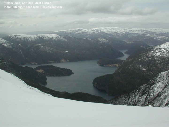
Trip notes (Hesjedalsnovene) Apr 2001This was a winter hike, snow to well above the ancles, strenuous, and I was back at the car 4 hours after I started without any significant breaks. On the way back, I crossed the partly frozen river in Øyadalen, and followed the old gravel road back to the trail junction. This is probably not so easy when the ice has melted.
Pictures from the Apr 2001 hike
No Javascript:
|


No Javascript:
1 2 3 4 5 6 7 8 9 10 11 12 13 14 15 16 17 18
Other hordaland mountains
 Other Vaksdal K. mountains
westcoastpeaks.com
Other Vaksdal K. mountains
westcoastpeaks.com


