
Norwegian Mountains, Møre og Romsdal
Storetinden (1408m) on skis, Apr 23 2011
To the main Storetinden page (maps, route descriptions, other trip reports, etc.)

The Bakkedalen route to Storetinden
(Click for larger image)
Returning to Bakkedalen...
Ever since Daniel and me skied Kvasshornet from Bakkedalen in May 2008, I have been thinking about going back and - preferrably - camp by Bakkedalsvatnet. Almost three years went by before I returned, and perhaps it was the ever-present avalanche danger (summer excluded) up here that made me wait that long. I don't know. But at the end of a nice Easter holiday, Anne and me went to Bakkedalen on this gorgeous April day.
I learned the day before that the road into Bakkedalen was open, which was good news. But it turned out that a small section of the road was in really poor condition, and only thanks to very aggressive driving from Anne, we managed to get into the valley. We had to park 900 meters east of Bakkedalssætra, but that was fine.
My choice of skis was actually a difficult one. Telemark is the default in the Sunnmørsalpane mountain region, but here we were facing 4,4km on a ridge (including ups and downs) and almost 2km along a road. The choice eventually fell on a wax-free Madshus Glittertind pair. Anne chose regular mountain skis, which clearly was the better choice.
We headed out 12:45pm, and knew that we had a wonderful day ahead of us...

On the way to Storetinden
(Click for larger image)
Avalanche?
I had told Anne that there was a severe avalanche danger on this mountain. As we approached Jolhornet's south face, we could see chunks of snow fall down. In fact, chunks of snow keep falling all the time, so it's simply a matter of not being at the wrong spot at the wrong time. I find this crossing an acceptable risk.
However, in the spring of 2008 - an avalanche went off high on Jolhornet's south face. It was a wet snow avalanche that looked just like a slab avalanche. It was quite scary to look at. And in spring! I couldn't make any sense out of it, and told the farmer down at Finnes about this, earlier in the day. He had also seen that avalanche, and acknowledged the fact that it was indeed strange.
But we weren't going to Jolhornet today, and just had to focus on getting past the avalanche zone in a safe manner...

1,2,3, GO!
(Click for larger image)
Steeper...
Once on the safe side, we could again focus on just enjoying the trip. We were making steady progress, and it was a delight to travel on light skis! It was gradually getting steeper, and I decided to put skins on after a while. The only thing between us and the ridge was a steep hill that I was certainly not going to ski!

To the ridge
(Click for larger image)
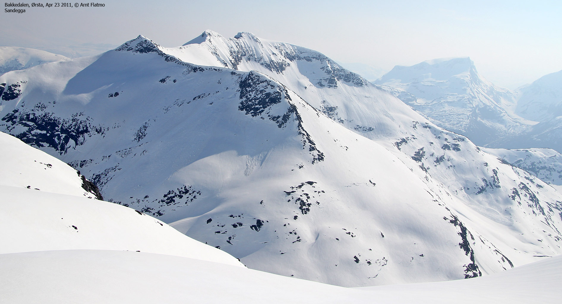
OMG!!!
Arriving on the ridge was just crazy. We had built up high expectations about the ridge to the summit and the scenery around us. And we were certainly not disappointed! Sunnmørsalpane grew more and more mighty by the minute. I had never seen Sandegga from this angle. What an incredible beautiful peak! And little by little, the ridge revealed itself. And when we had the Storetinden summit in clear view - OMG!

To the summit!
(Click for larger image)
Pico Grande...
We arrived on the summit 4:35pm - 3h:50m after heading out. On top of Pico Grande! Yeah! How lucky we are to be able to do stuff like this!

On top of Storetinden
(Click for larger image)
The descent.
After a nice stay on top of Storetinden, it was time to head back down. The snow was really wet and "sucking" , and downhill skiing did not work out so well for me. When we got back to the steep hill, Anne wanted to ski down the section that is marked as a glacier (south of the steep hill). I pictured that if I fell here, I could literally drown in all the wet snow that I would set in motion. I felt I'd be safer retracing my steps and asked that we stuck together.
Once back on the skis, there was no way I could keep up with Anne. It was a matter of survival...

Descending Storetinden
(Click for larger image)
We returned to the car 6:10pm - 5h:25m after heading out. The plan was to camp here, and we found a perfect spot by a bridge at the eastern end of Bakkedalsvatnet. I just love camping like this, and I do it way to seldom. This was the first camp in 2011 - about time!
We don't really have a language that can explain the inner happiness. That's OK. There doesn't have to be. But let me quickly add that the beer tasted heavenly...

Camp Bakkedalen
(Click for larger image)


