
Norwegian Mountains, Møre og RomsdalSætrefjellet, Nov 3 2007
This route is described on the Sætrefjellet main page.
The route
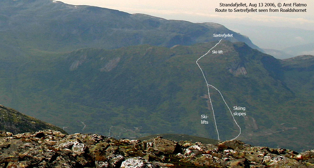
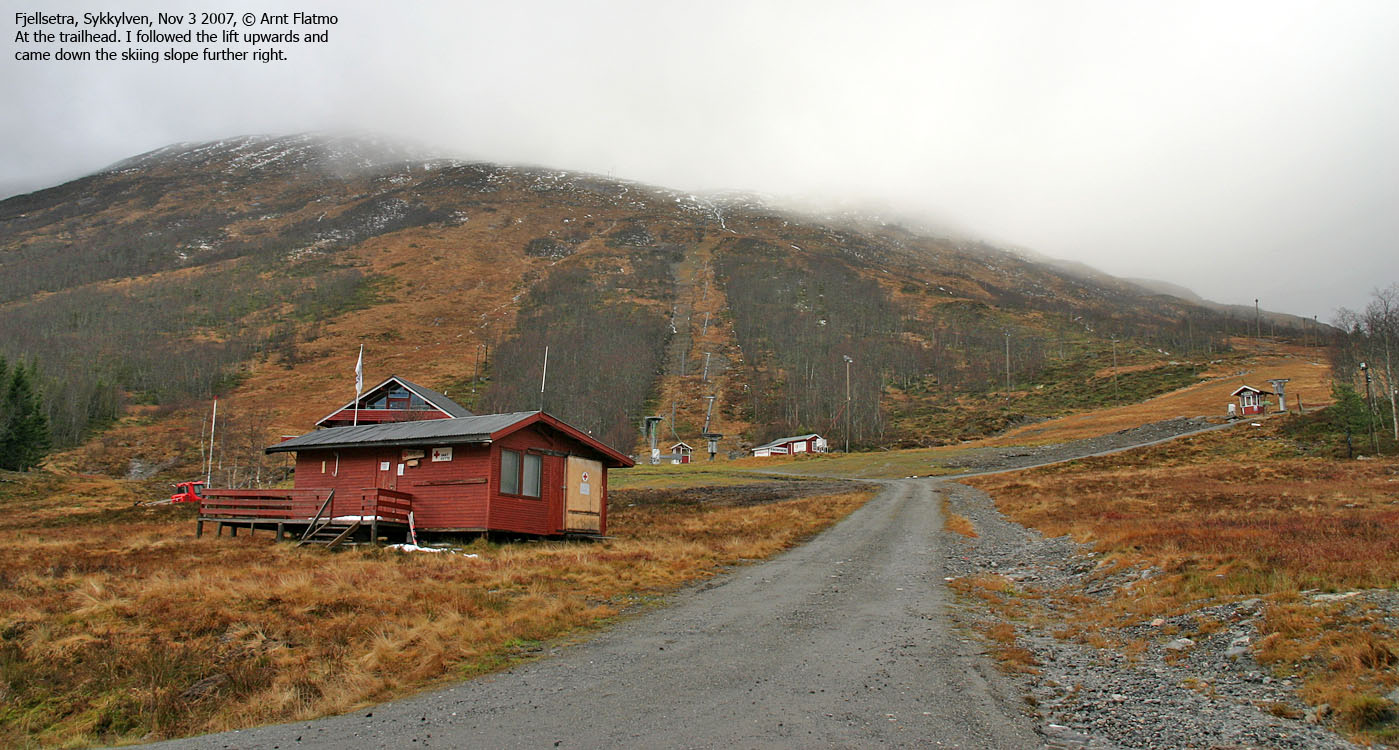
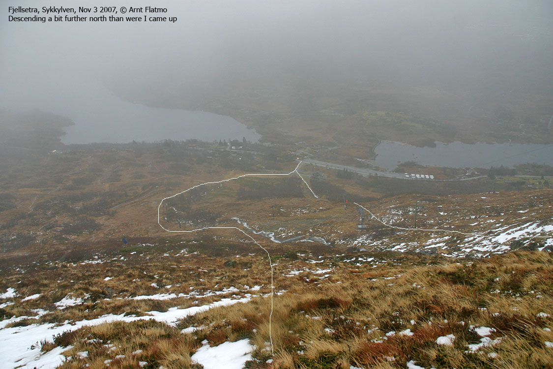
Neighbourhood scan Yet another rainy Saturday. Still, the urge to visit new terrain was strong, and I did a quick scan of the neighbourhood. The clouds hung low. Brattvåg reported fog down to 300m. I couldn't see over to Sykkylven. Because of fog or rain showers? I decided to head to Fjellsetra and visit Sætrefjellet (the mix of e and æ is unfortunate, but..). The mountain wasn't too high, below 900m, and neither fog nor snow should be a problem. My mind was made up. I drove to Magerholm and got on the ferry to Ørsneset (Sykkylven). Water, and lots of it Riksemelva caught my attention (see picture below). It seemed to have gone out of all proportions. Fitjavatnet seemed be almost level with the road (well, not quite so, but..). I hereby issue the following advisory to all readers of westcoastpeaks.com: Any reference to a creek or stream should for the time being be regarded as a river. No-brainer I parked at the main parking below the ski-lifts and watched my aging buddy Troll w o r k his way across the main road, just as if he was walking on glass. "Not quite energized today, little buddy?" We left the parking 12:13PM and after a rainy ascent along the ski-lifts, we entered fog at approx. 750m. Where there were patches of snow, there was actually lots of it. But for the most part, contact with snow could be avoided. The terrain was overall easy. No bush. Just grass. I didn't know that another ski-lift ran from the top of the hill and up to the summit. It was not marked on my map. However, that means that reaching the summit in fog is an absolute no-brainer. Those who don't like to hike mountains in fog, could "practice" here. Windy summit As I reached a cairn (UTM 32 V 382898 6914715), I believed this was the top. The ski-lift ended 66m to the northwest. But then I noticed "something" northwest of the ski-trek, 120m northwest of the cairn. I went over to check it out, and found what has got to be the (unmarked) high point. The time was 13:13PM, and it had taken exactly one hour. The wind was quite strong. It was both snowing and raining, and the snow whipped my face. Troll did not seem like a happy dog. I pulled my camera out of the two plastic bags protecting it. The wind ripped the bags out of my hand and they were gone in seconds. Quite a sight, actually. But since I don't like the concept of leaving plastic on a mountain, I had to go find them. If possible. This environmental bravery involved crossing rotten snow. That's not too bad, but rotten snow on top of a hole is less fun. And suddenly I found myself with snow up to my knees. And I was not wearing gaiters. I found the two bags, and that was quite a sight too. They were blown into an area that was slightly protected from the wind, and they were hovering above the ground, without moving further. Attaboy! Back on the high point, I had to let Troll out of the backpack. He was cold and had to move. Being close to blind, and quite helpless without a defined path, I certainly faced a challenge in getting him down the mountain. But I came prepared! I had brought a leash. Not that I haven't used a leash before, but only for restraint and control. Never for navigation. I was very curious about how well this would turn out. It turned out quite well. Not only did the leash help him always maintain the correct direction, but he also kept a faster pace than usual. NO! I was NOT dragging him. Just leading him gently, while sending positive feedback. We took another route down the mountain (down the skiing slope). The hillside was quite slippery, and I could not hold on to the leash, just feel it between my fingertips. I could fall (and I fell, at least three times) and did not want to behead the dog in the process... We were back at the car 13:52PM. A short, but good hike. Certainly better than staying home.
Pictures
Slideshow, all pics on this page:
To Sætrefjellet
No Javascript:
|


