
Norwegian Mountains, Møre og RomsdalSignalen, 231m
|
| Fylke/Kommune : | Møre og Romsdal/Giske |
| Maps : | 1120-I Vigra (Statens Kartverk, Norge 1:50 000) |
| Primary factor : | 231m |
| Hiked : | Feb 2006 - Oct 2007 |
| See also : | Aksla |
| See also : | Sukkertoppen |
| See also : | Storhornet |
| See also : | Havsteinen |
| See also : | Ørnebakken (Giske) |
| See also : | Other Giske mountains |

Signalen seen from the air
(Click for larger image)
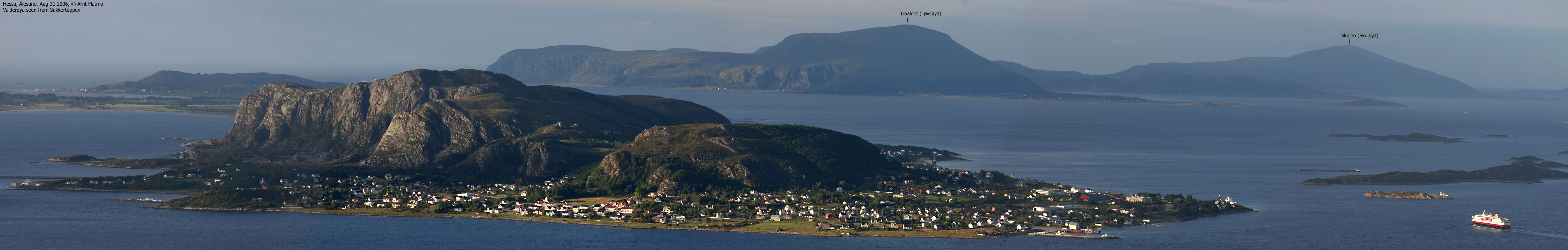
The coastal mountain Signalen is the highest point on Valderøya island, Giske kommune on Sunnmøre - one of three main regions in Møre og Romsdal county. Reaching Valderøya from the mainland is easy now that you have the Ellingsøytunnelen and Valderøtunnelen underwater tunnels from Ålesund (which in turn connects to the mainland via bridges..)
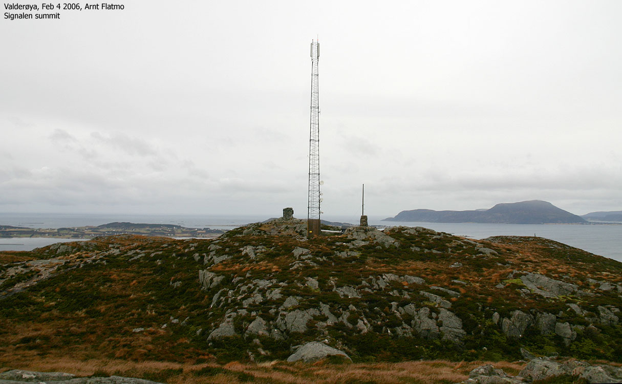
There are several routes that lead up to Signalen. The routes from Valderhaug and Sætredalen are described on this page. The summit plateau has of two humps of approx. the same height (230,61m and 230,71m according to Økonomisk Kartverk). The lowest of these humps is found southwest of the main hump with the largest cairn, and is not marked in any way. It is noteworthy that the name "Signalen" is not found on the 1:50,000 map, although it is found on Økonomisk Kartverk. Also noteworthy is the fact that the lake (dam) north of the summit does not have a name on either map.
On the summit, you will also find a lower cairn with a circular viewfinder. Between the two cairns is an antenna that blinks its light in the dark night. Perhaps that's why the mountain is called Signalen - "the signal".

Valderøya and Signalen
Signalen has steep cliffs to the east, popular by climbers and boulder enthusiasts. Here you will also find the Skjonghellaren cave.

Skjonghelleren seen from the air

The tourist attraction Skjonghellaren is a cave in the Signalen mountain, on the northwest side of Valderøya island outside the city of Ålesund. The cave is approx. 60m above sea level, the opening is 38m wide and the tunnel stretches 100m into the mountain.
The cave was inhabited in the Neolithic age. There has also been found traces of wildlife dating over 30.000 years back in Skjonghellaren. Visit the Godøy Coastal Museum, or search the internet for in-depth information about the cave.

Inside Skjonghelleren

Signalen (Norge 1:50,000: 231m, Ø.K.: 230,71m, UTM 32 V 351322 6934813) has a primary factor of 231m, being the high point on Valderøya island.

Valderøya fog

Google's interactive map. You can zoom, pan and click on the markers.
|
|

Norge i 3D Click on image (Java required) |
Notes: Class ratings are in reference to YDS. Click here for more information.
The trails described below are not necessarily the *easiest* trails to this mountain.
|
Route 1: Valderhaug - Signalen (all seasons)
|
|
Access
(all distances are approx. distances)
From Ålesund, follow highway RV658 towards Vigra (airport). Between the Ellingsøytunnelen and Valderøytunnelen undersea tunnels you have to pay toll. Per Dec 2005, the toll fare for passenger cars was NOK 60,-. Continue into Valderøytunnelen, and once you're out of the tunnel, turn left towards "Godøya".
Turn immediately left again towards "Valderhaug" in the first roundabout, and continue 4Km along the main road. Turn left onto "Øvstebøvegen" and follow this road 600m (turn left in a junction after 200m along this road). Next, turn right by a store ("Spar" per Feb 2006). Drive 400m and turn right (the third road to the right from the store). Follow this road 200m up to the Kolvikparken trailhead.
The route
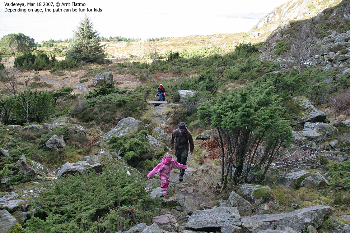
In short, follow the very visible trail all the way to the top. The trail can get quite wet in the lower sections.
Pictures from this route can be seen here and here.

Signalen seen from Molnesfjellet, Vigra

|
Route 2: Sætredalen - Signalen (all seasons)
|
|
Access
(all distances are approx. distances)
From Ålesund, follow highway RV658 towards Vigra (airport). Pass through Ellingsøytunnelen and Valderøytunnelen undersea tunnels, where you have to pay toll. Per Dec 2005, the toll fare for passenger cars was NOK 60,-. After Valderøytunnelen, continue 3,3Km and turn right towards Valderhaug just before Gjøsundsundet sound.
Drive 280m and turn right onto the Glopveien road. Drive this road westbound until it curves and comes back around. Near the curve, turn right and follow a rough road into an area where they extract gravel. It is safest to park before you enter this area, as trucks will be driving here in the daytime.
The route
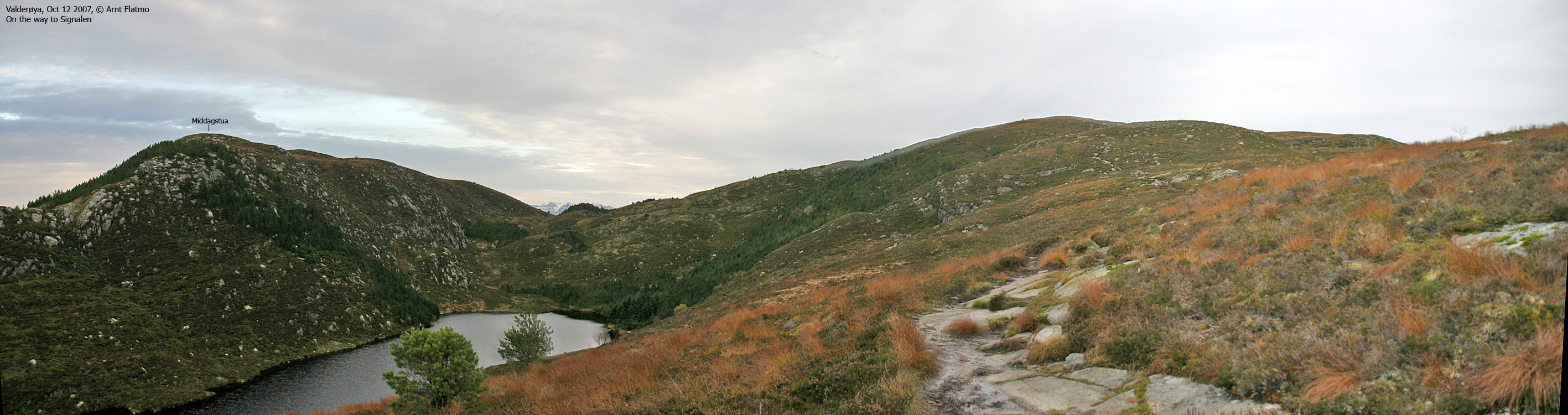
Head up to the gravel area and aim for a branch that runs in the direction of the dam. Follow a path up to the dam and continue on path up the mountain. Follow this path all the way to the top of Signalen.
Upon descent, follow the path that runs towards Storefjellet. Just before Storefjellet, the path changes direction and descends towards the dam.
Pictures from this route can be seen here.

Signalen seen from Fjellstua, Ålesund

|
Route 3: Valdervoll - Skjonghelleren (all seasons)
|
|
Access
(all distances are approx. distances)
From Ålesund, follow highway RV658 towards Vigra (airport). Between Ellingsøytunnelen and Valderøytunnelen undersea tunnels you have to pay toll. Per May 2006, the toll fare for passenger cars was NOK 60,-. Continue into Valderøytunnelen, and once you're out of the tunnel, turn left towards "Godøya".
In the upcoming roundabout, turn right and follow signs towards "Skjonghellaren". The road leads you to Valdervoll, where you park.
The route
From Valdervoll, follow a gravel road 500m (northbound), turn right onto a path (signed "Skjonghellaren") which leads up to the cave entrance and the main "hall".
Pictures from this route can be seen here and here.
 westcoastpeaks.com
Other Møre & Romsdal mountains
Other Norwegian mountains
westcoastpeaks.com
Other Møre & Romsdal mountains
Other Norwegian mountains


