
Norwegian Mountains, Sogn og Fjordane
Blåfjellet round trip on skis, Feb 14 2010
To the main Blåfjellet page (maps, route descriptions, other trip reports, etc.)

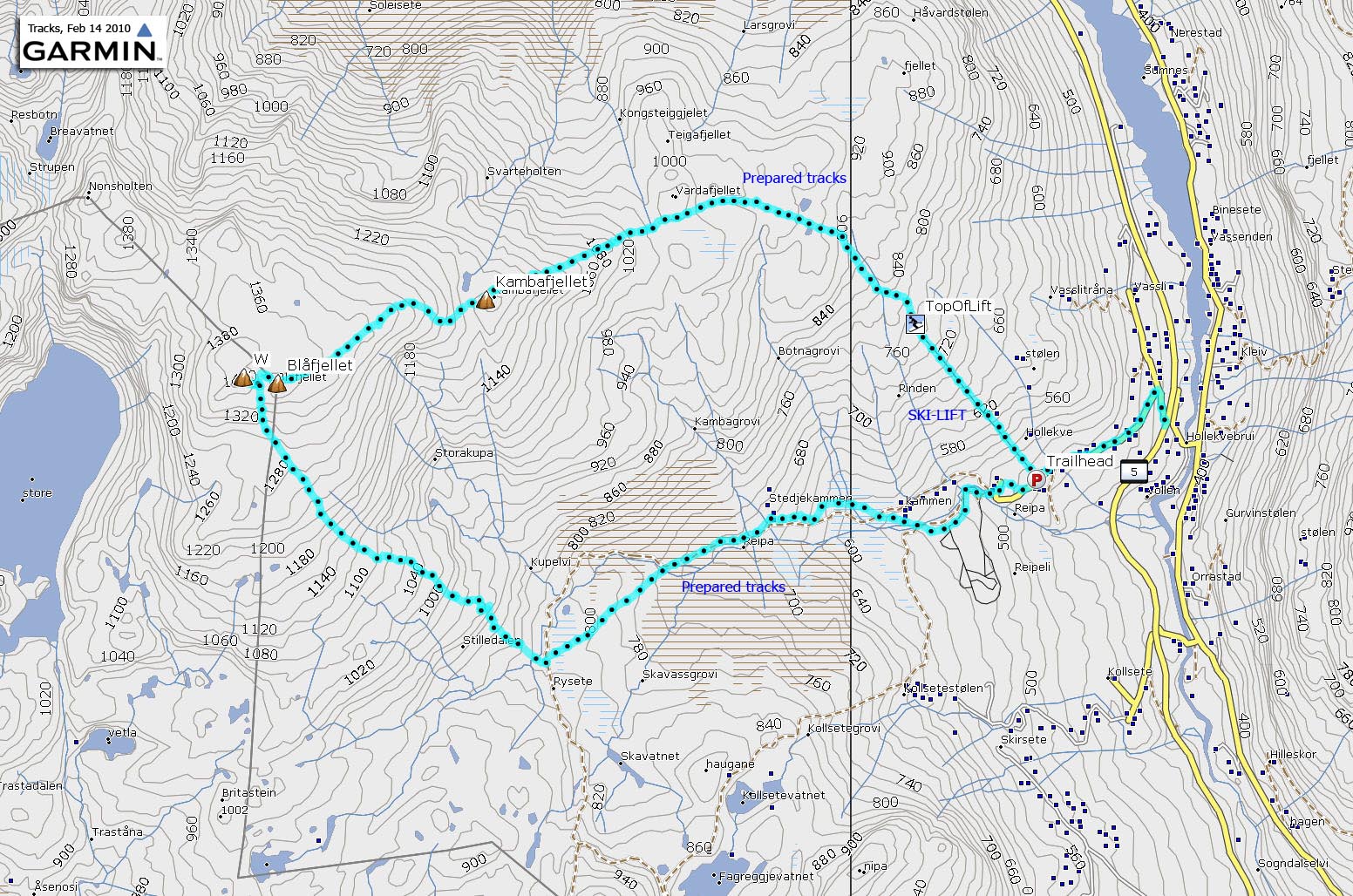
The Blåfjellet round trip route
(Click for larger image)
The day before, Anne Rudsengen and me visited Vorfjellet, and I wrote in my trip report; "The large amount of powder snow simply could not be ignored..".
According to Anne, this was not only wrong, it was plain wrong. The mere fact that the snow went high above our boots (making forward progress very slow) did not justify such a statement. True, skiing was indeed strenuous, but below the powder snow, there was grass and rock. Alas, there was not a lot of snow in the Sogn & Fjordane mountains this winter. I trust I have now set the records straight...

Celebrating powder snow
(Click for larger image)
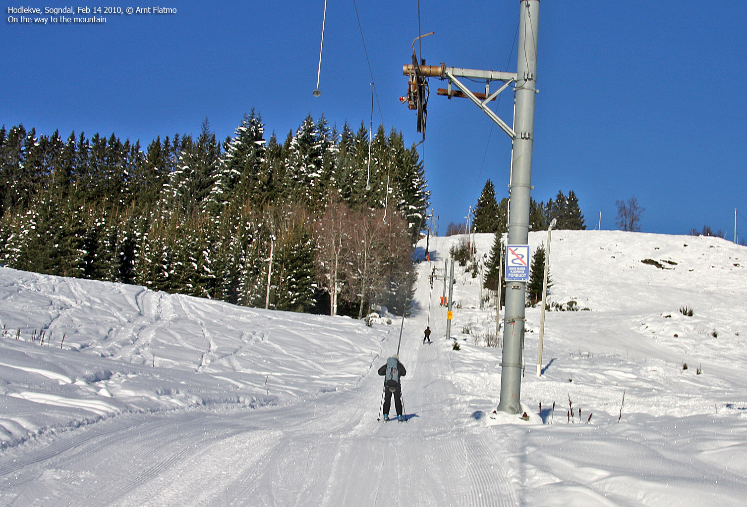
In any case, we agreed to find a mountain where we would not have to break trail, and Blåfjellet came up as the first candidate. The weather was gorgeous and we had a great day ahead of us. We took the ski lift up to 780m and followed the prepared tracks in the direction of Vardafjellet.
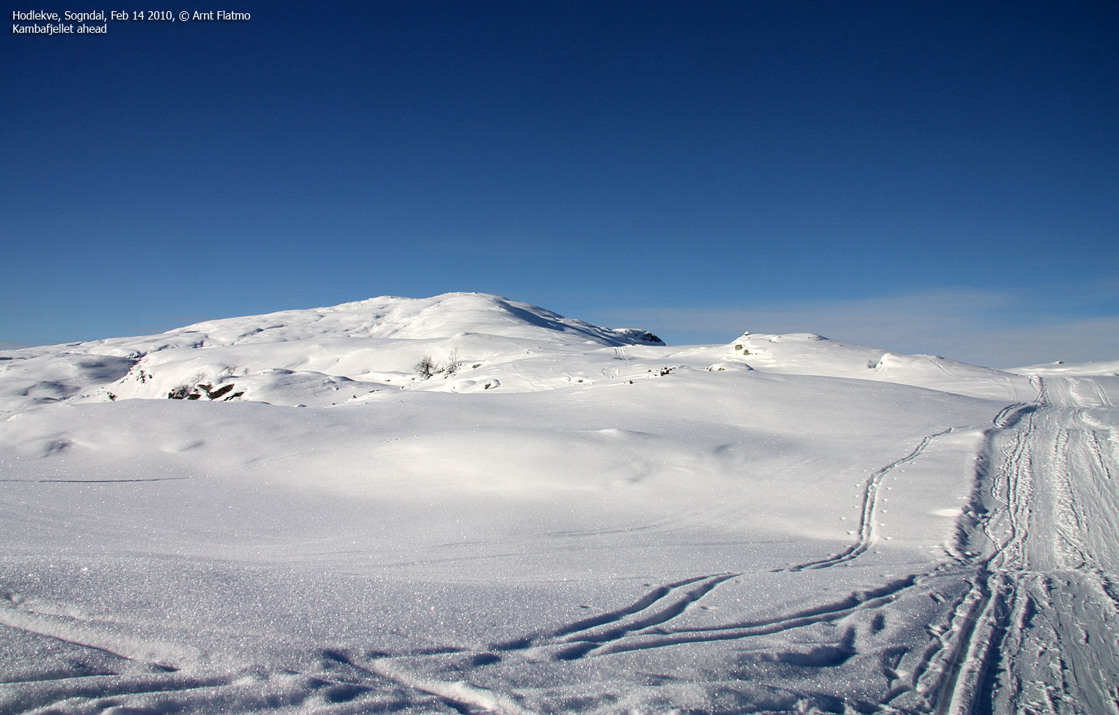
At 960m, we left the prepared tracks and followed regular tracks in the direction of Kambafjellet (and subsequently Blåfjellet).

Kambafjellet ahead
(Click for larger image)
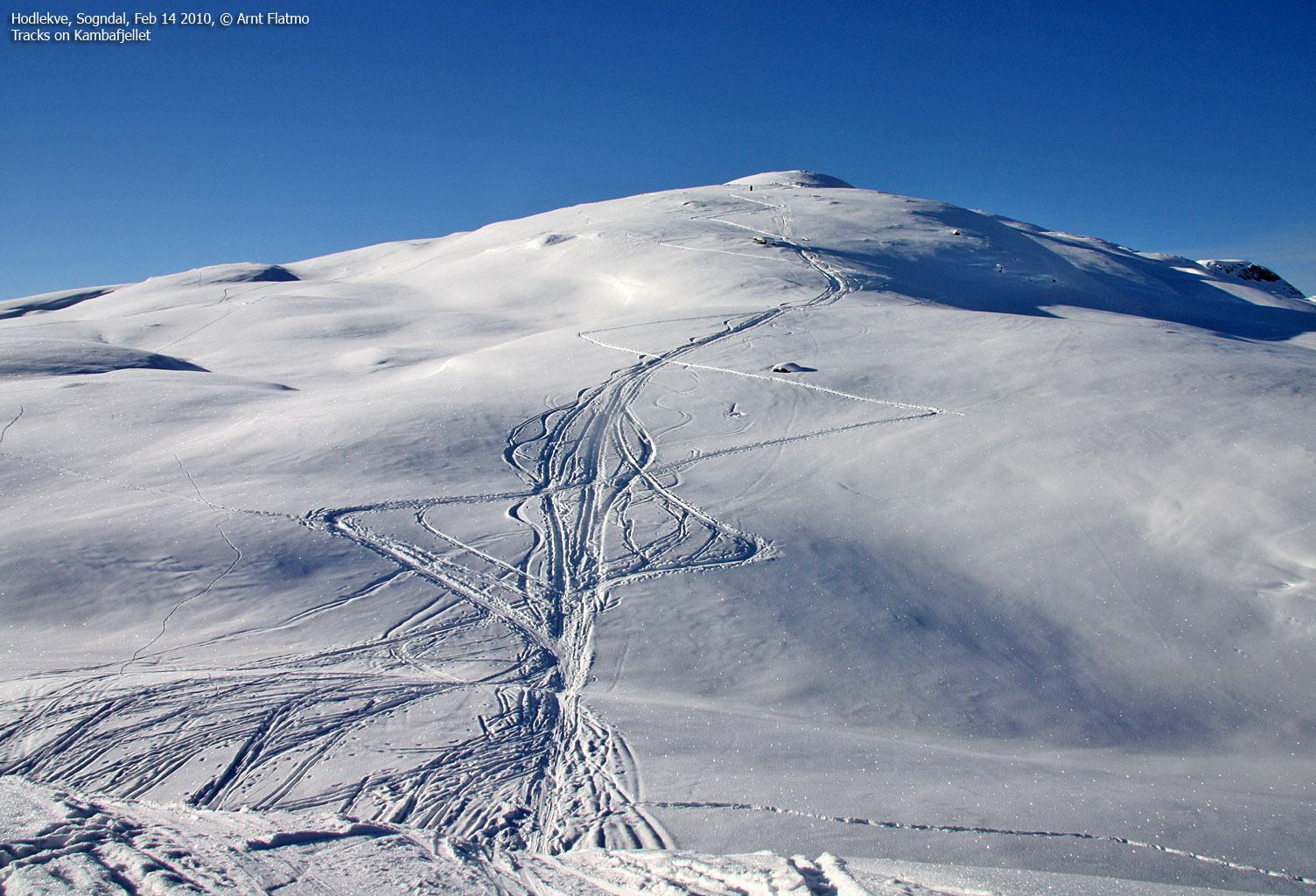
We had a short rest on Kambafjellet before continuing towards Blåfjellet. This part of the country was completely new to me, and I saw future skiing destinations everywhere. Asbjørnnosi, Synnevaskjer, Steindalsbreen, Stav, Blåskavlen, Bleia, Syrdalsbreen... My future (assuming I have one) looks busy...
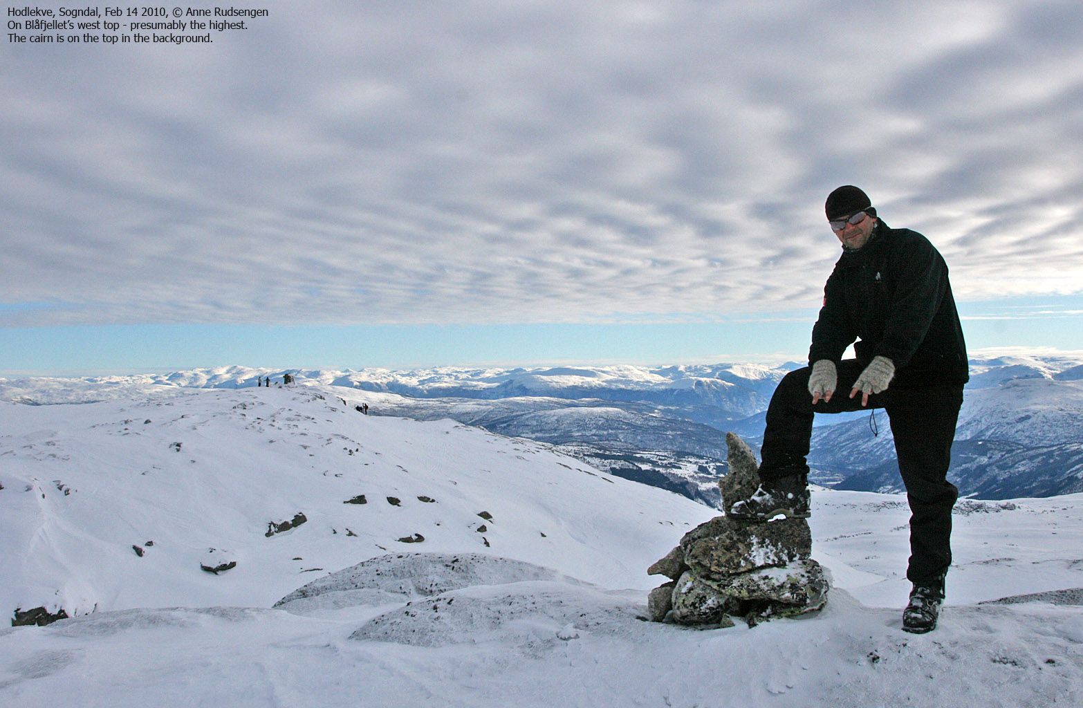
We arrived at Blåfjellet's east top 12:43pm - approx. 2 hours after leaving the ski lift and 2h:15m after heading out from the parking zone. I was already aware that the west top could be higher, but it was impossible to tell from the east top.

Anne, arriving on the east top
(Click for larger image)
After a short stay on the east top, we proceeded towards the west top. On the way up, I paid close attention to the view behind the east top. I was able to see beyond the east top just before arriving on the west top (making myself as small as possible). This is not science, but could indicate that the west top was indeed a bit higher. Unfortunately, the GPS readings were inconclusive - stating that both tops were 1403m.
OK, technicalities aside - it was time for the main event - the descent. We skied down the southeast ridge (with a stunning view), and joined the prepared tracks along the river Reipa. Ahead of us was a father with his two young sons. I skied at least 2km before I was able to overtake them both. I was utterly impressed with these two young lads. The oldest (approx. 10 years old) had his skis and arms pointing everywhere, but his centre of gravity was just amazing, and he stayed on his feet.
2:10pm, we were back at the trailhead - 3h:40m after heading out, we returned to the Hodlekve trailhead. Another fantastic mountain day in the Indre Sogn region had come to an end, and I sure look forward to more of the same...

Descending Blåfjellet
(Click for larger image)


