
|

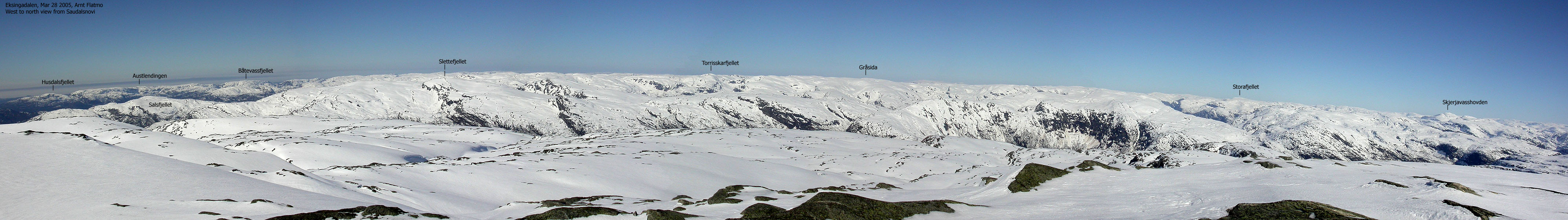
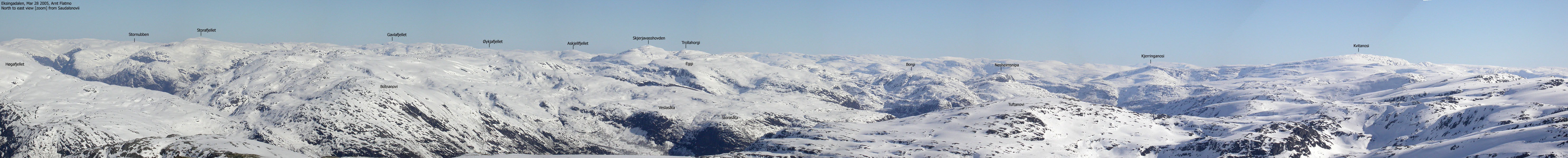
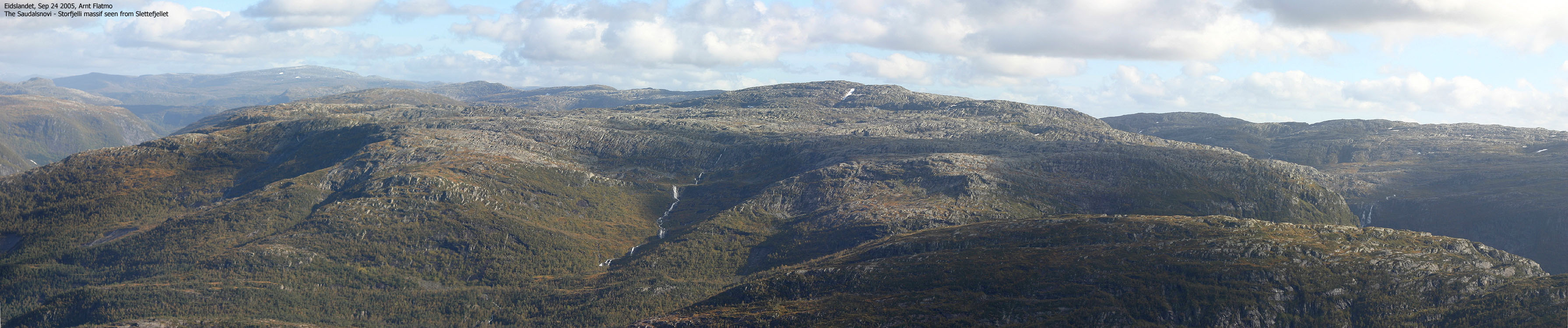
In the southwestern outskirts of the Stølsheimen mountain range, there is a mountain region enclosed by roads and fjords. The region is defined through highway E16, Teigdalen valley, Eksingadalen valley and Indre Osterfjord. There are 5 independent mountains exceeding 1100m elevation in this region: Blåvasshorgi (1133m), Storfjelli (1115m), Saudalsnovi (1110m), Kvanngrønavene (1105m) and Blåfjell (1101m).
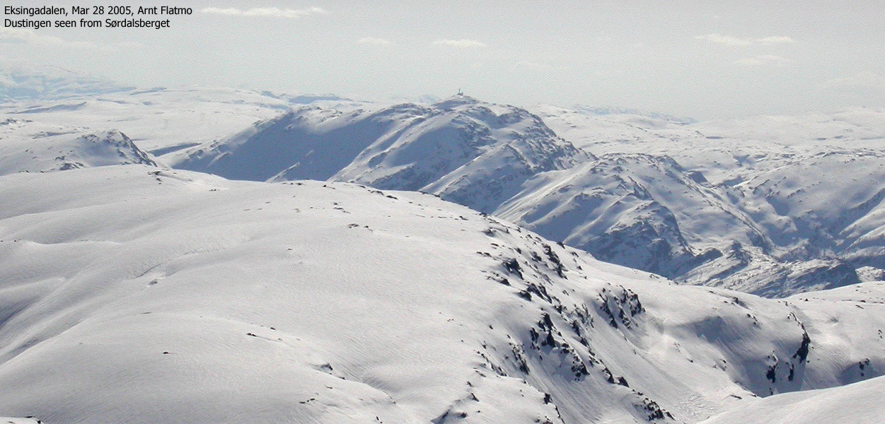
Storfjelli and Saudalsnovi are found west in this region, and connect to the rest of the region throuh the Sørdalsskardet pass (approx. 950m). "Sørdalsberget" is located above pass. The name has been quoted because the mountain has no name on the M711 map. According to Knut Øvstedal who knows this region well, the locals refer to this mountain as "Sørdalsberget".
From Sørdalsberget, you connect to the Osskardet pass, providing access to Norddalen valley, and subsequently Øvstedalen valley and a road connecting to highway E16. This means that both Storfjelli and Saudalsnovi can be reached via long valleys on either side of Sørdalsskardet. On my Storfjelli page, I have described a route from the west (Hesjedalen), but access via Sørdalen or Norddalen would also work well. And while Saudalsnovi can be reached from the south, this page will describe a route from Flatkvål in Eksingadalen, up Sørdalen.
To avoid naming confusion - Sørdalen valley (South valley) is descending towards the north, while Norddalen valley (North valley) is descending towards the south. All of these mountains are excellent skiing mountains, and my recommendation is that spring is the best season to experience these mountains. The views are quite good, as the pictures on this page will show. Saudalsnovi belongs to Vaksdal kommune, while Sørdalsberget belongs to Voss kommune. The Vaksdal/Voss border runs across the mountain, but the summit is fully within Voss kommune.
Saudalsnovi (M711: 1110m, Ø.K: -) has a primary factor of 200m towards the higher Stofjelli (1115m). The saddle is found between lakes Saudalsvatnet and Oksetjørni. Ref. the M711 map (20m contours), you cross the 920m contours on the high route, but not 900m. The saddle has been interpolated to 910m.
Sørdalsberget (M711: 1084m, Ø.K: -) has a primary factor of 134m towards the higher Storfjelli (1115m). The saddle is found in Sørdalsskardet pass. Ref. the M711 map (20m contours), you cross the 960m contours on the high route, but not 940m. The saddle has been interpolated to 950m.
Notes: Class ratings are in reference to YDS. Click here for more information.
The trails described below are not necessarily the *easiest* trails to this mountain.
|
Flatkvål - Saudalsnovi - Sørdalsberget (on skis)
|
|
From Bergen, follow highway E16 towards Oslo. From the Bergsdalen exit in Dale (approx. 50Km from Bergen), continue on highway E16 for 2,8Km and turn left towards Romarheim/Mo. Continue on this road for approx. 11,7Km until you reach the Gammersvik junction. Turn left towards Romarheim/Mo (don't drive across the bridge to Osterøy). 15,8Km after this junction, you reach another junction where the road towards Romarheim/Mo turns left. Drive straight ahead and after 26,1Km from the Gammersvik junction, turn right towards the Flatkvål church.
If the road conditions permits, you may follow this road for 1,1Km until you reach the end of the road at approx. 300m elevation. Find parking here.
Cross the Sørdalselvi river (just above the parking) and follow a tractor road on the west side of the river. When the tractor road ends, you see most of the valley ahead of you. A summer trail is indicated on the map, but the direction is quite obvious whether it is summer or winter.
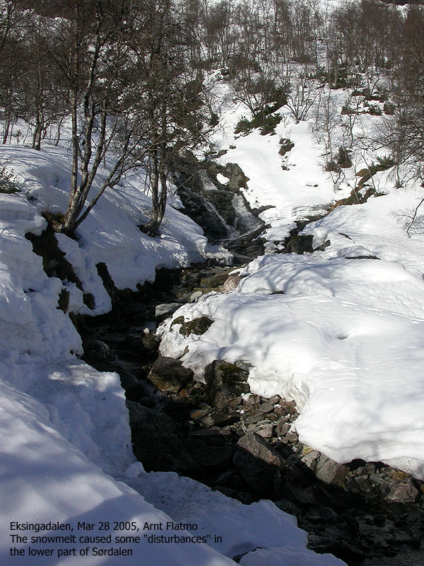
In the beginning, the winter route climbs up the forest, up to 300m away from the river. In spring, a number of creeks from Saudalsnovi may force you to look for good places to cross. The route gets more and more obvious the higher in the valley you get, and Nesstølen cabin (approx. 590m elevation) is a good place to take a rest.
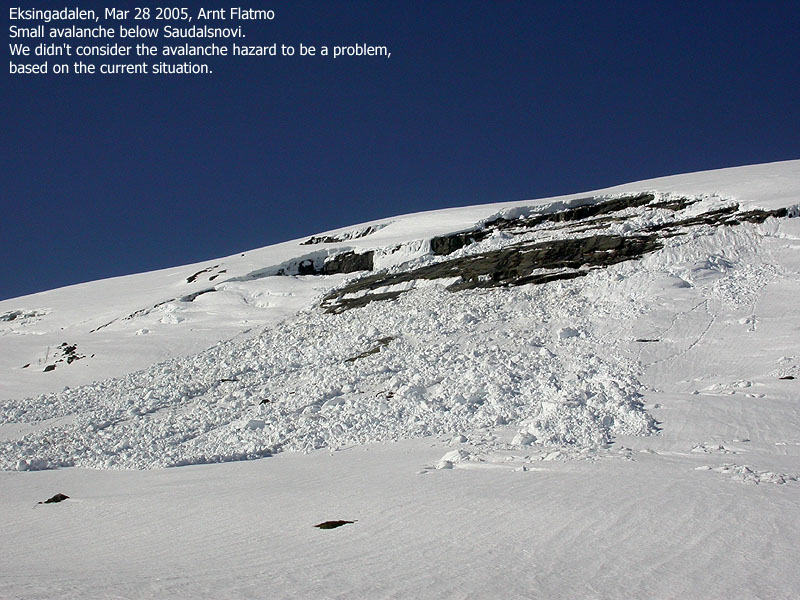
You may see avalanches along the way. You need to consider the avalanche hazard for yourself, but it is my impression that it is generally safe to stay in the bottom of the valley during your ascent.
1,5Km after Nesstølen, you have the option to ascend northwest up a long hill that will lead you directly towards the summit. Alternatively, continue all the way to Lake Oksetjørni and head northbound up a ridge towards Saudalsnovi.
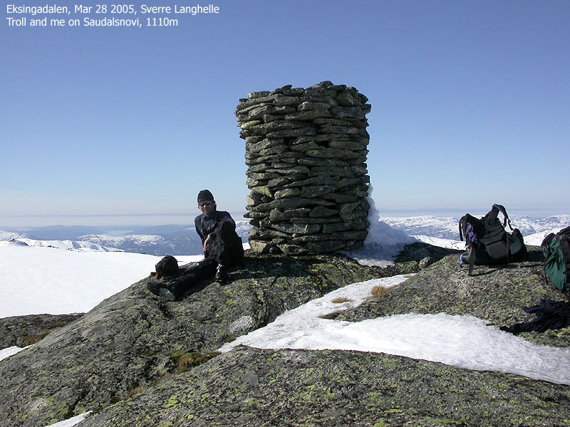
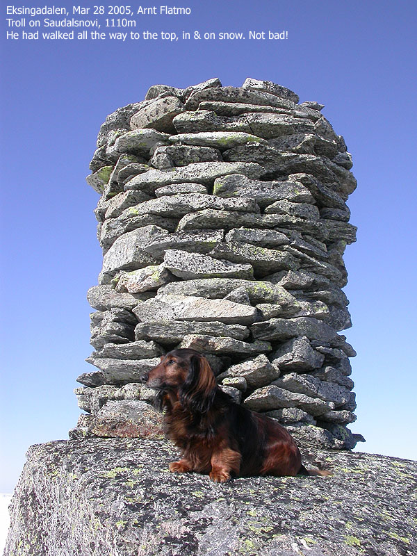
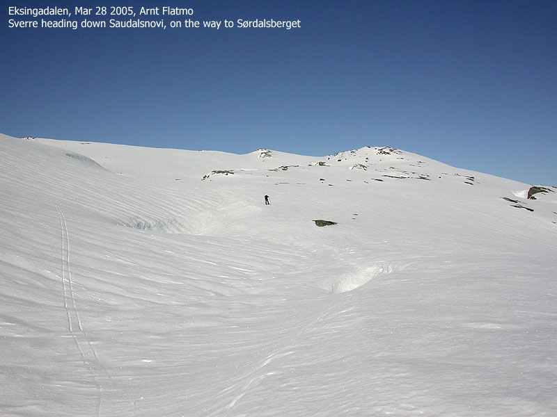
Saudalsnovi summit is marked by a large, fine cairn. Enjoy the summit views before you head south towards Sørdalsskardet. On your way down Saudalsnovi, you need to decide on which of the two ridges you shall follow. I suggest you follow the ridge closest to Sørdalen.
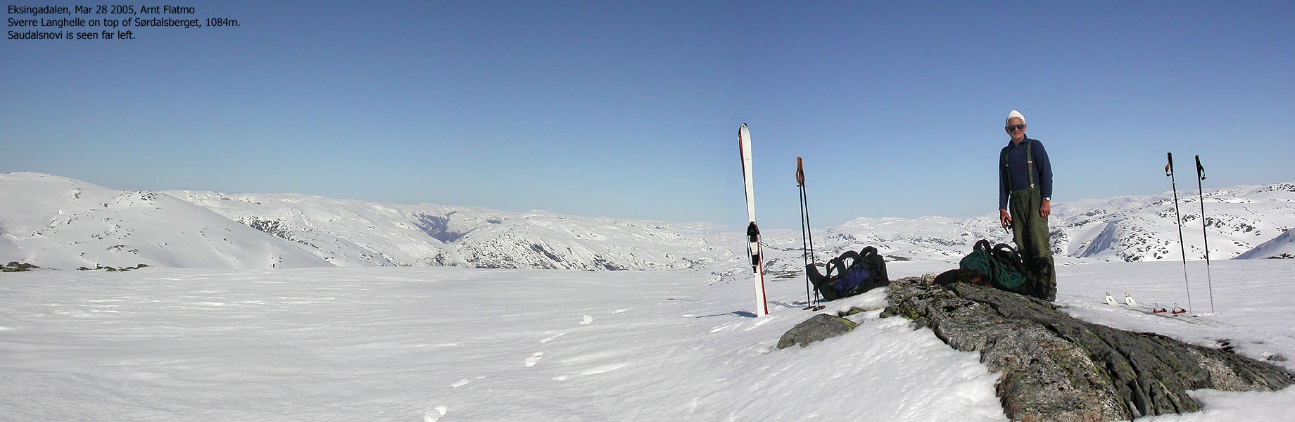
You may turn around here and ski back down Sørdalen, or head up to Sørdalsskardet pass to include Sørdalsberget on your trip. From the top of the pass, descend slightly and ascend Sørdalsberget from the south. There are indeed places to ascend directly from the pass, but the south route is less cumbersome. Follow the ridge up to Sørdalsberget where you see fit. The top of Sørdalsberget is marked by a few rocks. Descend to Sørdalspasset and ski down Sørdalen. This is a wonderful valley for skiing down.
|
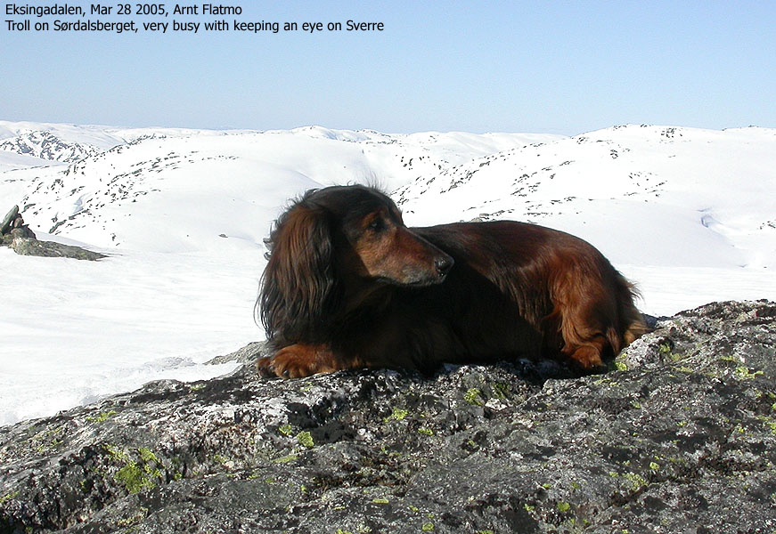
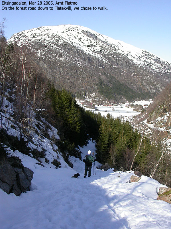
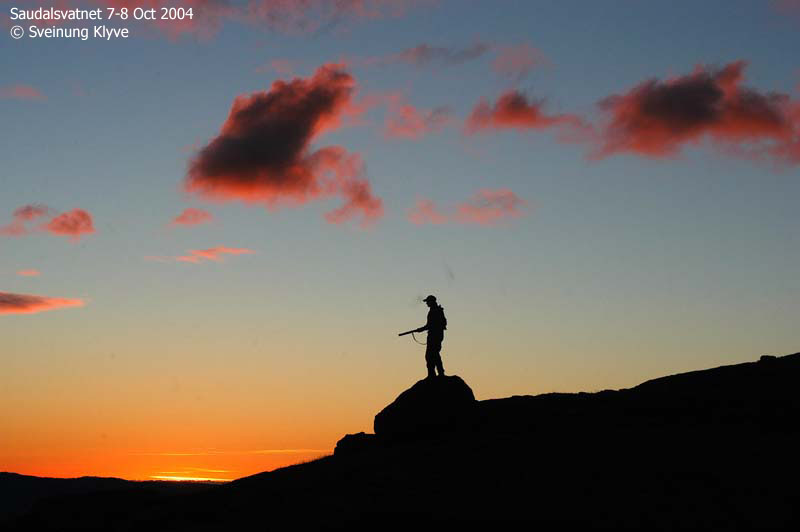
Trip report Mar 28 2005Uplifted from having visited the northern Folgefonna glacier, I kept thinking about what to do the next day, as I waited for the ferry to take me across Hardangerfjorden. The next day was the last day of Easter, and the weather forecast promised brilliant weather. I had been wanting to do Saudalsnovi for quite some time, and in the evening I called Sverre Langhelle and asked him if he wanted to come along. Since there was another top next to Saudalsnovi (Sørdalsberget), I told Sverre that I wanted to visit this top as well. Sverre lives in Straume, and after meeting him on one of my many visits to the Straume region, we've kept in touch. Sverre is (per March 2005) 66 years old, but is extremely fit. He told me he would have no problems skiing these mountains, and I never ever suspected he would have. I stopped by his house this Monday morning, and we drove in separate cars up to Flatkvål in Eksingadalen. It took me about an hour to get to Straume, and close to another hour to get to Flatkvål. I've been doing a lot of driving during Easter, and I felt sort of glad that Easter was coming to an end. This mountain region is Sverre's "backyard", and he has been up here many times. It felt good to just "tag along" for a change. I had some thoughts about how hard it would be to carry the dog (a small dachshund) all the way to Saudalsnovi and Sørdalsberget. But I was extremely pleased to see that "Troll" had plans to do serious walking this morning. It was all because of Sverre. Without Sverre around, he would have just been sitting there, wondering why he was on the ground. Whether the dog felt that Sverre needed close surveillance, or if he thought that chocolate would pour out of Sverre's pockets, I don't know. But he stuck to Sverre for the rest of the day. The snow was hard enough to carry him, and I did no longer have to worry about anything in this world. We had left the trailhead 10:20AM and reached Nesstølen 11:25AM. The valley was easy to follow. No ups and downs, just steady progress upwards. A big chunk of snow had left the slabs below Saudalsnovi, but based on the situation, we did not feel there was any danger in heading up this valley. There was a number of smaller avalanches from the mountains up to our left, but they did not amount to anything much. We agreed to take a shortcut up to Saudalsnovi, passing very near the largest avalanche. But we were now on a ridge, with rocks popping up here and there, and not in slab area. We reached the top of Saudalsnovi 12:50PM and took in the great views that these mountains have to offer. Troll had walked all the way to the summit, which was quite an outstanding effort by this small dog. The sun had now melted the hard surface, and Troll sunk in every step. But he never complained, just kept going. We had a long break on top, including lunch and started the descent towards Sørdalsskardet 13:35PM. The short pitch down was very enjoyable skiing. The destination was now Sørdalsberget. Earlier, we had discussed the possibility of skiing directly from Sørdalen up to this top, via the Brattefonni ridge. We found this ridge too steep for skiing, and headed up to Saudalsnovi instead. Sørdalsskardet pass offered a way to get onto the ridge to the top, but we agreed an approach from the south. After a short ski-trip up Sørdalsberget's southwest ridge, we reached the summit 14:30PM. The sun was burning hot and no wind. Good skiing, beautiful landscape and good company. What a day! We stayed a good while on Sørdalsberget before we decided to head home. I had Troll in the backpack while descending Saudalsnovi, but he walked most of the part up to Sørdalsberget on foot. He had now earned a long rest, and with this wonderful valley ahead of us, fun skiing was next on the agenda. We were back down by the cars 16:20PM. A 6 hour ski-trip (including breaks) had come to an end. Sverre had invited me to dinner, which was lovely. It was late in the evening before I got back to Bergen, extremely happy about this trip and the Easter holiday in general.
|
Move cursor to read notes, and click on the images to see full version.
Some of the thumbnails may have been cropped to fit the format.
Saudalsnovi


Sørdalsberget


No Javascript:
1 2 3 4 5 6 7 8 9 10 11 12 13 14 15 16 17 18 19 20 21 22 23 24 25 26 27 28 29 30 31 32 33


No Javascript:
|
This story (written in Norwegian) was submitted by Sveinung Klyve, aiming to
promote fishing in Lake Saudalsvatnet, which is among the best lakes for fishing
in Vaksdal kommune. Many thanks to Sveinung for this article
and the great photos.
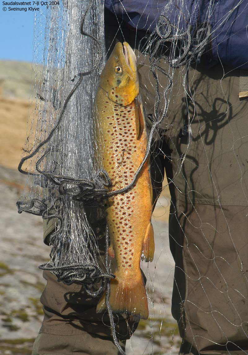
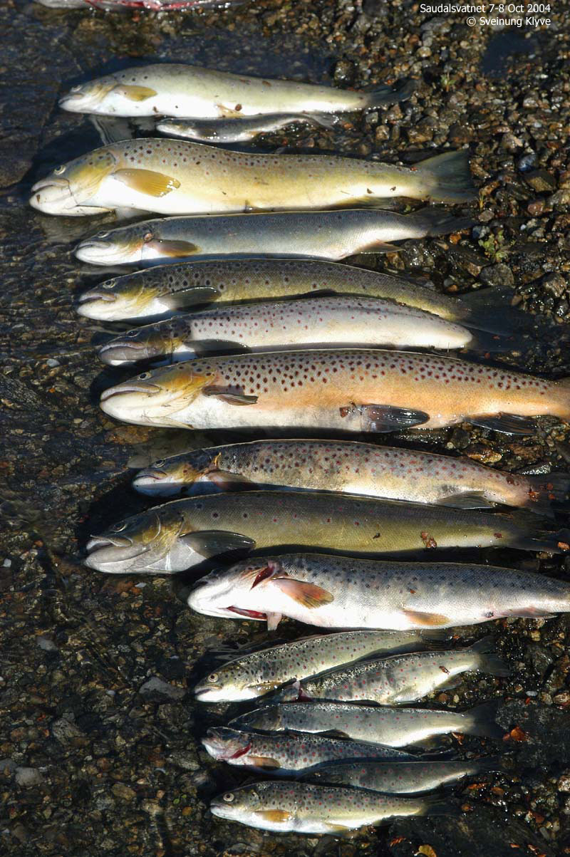
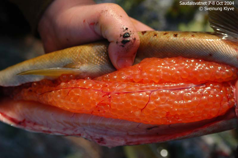
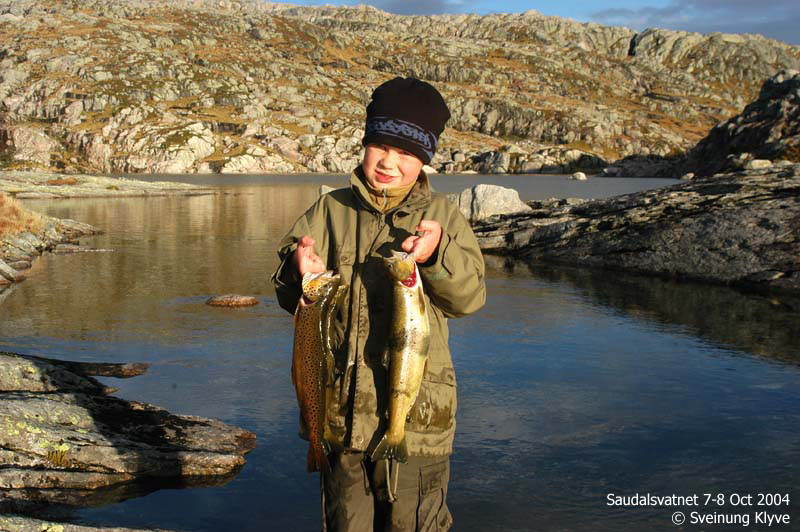
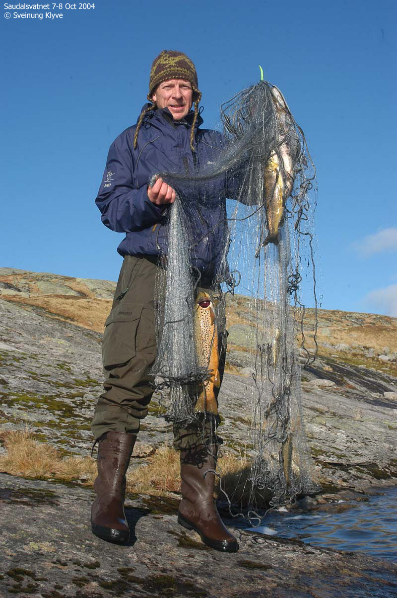
Bilda viser prøvefiske i Saudalsvatnet 7-8. oktober 2004. Fisket vart utført av Vaksdal kommune for miljøvernavdelinga i Hordaland av Sveinung Klyve, Tore Wiers og Per Kulshamar. Vatnet er sidan 1996 kalka med helikopter. 20.10 1997 var det sett ut ca 370 fisk i vatnet i regi av Vaksdal kommune. Fisken var kjøpt hjå Dale klekkeri på Dale og BKK sponsa flyginga, fordi dei flaug i fjella ved Eidsland like ved. Saudalsvatnet var då fisketomt grunna forsuring. Fram til 1970-åra var det fisk i vatnet og det er fortalt frå lokalt hald at det i 1950-åra vart teke fisk i vatnet på 3 kilo fortel Arnold Norheim på Eidsland. Prøvefisket no viser svært flott fiskekvalitet i vatnet. Fisken som vart sett har ein svært god kondisjon og er feit og fin og knallraud i kjøtet, som ein laks. Fisket med 6 garn gav 15 fisk i storleik 400-900 gram. I tillegg vart det teke småfisk som viser at fisken også gyter og yngelen klarer seg i vatnet. For tida er dette det beste fiskevatnet i Vaksdal kommune.
Slik finn du fram: Bildetekst: Saudalsvatnet ligg på 900 m i fjella mellom Eksingedalen og Stamnes. Du ser folk med gummibåt som tek prøvar i elva. Sondre Simmenes Wiers, 8 år, er med pappa Tore Wiers på fisket. Her held han 3 fine aurar på 5-900 gram. Yngel. Fiske med el-fiskeapparat i elvane viser at fisken gyt og at yngelen klarer seg. Dei minste fiskane er fødd i år og er ca 4 cm. Dei største er 14 cm og ca 3 år. Full av rogn: Den store fisken går no mot bekkane for å gyta. Her er ein fisk full av flott rogn. Kvart rognkorn kan gje ein ny fisk. Rød fisk: Fisken i Saudalsvatnet er rød i kjøtet og feit og fin med lite hovud og si i buken som ein laks.
Pictures:
No Javascript:
|
Other hordaland mountains
 Other Vaksdal K. mountains
Other Voss K. mountains
westcoastpeaks.com
Other Vaksdal K. mountains
Other Voss K. mountains
westcoastpeaks.com


