
Norwegian Mountains, Møre og Romsdal
Trollkyrkja & Sandnestindan, June 15 2008
To the main Sandnestindan page (maps, route descriptions, etc.)

The roundtrip
(Click for larger image)
was to visit Stordalstinden and Blåfjellet. Best case would be that I could hike across Trolltindan too, but as I had no information about this rugged ridge, I couldn't be sure. The natural entry point for this roundtrip seemed to be Trolldalen. I was aware of some caves in this area, but they were not on my agenda.
The weather was nice when Troll and I left Ålesund early this morning. Light rain was expected in the afternoon. Svein had invited me to a ski-trip to Ringstinden near Trollstigen, but I chose to be with my little buddy on this Sunday. I really wanted to go on that ski-trip, but a strange inner voice said I should spend time with Troll. I'm glad I listened to that voice, because 7 days later, Troll wasn't around anymore.
Two nice Dutchie tourists ..
gave special attention to Troll at the Trollkyrkja trailhead. They left a few minutes before we did, and when Troll and I were ready to leave (10:50AM), Troll kept an incredible pace. To catch up for more petting, obviously. I had to walk as fast as I could just to keep up with him. I got myself a good laugh. Appearances can be deceiving. There was still juice in the old legs...
We caught up with the Dutchies at the end of the forest road. I told them about Troll's efforts, and he got himself a solid dose of attention. The forest trail ahead was rocky and I decided to let him rest in the backpack. It was a hot day, and his tongue was longer than normal. Fortunately, the trail ran close to the river, and we had access to water all the way up to Trollkyrkja.
OK, I admit ..
I got a bit curious when I reached Trollkyrkja and saw the cave opening. A couple of Austrian tourists were reading the information pamphlet. I asked if they were about to head inside. They confirmed. I asked if I could tag along, as I didn't have a flashlight. They were happy to guide me.
Moving around in the first grotto was fairly easy. My new hiking mates were considerate and kept turning around so that I could have light. I contributed through the flash on my camera. The grotto was just a grotto, and I didn't find it all that exciting. But then we arrived the waterfall, 70m into the mountain. Wow. That was just amazing. A big rock obscured an otherwise perfect view, and the pool was too deep to enter. But I was happy just having seen it.

The first waterfall
(Click for larger image)
I figured we would have to return the same way we came, but then we discovered a narrow passage. The Austrian guy was leading on and yelled back down that he was out in the open. We followed after. I had to push the backpack (with Troll in it) ahead of me, and Troll was gazing at me with a puzzled expression on his face. I said to him, "I wonder if any dog has been in this tunnel before".
Out in the open ..
we noticed the ladder leading down to the second grotto. This ladder had "bars" (in lack of a better word..) around, which made it really awkward to descend with the backpack on. My face was glued into the ladder steps, trying to squeeze in. The only dogs having been in this grotto had to be Paris Hilton-type dogs. No German Shepards or Rottweilers, surely!
This grotto was just amazing and the waterfall was simply spectacular. Daylight came in from a hole above, and no flashlight was needed. What a start to the hike! And I hadn't even been on a mountain top yet. Once out, we spent some time searching for the third grotto, until I decided to say goodbye to the nice Austrian couple.
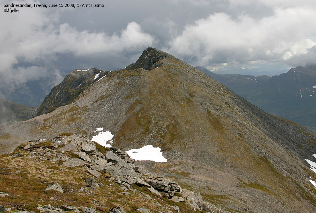
Blåfjellet (864m)
The walk to Blåfjellet was straightforward; I had to cross a ridge before I got it in view, and from then on, it was just an easy walk. I met a group of hikers coming down the mountain. They asked me why I was going "the wrong way". They were traversing Sandnestindan the classic way; from east to west. But they also had cars in both ends. I did not.
I reached the top of Blåfjellet 13:06PM. Fog was hammering on the mountain massif, but while Kvannfjellet was completely hidden in fog, the rest of my route was in the clear. I spent 10 minutes on the summit before moving on. Troll enjoyed his lunch, while I watched him with a certain envy. I had to forgotten to bring the two apples that I had in my car. I feared afternoon headache, but it would be worth it. At least, so it seemed from the trip so far.
Stordalstinden (894m)
I moved on towards Stordalstinden and caught up with the other hikers at the summit. We chatted for a while, and Troll found company in another dog. The hikers were local people. Some of them had never been to Stordalstinden before, although they lived almost at the foot of the mountain. I enjoy listening to stories like that - Dreams coming through.

Company on Stordalstinden
(Click for larger image)
Trolltindan (891m)
I said goodbye to the group and moved on towards Trolltindan. I tried to follow the top of the ridge as much as I could, but the ridge was too exposed to be on, while carrying a dog. For the most part, I followed the trade route, with some honorable exceptions...
Fog was more and more taking over the mountain, and views were limited. From Trolltindan, I could not see Tverrfjellet - my next stop. On the way down from Trolltindan, I met a hiker and his dog. "A lot of dogs on this mountain" - I thought to myself.
Tverrfjellet (835m)
I reached the top of Tverrfjellet 14:53PM in thich fog. Nothing could be seen from there, so there was no point in hanging around. I was getting hungry, and concluded that I wanted to exercise a rapid descent from the mountain. I let Troll walk for a while, but without a well-defined path, he had no sense of direction. This was clearly not working, and I had to put him in the backpack again. I then headed for a steep snow tongue that I had noticed on my way upwards, and I was down on the Trollkyrkja plateau within minutes. I watched the other hikers starting the descent of Trolltindan, 200m above me.
Descent
I walked back to the Trollkyrkja grottos and picked up the trail from there. I kept a good pace down along the river, and back down in the forest, Troll was able to do some walking on his own. He got himself some good exercise by the time we reached the trailhead, 16:11PM.
The trip took 5h:20m and had been memorable from start to finish. I strongly recommend this trip. I've grown more and more fond of the Fræna nature, and I'm already looking forward to my next trip up there.


