
Norwegian Mountains, Møre og Romsdal
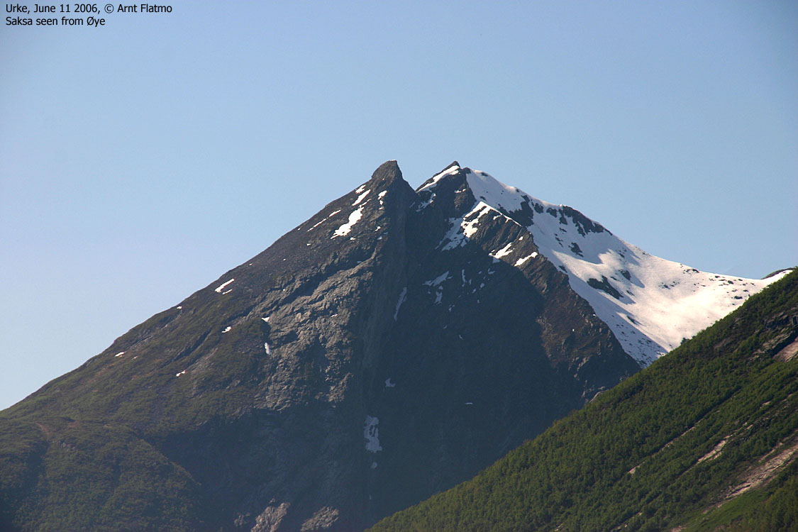
Saksa (1073m), June 11 2006
To the main Saksa & Leknesnakken page (maps, pictures, other trip reports)

Saksa
(Click for larger image)
Background
| My colleagues Torill and Einar had decided to join
Stranda Turlag for a this trip
to Saksa. It had been a while since the last hike with Torill, and this was also a
good opportunity to get familiar with the east side of Hjørundfjorden. I had never
been to Øye or Urke, and I had only watched Slogen from miles away. And besides,
I had never attended a Turlag trip (except for a ski-trip with Bergen Turlag Fjellsportgruppen).
Torill and I took the 07:20AM ferry from Magerholm and joined Einar at his cabin on Strandafjellet (quite a place, by the way). Along came Grete and her flatcoated retriever Emma. As I had also brought my dog Troll, the group now counted 6 heads and 16 feet. We met others participating the Turlag trip in Stranda and then we headed towards Urke. We stopped by Lygnstølvatnet in Norangsdalen valley and took a look at the results of the 1908 rock-slide (see article to the right). |
Lygnstølvatnet On May 26th 1908 a rock-slide came down from the mountain Keipen on the south side in the valley. The slide was so large that it made a rock-wall across the valley and thereby created a dam which later became this lake. Before the rock-slide, there was a "seter" or a mountain dairy farm where the lake is. The "seter" had nine "Sel" or small rock huts where the milkmaids stayed overnight. The old road through Norangsdalen, a rock fence with a gate and the remains from hut-foundation can still be seen on the bottom of the lake. By the road further to the west, you may see nature's own monument over the rock-slide; the rock Gangerolvsteinen. Source: Information poster by Lyngstølvatnet.
|
Confusing instructions sent us to the wrong trailhead, and we arrived the correct trailhead just to see the group leaving from Urke 10:25AM. We soon caught up with the rest of the group and took the lead. I was carrying Troll due to the amount of people (the group counted 31, not including dogs). If he set his mind to keeping the group together, it would have been a complete chaos on the narrow path. Besides, he could surely benefit from the backpack today. We "warmed up" the day before with a 6-hour traverse across three 1000m mountains in the Ørsta region the day before. My feet were sore and I guess his were as well.

Heading out from Urke
(Click for larger image)
To the south top
On the way up the forest, we received several complaints from the Turlag leader about walking too fast. I was carrying an 8Kg dog, and walking as slow as I possibly could. The complaints annoyed me. The problem was NOT that we moved too fast, but because people pause on the narrow path to drink water, remove clothes, take pictures, etc. This is an undisputed fact in a group of this size and is best solved by stopping at regular intervals and drop the kindergarden mentality. A gap emerged in the long line of hikers. Probably because of the heat and the steep forest, the complaints faded and from there on, the hike was nothing but enjoyable.
We took a rest at a fine viewpoint with running water at 630m elevation. Those in the front group were all likeable folks and there was a good atmosphere. The others must have paused further down because they didn't show up until we started to head up the final section of the mountain. This mountainside was a real "killer". It was a tremendously hot day and the mountainside was steep. The boulder didn't make it any easier. We approached the summit from the southeast, but should have ascended from the southwest. The final yards weren't difficult, but we found ourselves in steep and awkward terrain. A fall would have been painful.

The route to Saksa
(Click for larger image)
Our group reached the south top 13:10PM. The others followed in smaller groups during the next half hour. The view was truly awesome, but as the The Turlag trip ended on the south top, the hike wasn't "complete". We were of course free to visit the main top at our own risk. I went down and took a look at the route ahead. It didn't look difficult, but the narrow snowy ridge in the col didn't look very tempting. I didn't want to be the only one heading across, so I went back up and joined the others.

South top panorama
(Click for larger image)
To the north top
A few minutes later, one of the guys decided to head across. We didn't notice him until he was on the way up the center top, moving light and swiftly. When I saw him reach the main top, I decided to follow. On the way down to the col, I turned around and noticed 3 others following. Altogether, approx. 10 out of 31 decided to go for the north top.
The route was technically easy, but exposed. I was very focused when crossing the snowy col. A fall here would have ended in disaster in either direction. The rest of the route up to the north top was trivial, and I felt that the day was just perfect when I reached the top 13:45PM. On my way down, I met Torill and Einar who had decided that it was unbearable to stay behind. I was quite impressed with Torill, as I suspected that this terrain would be on the border of her "comfort zone". But they both moved swiftly down the airy ridge and across the col. While we were "hopping" between the tops, Grete was looking after Emma and Troll, both fairly exhausted from the heat.

The ridge seen from the summit
(Click for larger image)
Going home
We headed down a bit before the others and followed a better route down from the south top. After a break of water at the place we stopped on the way upwards, we continued downwards and reached Urke 16:10PM. We stopped by Hotel Union hoping we could get something to eat. We arrived between lunch and dinner, but they quickly(!) managed to serve us tasteful sandwiches. Complements to the hotel for their extra service on a busy Sunday. I was back in Ålesund 12,5 hours after leaving. A great day in the mountains.

Torill and Einar
(Click for larger image)
Pictures


