Norwegian Mountains, Sogn og Fjordane
Ryssdalshornet, 1201m
| County/ Municipality: | Sogn og Fjordane county/Gloppen | ||||
| Maps: | 1318-III Breim (Statens Kartverk, Norge 1:50 000) | ||||
| Primary factor: | 686m | ||||
| Hiked: | Aug 2011 | ||||
| See also: |
| ||||
| See also : | Other Sogn og Fjordane mountains on westcoastpeaks.com |

Ryssdalshornet

(Click for larger image)
Introduction
Ryssdalshornet is a dominating mountain located west of Breimsvatnet and southeast of Sandane. This is a very popular peak and the views from the top is part of the reason why.
There are a few routes leading up Ryssdalshornet, but the far most popular route runs from Ryssdal and this is the route described on this page. A forest road runs up to Ryssdalsstøylen cabins. From here, the mountain path is steep up to the north ridge. That is - steep as in strenuous, not dangerous. In one place you can choose to use the aid (or discomfort) of a fixed rope, but the common wanderer will get by without. However, on an icy slope - it might just prove to be useful...
Ryssdalshornet

(Click for larger image)
Primary factor:
Ryssdalshornet (Norge 1:50,000: 1201m, Økonomisk Kartverk: -, UTM 32 V 358237 6846638) has a primary factor of 686m towards the parent Storevarden (1425m). The defining saddle (approx. 32 V 358593 6844360) is found south of of Lake Dalevatnet. Ref. the 1:50,000 map (20m contours), the saddle is within the range 500-520m, interpolated to 515m to align with Petter Bjørstad's list.
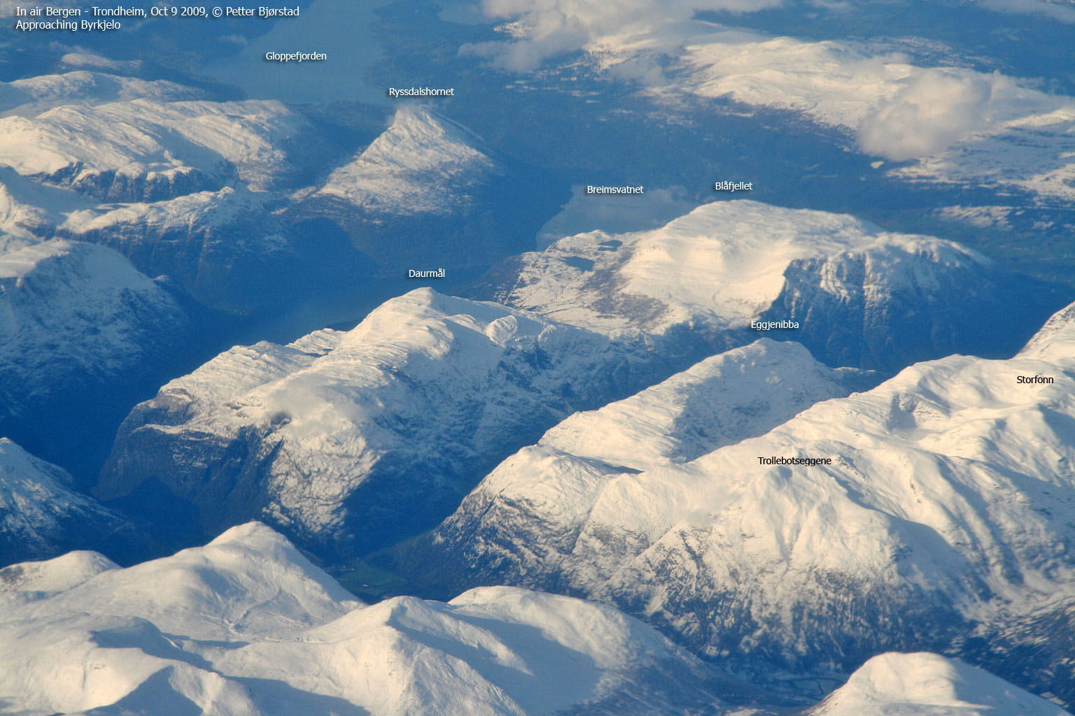
Ryssdalshornet seen from the air

(Click for larger image)
Google map
Google's interactive map. You can zoom, pan and click on the markers.
|
|
Route descriptions
| This disclaimer is regarding all of the literature and instructional guides posted on the westcoastpeaks.com website. These instructions are guidelines only, and should not be used in lieu of common sense or judgment when attempting any of the actions involved or instructed. Westcoastpeaks nor myself will not be liable nor will it indemnify any form of compensation to anyone who has injured, harmed or even killed themselves or others while following any of the instructions written within the website. It should be noted by any persons willing to undertake any of the instructions provided that mountains offer varying levels of risk, regardless of size or incline. Risks to be considered are as follows but not limited to: wild animals, weather, the terrain, bad judgment, inappropriate or insufficient equipment, improper training or experience and of course, bad luck... |
|
Route 1: Ryssdal - Ryssdalshornet
|
|
This route description is valid per Oct 2011
Access
(all distances are approx. distances)
This route description takes the place Sandane as the starting point. From the main junction east of Sandane;
- Follow E39 3,3km in the direction of Byrkjelo. Turn right towards "Kandal" (signposted).
- Drive 0,4km to a Y-fork. Turn right. Signposted "Ryssdal"
- Drive 280m (crossing a bridge) and turn left onto a gravel road.
- Drive 0,65km up to the Ryssdal parking.
The route:
The route

(Click for larger image)
Follow the forest road in the direction of Ryssdalsstøylen, then;
- Pass a gate
- Turn right at the "Ryssdalsstøylen/Gamlestigen" fork
- Turn left at the next fork
- Arrive at Ryssdalsstøylen, approx. 2km from the trailhead
- Follow the marked path towards "Ryssdalshornet" (signposted) up to the north ridge. There are a couple of steep (but not dangerous) sections.
- Follow the north ridge path to Ryssdalshornet summit, marked by a trigonometric point.
- Also visit the north top during your ascent or descent. This is where the visitor's register is, if it is there.
Pictures and Trip reports:
- Ryssdalshornet seen from other mountains
- Ryssdalshornet, May 8 2011 (w/Anne, Lise & Ove)
 westcoastpeaks.com
 Other Sogn og Fjordane mountains
 Other Norwegian mountains


