
Norwegian Mountains, Møre og RomsdalNørdbergsheida, 509m (Klovane)
|
| Fylke/Kommune : | Møre og Romsdal/Sande | ||||||||
| Maps : |
1119-III Vanylven (Statens Kartverk, Norge 1:50 000)
1119-IV Fosnavåg (Statens Kartverk, Norge 1:50 000) |
||||||||
| Primary factor : | 75m | ||||||||
| Hiked : | Mar 2007, Apr 2009 | ||||||||
| See also : |
| ||||||||
| See also : | Other Sande mountains |

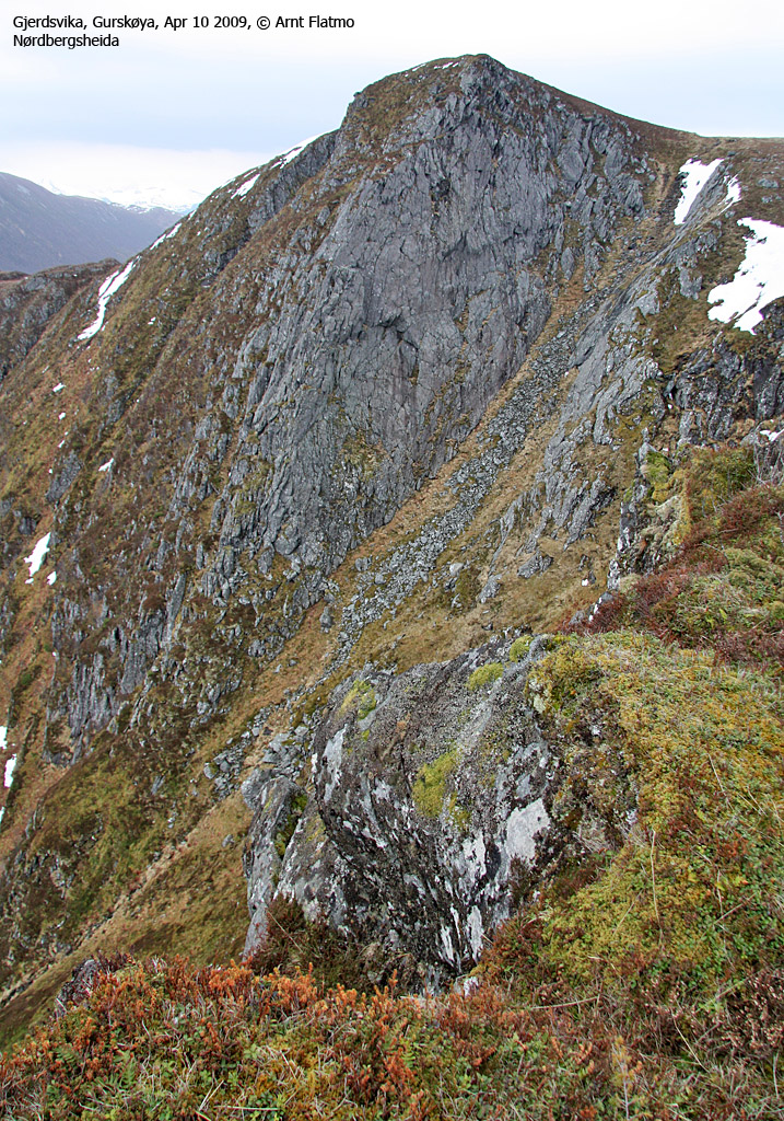
Nørdbergsheida by Storevatnet
(Click for larger image)
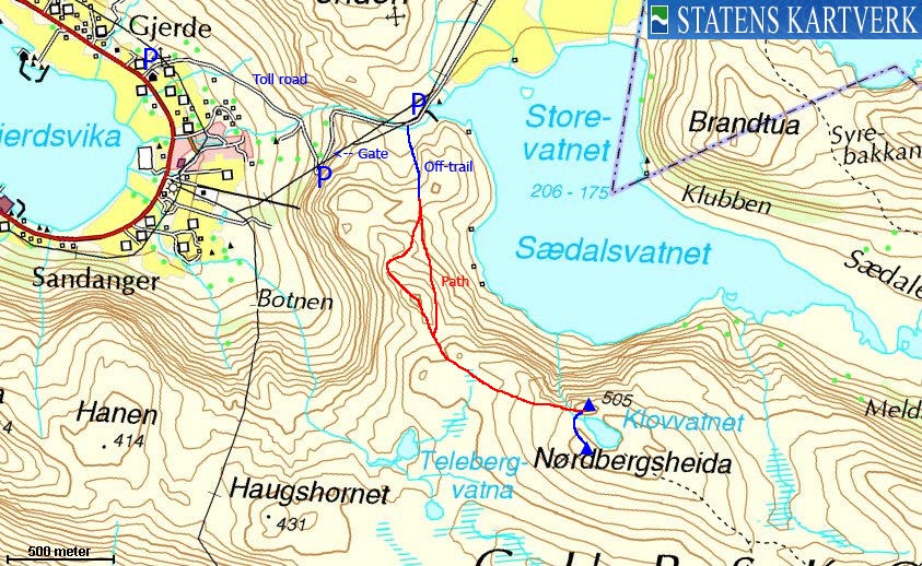
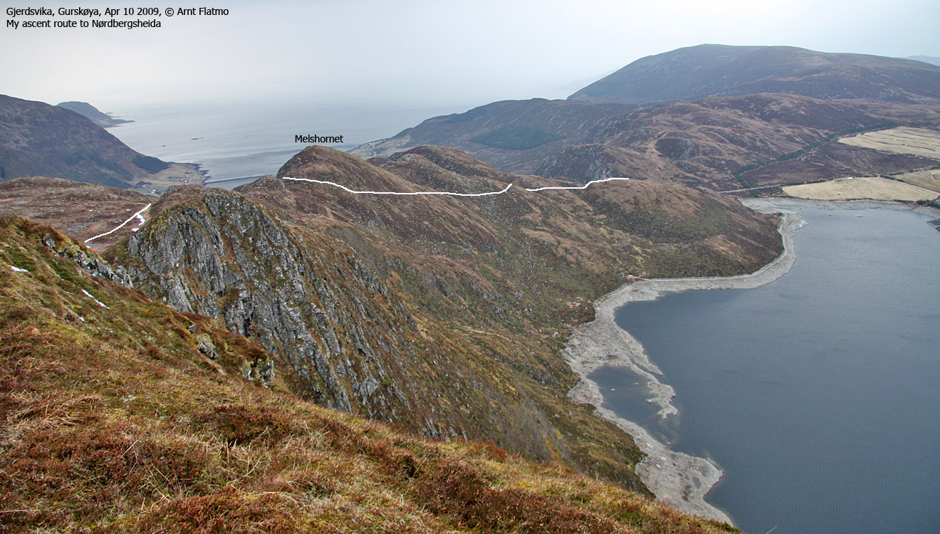
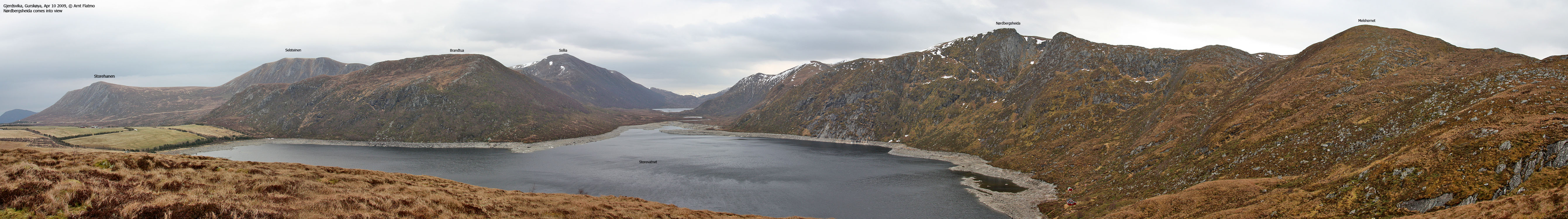
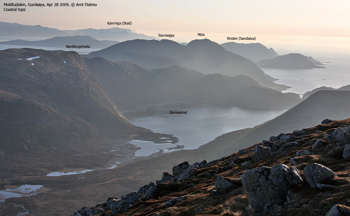
Nørdbergsheida (also called Klovane) is located centrally on the mountain ridge stretching from Leikongeidet and to the west. Storetua (592m) is the highest top on this ridge. Nørdbergsheida falls steep towards Storevatnet in the north, and not quite so steep towards Haugsbygda and the Gursken fjord. There are several routes to Nørdbergsheida, and this page will describe a route from Gjerdsvika (partly off-trail in the beginning), and across a minor top (approx. 406m) called Melshornet on older maps.
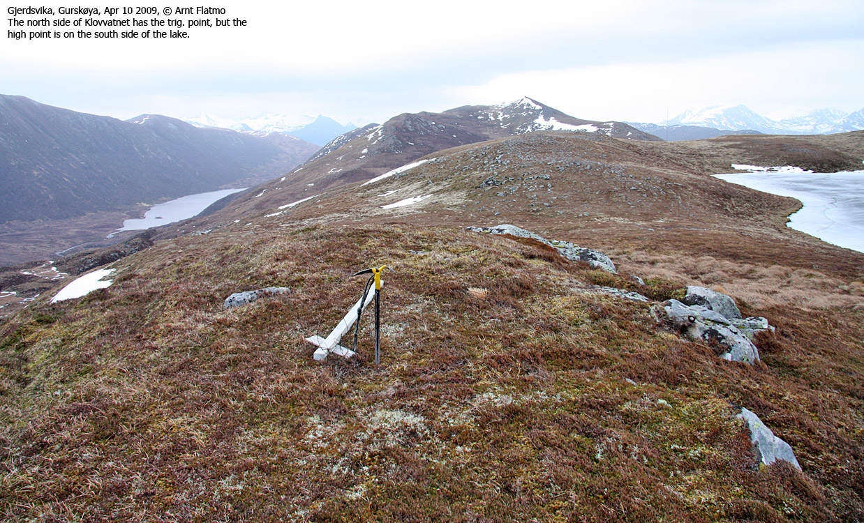
The trigonometric point (504,70m) on Nørdbergsheida is found on the north side of Lake Klovvatnet, but the high point (508,5) is found on the south side. The north top is perhaps the most interesting one, given the steep drop towards Storevatnet, but if you choose to visit this top, you should definitely take a walk around the lake.
Alternative routes could be from Haugsbygda via Haugshornet, or from Holte via Sæshorn or Storetua.
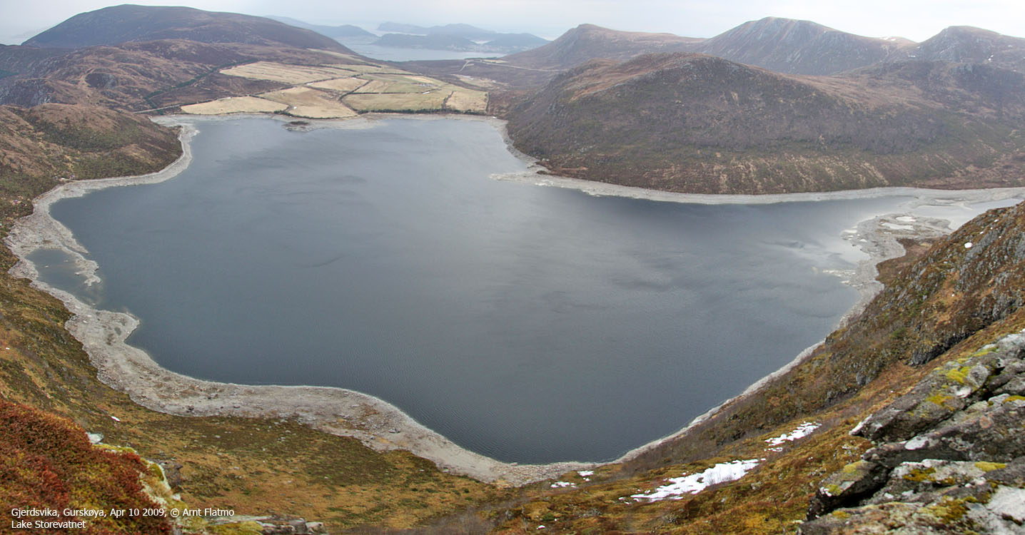
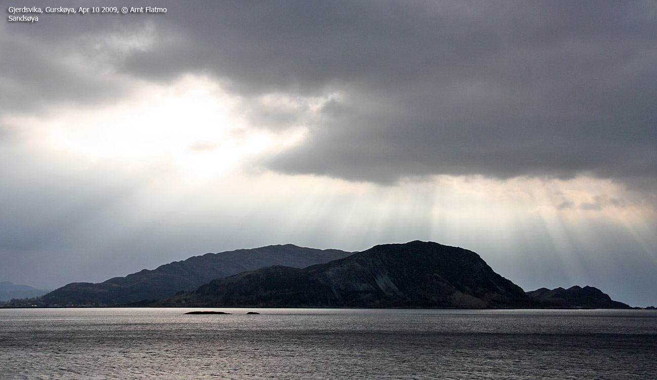
Lake Storevatnet
(Click for larger image)
Nørdbergsheida (Norge 1:50,000: -, Økonomisk Kartverk: 508.,5 ~ 509m, UTM 32 V 324608 6906092) has a primary factor of 75m, towards the higher parent mountain Storetua (592m). The saddle (approx. UTM 32 V 325417 6905664) is found at Kalvegjersmyra between these two tops. Ref. Økonomisk Kartverk (5m contours), the saddle height is defined through a fixed point - 434,4 ~ 434m (435m contours meet in the saddle)
Google's interactive map. You can zoom, pan and click on the markers.
|
|
|
|
Route 1: Gjerdsvika - Nørdbergsheida
|
|
Access
(all distances are approx. distances)
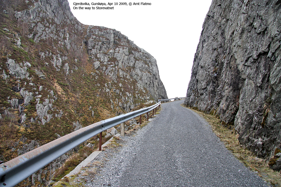
The nearest larger city is Ålesund. From Ålesund, follow highway E39 towards Bergen, and then RV61 towards Hareid. Take the Sulesund - Hareid ferry and follow RV61 (roughly) 3Km towards Ulsteinvik. At the roundabout outside Ulsteinvik, turn left and follow RV61 to the south and turn right when you see the "Fosnavåg/Måløy" signpost. Follow RV654 towards Fosnavåg. At the Fosnavåg/Moldtustranda junction (before the Herøy bridges), turn left towards Moldtustranda. Drive 15,6Km to Gjerdsvika and turn left by the chapel/prayer house.
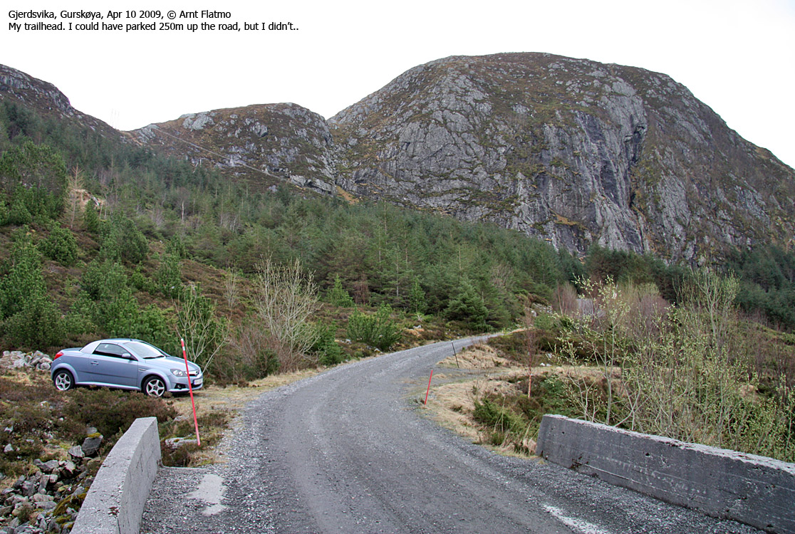
Drive 1,1km up the gravel road and find parking in a sharp curve (or by the bridge after 850m). The toll road (opens some time during spring) to Storevatnet begins just after the sharp curve. Driving up to Storevatnet saves you approx. 500m on foot.

Route from Gjerdsvika
(Click for larger image)
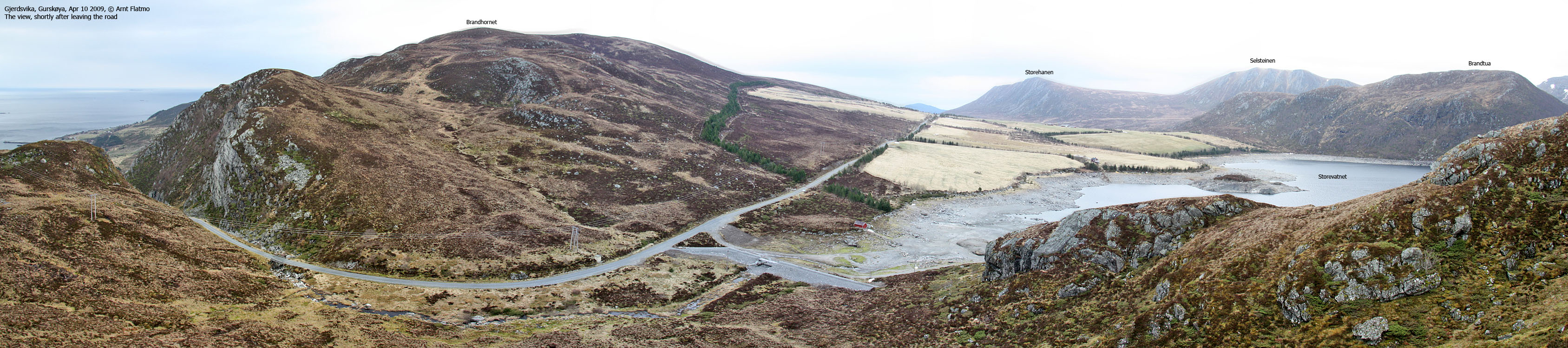
The route
Leave the road 100m before you get to Storevatnet. Head south towards - and up the ridge in front of you. There is no clear path across the meadow, but once on the ridge, you should be able to locate a vague path that descends slightly before it climbs south towards Melshornet. In fact, the path forks. One path runs along the ridge north of Melshornet and the other traverses the mountainside west of Melshornet.
From a small meadow between Melshornet and Nørdbergsheida, don't look for further paths. They are vague, and you don't really need them. Head southeast towards Nørdbergsheida and Lake Klovvatnet. The trigonometric point is found on the north side of the lake, but the high point is on the south side.


No Javascript:
0 1 2 3 4 5 6 7 8 9 10 11 12 13 14 15 16 17 18 19 20 21 22


No Javascript:
|
|


