
|

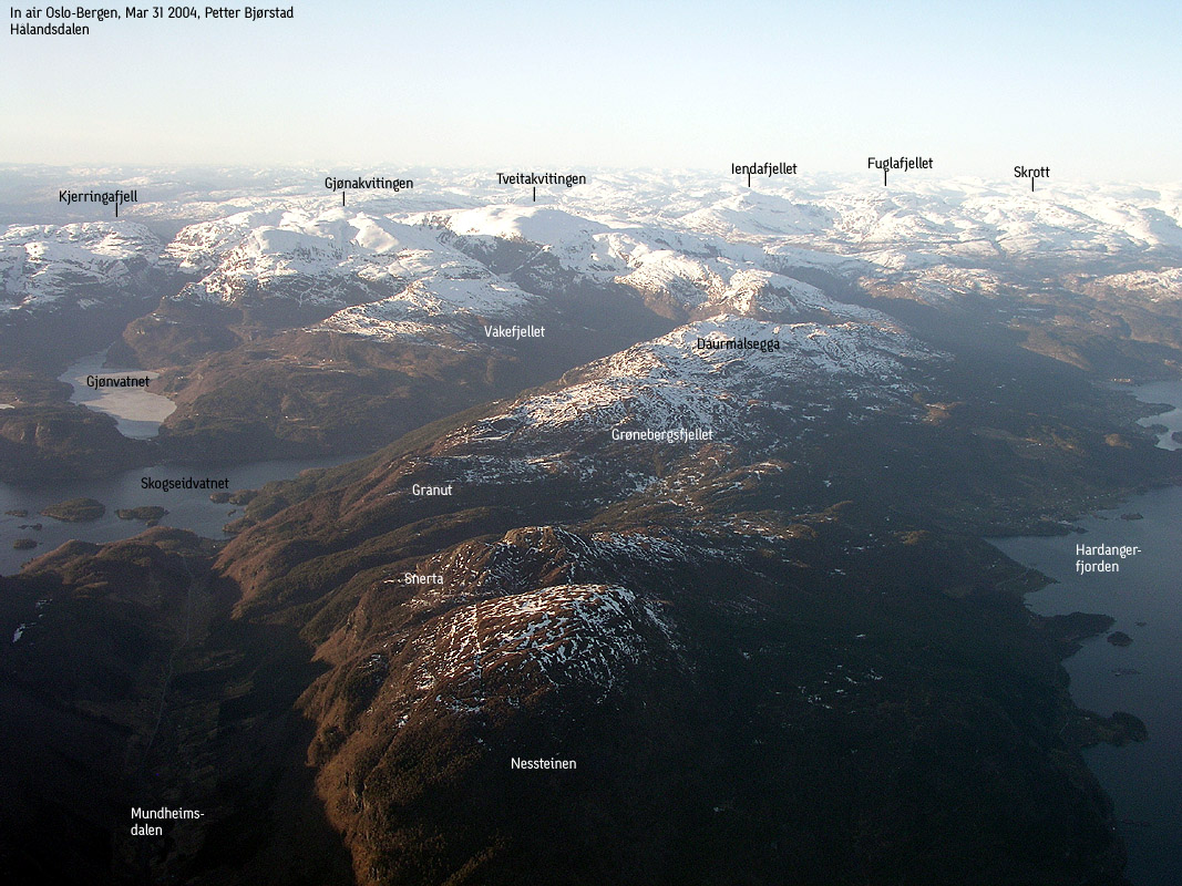
Nessteinen seen from Snerta(No Javascript) |
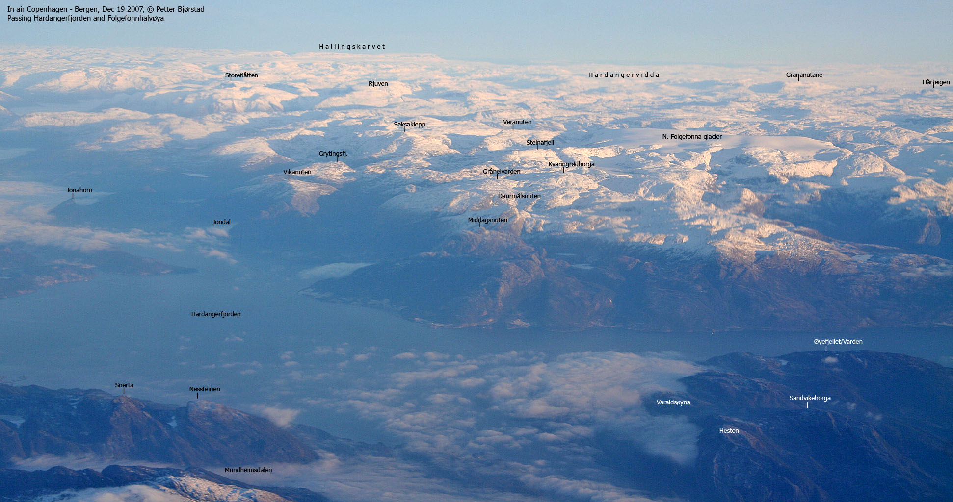
Nessteinen (or "Steinen - the rock - as the locals say) marks the end of a long mountain ridge that stretches from Kvamskogen to Mundheim. On this ridge you find Tveitakvitingen, Gjønakvitingen, Daurmålsegga and Snerta. You have tremendous views towards Hardangerfjorden and the mountains on the other side of the fjord. The views range from Granvin in the north to Stord in the southwest.
Nessteinen is in general not very accessible, but a few routes provide easy access. The route from Mundheim being the far easiest. The route description provided on this page starts at Mundheim, traverses Nessteinen, descends the northeast ridge and follows a forest road down to highway 49.
Nessteinen (M711: 659m, Ø.K: 663m) has a primary factor of 175m towards the higher Snerta (682m). The saddle is found in the pass between Nessteinen and Snerta. Ref. Økonomisk Kartverk (5m contours), you cross the 490m contours on the high route, but not 485m. The saddle height is interpolated to 488m.
Note that there is no deviation between M711 and Ø.K. M711 shows only the 659m trig. point, and not point 663m, which is the highest point.
Note: Class ratings are in reference to YDS (Yosemite Decimal System).
Note: The trail described below is not necessarily the easiest trail to this mountain.
|
Mundheim - Nessteinen traverse (summer)
|
|
Access
From Bergen, follow highway E16 towards Oslo. From the E16/highway 7 junction at Trengereid, follow highway 7 (turn right in the roundabout). Follow highway 7 until you reach the highway 48 exit just after Bjørkheim and two tunnels. Follow highway 48 for 41,2Km and you will see a small bridge to your left. Mundheim is just down the road. The 50Km/h zone begins here A community building lies 50m down the road, and this may be a good place to park the car.
The route
Cross the bridge and follow a grassy forest road that switchbacks upwards (another forest road runs to the right - do not follow this one) Follow the forest road up to a gate. A quite visible forest path continues on the other side. The path runs in the direction of the Nessteinen southwest ridge, rounds the ridge and after crossing a stream, the path runs northeast from 300m to 500m elevation.
Somewhere between crossing the stream and running out of path, there should be a path (marked with plastic ribbons) that takes you back on the southwest ridge. I never found this trail. I did see a number of paths which I assumed were sheep tracks. If you stick with your path, you will be out of the forest by the time you run out of a path. Adjust your course nortbound and head upwards. You will arrive the summit plateau near the 659m trig. point - marked by a pole and a standing rock.
Continue northwest across the plateau, following the bumps. One of these are the 663m high point, but is not marked. You will see a small cairn below the high point, but I don't know what this cairn is meant to indicate. Perhaps a route down the mountain (I know a trail runs down the south side). Continue descending northeast on the sharp northeast ridge. The hillside is steep, but some scattered birch may provide mental comfort. It is not likely you will fall off the ridge in case you slide. A vague path (probably sheep tracks) switchbacks down the ridge. The ridge path ends in a narrow spot where you must be careful. You are now on top of a long scree area that will take you away from the ridge and down to the forest. The scree is *very* loose and you should pay attention here. A fall will most likely result in a short, but unpleasant slide down the scree.
On your way down the ridge, you will see the forest road further down to your right. You will be heading down the forest off trail. I suggest you descend eastbound down to 300m elevation and then go southbound until you reach the forest road. When you arrive the forest road, turn left and head downwards. When you reach a road junction (wood may be piled up here), you may either go left (the route indicated on the map) or right. If you go right, stay left in any junctions and you will end up on highway 49 at the Nes junction - 650m closer to Mundheim than if you follow the map route. Depending on your choice, you will have a 2-2,6Km walk back to the trailhead.
|
Trip Report Apr 24 2004This Saturday was cloudy, the light was flat and it was raining some. My plans for a trip to Jonstein (Jondal) was cancelled immediately. I wanted sunshine for the Jonstein pictures. Instead I decided to drive to Mundheim and "finish off" Nessteinen, which I had been thinking about for some time. The decision didn't come easy. After 2600Km of driving in the Easter, while being sick, I wasn't exactly keen on driving. I was finally able to kick my butt and get out of Bergen. It was raining nearly all the way to Mundheim, but when I got to the trailhead, it didn't rain any longer. I spoke to a local who gave me the most complex route description ever. When I asked about the northeast ridge, he told me to absolutely stay away from that ridge, as I was bound to get stuck - or "skårfeste" as they say in these parts. Before setting off on the hike, I looked at a big rock that had come down from the mountain above in March 2004. There were actually two rocks, each weighing 200-300 tons. One landed very next to a house, while the other totally smashed a garage. This one was later removed, as it was partly in the road. An elder lady had left the house a couple of months earlier, and a family member moved in some time after the rockfall. In an interview he gave later, he stated that he wasn't nervous about moving in, but - "it could be hard to get a girlfriend"... I left the car 12:45PM and headed up the obvious forest road. After a gate, the forest road turned into a forest path which I followed until it ended - well aware of that I had missed the trail that would get me on the high ridge. By the time I was out of a trail, I was also out of the forest, and it was just a matter of heading upwards. This plan led me straight to the 659m trig. point, which I arrived 13:45M, exactly 1 hour after leaving the car. I thought that was a bit quick, especially since I hadn't rushed anything. I continued towards the northeast ridge, determined to study it closely, although I anticipated I would have to walk back up again. This was clearly a class 2+ route, as I found myself almost sitting on my ass, moving very carefully downwards. It wasn't directly exposed - bushes would have stopped any slide - but it was airy enough to call for careful moves. I was soon down, quite satisified about having traversed the mountain. After a quick bush war down the forest, I was back on the forest road which I had walked on my hike to Snerta, a few months earlier. Almost down by the highway, I met a mother and her son, whom I walked together with back to the highway. They showed me a shortcut which took us to the Nes junction, instead of the Haugabruna junction - where I had planned to go. We had a pleasant chat down the forest. She told me she also had descended the northeast ridge - or "Steinsteg" ("rock steps") as they call it. They also told me that they had been to Galdhøpiggen last year. They were following a rope team from Juvasshytta, led by a guide that had been to Mt. Everest several times. According to juvasshytta.no, this is Ang Dorjee Sherpa, which had (as this was written) ascended Everest 6 times. Not a bad track record, indeed. I had a few kilometres on road before I was back at the car. 15:15PM, the hike was over, 2.5 hours after it begun. Back in Bergen, I wasn't quite "satisfied" and *had to* hike Ulriken (605m). After 1050m vertical meters, the outdoor activities for the day were officially over.
Pictures from the Apr 24 2004 hike:
Move cursor to read notes, and click on the images to see full version.
No Javascript: 1 2 3 4 5 6 7 8 9 10 11 12 13 14 15 16 17
Pictures from other hikes:
No Javascript:
|


