
Norwegian Mountains, Møre og Romsdal
Nerlandsøya round trip, July 3 2009
(Storevarden, Rjåhornet, Skagetåa)
To the main Storevarden & Skagetåa pages (maps, route descriptions, other trip reports, etc.)

The route
(Click for larger image)
It could no longer be postponed. Rjåhornet simply had to be visited. Now! I had been to almost all of the tops in the Herøy/Sande region, except for this one. My friend Vidar and I had - for quite some time - talked about a round trip on Nerlandsøya. He had already been to Storevarden and Rjåhornet, but not to Skagetåa. It was Friday afternoon when I called Vidar. I explained the urgency, and fortunately he understood the situation. It was an alarm (so to speak). Help! Fellow mountain man in trouble!
We drove to the Kvalsund trailhead (the mountain road) and headed out 7:55pm. The plan was to hike to Storevarden, then to Rjåhornet and Skagetåa before we would descend at Koparstad. Vidar had organized transport from Koparstad back to Kvalsund.
It was evident that Storevarden would be fogged in, but perhaps we could get some views from the other tops?

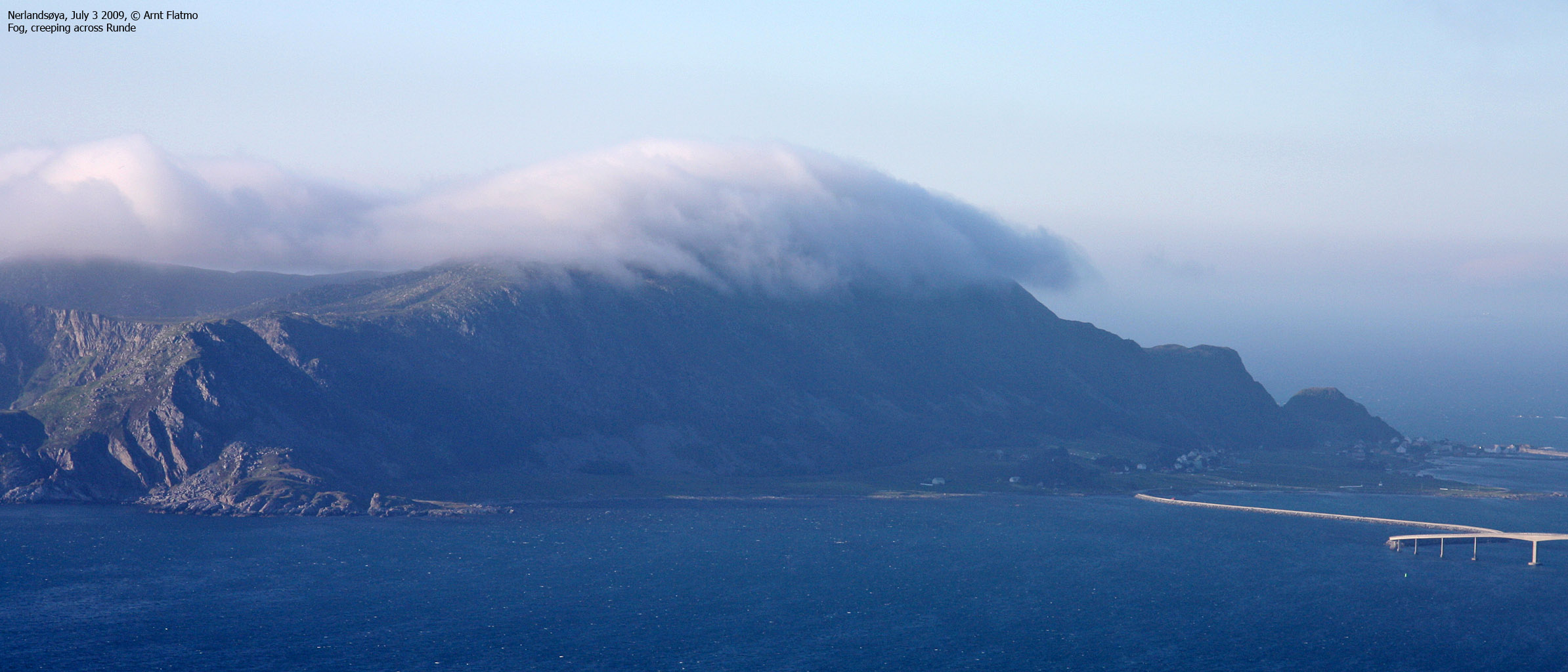
The sun is out, but ..
(Click for larger image)
After 50 minutes, we reached Storevarden (430m) - the highest point on the island. As expected, we didn't see much, so we continued towards Rjåhornet after a short stay. Halfway, we were below the fog, and even if Rjåhornet is almost equally high, it was in the clear. I liked this moving fog. Suddenly - features would pop up - only to disappear a few seconds later. It was just impossible to capture the real atmosphere, caused by this fog, onto a camera chip.

Looking back on Storevarden
(Click for larger image)
We arrived on Rjåhornet 9:15pm, and Rjåhornet was now in the bag. I could finally sleep again at night. We had a quick rest by the summit cairn, but soon had to move on in order to be home before midnight. I didn't expect there to be a path between Rjåhornet and Skagetåa, so I recommended an off-trail route. Vidar didn't seem to enjoy this direct route as much as I did, but he limited himself to a couple of understatements..
The route from Lemevatnet and up to Skagetåa had a number of small, but cool cliffs, and I went bananas. Every attempt of trying to get Vidar to scramble, failed. Seen through Vidar's eyes, I was most likely a hopeless case, far beyond rescue...

On Skagetåa
(Click for larger image)
We reached Skagetåa 22pm. Now Vidar had also got himself a new top. I was very eager to see more of Skagetåa's southwest ridge. A friend and I attempted this ridge last year, but it ended in a total failure. Vidar decided to follow my exploration from above. Even if I descended down to 250m elevation, I still didn't get a good view of the ridge from above. I headed up again and we set course for Koparstad.

Keipen on Skorpa island
(Click for larger image)
Vidar hadn't really explained the organized transport part in detail, other than that he would be picking up a family car. But to get there, we had to walk 1,5km along the Koparstad road. That was OK. Vidar grew up in this area, so it was a walk through his childhood neighbourhood. 23pm, the walk was over - 3 hours after we headed out from Kvalsund. It had been a very nice walk in a beautiful coastal landscape.


