
Norwegian Mountains, Møre og Romsdal
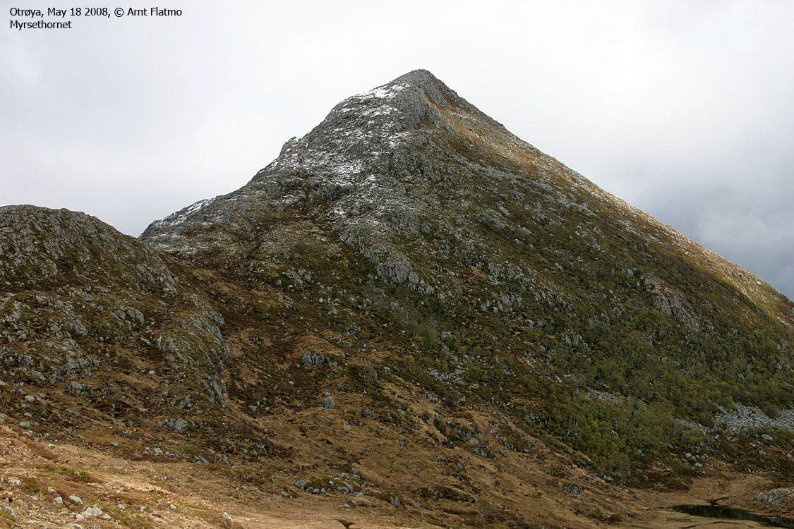
Myrsethornet & Manfjellet from Nord-Heggdal,
May 18 2008
To the main Myrsethornet/Manfjellet page.

The upper route
(Click for larger image)
On this Sunday in May 2008, I headed to Otrøya to visit the only two independent Midsund tops that I yet hadn't been to. I chose Nord-Heggdal as the starting point. My friend Petter and I had skied Oppstadhornet and Heggdalshornet from Nord-Heggdal one month earlier, but today's trip would be a hike. There was still some snow on the mountain, but not enough to warrant skis. Along for the trip came my little buddy Troll. Little did I know then that one month later, Troll would no longer be around.
The weather could have been better, but it seemed that I would only have to deal with fog high on the mountain. And some rain, hail and a strong winds too, but hey, I couldn't complain. I had chosen to come here. At this point in his life, Troll preferred to be in the backpack during ascents. Well, most of his life, actually. When I think of it...
I followed signs towards Myrsethornet until I reached the Myran meadows, and had the mountain right in front of me. I had lost sight of the path, but that didn't matter much at this point. On the other hand, crossing the meadow was no fun. Turf after turf. No rhythm..
On my way up to Tverrheia (I wanted to visit this point too), I entered the fog. It wasn't difficult to navigate, and I liked the atmosphere. The wind was quite fierce and Troll didn't want to leave the backpack when I reached the Tverrheia high point. So I continued towards Myrsethornet, and reached the high point 1:45pm, 1h:45m after leaving the trailhead. After a short break, I moved on, passed some cairns, and looked down what appeared to be a slightly steep ridge. Manfjellet summit could still not be seen, but I noticed that the weather was improving.

View down from Myrsethornet
(Click for larger image)
The ridge wasn't too bad. It was just a matter of not falling on slippery rock. Getting onto Manfjellet was also quite straightforward, and I passed the south top in thick fog. But as I reached Manfjellet high point, there was a dramatic change in the weather. For the better. I could now see the blue sea and green fields, almost 700m down below. Quite a contrast to the snowy ridge I was on. These types of contrasts do something to me. Something good! And May may (..) very well be my favorite month of the year...

Contrasts
(Click for larger image)
From Manfjellet, I took a direct route down the south ridge. A bit steep in places, but nothing difficult. I followed the stream from Tjernskaret which lead me to a nice waterfall. According to the GPS, the forest road I had been on earlier, was just below this waterfall. Again, the descent was a bit steep, but fun. I guess this waterfall doesn't receive a whole lot of visitors.
Back on the forest road, Troll was absolutely positive about the idea of walking. I've always enjoyed walking behind him, watching him go from side to side, absorbed by details that are completely foreign to humans. Watching him wag his tail, being completely in his own world, yet always keeping one eye on the owner. We've had many moments like that...

Troll, leading on
(Click for larger image)
We were back at the trailhead 4:12pm, 4h:10m after leaving it. Goodbye to Otrøya for now. I've indeed had some fine trips on this island.


