
|


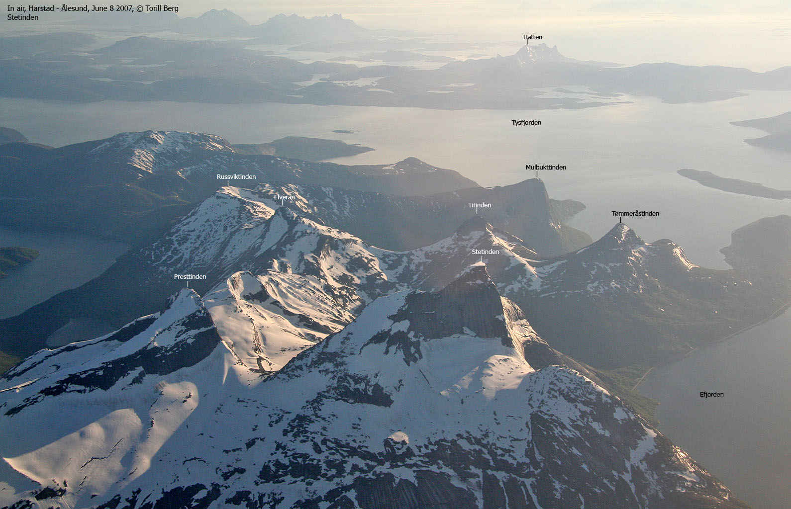
Mulbukttinden (Muvlletjåhkkå in the Sami language) is part of the same mountain massif that also comprise Stetinden. It is one of the very lowest tops in this massif, but has a spectacular rise 765 meters up from Tømmeråsfjorden - one of Tysfjorden's many arms. The mountain has its name from the Mulbukta bay by Tømmeråsfjorden.
The mountain is easily reached from Brattlitunnelen's northern entrance. A path runs up along the powerline. The remaining section up to the summit is easy walking. The north & northeast faces are quite impressive, and may possibly offer fun climbing routes. It is however a good idea to talk to the locals before climbing. A part of the mountain has collapsed (in recent time) and the overall rock quality needs to be examined and considered.
Mulbukttinden (Norge 1:50,000: -, Økonomisk Kartverk: 764,9m ~ 765m , UTM 33 W 559842 7562714) has a primary factor of 217m, towards the higher parent mountain Russviktinden (940m). The saddle (approx. UTM 33 W 559806 7561233) is found on Fugljordfjellet, between Mulbukttinden and Storfjellet. Ref. Økonomisk Kartverk (5m contours), these saddle is within the range 545-550m, interpolated to 548m.

Google's interactive map. You can zoom, pan and click on the markers.
Notes: Class ratings are in reference to YDS. Click here for more information.
The trails described below are not necessarily the *easiest* trails to this mountain.
|
Brattlitunnelen - Mulbukttinden (summer/autumn)
|
|
Access
(all distances are approx. distances)
The closest larger city is Narvik. From Narvik, follow highway E6 to the southwest. Pass the place Ballangen, cross Forsahavet across the islands Storøya and Hallvardøya, and then turn left onto highway RV827 (Kjøpsvik). Follow this road approx. 25,1Km, after having passed Efjordtunnelen, Stefjordtunnelen, Tømmeråstunnelen, and Neppviktunnelen. 200m before the Brattlitunnelen tunnel, turn right onto a gravel road. Find parking nearby.
The route
Once on the gravel road, the path begins at the point where the road turns northeast (UTM 33 W 561090 7561602). The path is vague until you reach the powerline after 100m. The path under the powerline can be very wet (high grass) after rain.
Follow the path all the way to Fugljordfjellet and turn right, in the direction of Mulbukttinden. The terrain is quite easy and obvious, so no path is needed.
The high point is found at 33 W 559842 7562714. A trignometric point is found 116m to the northwest - UTM 33 W 559756 7562783. You'll have an awesome view down to Tømmeråsfjorden.


