
|

Melsåta seen near Sætrabø(No Javascript) |
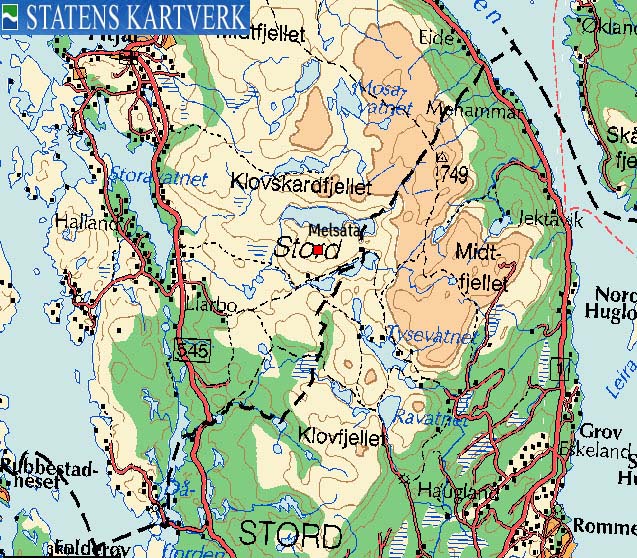
Melsåta is one of several lower tops, located west of the high mountain plateau on Stord island. Melsåta has a central location, providing good views towards the north, south and west, as well as to the higher mountains in the east.
The mountain can be reached on a good trail from the Sætrabø trailhead to the very top, and is well suited as a family hike. On this page, I have outlined a round-trip hike, which includes Sætrabøfjellet - a lower top, just south of Melsåta. The only off-trail section is from the top of Sætrabøfjellet to the foothills of Melsåta.
The trailhead described on this web page - Sætrabø - is probably the best starting point for reaching Melsåta. There are many good trails on Stord island, so other options are available.
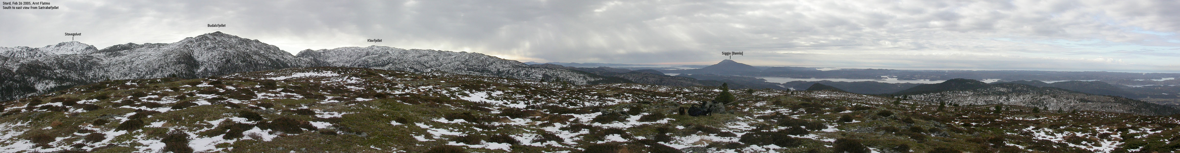
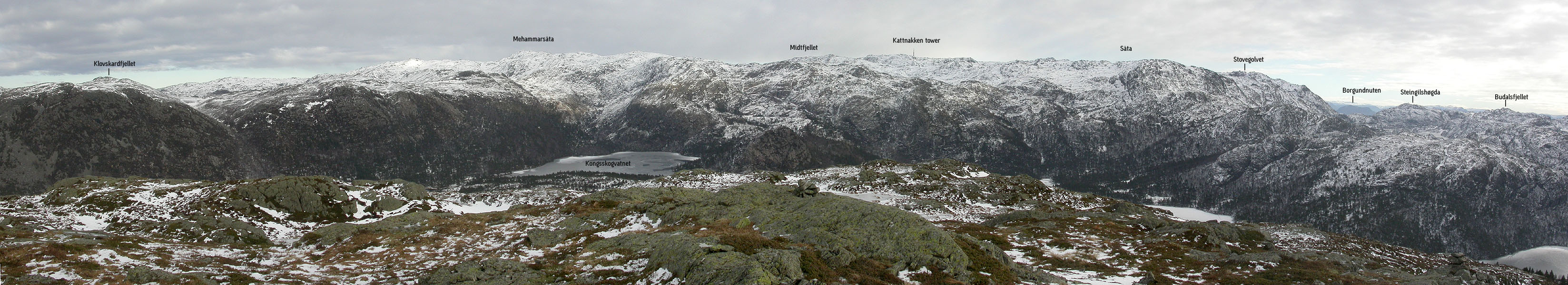
Melsåta (M711: 499m, Ø.K: 499,30m) has a primary factor of 191m towards the higher Mehammarsåta/Kattnakken massif. The saddle is found E of Melsåta, S of lake Kongsskogvatnet. Ref. Økonomisk Kartverk (5m contours), you cross the 310m contours on the high route, but not 305m. The saddle height has been interpolated to 308m. This ranks Melsåta as #1 on the Fitjar primary factor list.
Sætrabøfjellet (M711: 378m, Ø.K: 377,78m has a primary factor of 80m towards the higher Budalsfjellet (528m) The saddle is found SE of Sætrabøfjellet, between the two tops. Ref. Økonomisk Kartverk (5m contours), you cross the 300m contours on the high route, but not 295m. The saddle height has been interpolated to 298m. A primary factor of 80m will not put this mountain on my list of independent Fitjar mountains.
Notes: Class ratings are in reference to YDS. Click here for more information.
The trails described below are not necessarily the *easiest* trails to this mountain.
|
Sætrabø - Sætrabø - Mels&arign;ta round-trip (summer/autumn)
|
|
From Bergen, follow highway E39 southbound towards Halhjem (outside Os). The distance is approx. 23,5Km from the RV580/E16 junction at Nesttun to Halhjem. Take the ferry to Sandvikvågen on Stord. Drive up a hill (approx. 600m) and turn right towards Fitjar. Follow this road (through the Fitjar village) for approx. 12,7Km from where you turned towards Fitjar. Turn left onto a gravel road in a 3-way junction where the rightmost road tuns towards Koløyholmen.
Follow the road upwards. Ignore the first side road to your right. In a Y-fork after 500m, turn right. Follow this road for 1,2Km (distance from the main road) and find parking on your right. There is a fence (no gate) ahead of you, and trail information to your left. The road continues towards Sætrabø, but this is where you begin the hike.
To Sætrabøfjellet
Follow the trail pointing towards "Sørlivatnet/Prestetråkka til Stord", located at the parking. On top of the first hill, you get a clear view towards Melsåta. After approx. 450m, you meet a forest road (most likely from Sætrabø) Turn left. Approx. 400m later, you run into a trailfork. Turn right (Prestatråkket) and follow this trail until you have a clear south view. Leave the trail head, turn left and walk off-trail towards Sætrabøfjellet summit. The terrain is easy, but you will have to advance up a minor cliff. No problems here. The summit consists of a cairn and a pole, located a few meters apart.
To Melsåta
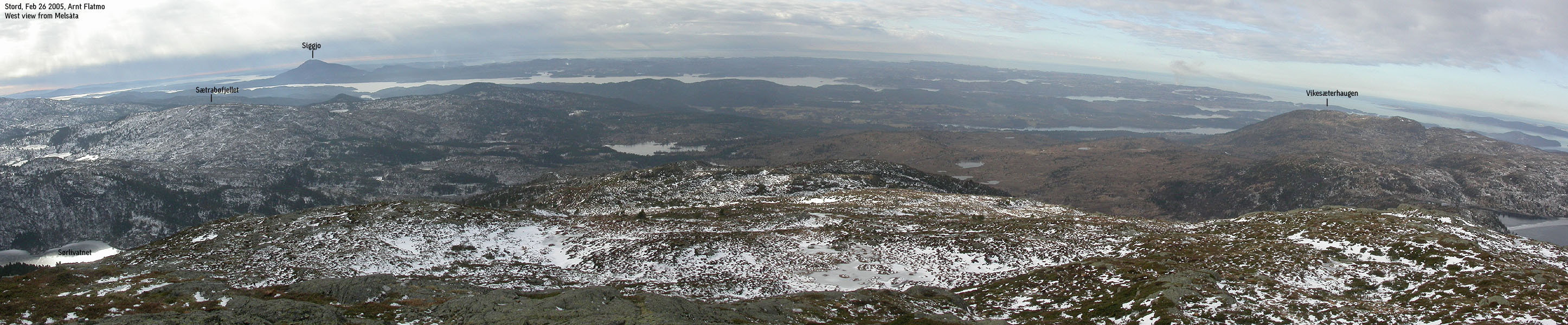
Head off-trail northeast towards the west end of lake Sørlivatnet. You will see a sign towards Melen. Follow this trail that takes you to the top of Melsåta. You will find a cairn at the summit, and in the summer/autumn, you will find a trail register in a container by the cairn.
Back to the trailhead
Head back down to lake Sørlivatnet, and follow a forest road towards southwest. After approx. 300m, leave the forest road when you see the sign to Sætrabø. Follow this trail to the southwest, and you will eventually join the trail you followed towards Sætrabøfjellet.
Notes
The terrain is in general friendly. In summer/autumn, parts of the trail are boggy ground. The trails are quite visible, and marked by "T", here and there.
|
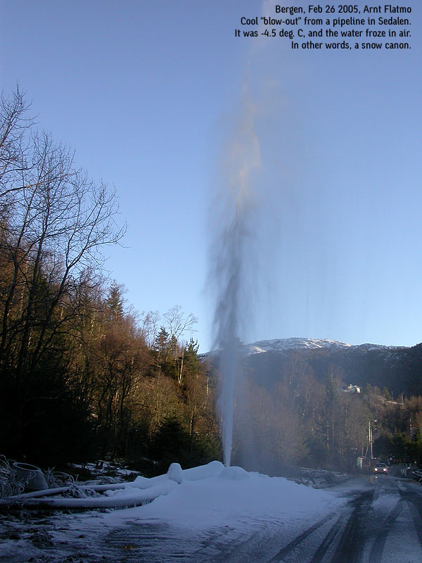
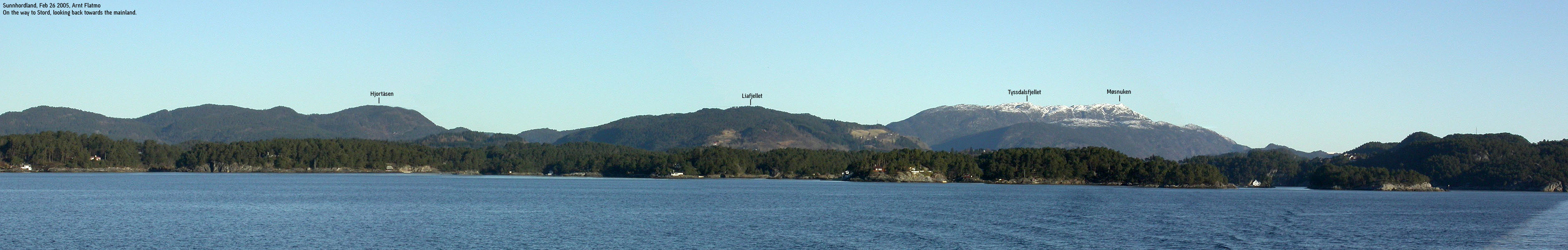
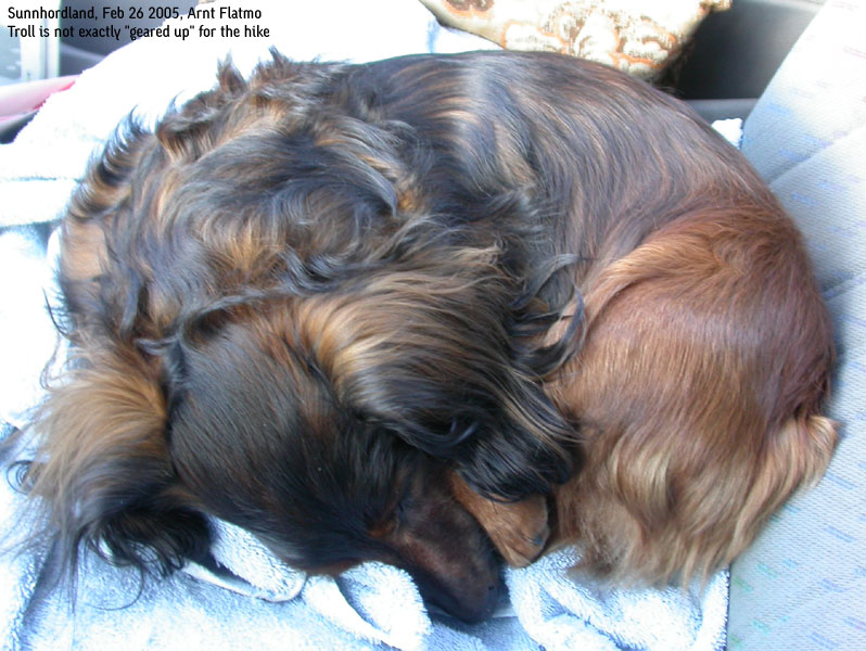
Trip report Feb 26 2005It was sort of a shame to head towards the lower mountains this wonderful Saturday morning. But having skied in the Finse mountains just a few days earlier, I was now eager to complete Fitjar kommune. There were two mountains yet to do, and the plan was to do them in one day. It would be two different hikes, but the amount of "work" seemed moderate. I took the 10:00AM ferry from Halhjem, and was a bit disappointed when I saw a belt of clouds above Stord. Oh well, no complaints. After all, it was not raining, and it would be a good day in any circumstance. I had chosen a potentially good trailhead, and it seemed to be a good decision when I parked the car a bit below Sætrabø We started walking 11:30AM, and as usual, Troll gave up after a couple of hundred meters. Route selection was a no-brainer. The terrain was easy and I had the necessary overview, from the very beginning. In fact, I think this was the best time to do these mountains. The boggy ground was frozen, and although the trail was very icy, there was always a rock here and there, popping up. The little amount of snow left caused no reduction in the pace, when I went off-trail. With Troll on my back, I arrived the top of Sætrabøfjellet 12:15PM. The GPS reading was the same as the height on the map - 378m. Troll believed this was it, and whined for his lunch while I took a quick round of pictures. I cursed the clouds above, making the pictures much more dull. I moved on and took course towards the western end of lake Sørlivatnet. I had expected to continue off-trail up to Melsåta, but down by the lake, I found a sign pointing to Melen. Melen is either the name of the area, and/or a contracted form of Melsåta: Melsåten -> Mel-en. This was a marked trail (sticks with red paint) that took us straight to the summit. Troll was now walking, seemingly happy to be out of the backpack. We kept a good pace, and reached the summit 13:00PM. Troll got his lunch while I took a round of pictures. Afterwards, I had lunch (A Mars chocolate bar and a bottle of Sprite Zero - tasty!) and took a GPS reading. 499m. The GPS and the map heights seemed to be quite in sync today. There was yet another hill to do. We headed back to the trailhead, and was content about the fact that Troll was now really in the walking mood. He handled the icy trail like a mountain dog is supposed to! We were back at the car 14:10PM, and headed towards Handfjellsåta - the last mountain in Fitjar kommune.
Pictures from the Feb 26 2005 hike
Move cursor to read notes, and click on the images to see full version.
No Javascript:
|
Other hordaland mountains
 Other Fitjar K. mountains
westcoastpeaks.com
Other Fitjar K. mountains
westcoastpeaks.com


