
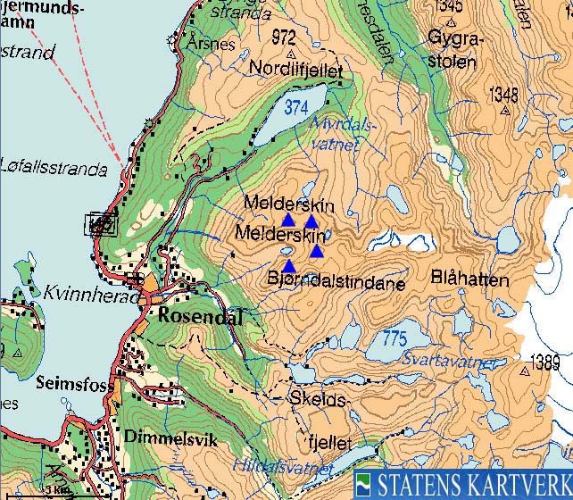
Click here for the main Melderskin/Laurdalstind page.

(No Javascript) |

(No Javascript) |
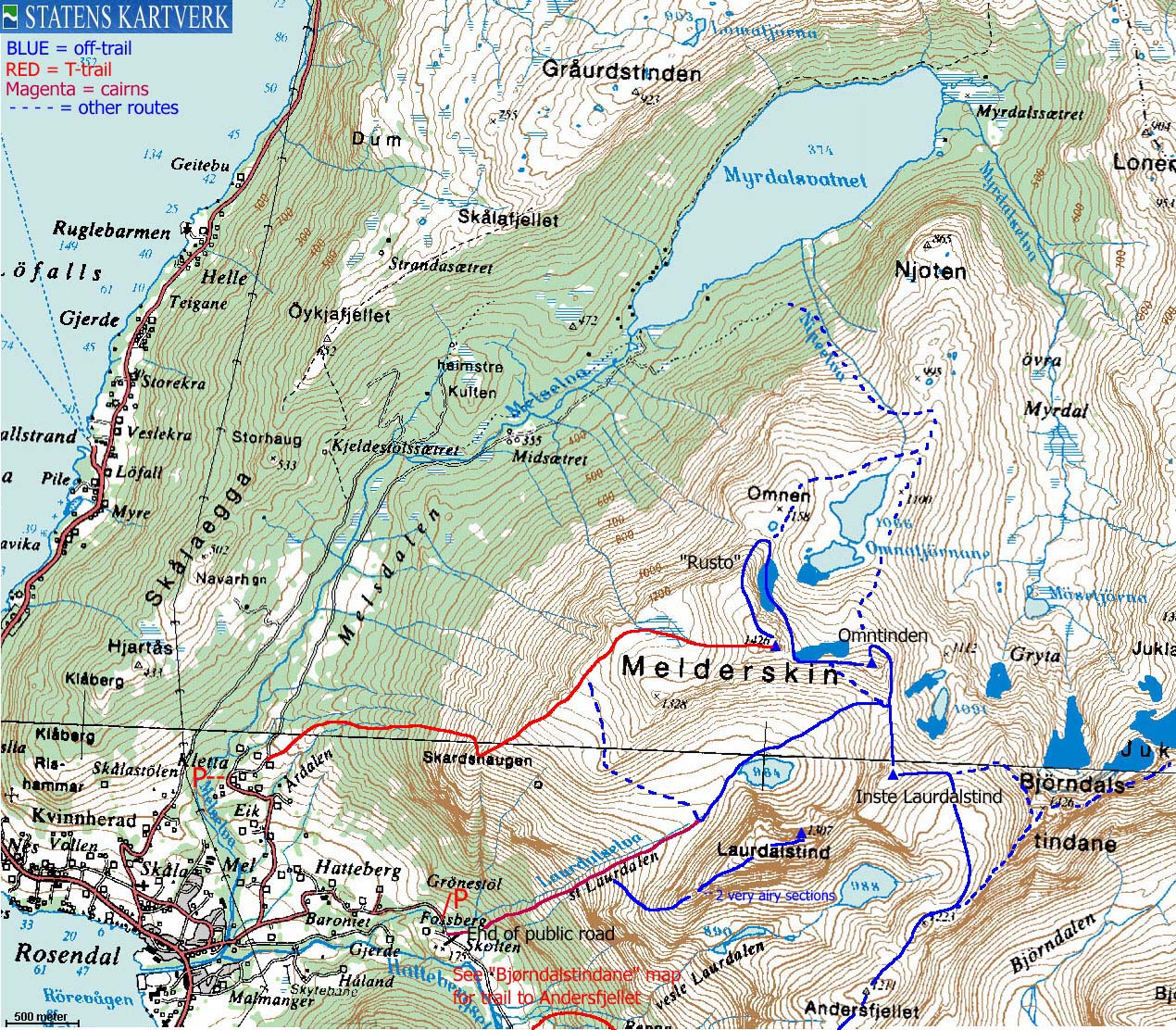
Route summary: From Muradalen, up St. Laurdalen to Inste Laurdalstind. Across the ridge to Omntinden and then up Melderskin via the NW ridge. Descent to Kletta. Map is found on the Melderskin front page.
Two good things were about to happen this week-end. First, the weather forecast promised sunshine and second, my colleague Agnete wanted to borrow my dachshund "Troll" for the week-end. This left me with a super-light backpack (I normally carry the dog a lot) and the opportunity to go off an a most excellent hike.
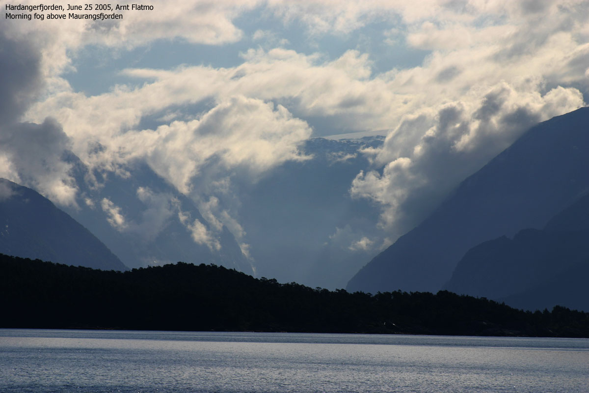
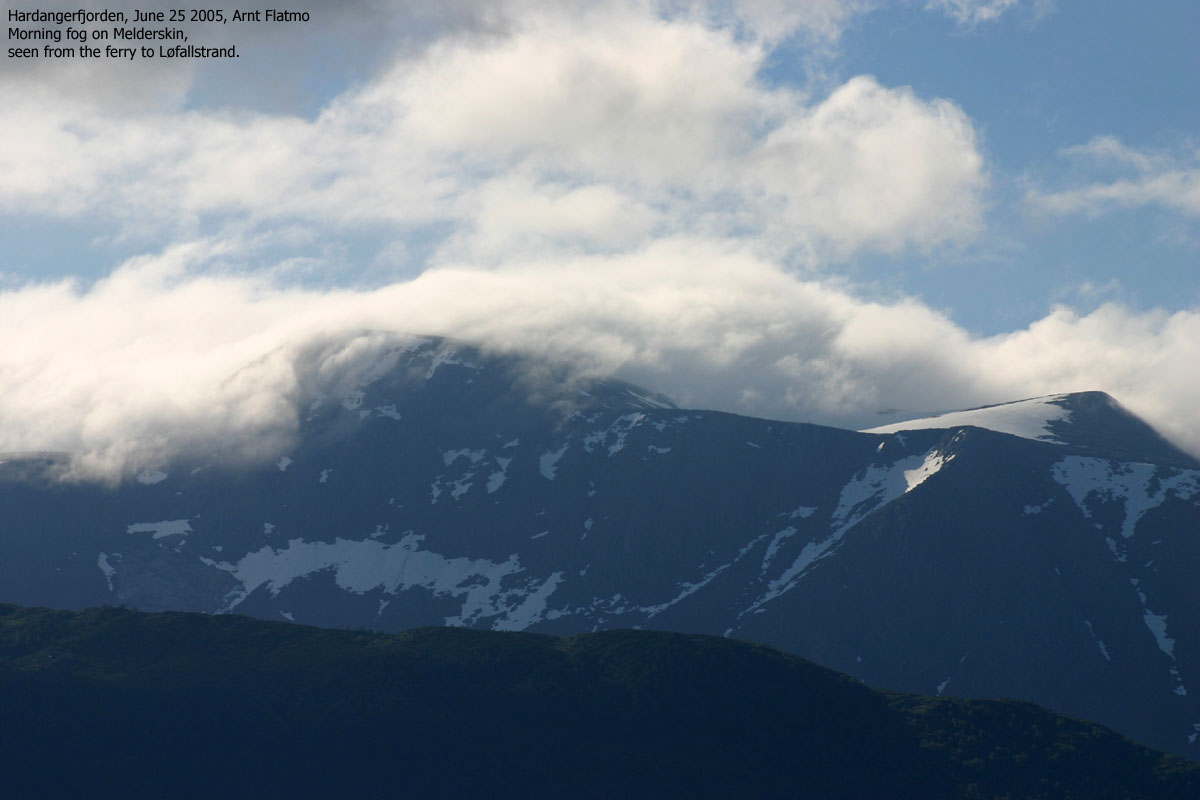
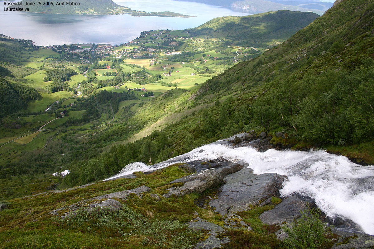
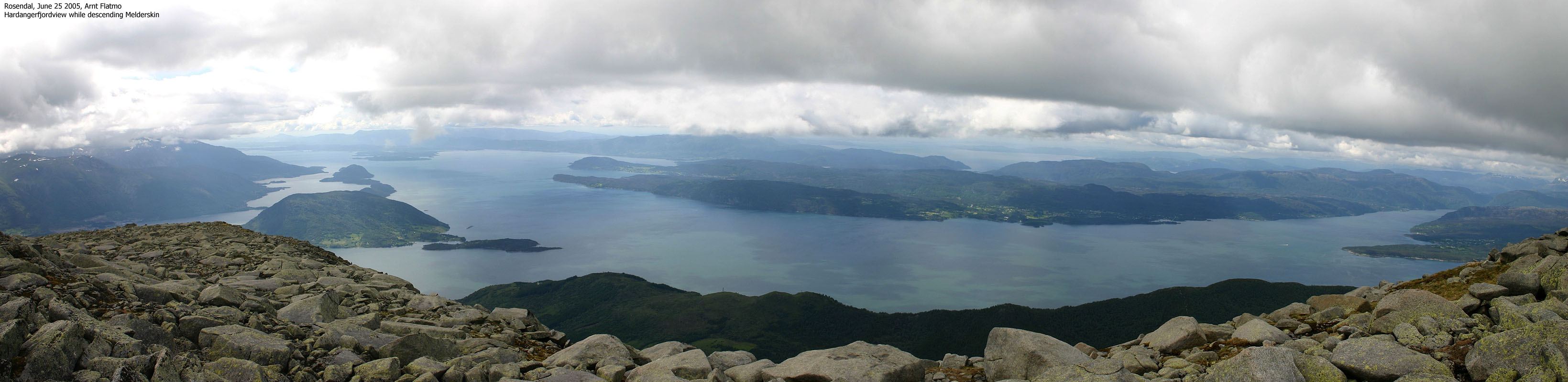
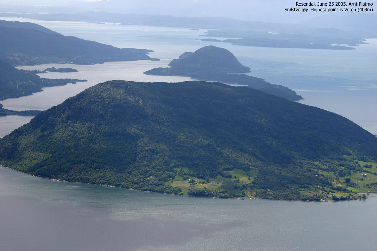
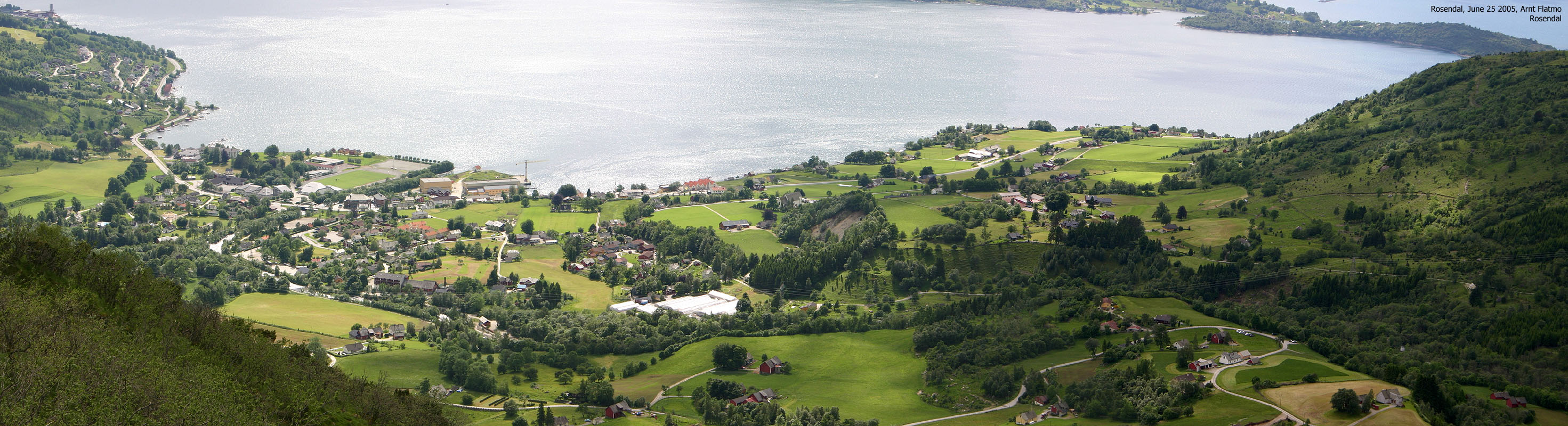
The choice of mountain was easy. I hadn't been to Melderskin since the autumn 2000 and I didn't have any good pictures from the mountain. The choice of route was also clear, as I had wanted to take a closer look at the smaller tops on the ridge towards Bjørndalstindane. I left Bergen early morning, aiming for the 08:40AM ferry across Hardangerfjorden. When I arrived the ferry, the Rosendal mountains were almost hidden in fog. There were no worries, as I was confident the fog would burn off in the coming hours.
I drove to the end of the public road in Muradalen. The plan was to hike up Laurdalen and descend the normal route to Kletta. The distance between the two trailheads was only 2,5Km. Petter and I headed up this route back in 2002, on our way to Laurdalstind. I was curious if I remembered the route. I started out 09:30AM and had to search before I found the trail. Well, trail is an overstatement. The route up along the river is marked by rocks. The path was almost invisible in the lower forest. The grass was high and wet. Within minutes, I was soaking wet. My old and well worn hiking boots attracted moisture like a jamjar attracts wasps. The only value I had by following the cairns was that I got confirmation that someone had been here before.
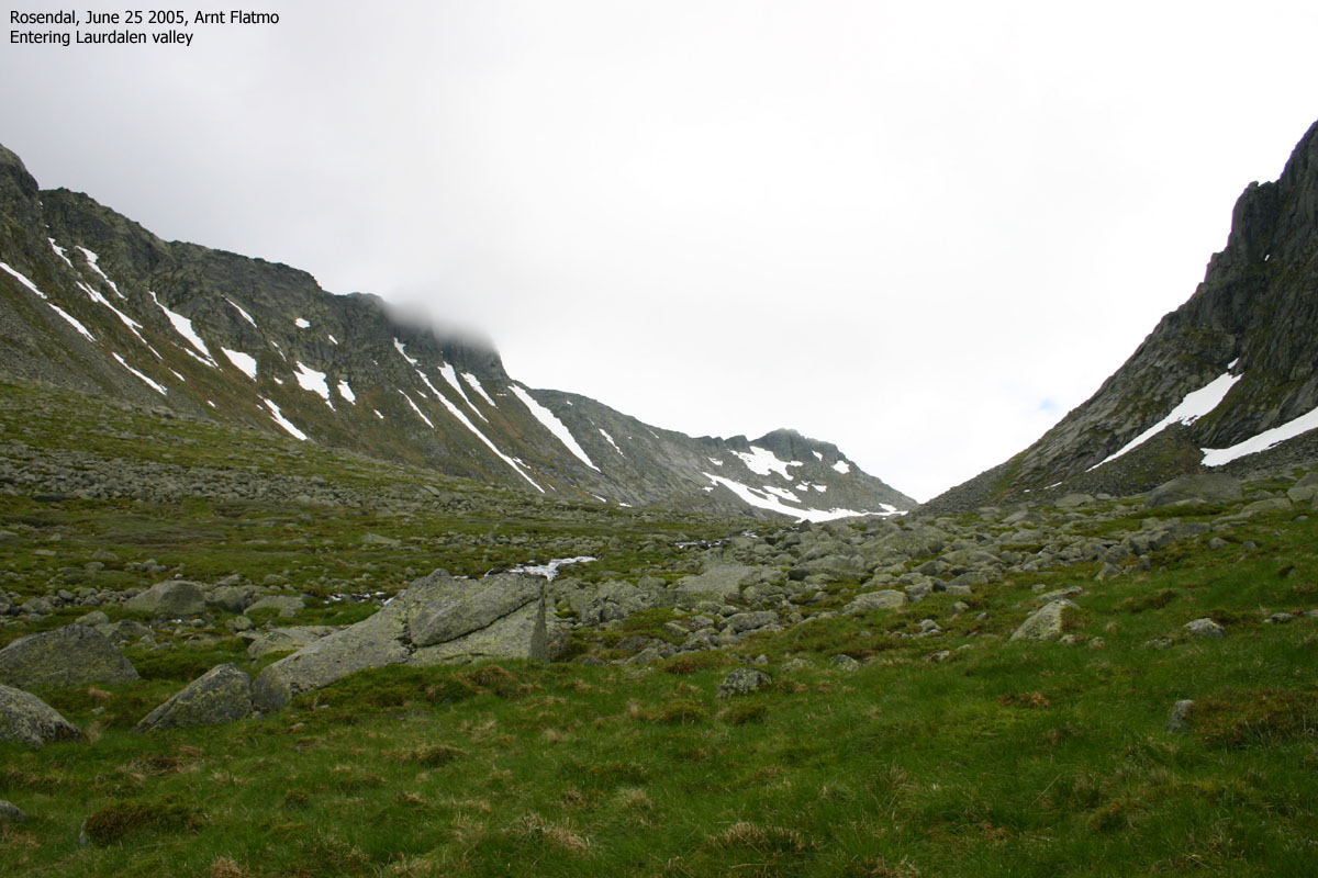
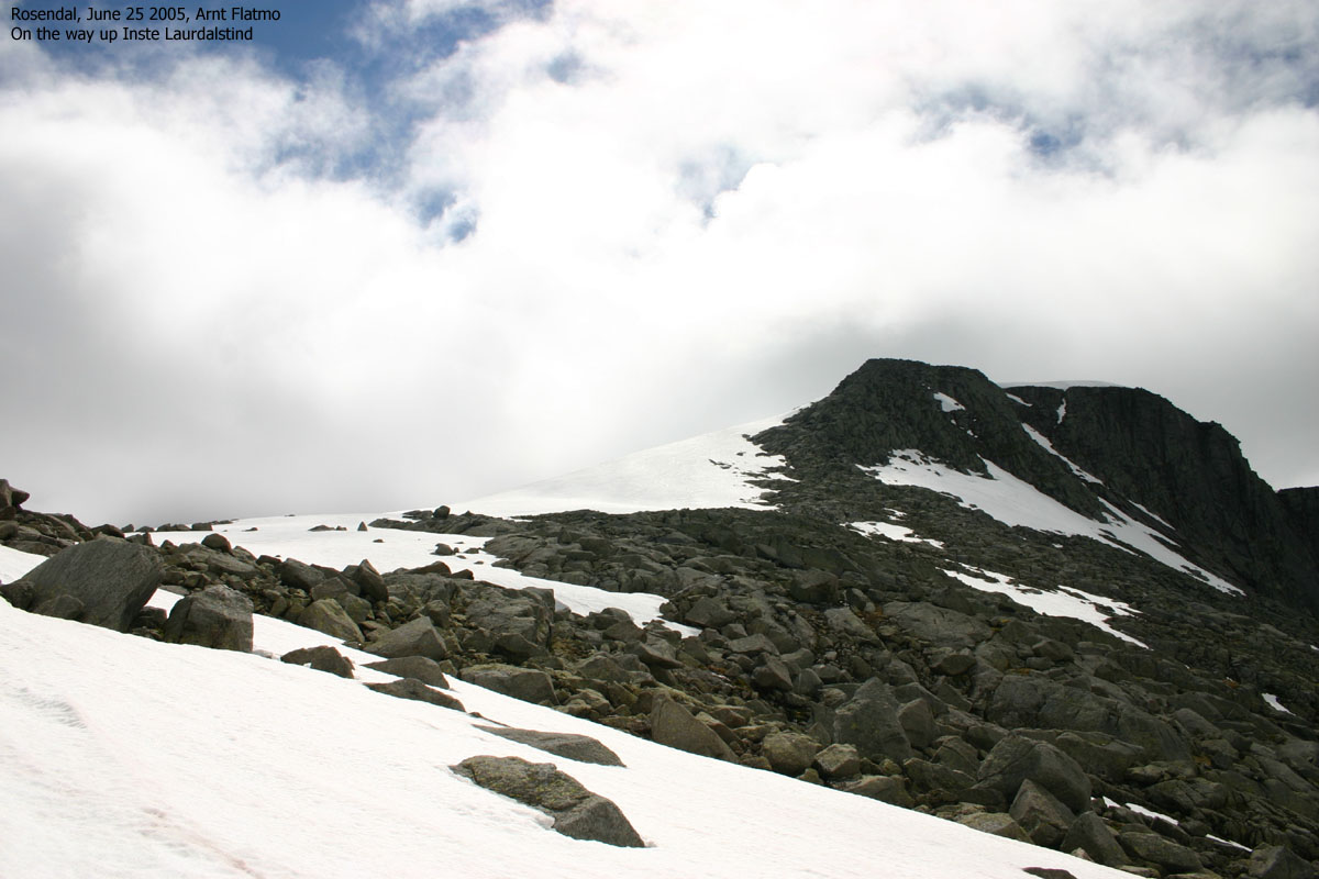
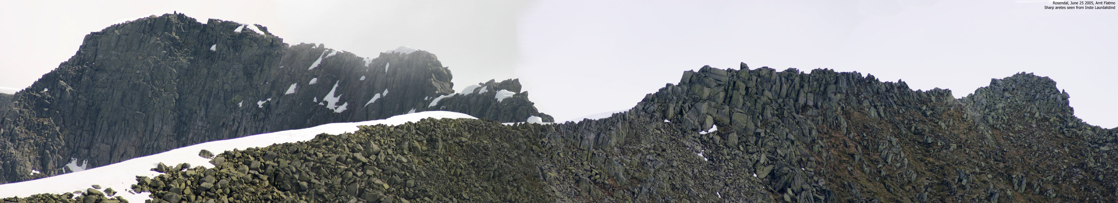
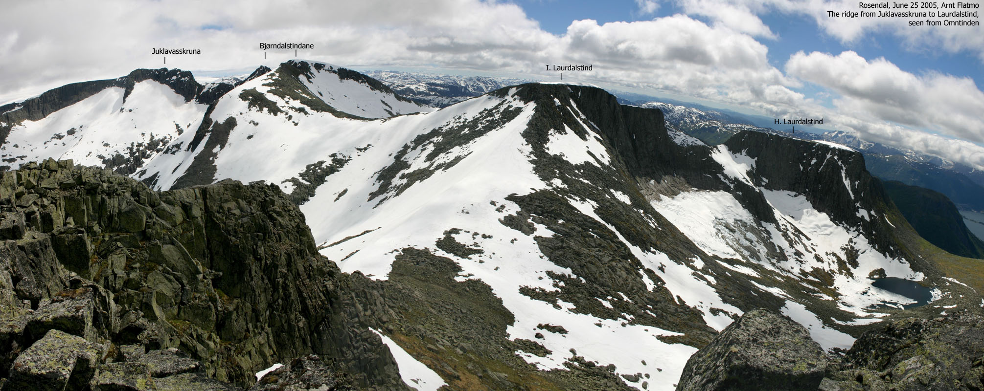
Up in Laurdalen it was time to get the water out of the socks and soles. I had brought an extra pair of socks, but wanted to save them for later. I hadn't even reached the snow yet. I enjoyed myself. I had left the worst part behind, and could now just focus on getting a clear picture of the area. The Heimste Laurdalstind SW ridge didn't look too bad. I remembered telling Petter when I saw this ridge - "this is my kind of mountain". I also remembered taking back this statement when we ran into the first of two very narrow sections on the ridge. I looked up to the Melderskin side and besides the immediate route up to the left, another couloir looked very possible. I moved on.
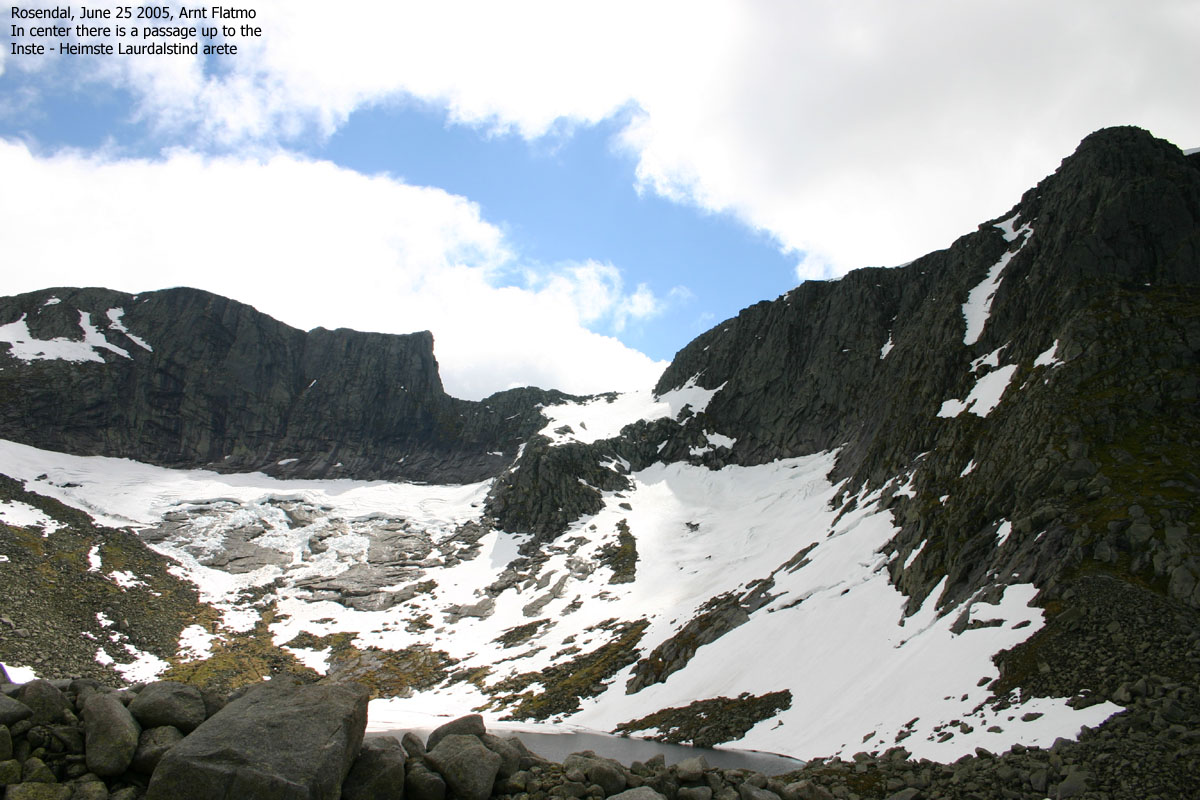
As I passed Lake 964m, I got a good view towards the route up to the Heimste - Inste Laurdalstind saddle. I promised myself to return soon for the traverse of Heimste Laurdalstind. I would be happy with descending here, and had no ambitions on taking on the steep pillar below Inste Laurdalstind. I moved up towards the Omntinden - Inste Laurdalstind ridge and noticed the fog about to leave Melderskin. It was still quite cold, and my toes were numb. I took my first break and had a change of socks.
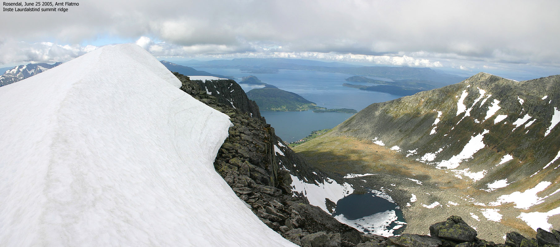
I reached the top of Inste Laurdalstind 12:35PM. It had taken me 3 hours, and without any form of rush. The walk up the ridge was quite easy, as the snowmelt had turned the ridge into a less airy experience. Even if I was cold, it felt tremendously good to be up here. I knew that this hike would go straight into my top-20 list, and the hike had just begun. The scenery was just amazing. Not that Norway lacks mountains like these. On the contrary. But this was my "home turf" and mountains like these are rare in Hordaland. The GPS showed 1381m as a steady number (accuracy +- 6m). As there is no 1380m contour on this mountain, I settled for 1379m. The GPS is usually reliable, within a few meters accuracy.
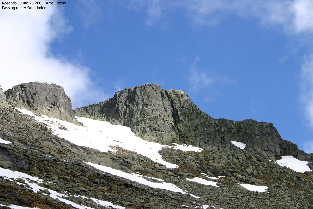
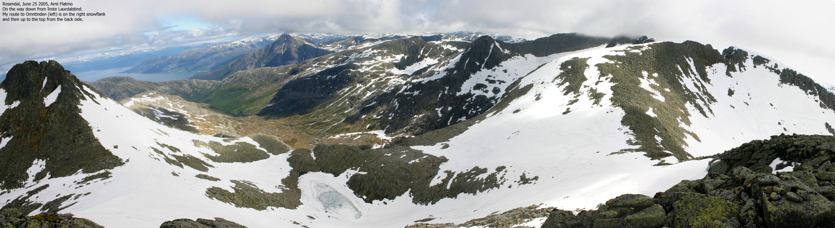
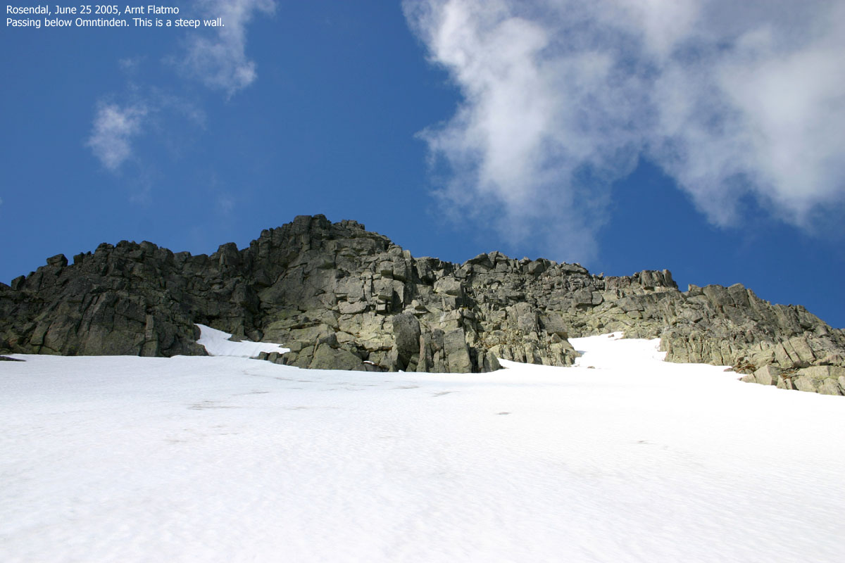
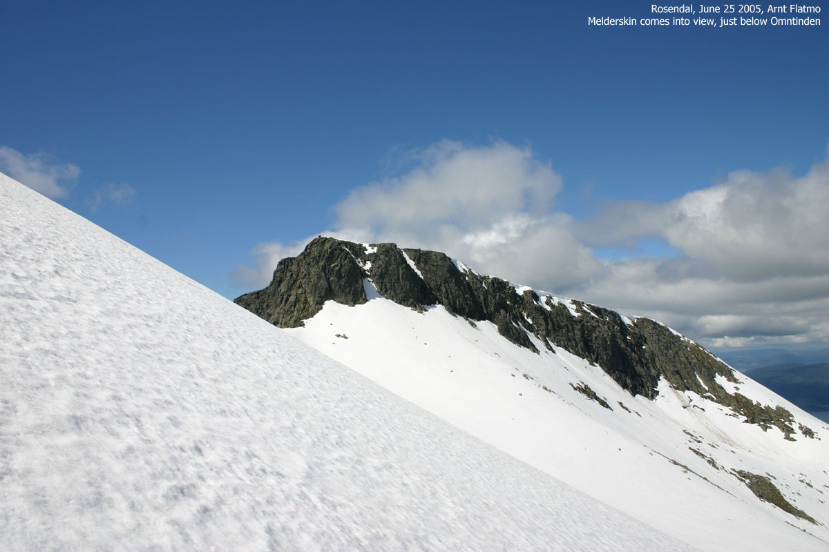
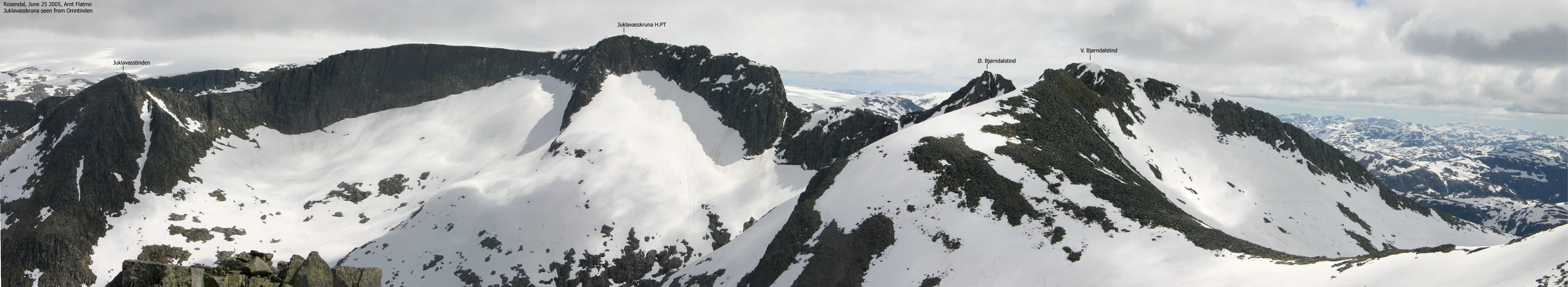
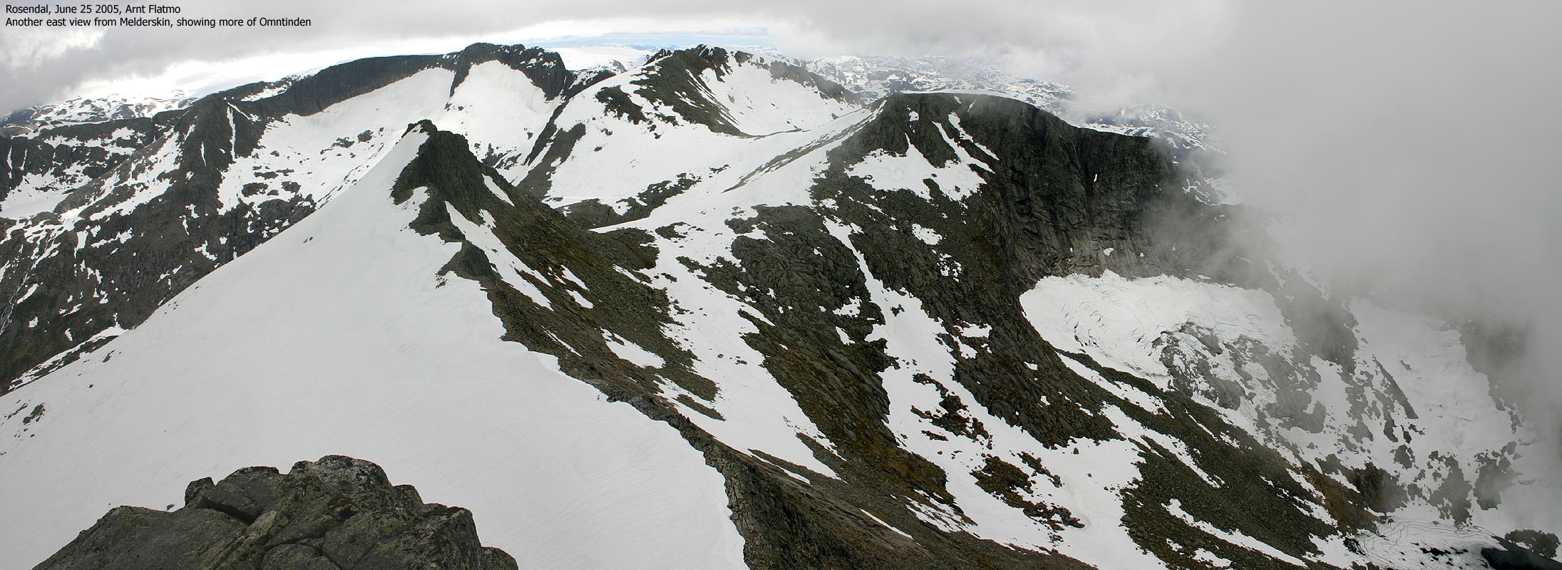
It was time to move on, and I had to figure out how I could get to Omntinden. The approach directly up to the Omntinden - Melderskin ridge was obvious. Steep, but quite doable. Since this hike was mostly about research, I decided to walk around Omntinden on the east side, after concluding that a direct approach would be impossible without climbing gear. The snow slopes from Omntinden were by no means intimidating, and I began traversing the slope. The combination of bergschrund-type holes caused by snowmelt, icy snow in places and some distance down to the foothills made my pulse go up one beat before I reached the rocks on the far side. Comfort was found by looking up to the INSANELY steep cliffs above me. At least I was down here, and not up there. As I rounded the "corner", I entered more gentle terrain. I approached Omntinden on the north side, through a steep but not airy hill.
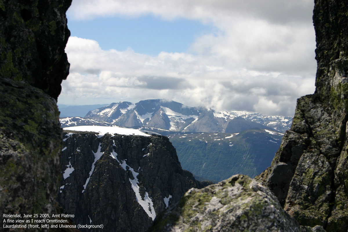
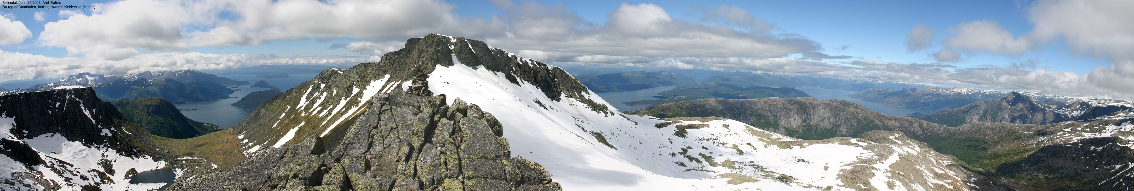
13:30PM, I was standing on top of Omntinden. The narrow top ridge didn't offer headroom for unplanned manoeuvres. Especially while wearing crampons. The GPS showed 1380m as the height, and as there is no 1380m contour on Omntinden, I subtracted 2m on this mountain also, and concluded that 1378m is better than guesswork.
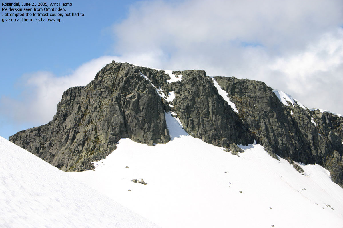
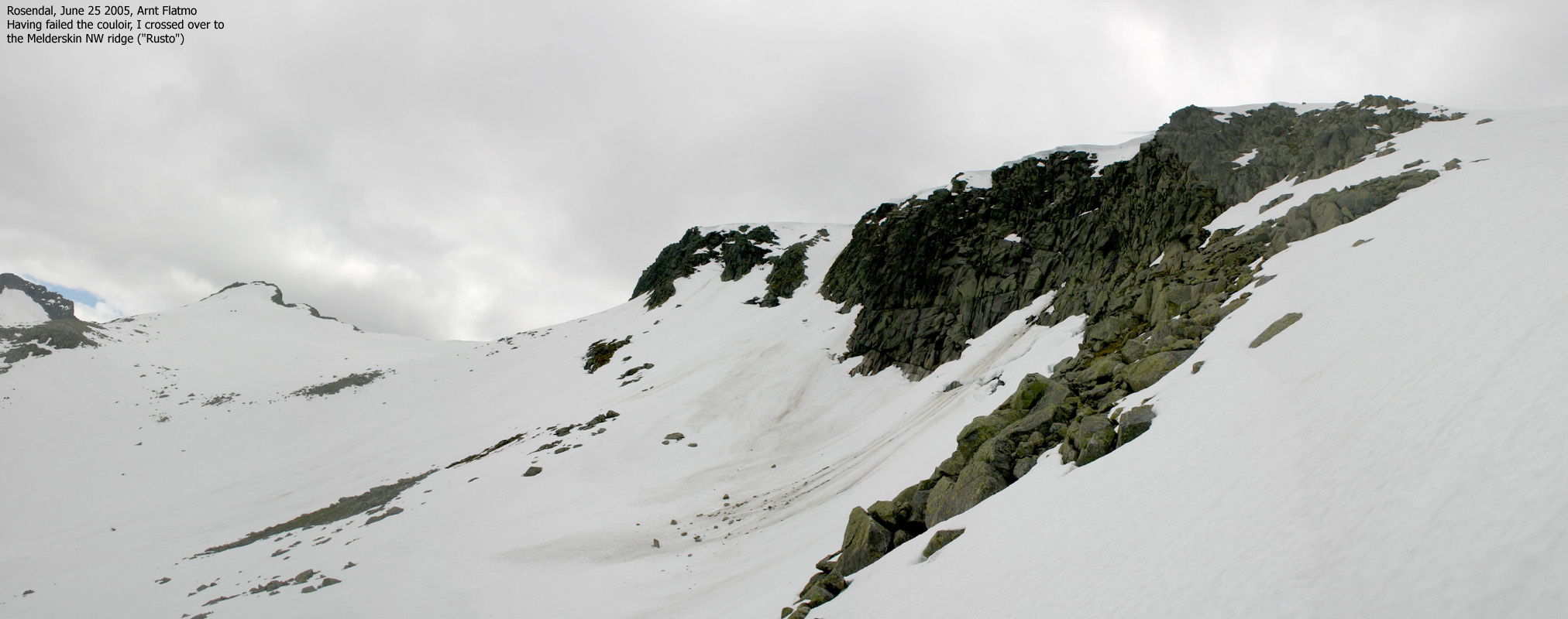
I looked towards Melderskin and tried to get an impression of the couloir that led directly to the summit cairn. I couldn't, from this angle. I left Omntinden and headed directly towards the bottom of the couloir. I pulled out my second ice-axe and put the camera in the back-pack. In case I would be free-floating down the couloir, I wasn't about to ruin the brand new camera. Gadgets have first priority. Life second.
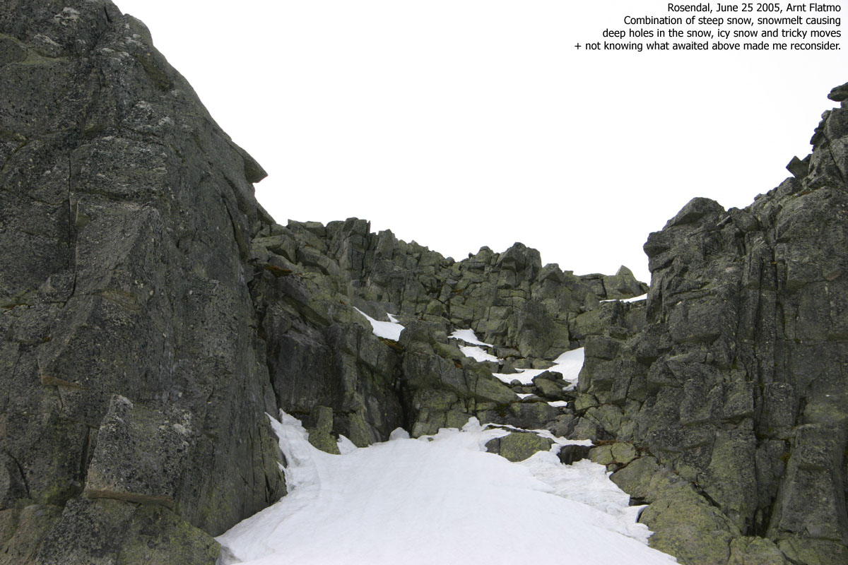
The good thing about the couloir was that it ended in a gentle slope, and I didn't have to worry about falling off the mountain. The bad thing was that snowmelt caused rock to pop out and the Bergschrund-type traps that go along with it. On top of this, parts of the couloir were quite icy, located in the shadow. Just as I had built up the moral courage to attempt passing the lower rocks, one foot went through a deep hole. I pictured myself downclimbing this thing in case of further problems higher up, and took the right choice. I chickened out and moved on.
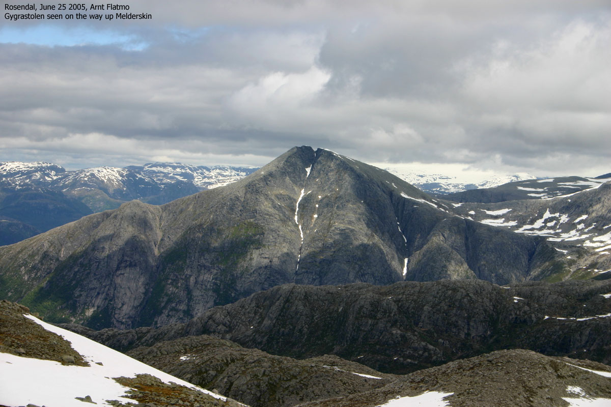
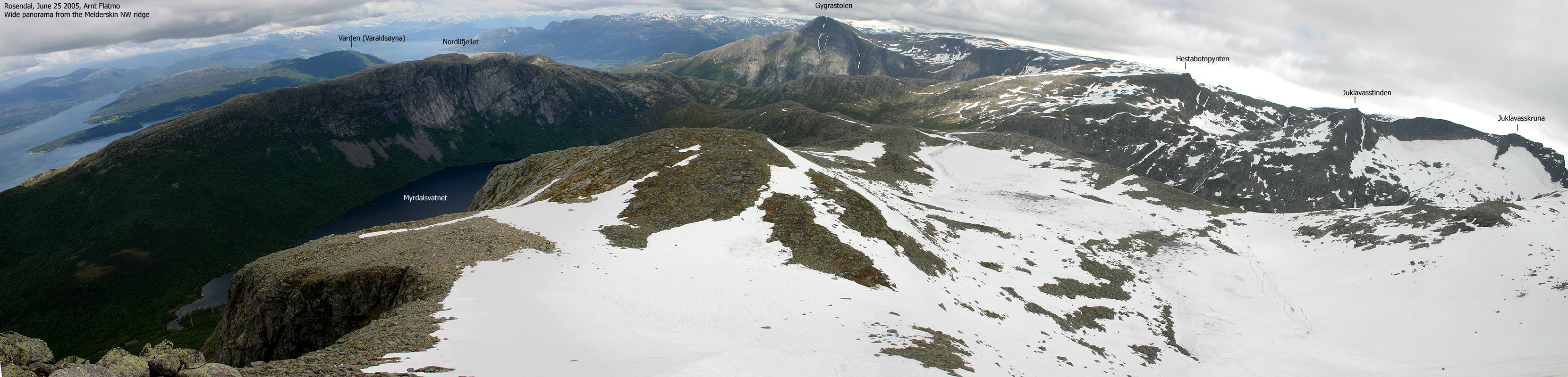
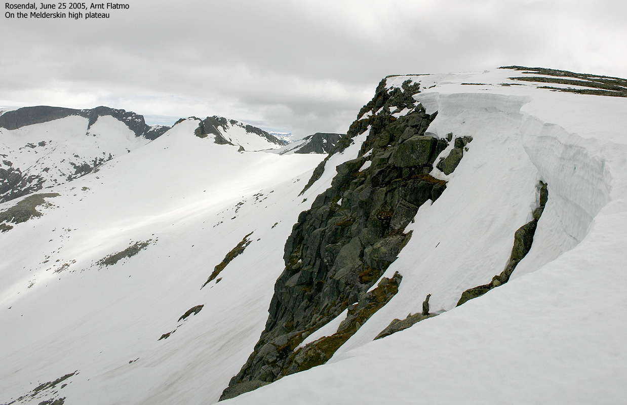
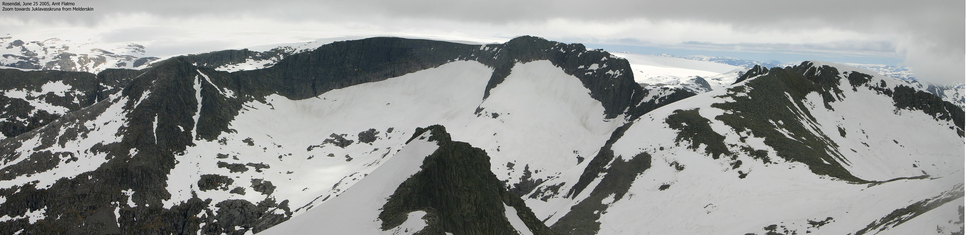
My eyes fell on a snowflank that had to be the NW ridge. This was a ridge that I knew nothing about, but from my position, it looked easy. I had to descend 200m before being able to get onto the ridge, and once on it, I found it was exactly the same type of ridge as the ridge to Inste Laurdalstind. Perhaps one "notch" more airy when there is nothing but snow. I shouted a solid "YEAH" as I entered the summit plateau on Melderskin. Would Surfer Girl be on the mountain? I had walked for 5 hours straight. I was a bit cold and tired. My lunch consisted of two apples and a few bisquits. None had been touched so far. As I entered Melderskin summit 14:50PM, I felt like the man coming out of the woods after two years. A group of 5-6 people at the summit brought me back to reality. And Surfer Girl was not on the mountain...
I chatted briefly with the other hikers before they left. I felt I had deserved at least one of the apples and watched the fog moving on over the Rosendal mountains. It didn't matter. I had already taken all the pictures I wanted to take. This was a turning point. I was going home now. I like that sensation when hike changes from ascent to descent. It has nothing to do with easier terrain. More the fact that the mission is accomplished, and now it is time to go home.
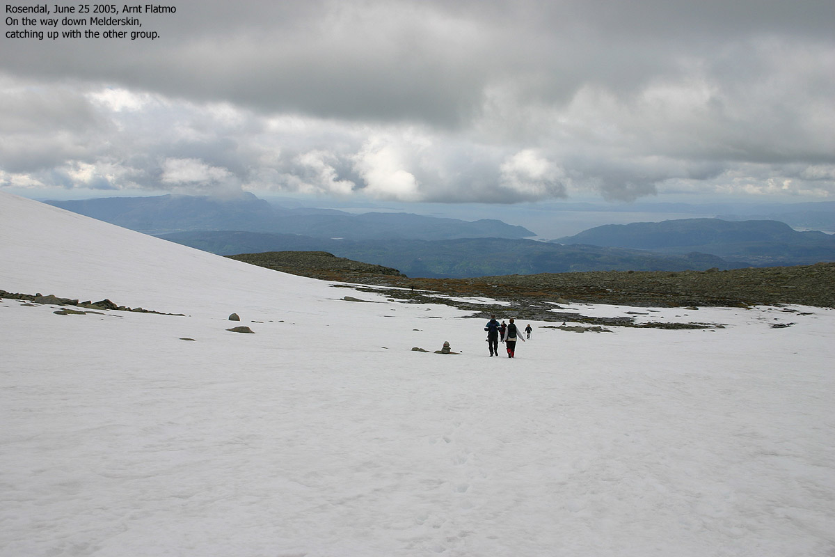
I left Melderskin 15:00PM and kept a fair pace down the mountain. I passed the others early on and reached the Kletta trailhead 16:10PM. I chatted with a local who told me I could take a shortcut towards the Barony. 16:45PM, I was back at the car in Muradalen. A long, but very rewarding hike was over, and I already started to look forward to my next hike in these mountains.
Move cursor to read notes, and click on the images to see full version.
Some of the thumbnails may have been cropped to fit the format
Some pictures are not ideal for modem users!
Errata:
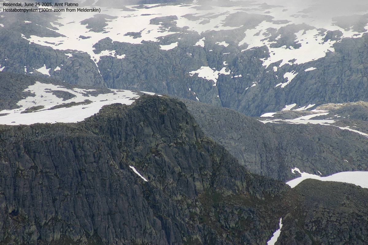
Picture #68 says "300m zoom". The correct text should read "300mm zoom"
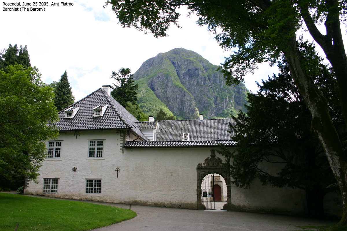
On the way to Rosendal


To Inste Laurdalstind


To Omntinden


To Melderskin


Descent


No Javascript:
1 2 3 4 5 6 7 8 9 10 11 12 13 14 15 16 17 18 19 20 21 22 23 24 25 26 27 28 29 30 31 32 33 34 35 36 37 38 39 40 41 42 43 44 45 46 47 48 49 50 51 52 53 54 55 56 57 58 59 60 61 62 63 64 65 66 67 68 69 70 71 72 73 74 75 76 77 78 79 80 81 82 83 84 85 86
Other hordaland mountains
 Other Kvinnherad K. mountains
westcoastpeaks.com
Other Kvinnherad K. mountains
westcoastpeaks.com