
|


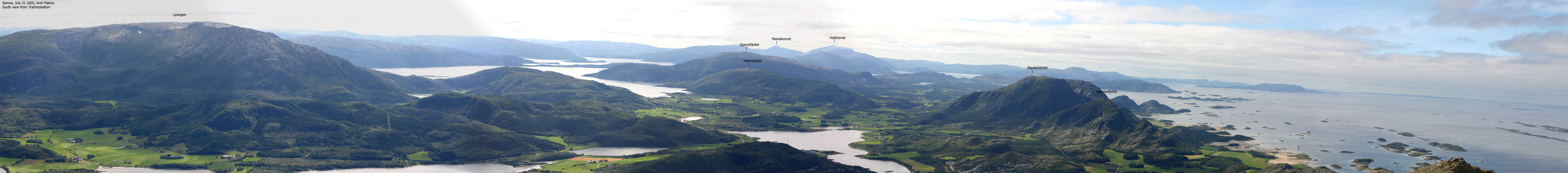
Lysingen is the highest mountain in Sømna kommune, located 15Km southeast of Brønnøysund. The mountain is a big hump. One of the few distinct features is Lysingshesten (the Lysingen horse) - point 609m 1,4Km northwest of Lysingen summit.
The mountain offers good views all around. You'll be able to see Lovund (weather permitting), Høyholmstindane, Storfinnkneet, Snøfjelltinden, Vist-tindan, Breidvasstinden and a whole range of Velfjord, Grane and Bindal mountains, as well as the beautiful Heilhornet above Bindal.
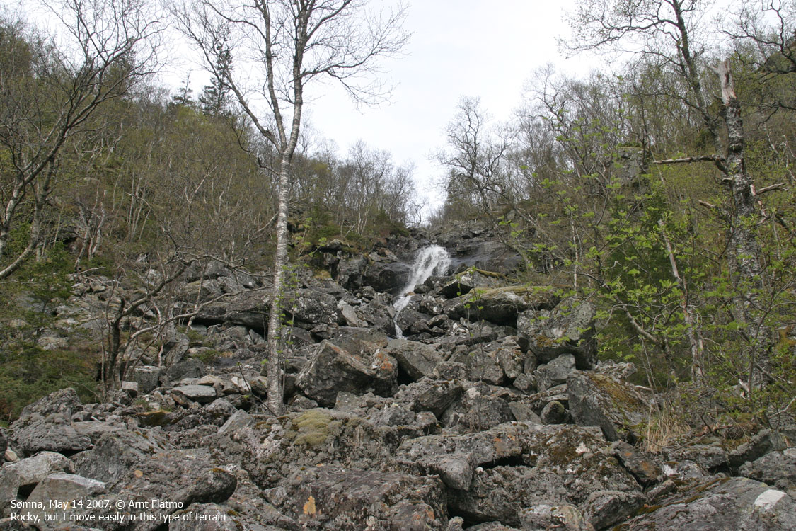
There are several routes you can follow, but per May 2007, none are particulary well marked. This web page will describe access via Holandsvatnet. The route fits best those who doesn't really matter if there is a path or not. Because there isn't any. But except for a short boulder section near a waterfall, the route is fairly easy.

Lysingen (Norge 1:50,000: 647m/648m, Økonomisk Kartverk: 648,45m, UTM 33 W 375413 7249242) has a primary factor of 625m, towards the higher parent Hardangsfjellet (787m). The saddle (approx. 33 W 383414 7252318) is found east of Lake Djupvatnet and south of point 88m. This is north of Krumfjellet. Ref. Økonomisk Kartverk (5m contours), the saddle is within the range 20-25m, interpolated to 23m.
Hardangsfjellet is only 11Km across Ursfjorden, but the primary factor measures the lowest point on the highest route, and the highest route runs around the fjord, via Grøndalsfjellet, Roparvikheia, Krumfjellet, Gravtinden and Grønlifjellet.
Google's interactive map. You can zoom, pan and click on the markers.
Notes: Class ratings are in reference to YDS. Click here for more information.
The trails described below are not necessarily the *easiest* trails to this mountain.
|
Holandsvatnet - Lysingen (Summer/autumn)
|
|
Access
(All distances are approx.)
Locate the RV17/RV76 junction (Horn/Andalsvågen/Vega), 2,8Km outside the centre of Brønnøysund. From here, follow RV17 28,2Km (in the direction of Vennesund, and not towards Horn). Turn left towards "Holand". Drive 1,6Km and turn right towards "Holandsvatnet". Drive 300m to the public parking at Lake Holandsvatnet.
The route
From the public parking, walk to the southwest side of the lake. Leave the road, cross a creek and follow a tractor road along the south shore. Follow this road up the forest (stay left in a fork at 40m elev.) up to 120m elevation (per May 2007).
Head northwest towards the waterfall in Lislfjellgrova. Pass the waterfall to the left, up a boulder section. There is also plenty of boulder above the waterfall, all the way up to 260m elevation. Next, you cross a meadow. Faint, red marks can be seen on a few trees. Follow the river upwards, and pick your best route.
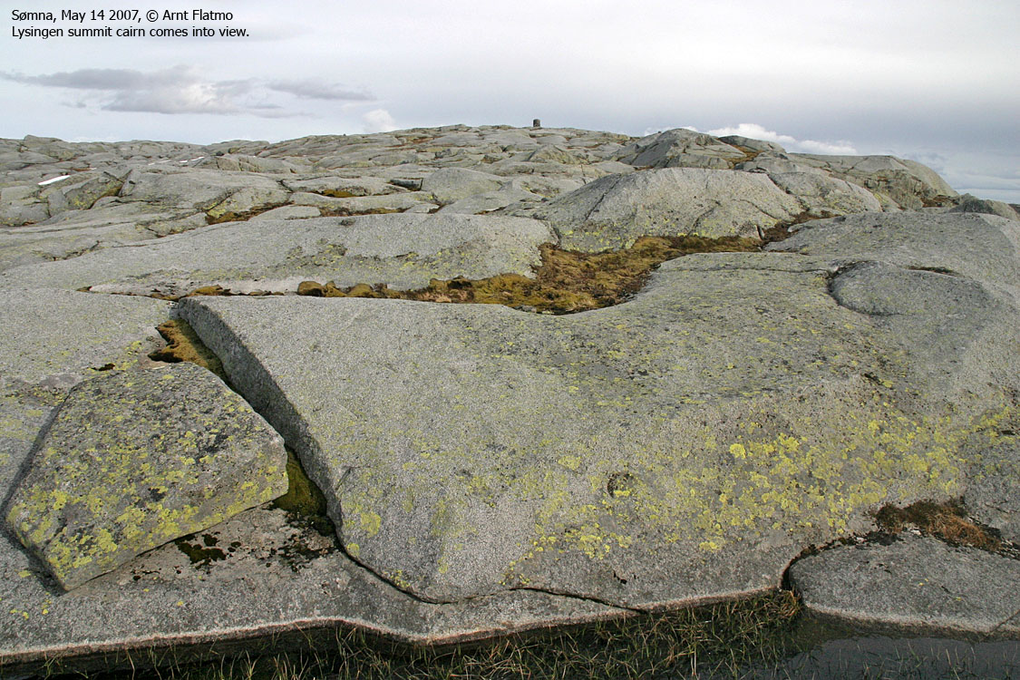
As you find yourself below Lysingshesten, you will have to scout for the best route. Slab areas prevent you from going wherever you like. Head for Lysingen's western shoulder when you see fit. Once on the shoulder, the terrain is fairly trivial. Lysingen is marked by a large cairn. Inside the cairn, you will find a container that may or may not contain a visitor register.


 westcoastpeaks.com
Other Nordland mountains
Other Norwegian mountains
westcoastpeaks.com
Other Nordland mountains
Other Norwegian mountains

