
My friend Lars, living in Tønsberg, Norway, came over to Bergen for a week-end visit. The traditional way of taking care of guests is to show them the usual city sights - Fløybanen, the aquarium, the theatre, the fish market, etc. I'm thinking differently, and asked to Lars to bring some hiking gear along.
I picked him up at the train station 14:55PM, and already by 16:50PM, he was standing below the Ulriken tower. Idle time is evil time. My dog Troll came along, and we had a nice hike. It was the first day in 2005 that it hadn't been raining, and we reached the tower just as it was getting dark. The mountain was icy all over, and we had to seriously mind our steps on the way down. After this legwork, we had earned the right to pizza, beer and a good movie.


No Javascript:
For more information about Ulriken, see the main Ulriken page.
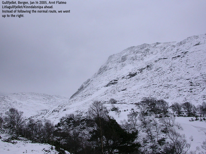
The plan for this Saturday was to bring Lars to Gullfjellstoppen, the highest mountain in Bergen kommune. We headed up from lake Osavatnet, but already by lake Svartavatnet, I suspected that we might not reach the top. The wind was howling above, and the weather on top seemed to be a bit unfriendly. All white. In Kinndalen, we took the direct route up to Litlagullfjellet (also known as Kinndalsnipa). The snow was perfect to walk on, and there was hardly any ice. The ice-axes came only in handy when the gusts tried to wipe us down the slopes.
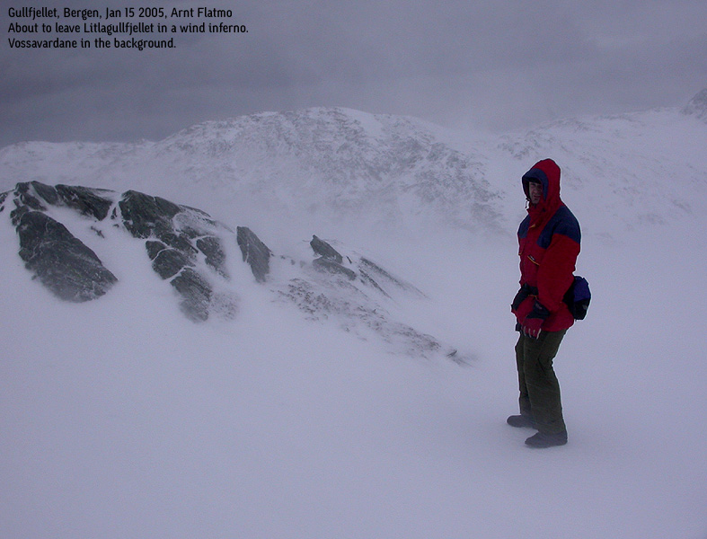
On top, we measured the wind-speed to be 26 m/s (storm) It felt like tiny icicles flew through the air, and it was almost impossible to look against the wind. Communicating with each other required close contact, face north and yelling. We decided to not go higher, because our eyes took a hard beating from the wind. It came hardly as any surprise that the mountain was not crowded this Saturday.
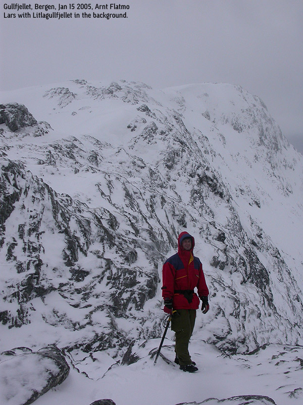
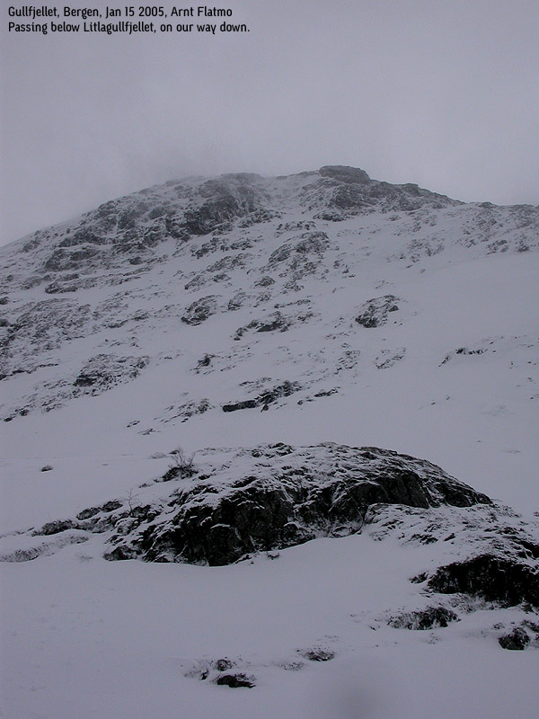
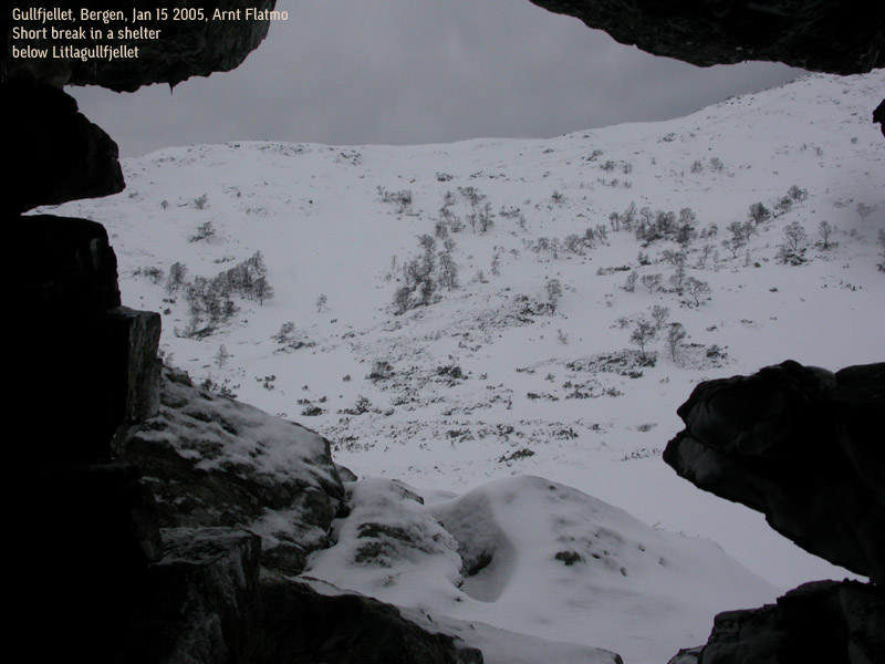
We descended via the normal route into Kinndalen, where we found a fun shelter below a big rock. This was just below Litlagullfjellet. Someone had put some rocks in place, and created a shelter from the wind. We squeezed into this shelter and treated ourselves with a hot drink.
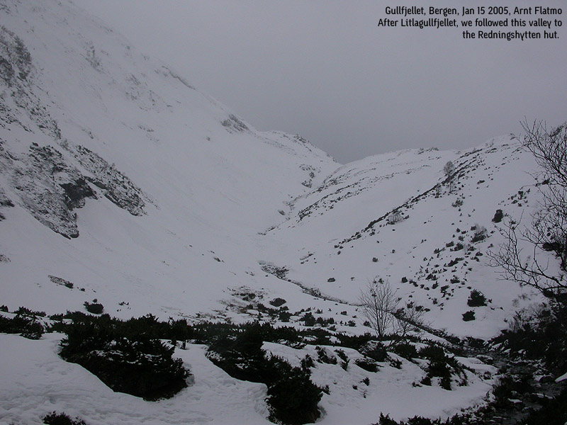
We walked along the base of Ronamanen towards Redningshytten. Redningshytten was not crowded. A couple left as we arrived, and one was inside the hut. After another hot drink, we followed the trade route back to lake Osavatnet. The total distance was 12Km and took 4,5 hours. All in all, a very nice walk. Just too bad that the wind prevented us from reaching the top of the mountain. This effort earned us another good movie, more beer and a taco dinner in the evening.


No Javascript
1 2 3 4 5 6 7 8 9 10 11 12 13 14 15
For more information on Gullfjellet, see the Gullfjellstoppen page.
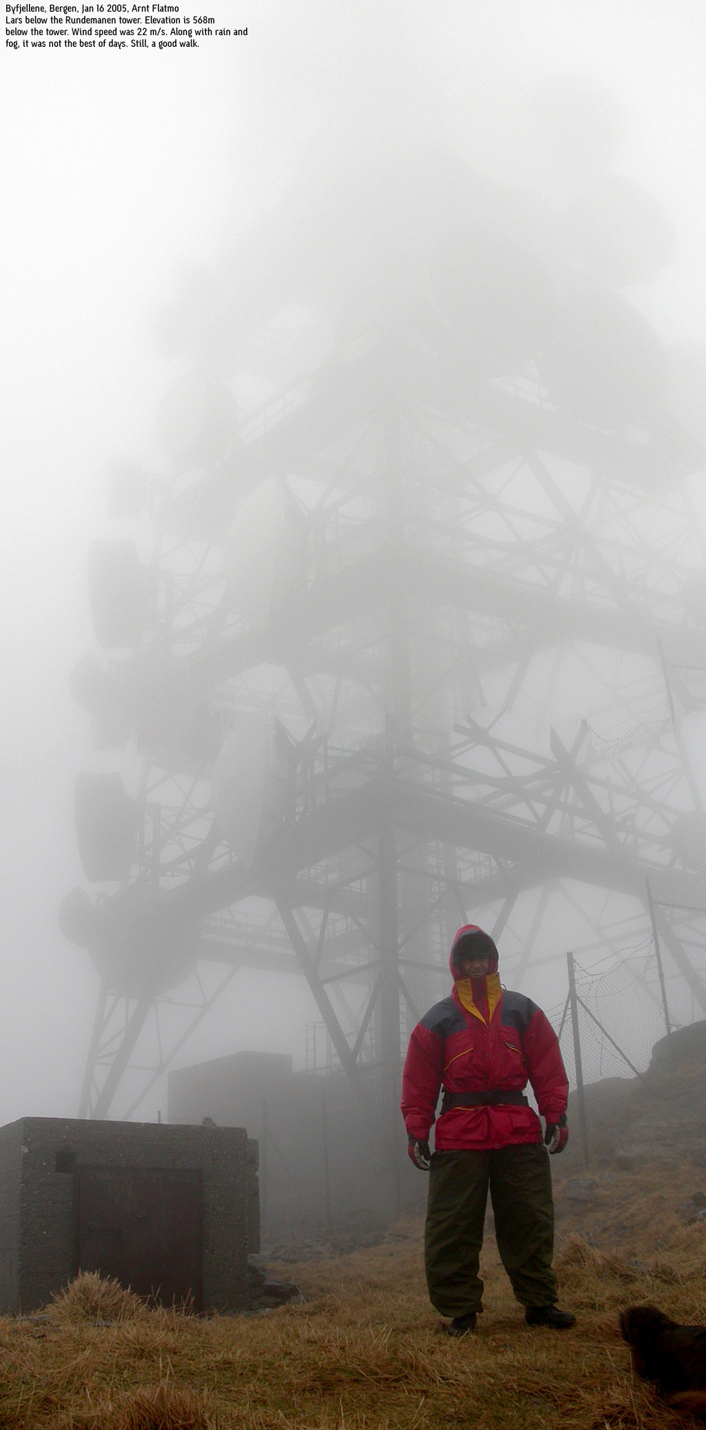
Presenting a beautiful sunny Bergen Sunday to Lars, was not just in the cards. Wind, fog and rain was the painted picture as we gazed out the window with sleepy eyes. Yesterday's taco dinner seemed still "alive", and we both felt for a stroll. We headed up the standard route from Svartediket dam towards Rundemanen.
The lower sections of the hillside were fairly crowded, but on the summit plateau, there were few living souls. Although I have been to Rundemanen several times, I still found comfort in the map. The fog was pretty thick. We measured the wind speed to 22 m/s. We were soaking wet and a bit cold. A hike across Vidden did not seem overwhelmingly important. Troll had held us company on this hike and walked the whole distance. Wet to the bone, He didn't seem very interested in extending this hike any longer than strictly necessary. We had hiked 11,5Km and decided to spend the evening playing backgammon and watching good movies. Perhaps there was a beer left in the fridge?


No Javascript:
For more information about Rundemanen, see the Rundemanen page.
Work day. I dropped Lars off at the Bergen aquarium while I went to work. Lars was flying out in the evening, but there was time for an afternoon walk. We got together after work and aggressively finished off a large pizza at Dolly Dimples, before we continued towards Løvstakken.
We headed up towards Løvstakken from Fredlundsvingen. It was the third time I walked this route, and it was the third time the fog covered the mountain. Still, with headlights, the route was easy to follow. We kept a steady pace upwards, and Lars uttered that Pepsi & pizza hardly could be called optimal food before fast hiking.
On top, the fog was indeed thick, and the visibility was limited to a few yards. We were on top 18:15PM, and the hike took approx. 40 minutes. Back home for a quick shower before dropping Lars off at the Flesland airport.


No Javascript:
For more information about Løvstakken, see the Løvstakken page.
 Other hordaland mountains
Other Bergen K. mountains
westcoastpeaks.com
Other hordaland mountains
Other Bergen K. mountains
westcoastpeaks.com