
Norwegian Mountains, Møre og RomsdalLidaveten, 592m (Steinnesviten)

Lidaveten seen from Liahornet
IntroductionLidaveten is a popular top, located on the Ørsta/Volda border just northeast of Ørsta. Strategically positioned where Voldafjorden, Ørstafjorden, Rovdefjorden and Vartdalsfjorden meet, Lidaveten was home to one of the many coastal "vetter" (wooden cairns, set on fire under enemy attack) during the Viking era. Apparently, wooden cairns were also used on top of Lidaveten as late as Kapertiden (1807-1814), when piracy was (sort of) legal in Denmark/Norway. To be more precise, the Ørsta/Volda border runs roughly 250m east of Lidaveten's summit. Although the mountain is shared between the two municipalities, the summit belongs to Volda. Lidaveten is normally hiked from the Eidem farm, southeast of Lidaveten. A path runs all the way to the top, which is marked by a characteristic cairn... 
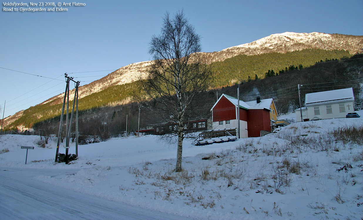
Lidaveten seen from the road to Eidem
While Lidaveten offers a nice walk in summer/autumn, the mountain does not offer nice skiing terrain in winter. Unless you like skiing in steep forests, you should perhaps visit Melshornet instead, 10km to the southeast. But the view is grand. All around. The route description describes a winter approach, but is also valid for summer.
Primary factor:Lidaveten (Norge 1:50,000: 592m, Økonomisk Kartverk (ØK): 592,03m, UTM 32 V 342641 6902151) has a primary factor of 444m towards the higher parent mountain Helgehornet (626m). The defining saddle (approx. UTM 32 V 343130 6900960) is found along the road, near Eidem. Ref. Økonomisk Kartverk map (5m contours), the saddle is within the range 150-155m, interpolated to 153m. GPS measurement on the summit (ground) read 586m, averaged over a 5-minute period (error margin +/- 3m).
Google map
Google's interactive map. You can zoom, pan and click on the markers.
Trail descriptions
|
|
Route 1: Berkvika - Lidaveten (all seasons)
|
|
Access
(all distances are approx. distances)
The nearest larger city is Ålesund. From Ålesund, you have two options:
a) Via Hareidlandet:
Follow highway E39 towards Bergen, and then RV61 towards Hareid. Take the Sulesund - Hareid ferry. From the roundabout in Hareid, follow RV61/RV653 and pass Ulsteinvik (11,1km), don't turn right towards Måløy/Fosnavåg (16,8km), enter Eiksundtunnelen tunnel and just after you exit this tunnel (33,4km), turn left. In the junction that immediately follows, turn left towards Steinnes/Berkneset. Drive 6,7km and find parking along the road when you see the Gjerdegarden (and Eidem) sign. A car road runs all the way up to Eidem, from where the forest path begins. This route description is based on parking down by the main road.
b) Via Festøya:
From Ålesund, follow highway E39 towards Bergen/Volda to the ferry at Solavågen. Take the ferry over to Festøy, turn right at Festøy and follow E39 towards Ørsta (38,3Km). In the highway RV655/E39 junction in Ørsta, follow E39 towards Volda. Near Hovden airport, turn right towards Ulsteinvik. Just before Eiksundtunnelen tunnel, turn right and then left towards Steinnes/Berkneset. Then follow instructions described in a) above.
The route

Route to Lidaveten
(Click for larger image)
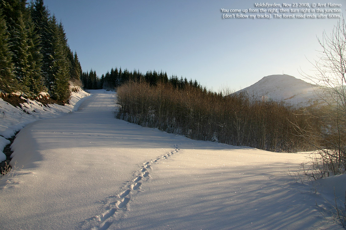
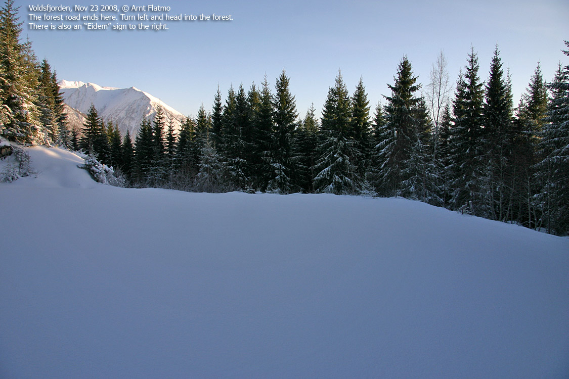
Follow the road to Eidem for 1km. Just after a sharp curve to the right, turn left and get onto a forest road heading northwest. You will see the "Veten" trail sign. Follow this forest road 500m to a junction, then turn right. Follow this forest road 600m until road end. Turn left and follow a path up the forest. The path takes you all the way up to Lidaveten summit, marked by a large cairn.
 westcoastpeaks.com
Other Møre & Romsdal mountains
Other Norwegian mountains
westcoastpeaks.com
Other Møre & Romsdal mountains
Other Norwegian mountains


