
Norwegian Mountains, Møre og RomsdalLeirvågfjellet, 254m (Høgefjellet)

Leirvågfjellet
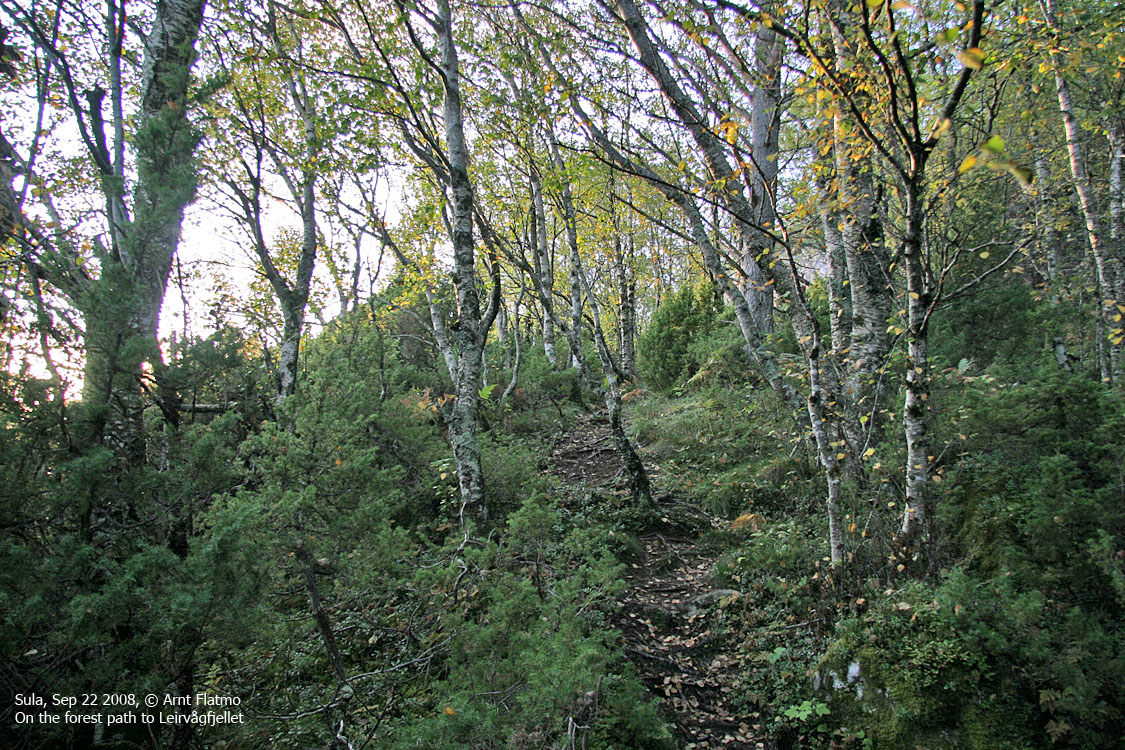
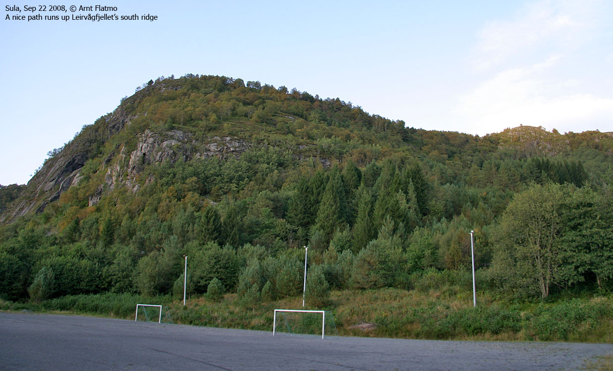
IntroductionDespite its modest height, Leirvågfjellet is an excellent viewpoint towards the famous Hjørundfjorden and the mountains that rise 1400-1500m up from this fjord. You have also a good view towards the western Haram mountains, while Blindheimsfjellet on Uksenøya obscures some of the northern views. Reaching the top is an easy walk on a good paths, some a bit boggy after rain. This page describes access from the Veibust and the Leirvåg side. The mountain is quite popular, and when you take the trip, you'll understand why.
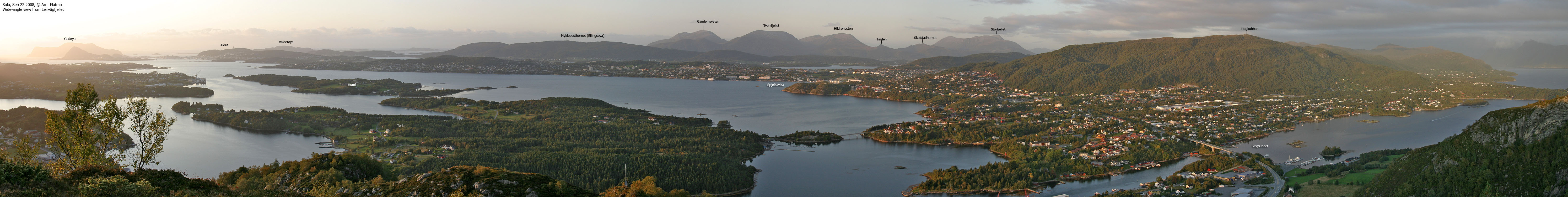
View from Leirvågfjellet
Primary factor:Leirvågfjellet (Norge 1:50,000: -, Økonomisk Kartverk: 254m, UTM 32 V 362421 6924287) has a primary factor of 231m towards the higher parent mountain Solavågsfjellet (263m). The defining saddle (approx. UTM 32 V 360829 6924435) is found below the Solavågen overpass (where the road to Solavågen passes above RV61). Ref. Økonomisk Kartverk (5m contours), the saddle is within the range 20-25m, interpolated to 23m. Note: Map point 251m is a trigonometric point, but it is not the highest point.
Google map
Google's interactive map. You can zoom, pan and click on the
markers.
Trail descriptions
These routes description were valid per Sep. 2008. All distances are approx. distances.
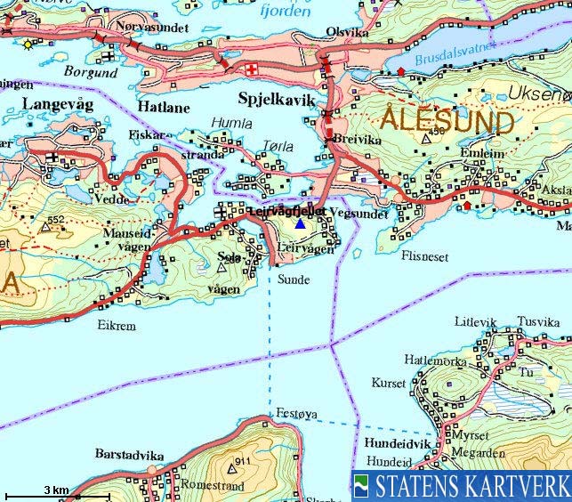
Access From Ålesund, follow highway E136->E39 towards Bergen. Approx 300m after you've passed the bridge across Vegsundet, turn right towards Veibust (signed). Follow the road as it runs under E39 (small tunnel) and then drive along the bay. Approx. 950m after you passed under E39, turn right when you arrive at the Valldal Trevarebutikk building. Follow the road 200m upwards (turn right in the first junction) and when you see the Torvmyrvegen sign, find a place to park. The route Head up the nearest road and locate the path which begins at road end. You will now cross most of Leirvågfjellet, heading westbound (sometimes southwest, sometimes northwest) on a path that may be boggy after rain. You will see crossing paths, but stay on the most worn path. When you reach a bog area (190m-200m elevation), stay true to the path, even if it seems to run in the wrong direction. The path will curve back around and lead you to the top. Note that point 251m (with a trig. point) is not the highest point. A 3m higher top is found approx. 100m further south on the summit plateau.
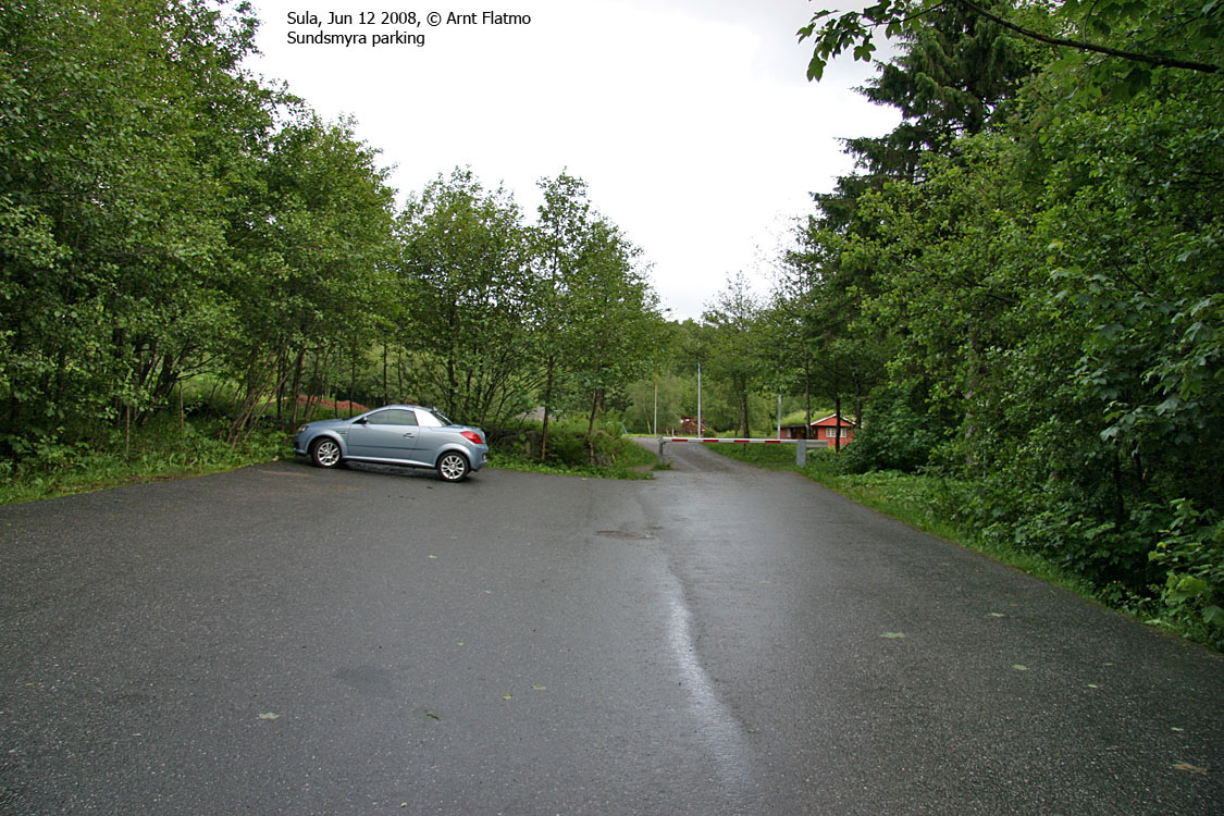
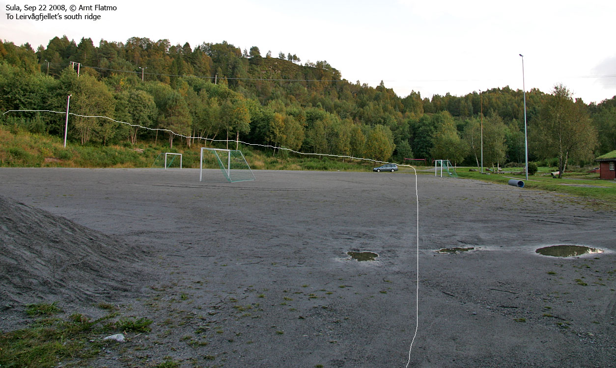
Access From Ålesund, follow highway E136->E39 towards Bergen. Approaching Solavågen, turn left towards Bergen and drive towards the Solavågen - Festøya ferry. After 750m, turn left towards Leirvågen (signed). Turn immediately left again, drive 80m and turn right onto Leirvågdalen road (signed Sundsmyra). Follow this road upwards (stay right in a 3-way junction after 200 meters) the parking at Sundsmyra sports field. The route 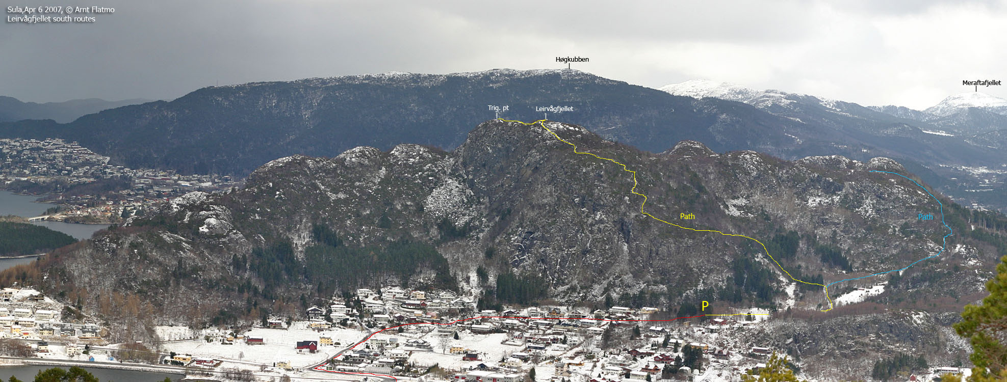
South ridge route
From the parking, cross the sports field, turn left onto a forest road and head into the forest. After approx. 100 meters, turn left (signposted "Leirvågfjellet"), cross a creek and follow the path that runs up the south ridge. Follow this path all the way to the high point. As an alternative descent route; head over to the trig. point (100m to the north). Follow the path to Veibust southeast 250m. Turn right in a fork and head southbound (the path you're on is more worn than the one towards Veibust). This path will take you back to the sports field. Per Sep. 2008, this roundtrip was partially marked with orange
markers in trees.
Pictures and Trip reports:
|
|
|


