
For Information, maps, trailhead and route descriptions, click HERE.
This Saturday wasn't the worst of days, in terms of the weather. But it was still a grey and rainy day all around. So what to do? What to do? ...
I find that if it rains for a long period of time, I stop caring about it. So I packed my gear, grabbed the dog and went for the ferry to Sykkylven. Just like 5 days earlier, I was standing on the ferry, wondering where to go. The clouds weren't low (yet), so when I noticed Blåtinden and Lafjellet, I decided to go there.
I was on my way to Fjellsetra without any knowledge about the route or the mountains. But it seemed obvious that I should hike up Sunndalen, and so I found a gravel road leading up to some cabins, a bit higher than the road to Fjellsetra. Nobody was home, so I figured it would be OK to leave the car next to a cabin. I put my dog (Troll) in the backpack, and off we went, 11:23AM.
To Lafjellet
The meadow towards Sunndalen was boggy and wet, but as my direct contact with bush was limited, I was quite happy. On my way upwards, I decided to follow Lafjellet's east ridge and perhaps make a roundtrip of it. The direct route towards this ridge meant bush contact, so I treated myself with a small detour.
From distance, it seemed that getting onto the ridge could be a steep and slippery experience. But it wasn't. Looks were just deceiving. The last month's virus attack had severly reduced my physical condition, and I was grasping for air every now and then. Carrying a dog didn't make the hike easier. But then I managed to focus on the upsides. It had stopped raining and there was actually a few rays of sunshine. Furthermore, my two targets for the day were free of fog.
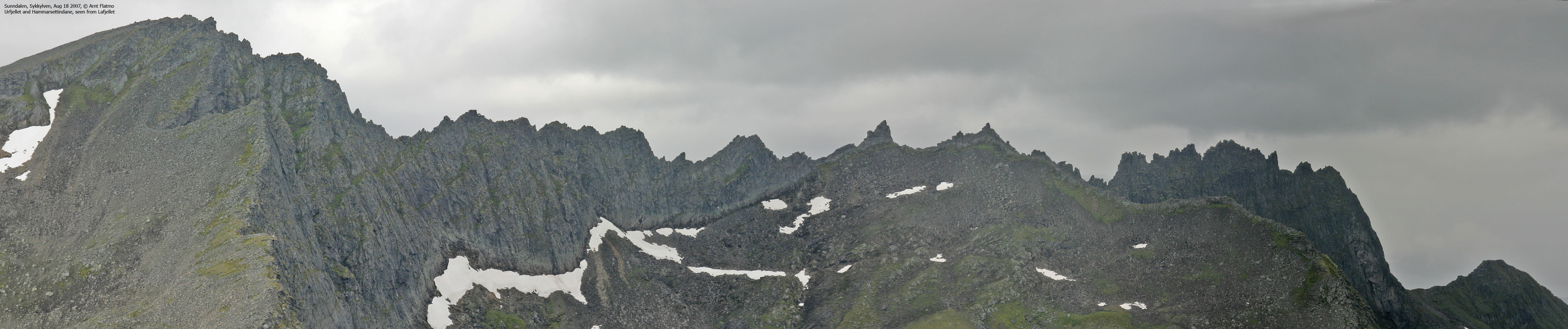
Speaking of fog, a white foggy monster was squeezing its way up Sunndalen (from the north) and crawled up Langfjella and Sætrefjellet, meter by meter. I got the urge to move on, getting to the top before the fog did. The fog was beautiful, though. I kept on staring at it.
I reached Lafjellet summit 12:50PM. From the old trig. point at the center of the summit plateau, I went directly to the cairn. This was obviously the high point. At the cairn, I changed my mind. The trig. point HAD to be the high point. And I never figured it out. The GPS told me that both points were 1165m, 4m higher than the map height. After a short stop for pictures, I moved on.
To Blåtinden
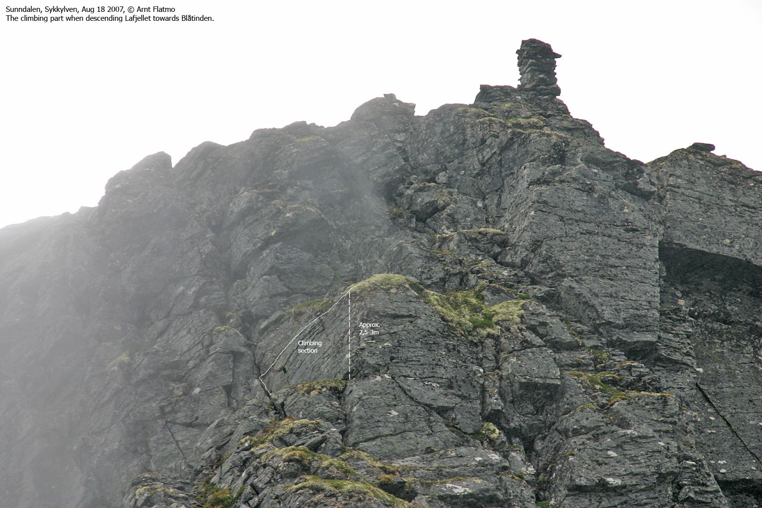
Blåtinden summit was still visible. The fog had reduced its speed and was still working its way up Langfjella. On my way to Lafjellet, the ridge between the two tops looked like nothing at all and I got myself a small, pleasant "surprise" when I noticed the steep descent route from Lafjellet. The route was easy in the beginning. Then there was a 2,5-3m cliff that called for some clever manoeuvres:
First, I left the dog and climbed down a very slippery, but short ledge. That was easy enough. So I went back up, took the dog out of the backpack (climbing with him on the back wasn't doable), positioned him at the top of the ledge. Then I laid down on the ledge with my foot against the mountain, only to find that I couldn't reach him. Come here, I told him. The wise ass immediately went looking for a better route.
So I climbed back up and put him back into position before climbing back down. This time I repeated the come here instruction with a much firmer voice. That helped. As expected, the ledge was too slippery for him to get a grip, so he sailed a short pitch before I got hold of him.
There I was, laying on this ledge with my left hand around the dog's neck, my right hand in a crack behind my back and my right foot against a small rock that kept me from sliding further down. "This is awkward", I remember thinking before figuring out the right moves in order to get the dog down. Afterwards, I went back up to get my backpack. Back down, I somewhat felt that I knew this obstacle quite well by now.
The rest of the descent was trivial, and so was the hike up to Blåtinden. We arrived the (only) high point 13:20PM. My luck never seemed to end. The fog was now on its way to point 1118m, which meant that I would be able to get down from Blåtinden before the fog hit the mountain.
Descent, via point 1118m
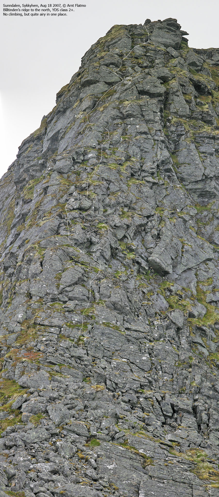
The descent from Blåtinden was less cumbersome, but more steep and airy than down from Lafjellet. The "crux" of this route was a slab that headed towards the eastern face, but the slab had an edge, making it possible to walk the edge with great caution. I found this passage interesting, but I won't blame those who decided to turn around at this point.
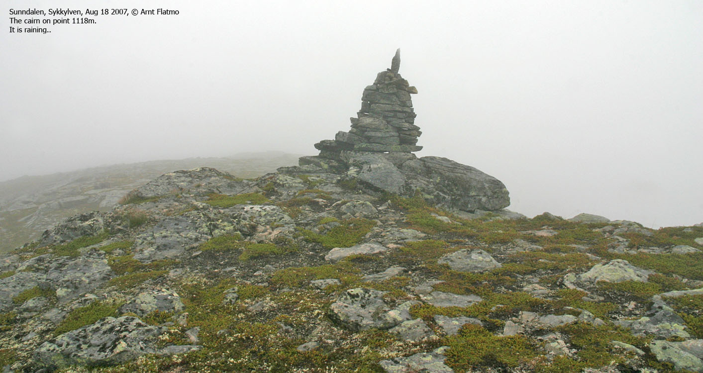
The fog came as I reached the cairn on point 1118m, 13:45PM. The fog was still "light", and I could see my descent route well from up here. We passed a snow field, taking the time to let the dog "play a little while" before moving on. The descent into Sunndalen and the return to the trailhead was uneventful and we reached the car 14:37PM. The roundtrip had taken just a little more than 3 hours, and it had been far more interesting than I had expected.
To Lafjellet


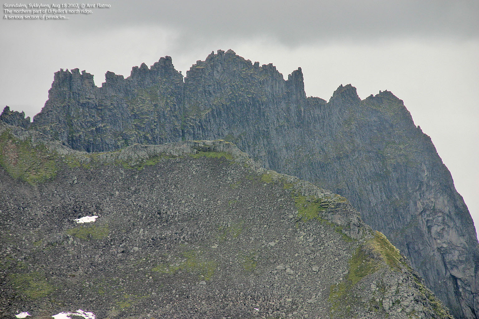
Views from Lafjellet


To Blåtinden


Views from Blåtinden


Descent from Blåtinden


Point 1118m and descent


No Javascript:
1 2 3 4 5 6 7 8 9 10 11 12 13 14 15 16 17 18 19 20 21 22 23 24 25 26 27 28 29 30 31
 westcoastpeaks.com
Other Møre & Romsdal mountains
Other Norwegian mountains
westcoastpeaks.com
Other Møre & Romsdal mountains
Other Norwegian mountains