
|

Passing below Kula(No Javascript) |
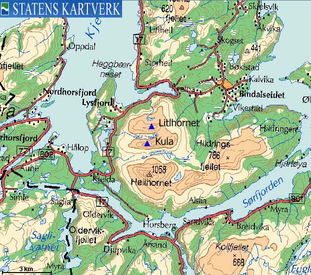
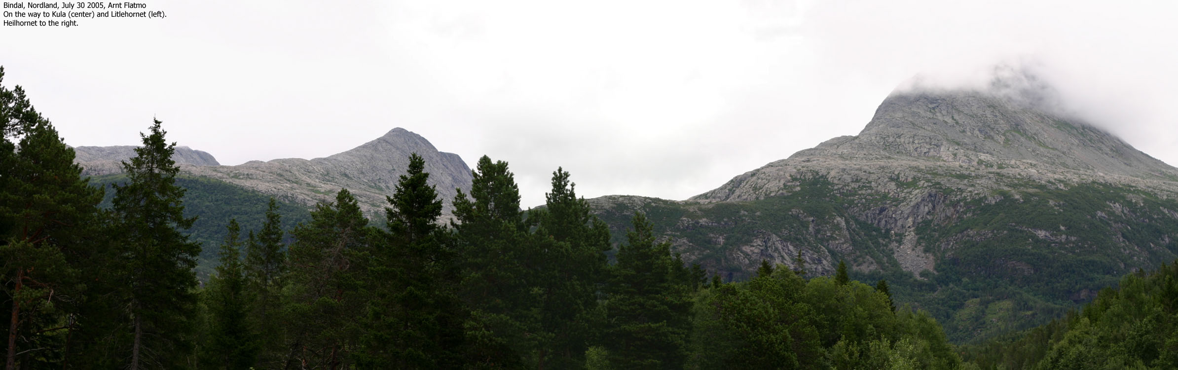
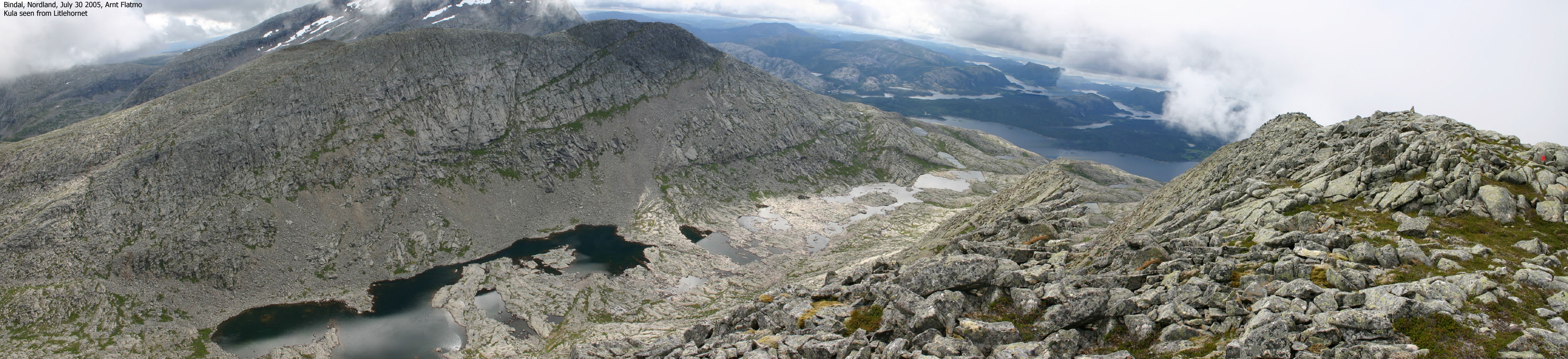
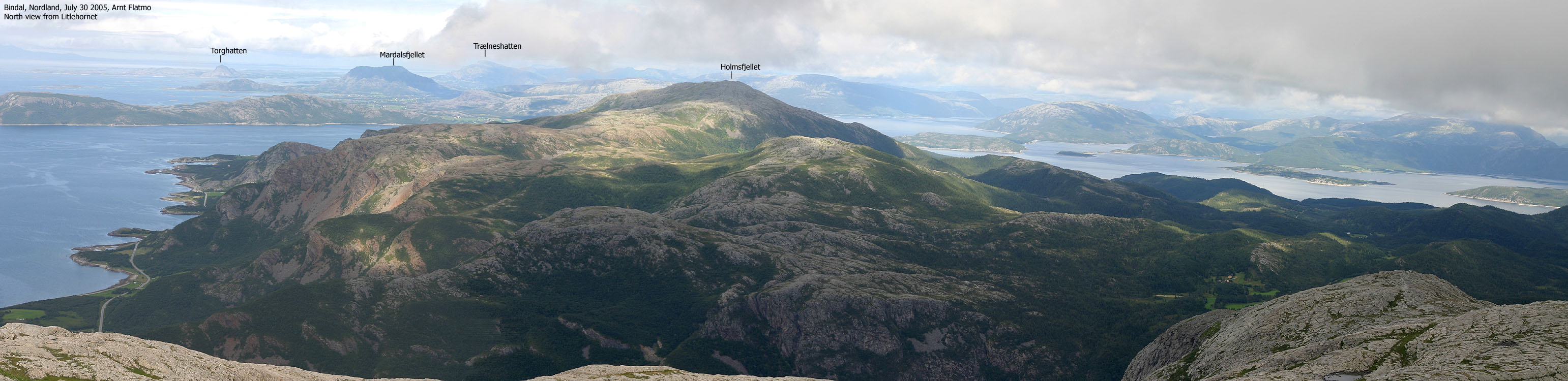
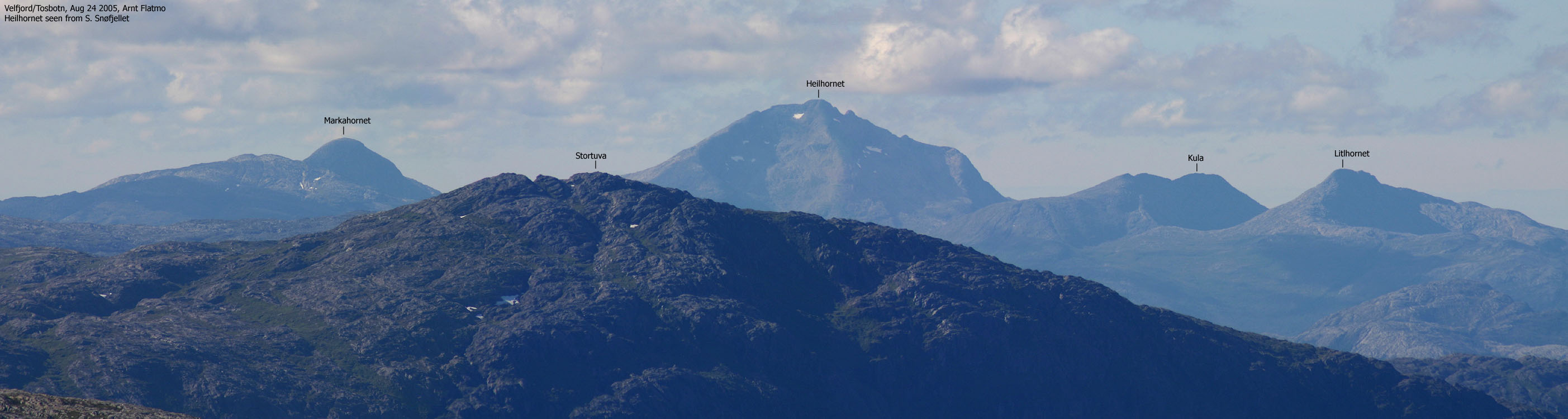
I'm not sure what "Kula" exactly means and how it translates. My first thought is "the bullet", and the mountain indeed looks like a bullet from various angles. Kula certainly joins the group of highly characteristic mountains on the Helgeland (part of Nordland county) coastline. "Litlhornet" ("Little horn") obviously relates to the greater Heilhornet, which completely dominate the surrounding neighbours. This also includes the distinct Markahornet (856m), which I haven't visited yet.
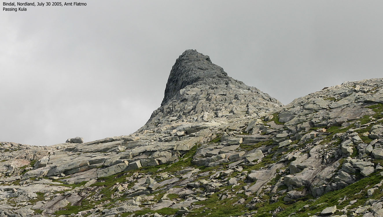
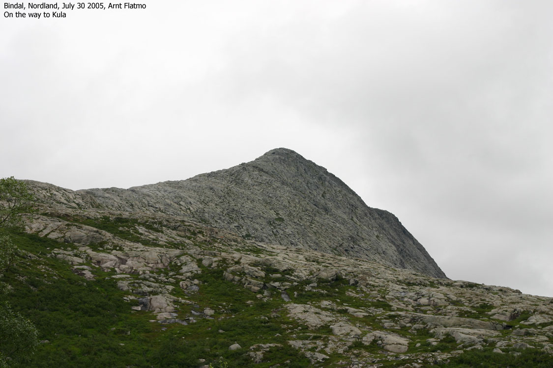
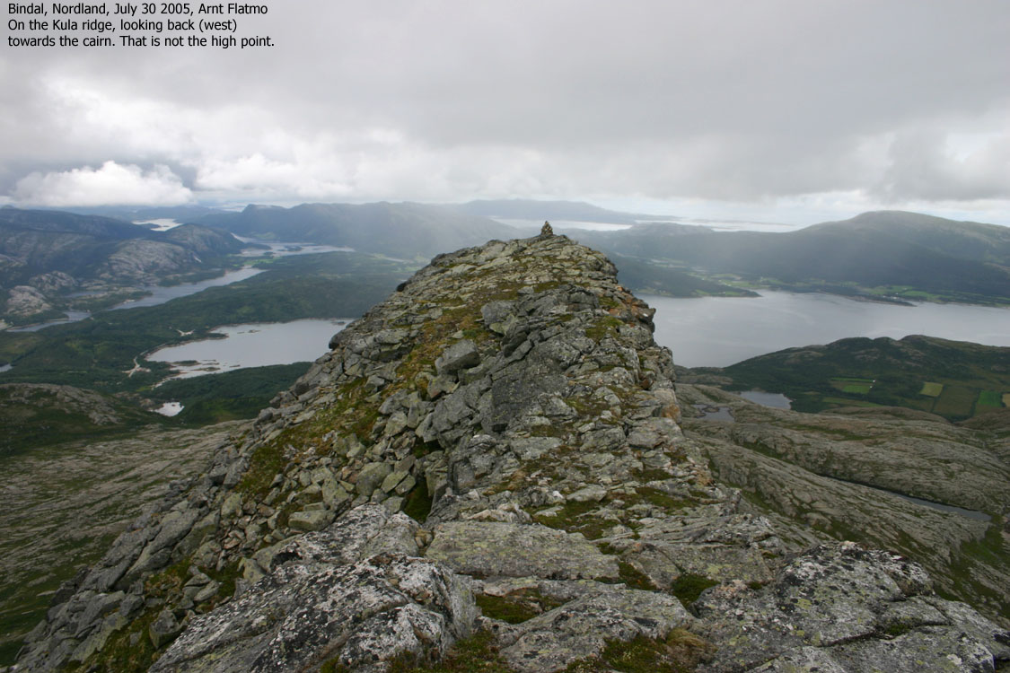
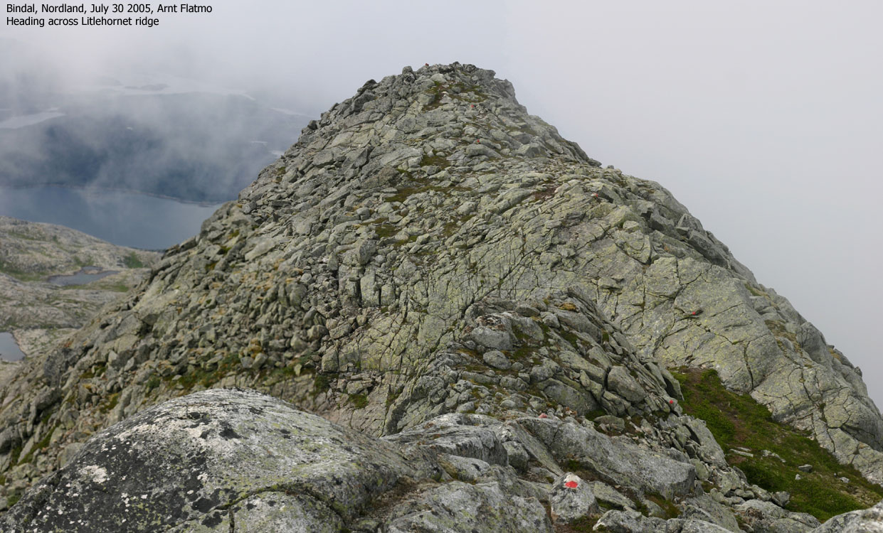
At first glance, there is nothing extraordinary with these two mountains. They are both popular and a T-trail guide you safely up and down Litlhornet in case of fog. But when you get on top of the Kula ridge, a 500+ meter long, spectacular narrow and airy ridge appears in front of you. My guess is that few attempt to traverse this ridge, although the ridge is not technically difficult.
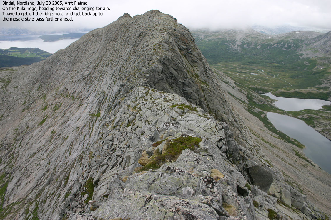
A few places, only a couple of rocks separates Kula's east and west side. In addition, at one point you have to climb off the ridge and get back on it a few meters ahead. Hikers that are comfortable with airy terrain may not find this ridge very challenging, but it is nevertheless a very fun ridgewalk!
On this web-page, I have described a round trip route across Kula and Litlhornet. Priority no. 1 in this area is of course Heilhornet. If you have the time and energy, try to include the Kula ridge as well.
Kula (M711: -, Ø.K: -, Norgesglasset: 778m) has a primary factor of 239m towards the higher Litlhornet (797m) The saddle is found between the two mountains, east of the Tjørnan lakes. Ref. the 1725-II map (20m contours), you cross the 540m contours on the high route, but not 520m. The saddle height has been interpolated to 539m because the 540m contours are quite close, and the pass nearly flat.
Comments:
I have to admit that I really don't know where the high point on this ridge is. On my way across, I could swear that the far point on the ridge was the high point. Once there, and looking back, it looked like the high point was early on the ridge. The maps are not helpful either. The 2003 edition show point 770m east of the lowest point on the ridge. Norgesglasset show the same, but also shows point 778m west of the low point. The Garmin GPS map show only contours, no heights. My GPS track profile (which I'm not sure is reliable because I'm continously moving) shows up to 792m east of the low point. However, I chose 778m from Norgesglasset. The main point is that I'm just not sure, although I *think* the high point is west of the low point.
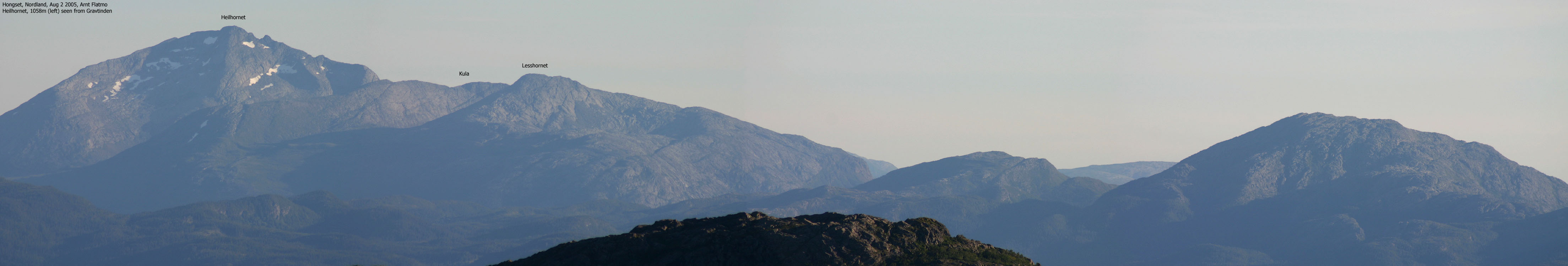
Litlhornet (M711: 797m, Ø.K: -) has a primary factor of 407m towards the higher Heilhornet (1058m). The saddle is found between Kula and Heilhornet, west of Lake Amundstjørna. Ref. the 1725-II map (20m contours), you cross the 400m contours on the high route, but not 380m. The saddle height has been interpolated to 390m. The general terrain has been taken into consideration here.
Comments:
Norgesglasset show 799m as the height. My GPS reading is 795m, which is lower than the map heights. I have chosen to stick with the 1725-II height.
Notes: Class ratings are in reference to YDS. Click here for more information.
The trails described below are not necessarily the *easiest* trails to this mountain.
|
Jordalen - all tops round trip (summer/autumn)
|
|
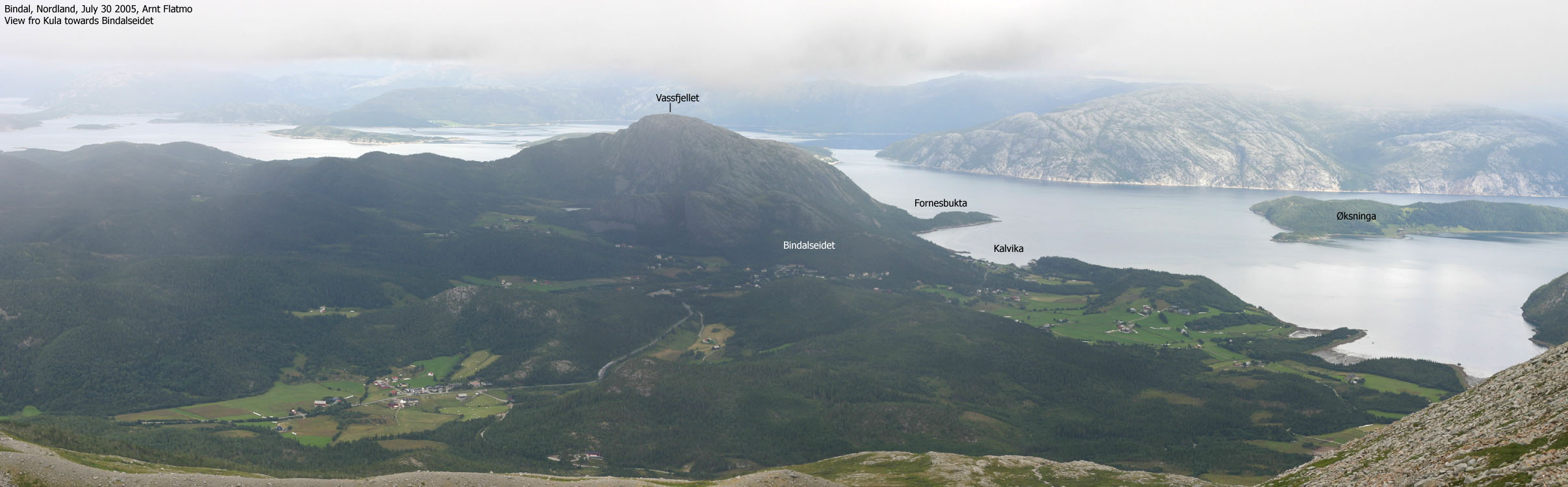
From Trondheim, follow highway E6 northbound. At Gartland, north of Grong and south of Harran, exit onto highway 775 towards Brønnøysund. At Høylandet, follow highway 17 northbound. Cross the Nordland/ Sør-Trøndelag border north of Foldereid and locate Heilhornet Gjestgiveri on the left-hand side of the road after passing Årsand. Approx. 1,5Km after Heilhornet Gjestgiveri, locate parking on the left-hand side of the road. A red arrow is pointing towards the trail, next to a stream on the right-hand side of the road. If you arrive from the north via ferry, the trailhead is approx. 17,3Km from Holm.
Follow the "T" marked (red paint) trail left of a small stream opposite the parking. The trail climbs steep up to a birch forest. The trail is visible and easy to follow. Parts of this route can be wet and muddy. The trail then climbs towards a crossing ridge that connects Kula and Heilhornet. The trail forks on this ridge, and the trail towards "Lesshornet" runs to the left.
Kula
Go left and follow "Lesshornet" trail until you have the distinct Kula ridge up to your right. Head up this ridge towards a cairn that marks the west end of the ridge. The ridge is quite easy to follow, but the boulder gets bigger and the ridge more narrow, the higher up you go.
A fascinating, and perhaps intimidating ridge appears in front of you. You walk safely most of the way, but in a couple of places the ridge is extremely narrow. Head for heights is needed here.
The lowest point on the ridge is located on the middle of the ridge. Upon descent to this point, you will need to descend (to your right) the top of the ridge and get back on a few meters ahead. A large rock that has broken off will come in useful as you scramble off the ridge. Get back on the ridge where the rock has mosaic pattern. Everything is quite obvious as you go along.
Down at the lowest point, you will need to bypass the narrow ridge on the left-hand side. Step careful from turf to turf here. This is an airy spot, but less challenging than the previous obstacle.
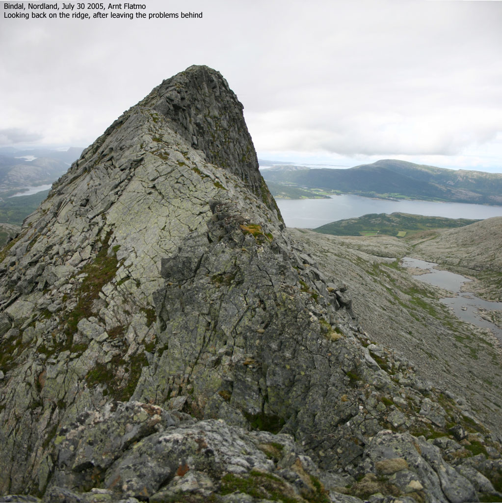
The rest of the route is trivial, compared to what you have been across. Make sure to figure out where the high point is, and send me an email :)
With snow or ice, axe and crampons are mandatory for traversing Kula.
Litlhornet
From the eastern top on Kula, follow the main ridge approx. 300m and begin the descent towards the northeast. I recommend that you begin the descent when you see the entire route down to the Kula - Litlhornet saddle.
The route up to Litlhornet is straightforward; head upwards and find ways around the numerous cliffbands. Move gradually towards the right so you'll end up on Litlhornet's east ridge. The high point (cairn) is located on Litlhornet's east side. Follow the "T" trail down Litlhornet and back to the trailhead.
16,5 hours had passed since I came down from Vetlafjellet in the Voss region, on my way to Brønnøysund (northern Norway). Along the way across Sognefjellet, I took these late evening pictures. I had been driving most of the night, and now I was passing Heilhornet, a mountain in Bindal which Petter and I visited back in September 2003. Heilhornet has two lower neighbours - Litlhornet and Kula, and all of these mountains share the same trailhead. As I already knew this trailhead, I decided to visit at least one of the mountains. I didn't bother to bring out the map. The mountains looked easy when viewed from Heilhornet. There should be no problems.
My small dachshund "Troll" and I left the Heilhornet trailhead 11:30AM. It was a nice day. Some local fog was burning off the top of Heilhornet, but Kula had no fog at all. From what I could see, this would be an easy walk. Just follow the ridge to the top. I carried Troll up through the forest, but let him out at the Litlhornet/Heilhornet trail fork. There were T-trails to both Litlhornet and Heilhornet. I expected there to be a T-trail to Kula as well, but there wasn't.
I wanted to see if Troll could walk all the way up to Kula summit, and he almost did. I chose to carry him just before the (first) top, because the high part of the ridge was a bit too awkward for him. Besides, the ridge had turned quite narrow, and there wasn't much room for a dog wandering about.
When I reached the cairn at 12:45PM, my heart skipped at least two beats. Ahead of me was a long ridge, almost a kilometer, obviously narrow and spooky in places. Instantly, I expected similar passages that Heilhornet has to offer. The original plan had been to traverse Kula and come back over Litlhornet. I wanted to stick to the plan and decided to give the ridge a try. With the dog firmly secured in the backpack.
It didn't take long before the ridge got very narrow and required focus. I was absolutely certain that the top was at the far end of the ridge, but may have passed the high point early without realising this. The main problem was halfway along the ridge, near a saddle that marks the lowest point on the ridge. It was simply not doable to follow the top of the ridge here (unless roped). With a dog in my top-heavy backpack, I felt the adrenaline pump. The solution to the problem was quite obvious. Get off the ridge and bypass the problem on the right-hand side.
I left the dog and the backpack while scrambling down a short section. Technically very easy, but indeed airy. By the looks of the eyes of the dog, he felt so too. We were soon back on the ridge, heading down to the lowest point on the ridge. Passing this point also required focus. I had to bypass the top of the ridge, this time on the left-hand side. Once back on safer ground, I continued up to what I thought was the summit, only to discover that it probably wasn't. I must have passed the summit long before the saddle.
The descent was trivial. I followed boulder down to the Litlhornet-Kula saddle and decided to hit Litlhornet straight on - rather than getting up on Litlhornet's east ridge. This was big rock terrain, but with sufficient passages to the levels above. 13:55PM, I was standing on the top of Litlhornet.
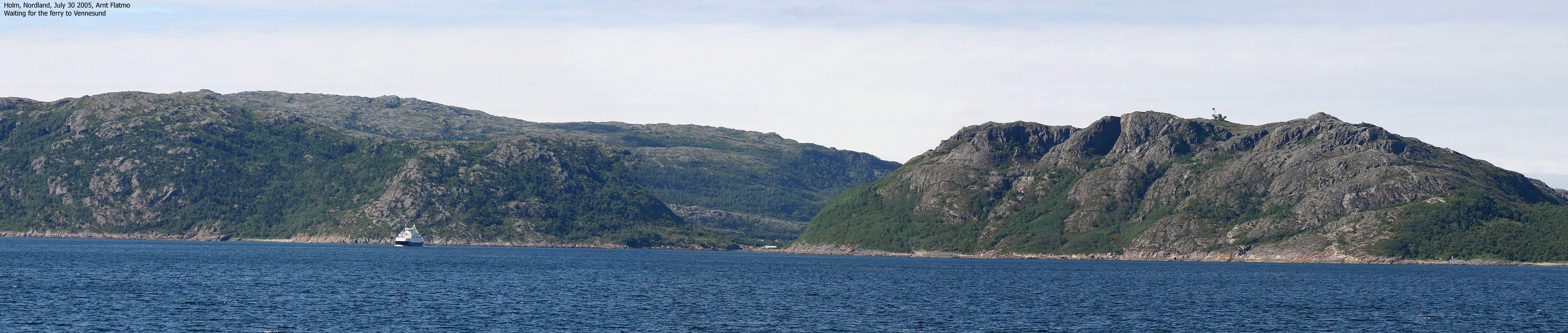
As I could see the T-trail, I expected the ridge to be easy (which it was). I let Troll out of the backpack when we reached the Litlhornet-Heilhornet trail fork and we were back at the car 14:55PM. We then took the Holm-Vennesund ferry and aimed for our destination, where Troll would spend his "summer vacation" while I roamed around, visiting cool mountains.
Move cursor to read notes, and click on the images to see full version.
Some of the thumbnails may have been cropped to fit the format.
To Kula


Traversing Kula


Litlhornet


Holm


No Javascript:
1 2 3 4 5 6 7 8 9 10 11 12 13 14 15 16 17 18 19 20 21 22 23 24 25 26 27 28 29 30 31 32


No Javascript:
Other hordaland mountains
 Other Norwegian mountains
westcoastpeaks.com
Other Norwegian mountains
westcoastpeaks.com

