
Norwegian Mountains, Møre og RomsdalBispen, 1462m
|
| Fylke/Kommune : | Møre og Romsdal/Rauma | ||||||
| Maps : | 1319-IV Valldal (Statens Kartverk, Norge 1:50 000) | ||||||
| Primary factor : |
Kongen: 464m Bispen: 332m |
||||||
| Hiked : | June 2008 | ||||||
| See also : |
| ||||||
| See also : | Other Rauma mountains |
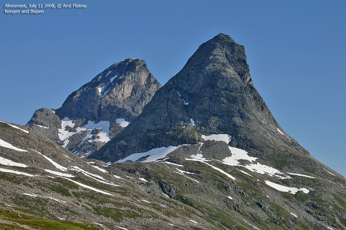
Bispen and Kongen
(Click for larger image)
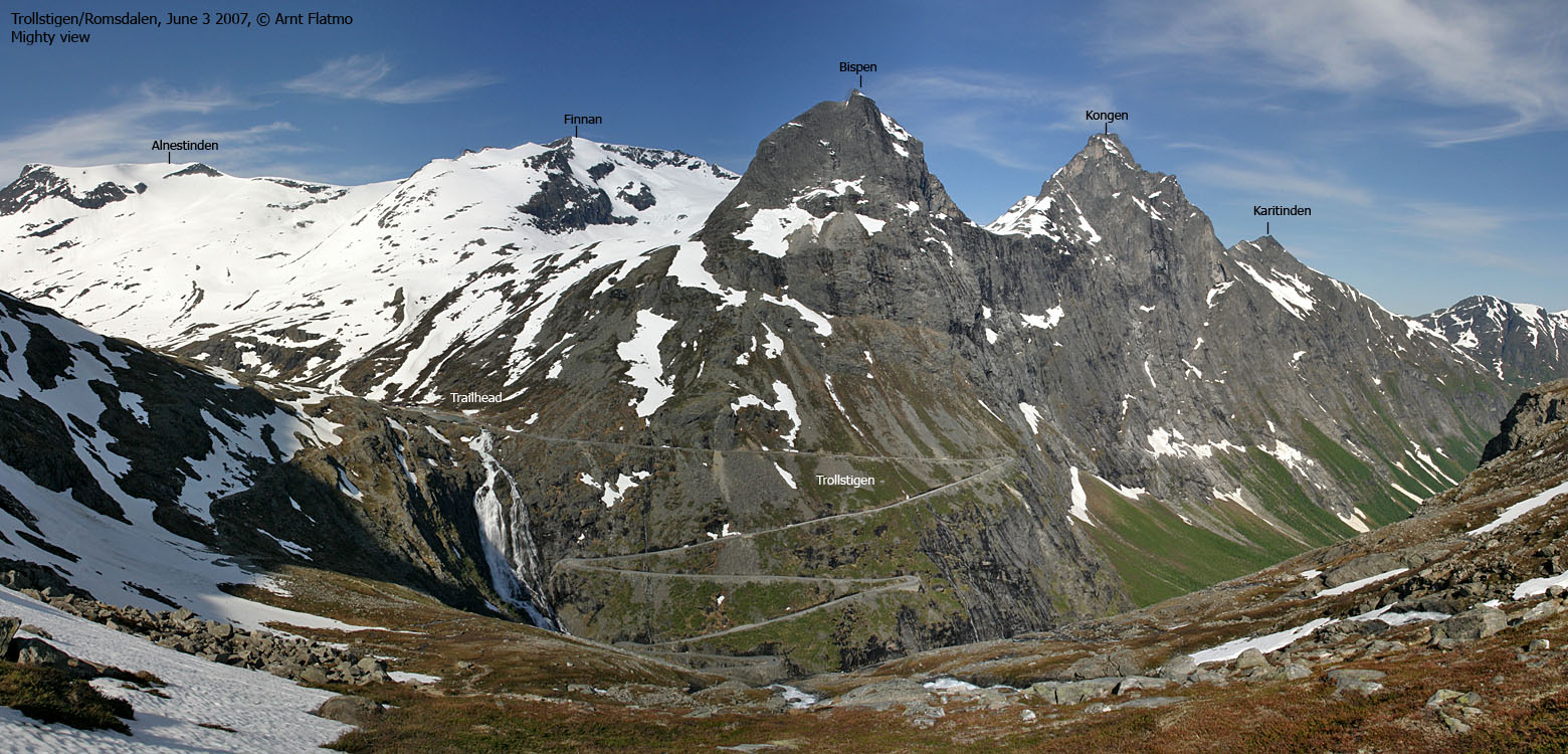
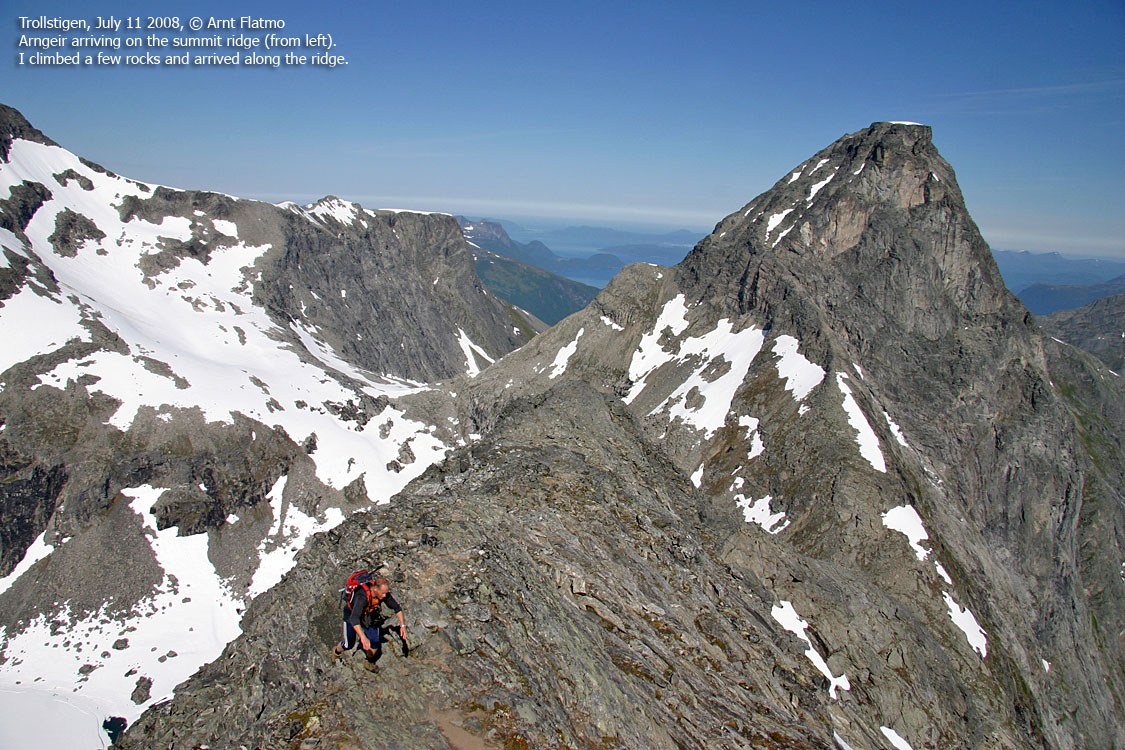
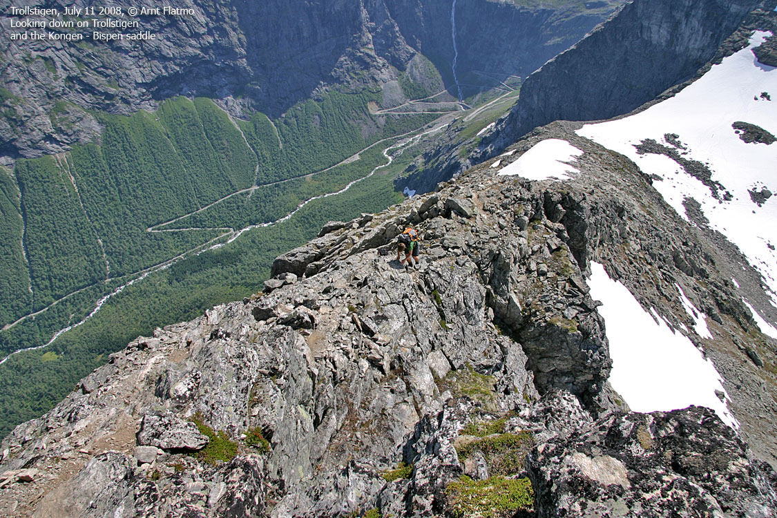
Kongen (The King) and Bispen (The Bishop) rise steep above the famous Trollstigen road and Isterdalen valley. And yes, there is Dronninga (The Queen) too, located just north of Kongen. These mountains attracks climbers, hikers and basejumpers. The prime hiking season is July through September, and you don't have to be a mountain climber to reach the summits. However, a good portion of mountain experience will be useful. Unfortunately, loose rocks make the peaks (and Bispen in particular) extremely dangerous. If you have hikers below you, move "on your toes" or try to scramble on solid rock instead.
The normal routes to the two tops begin in the Bispen - Kongen saddle. The route to Bispen is mostly cairned, and a vague path can be followed. The route to Kongen is partly cairned, and has a couple of strategically marks painted in red. The two peaks are roughly equally easy (or difficult). The route to Kongen is easier to understand and follow (once you're on your way) but the hardest point on the route is slightly more difficult than anything you will find on the easiest route on Bispen. Thus, this site considers the route to Bispen to be YDS class 3, while the route to Kongen is YDS class 4. This may be argued, as some consider Kongen to be an easier scramble than Bispen. Do note that when the optimal route on Bispen is not followed, you can run into several YDS class 4 pitches.
Bispen and Kongen
(Click for larger image)
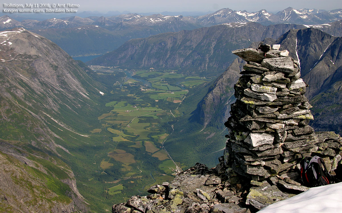
Kongen (Norge 1:50,000: -, Økonomisk Kartverk: -, Garmin GPS Map: 1614m, UTM 32 V 429801 6927584) has a primary factor of 464m towards the higher parent mountain Finnan (1786m). The defining saddle (approx. UTM 32 V 429238 6927117) is found between the two tops, north of Bispevatnet. Ref. Norge 1:50,000 (20m contours), the saddle is within the range 1140-1160m, interpolated to 1150m.
GPS measurement on Kongen read 1616m (0,8m error margin), as average over 10 minutes on top of the summit cairn (2m high).
Bispen (Norge 1:50,000: 1462m, Økonomisk Kartverk: -, UTM 32 V 430362 6926373) has a primary factor of 332m towards the higher parent mountain Kongen (1614m). The defining saddle (approx. UTM 32 V 430157 6926900) is found between the two tops. Ref. Norge 1:50,000 (20m contours), the saddle is within the range 1120-1140m, interpolated to 1130m.
GPS measurement on Bispen read 1469m (0,8m error margin), as average over 10 minutes on top of the summit cairn (1,5m high). A waypoint in the Bispen-Kongen saddle reported 1133m, with 5m error margin. This waypoint was only sampled over a 2-minute period.
Google's interactive map. You can zoom, pan and click on the markers.
|
|
|
Notes: Class ratings are in reference to YDS. Click here for more information.
The trails described below are not necessarily the *easiest* trails to this mountain.
|
Route 1: Trollstigen - Bispen (summer)
|
|
Access
(all distances are approx. distances)
Note: The Trollstigen road is open between late spring and late autumn. Check this link for road info.
From Ålesund, you can drive to Trollstigen via E136 to Åndalsnes, then southbound to the RV63 Trollstigen junction and then up the Isterdalen valley.
Or; follow E39 to Sjøholt (29Km from Breivika), turn right towards "Stordal/Geiranger" and continue along Norddalsfjorden on RV63 to the place Valldal (Sylte) (45Km). Turn north and follow RV63 to the top of Valldalen (Alnesreset) and then down to the parking above the Trollstigen switchbacks (34,5Km).
The route

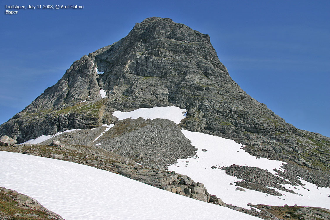
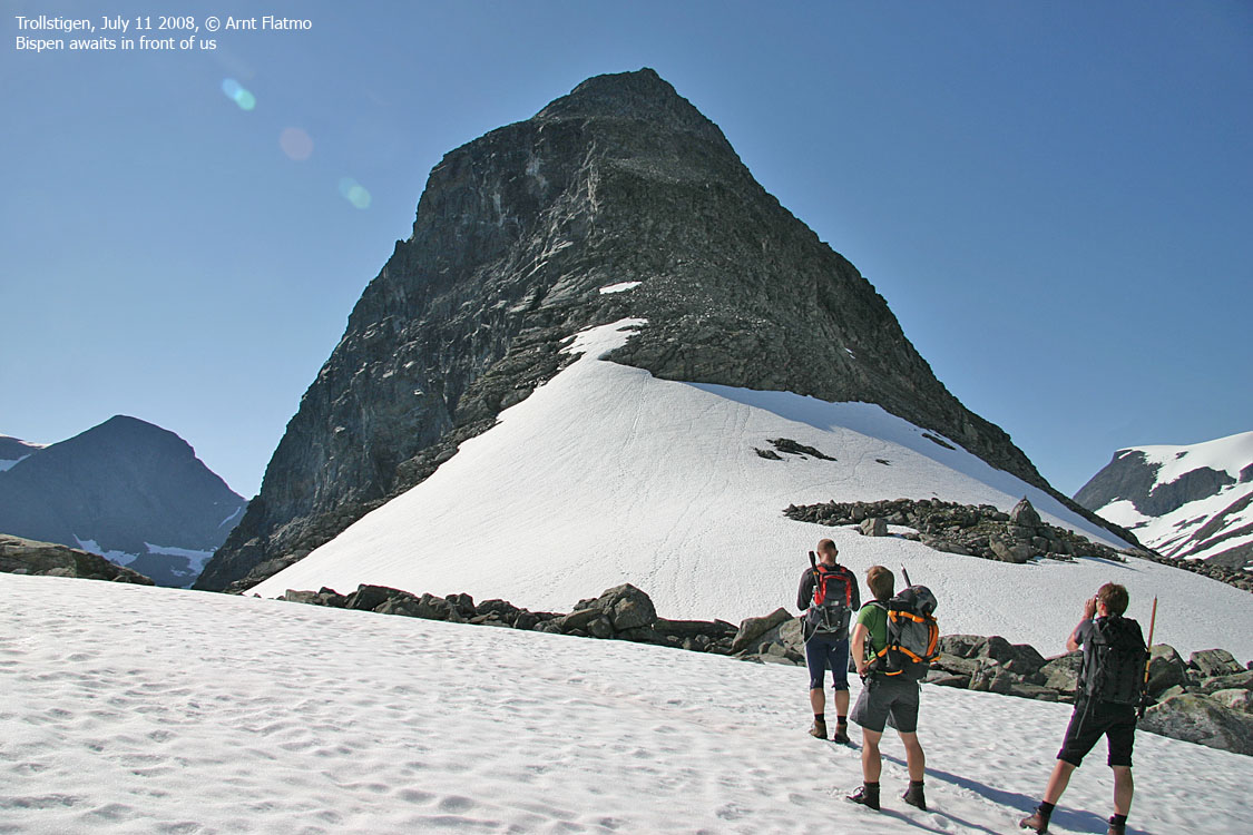
The route up Bispen
(Click for larger image)
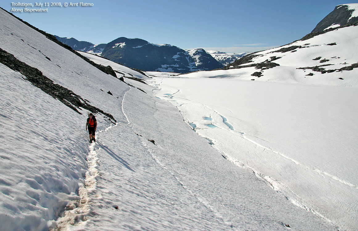
From the parking, walk along a small lake, towards the stream coming from Lake Bispevatnet. Follow the path upwards, close to the stream. Pass Bispen and enjoy the view towards this fine peak. Walk along Bispevatnet and turn north/northeast when you're halfway past the lake. Head up to the Bispen - Kongen saddle, where Bispen rise high and steep above you.
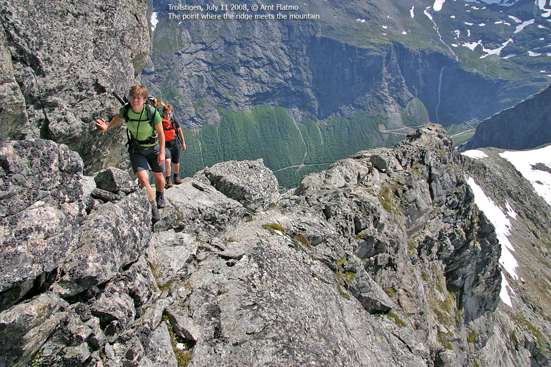
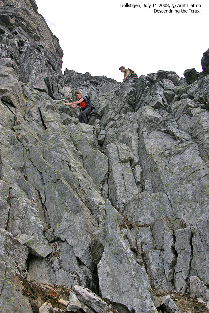
The route upwards is mostly cairned and you'll be able to follow the path in most places. Just before the summit ridge, the route runs down on the right-hand side, until you top out on the ridge close to the summit cairn. This upper route has one point which some might consider exposed. Bispen summit is marked by a proper cairn.
Note that the steep sections offer various options for ascent/descent. It is very easy, at least upon descent, to end up in terrain that is much steeper than you ascended. So be mindful about the route. Upon your first visit, consider not ascending in fog! Especially if you're alone. The most important thing to remember is not to cause rockfall. On large parts of the mountain, a flying rock will end up on or near the path below you. The path is treacherous, as the wear and tear dig out rocks from below. If possible, scrambling on solid rock next to the path is a better alternative.
|
Route 2: Trollstigen - Kongen (summer)
|
|
Access
Same as for Bispen above.
The route

The route up Kongen
(Click for larger image)
Head to the Bispen - Kongen saddle, as described for Bispen above.
Continue up the southeast ridge, which (amazingly enough) isn't directly exposed. The ridge leads you into the south face. Once in, you'll notice two gullies up to your left. Head up the left-hand side of the second gully (counting from you). A rock with red paint indicates the (obvious) direction.
When the ridge and the gully ends in a steep wall, turn right, cross the gully and scramble up to a ridge that connects to another gully (not the first) Getting from the one gully to the other is the crux of the route. It is fairly simple scrambling, but it's a bit steep, so be careful upon descent. Once into the other gully, proceed up to the summit, which is marked by a proper cairn. There is also a viewpoint cairn on your right-hand side as you enter the summit plateau.
There seems to be another route going up the southwest ridge, starting in the Finnan - Kongen saddle. If you're into scrambling you may consider this route instead, and descend the route described above.
 westcoastpeaks.com
Other Møre & Romsdal mountains
Other Norwegian mountains
westcoastpeaks.com
Other Møre & Romsdal mountains
Other Norwegian mountains


