
|

Kaldafjellet above Reimegrend(No Javascript) |
Kaldanuten is the highest point on Kaldafjellet, which dominates the north side of the spectacular Raundalen valley east of Voss. This mountain must not be confused with Kaldenuten (1332m) near Lake Torfinnsvatnet or Kaldanuten (1437m), a little further north of the Kaldenuten described here. I am not sure what "Kalde-" and "Kalda-" refers to, but it is natural to think of the Norwegian word "kald", which is cold in English. "Nut" means peak while "fjellet" means mountain. Thus, if my assumption is correct; Kaldanuten on Kaldafjellet is Cold Peak on Cold Mountain
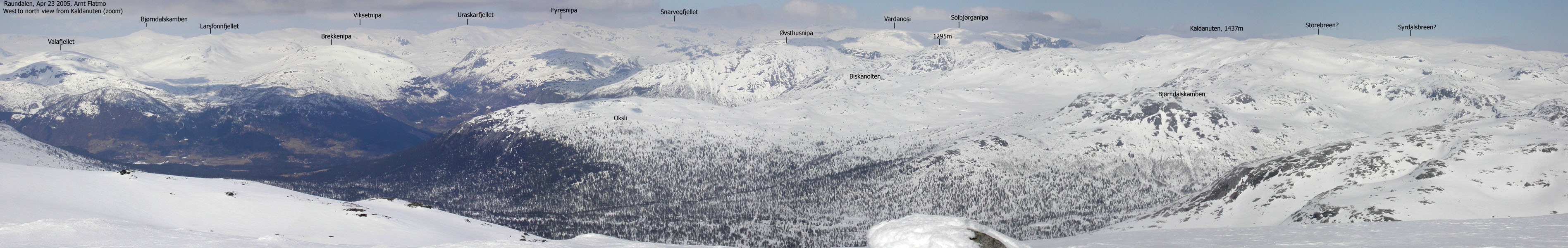
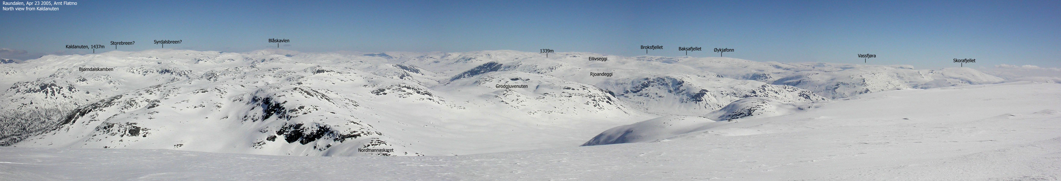
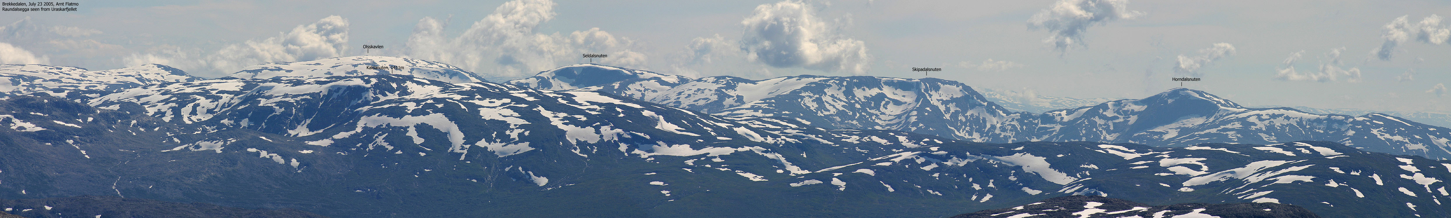
Kaldanuten 1437m and Kaldanuten 1411m are the two highest peaks in the Hordaland region north of Raundalen, east of highway E16 (Bergen - Oslo) and south and east of the Hordaland/Sogn og Fjordane county border. The views from Kaldafjellet are extensive. A vast number of peaks can be seen to the east, north and west, while Raundalsegga blocks the views towards the south. Raundalsegga is a string of tops that stretch from Voss towards Ulvik, and with these majestic mountains there is no reason why anyone would want to see beyond these mountains.
Kaldafjellet is foremost a skiing mountain. The most popular route is from the Reimegrend cabin village. It is easy to make a round trip, select route variations, and extend the trip to any preferred distance.
Kaldanuten (M711: 1411m, Ø.K: -) has a primary factor of 301m towards the higher Kaldanuten (1437m) The saddle is found in Nordmannaskaret. Ref. the M711 map (20m contours), you cross the 1120m contours on the high route, but not 1100m. The saddle height has been interpolated to 1110m.
Notes: Class ratings are in reference to YDS. Click here for more information.
The trails described below are not necessarily the *easiest* trails to this mountain.
|
Reimegrend - Kaldanuten - Åmidlenutane round trip (spring, on skis)
|
|
From the main traffic light in Voss, proceed northbound - signed Gjernes (Do not follow highway E16 towards Oslo). Follow this road for 1,7Km and turn right onto highway RV13. Follow RV13 for 750m and turn left towards Mjølfjell. Follow the Mjølfjell road up Raundalen for 20,1Km to Reimegrend. Turn left onto a gravel road. You see a "Voss/Urdland" bicycle sign here. Follow the main road upwards for 700m and locate a parking area to your left (Brekka).
A sign says that parking is reserved for cabin owners. Outside the major winter week-ends and holidays, I expect there should be no problem of parking up here. Otherwise, try to find parking down by the main road. Note that there are general parking restrictions along the narrow Raundalen road.
From the Brekka trailhead, head northwest along Brekkelvi river to the Brekkestølen cabins. Stay left of the river and proceed north-northeast towards Brekkebotnen. Ascend gradually towards Skrednuten and approach Skrednuten from the east or the north east.
From Skrednuten, follow a ridge northbound to 1280m elevation. Turn northeast and proceed up to Kaldanuten summit. There are two cairns and a summit cabin.
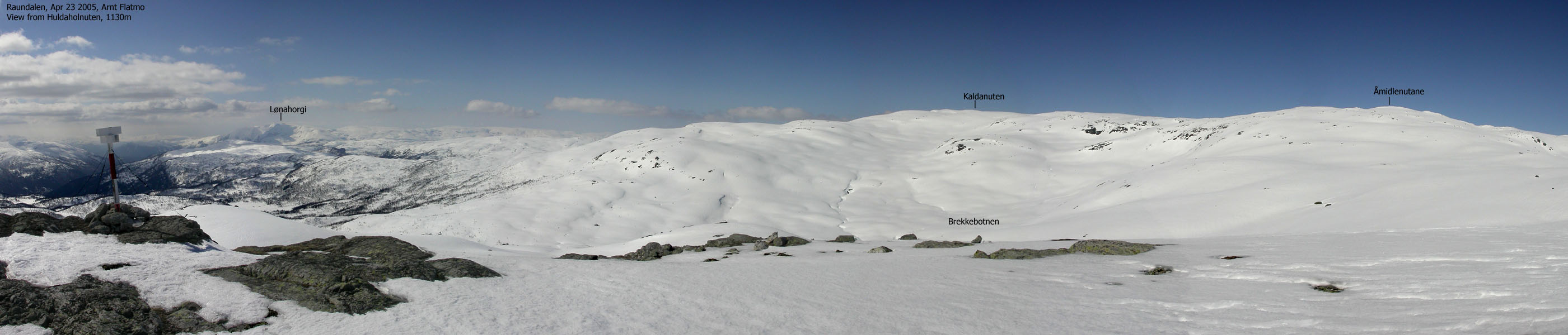
Maintain a southeast route towards Åmidlenutane. From the 1374m high point, proceed southwest to Huldaholnuten. Descend northbound down to Brekkebotnen and follow the river on the east side back to Brekkestølen. From Brekkestølen follow your upwards route back to Brekka.
Kaldafjellet is in general a very gentle skiing mountain. Be aware of avalanche hazard down to Brekkebotnen (Skrednuten means Avalanche Peak in English). Stay on ridges if you suspect there could be avalanche hazard.
|
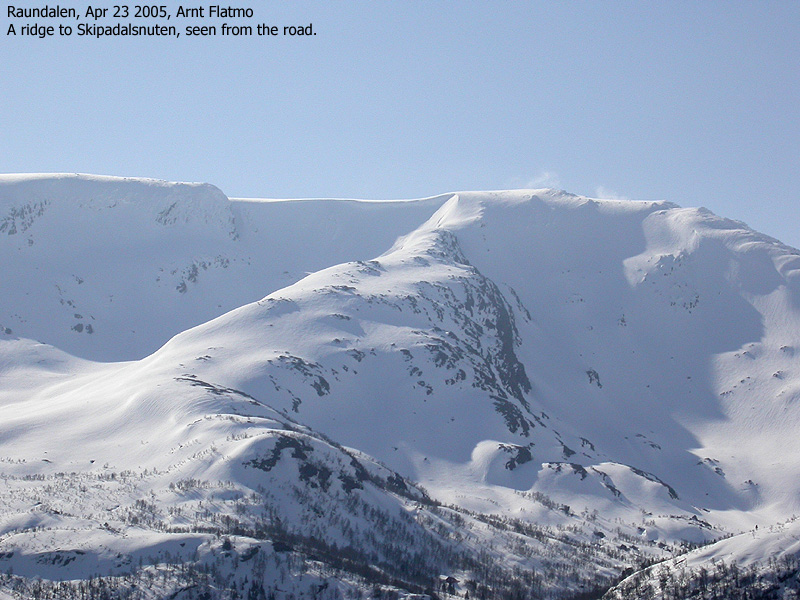
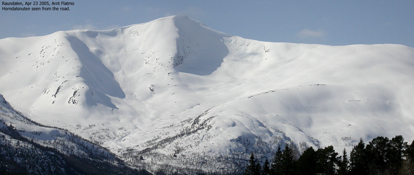
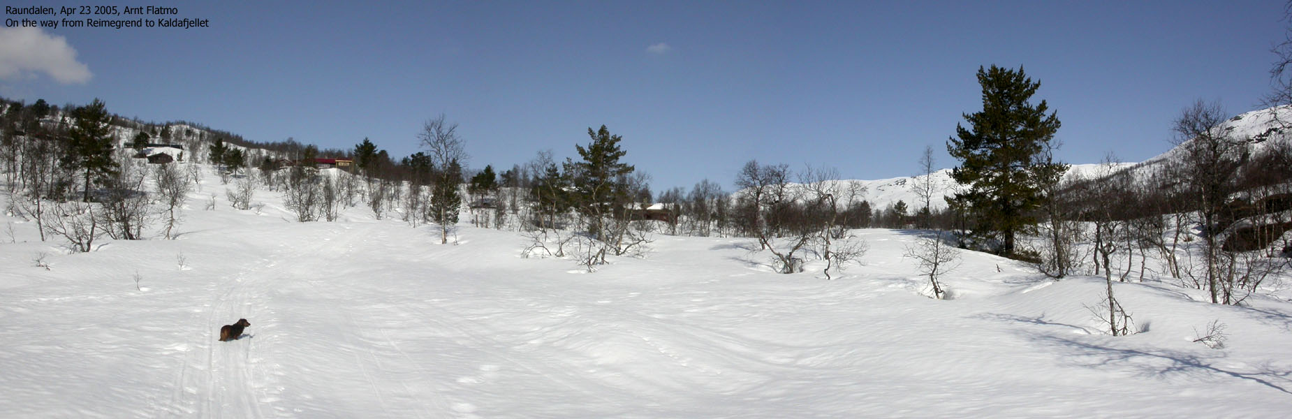
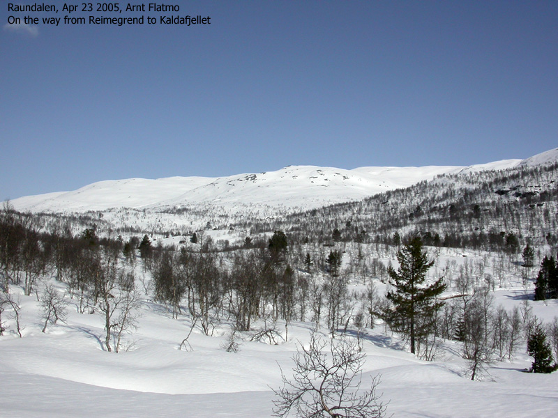
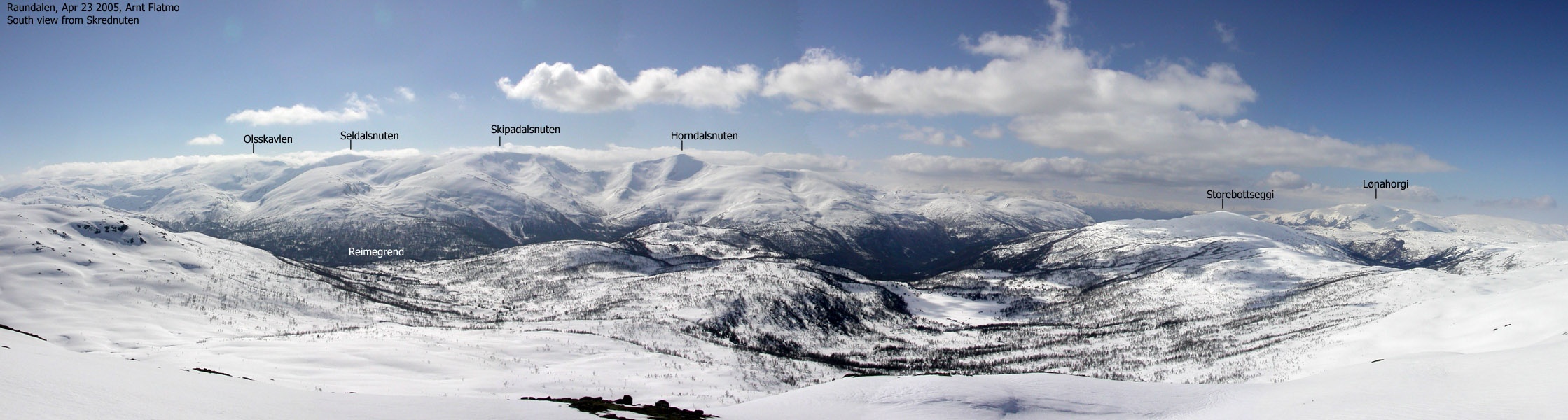
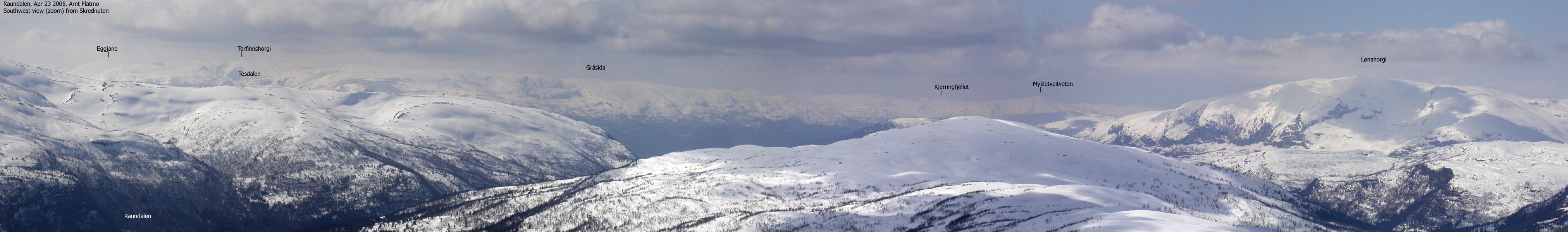
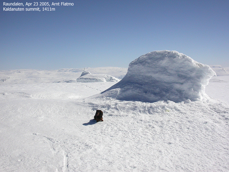
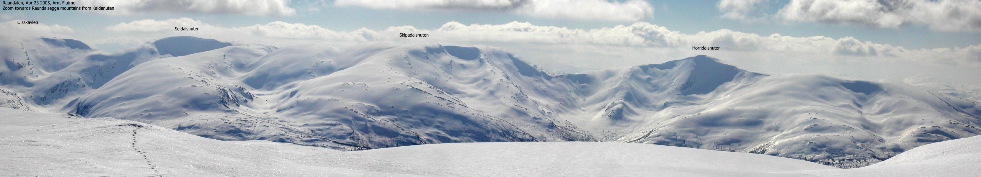
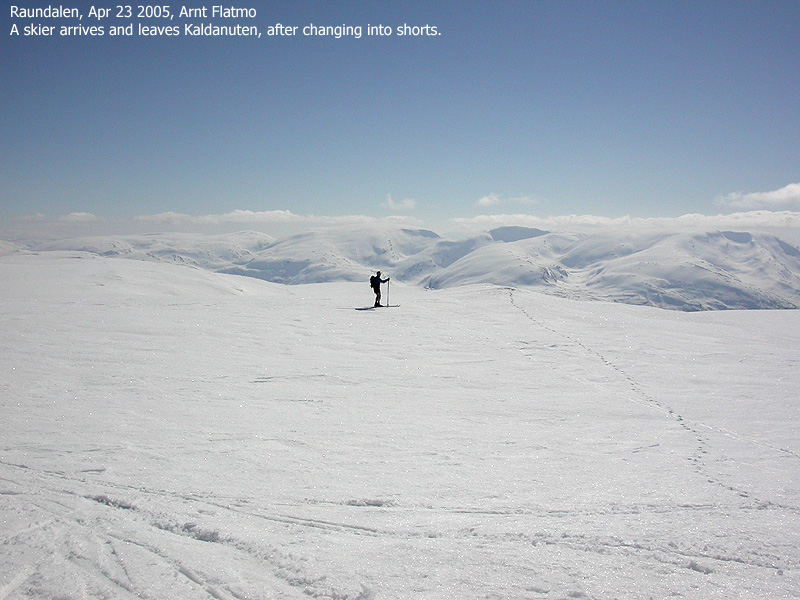
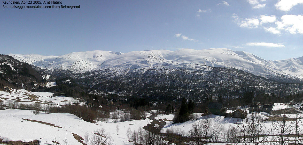
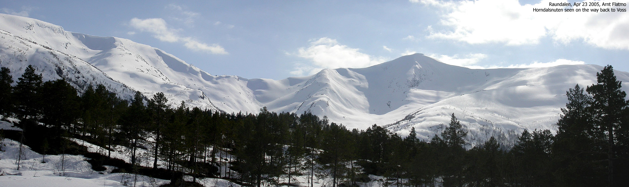
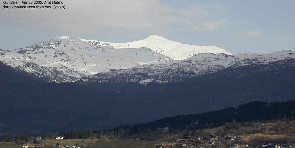
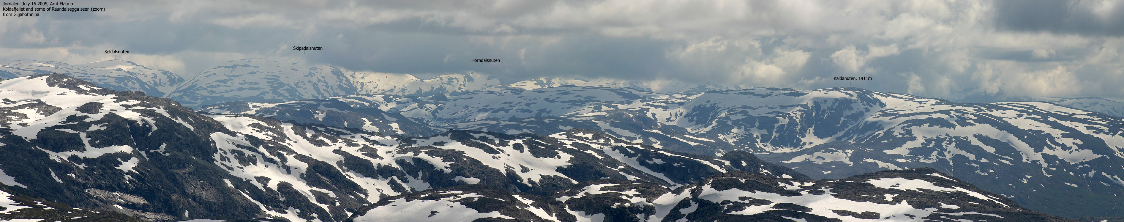
Trip report Apr 23 2005Saturday had come and the weather was (still) stunning. I spent time on Friday evening deciding on where to go, and ended up with Kaldanuten above Raundalen. I hadn't been to a single mountain between Nærøyfjorden and Raundalen, and it was high time that I visited this area. It was a long drive from Bergen to Reimegrend, but the mountain awaiting would surely be worth it. It wasn't difficult to find the trailhead at Reimegrend. I disregarded a sign about parking for cabin owners only. There were only a few cars on the parking ground, and I didn't expect there to be many more. My dachshund Troll and I left the trailhead 11:00AM. I had hoped the dog was able to walk some of the distance. There were (of course) tracks towards Brekkestølen, and the tracks were still hard this early in the day. Troll had no problems walking, and moreover, it looked like he was having a good time. We followed the tracks to Brekkestølen and then took a direct course towards Skrednuten. I didn't see any more tracks up the valley, and wondered if the normal skiing route from Brekkestølen was going in direction of the Storebottseggi - Kaldanuten ridge. As we reached the foothills of Skrednuten, the snow had turned signficantly softer. Troll seemed however willing to fight for this mountain. I switchbacked up the hillside, and Troll paused to see if I would change my course. He found it more energy-saving to walk straight up rather than following the switchback tracks. Or he was just being dumb. I don't know... We reached Skrednuten 12:40PM. The panorama towards the Raundalsegga mountains was overwhelming. No pictures could truly capture these beautiful mountains, with Horndalsnuten as the primary eye-catching peak. I never thought Horndalsnuten looked very special from the Voss side, but from the Raundalen side it was surely the king of all mountains. After a short break on Skrednuten, we continued upwards. The snow got gradually firmer and Troll didn't have difficulties following my pace. We reached Kaldanuten summit 13:45PM. The horizon was hazy, and I felt cheated on the finest northern views. After a quick 360 deg. scan, I had identified the Raundalsegga mountains, Vassfjøra, Gråsida, Lønahorgi, Oppheim and the beginning of Nærøydalen valley. The rest of the views were white, rounded mountains which I would need a map to identify. I realized that there was a whole lot of skiing/walking ahead of me in this territory, but at least I had begun. I left Troll at the cairn and skied around the summit plateau for pictures when I suddenly heard heavy barking from the cairn. We had obviously company. I only noticed an older man changing into shorts before he turned back around. Troll seemed satisfied having been able to defend the cairn and was clearly in the mood for a lunch reward. During lunch, I noticed that there were a good amount of clouds towards the sea, while I had only blue sky above me. Yet another week-end on the right side of the clouds. The same thing happened on Blåkoll one week earlier. It was a wonderful day, and I was torn between heading back down or extending the trip. I ended up with heading back down, but decided to visit Åmidlenutane first. The trip across the ridge didn't take long, and I was on top of point 1374m 14:45PM. Troll had given up halfway across the ridge, and was now seeing the landscape from the backpack. Skiing down from Åmidlenutane was big fun. The snow conditions were perfect, and with the worst Telemark technique you've ever seen, I had the time of my life in a downhill. Troll is surprisingly calm when exposed to what must appear as a powerful G-force when I make the sudden turns. When I ski on a flat surface, his head hangs loose and low, and I suspect he takes a nap from time to time. After a short stop for pictures at Huldaholnuten, I skied down into Brekkebotnen and along the east side of the river before I joined my upwards track at Brekkestølen. We were back at the car 15:35PM, and while I was organizing the equipment in the car, Troll fell asleep on the gravel next to the car. I'm sure he had a good time on the mountain although he did a tremendous amount of walking given his high age (11,5 years) and the soft snow.
|
Move cursor to read notes, and click on the images to see full version.
Some of the thumbnails may have been cropped to fit the format.
To Skrednuten


To Kaldanuten


To Åmidlenutane and back down


Pictures from Raundalen and Voss


No Javascript:
1 2 3 4 5 6 7 8 9 10 11 12 13 14 15 16 17 18 19 20 21 22 23 24 25 26 27 28 29 30 31 32 33 34 35 36 37 38


No Javascript:
Other hordaland mountains
 Other Voss K. mountains
westcoastpeaks.com
Other Voss K. mountains
westcoastpeaks.com

