
Norwegian Mountains, Møre og Romsdal
|
Jønshornet, 1419m (Ramoen)
|
Randers Topp, 1414m
|
| Fylke/Kommune : | Møre og Romsdal/Ørsta | ||||||
| Maps : | 1119-I Ålesund (Statens Kartverk, Norge 1:50 000) | ||||||
| Primary factor : |
Jønshornet: 449m Rametinden: 108m Svinetinden: 102m Randers Topp: 144m Mohns Topp: 79m |
||||||
| Hiked : | July 2008 | ||||||
| See also : |
| ||||||
| See also : | Other Ørsta mountains |

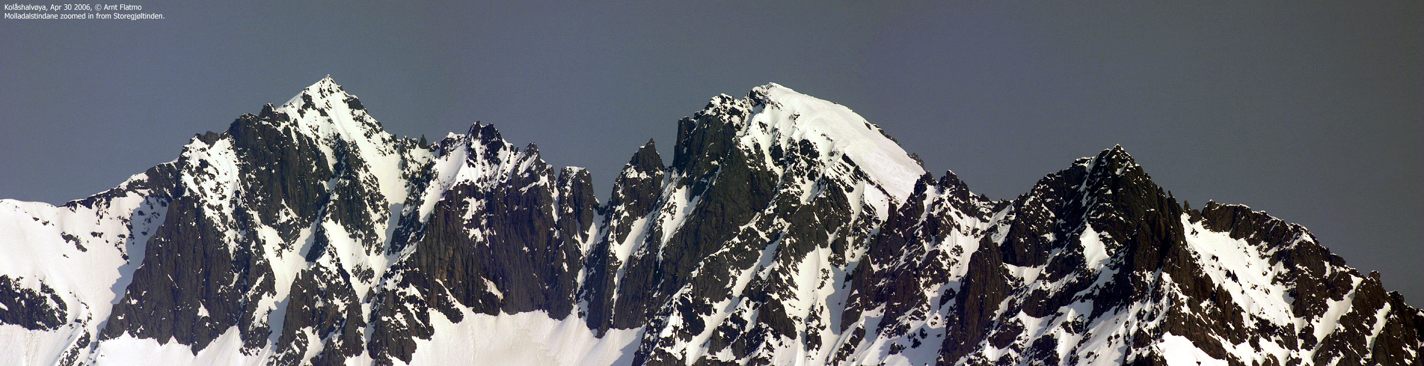
Molladalstindane (© Olav Lillebø)
(Click for larger image)
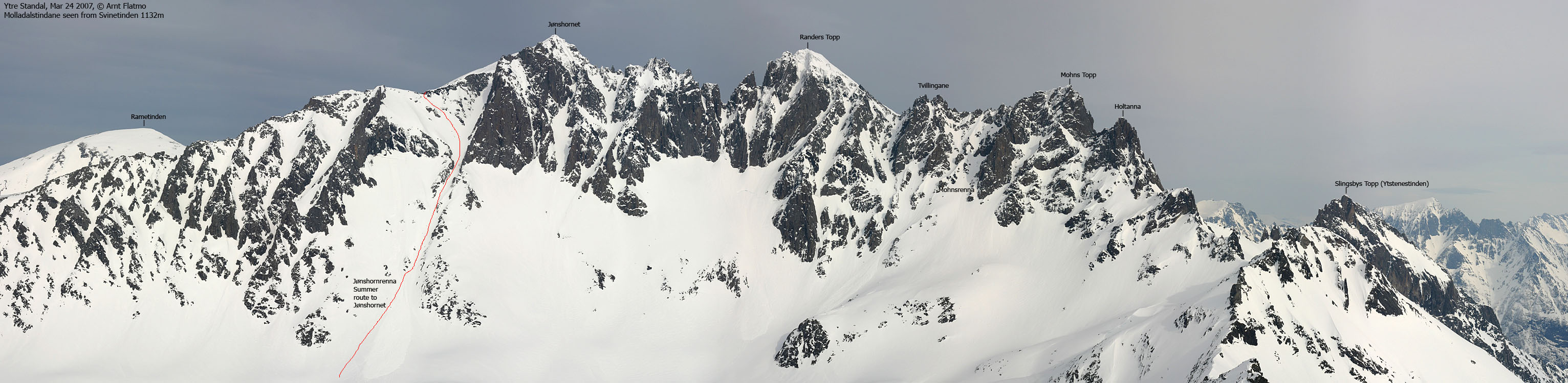
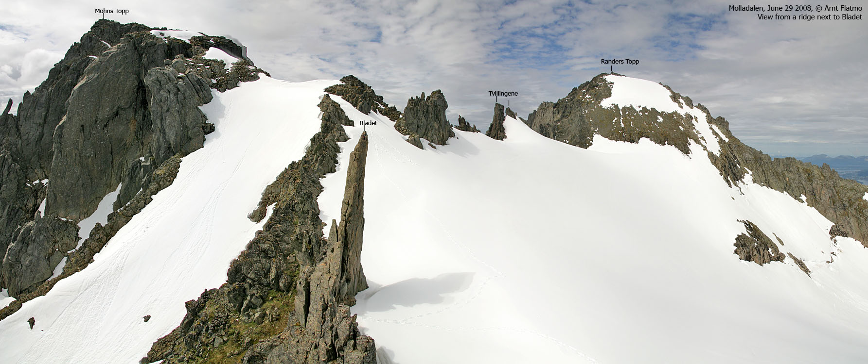
The Molladalstindane peaks are famous for their characteristic features, and for being a climbing "paradise". An entire book could be written about the Molladalen valley, the peaks, the climbing routes, the glaciers, the aretes, and so on. I will merely point out that the most known tops are Jønshornet, Randers Topp, Mohns Topp, Slingsbys Topp (Ytstenestinden) and Holtanna. You will also find (a.o.) the Bladet (the blade), Giganten (the giant) pinnacles up here. Several smaller tops, pinnacles and rock features have also been given names (S. Jønshornet, ø. Jønshornet, Molladalsgubben, etc.) Some refer to the peaks as "Jønshornet og de tre søstre" (Jønshornet and the three sisters), refering to Randers Topp, Mohns Topp and Slingsbys Topp. Not a "polite" way to refer to three men (Kristoffer Randers, Emmanuel Mohn and William C. Slingsby), famous for their impact on Norwegian climbing.

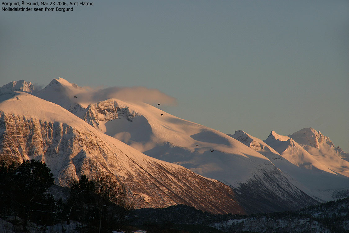
A long and rugged mountain ridge starts with Svinetinden (1092m), continues across Rametinden, Molladalstindane, Grønetinden, Svinetinden (1132m), Storkopptindane, Romedalstinden, Kolåstinden (and Fingeren) before it ends at Standaleitet. Along the main ridge, you will never drop below 960m elevation. Several long branches lead from the main ridge, such as the Sætretindane branch and the Langenestinden branch. In short, those who want to spend the summer with climbs and ridgewalks can safely head for this northern part of Kolåshalvøya (the Kolås peninsula), only a short drive (+ ferry) from the nearest larger city - Ålesund.

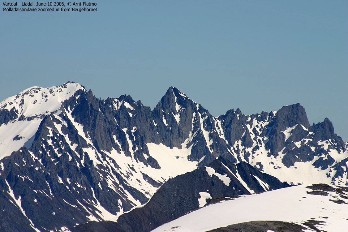
Molladalstindane seen from Bergehornet
People on the Hjørundfjorden side refer to this popular mountain as "Jønshornet", while on the Barstadvika side, they call it "Ramoen". On this web site, "Jønshornet" is the chosen name. The fishermen also called it Ramoen, and the mountain (along with Kolåstinden) were important coastal landmarks. In his book "Sunnmøre, K. Randers guesses that the male name Ramo (old Norse) is the base for the mountain name. Likewise, he guesses that Jønshornet comes from the male name Jøns. "Horn" is the same as in English. The first known ascent was done by Geoffrey Hastings in 1889. However, he found a cairn on the summit. Was it put there by Jøns?


The normal hiking routes to Jønshornet run from Barstaddalen. One route runs across Rametinden (1198m), the other up the Jønshornrenna couloir from Molladalen. Both routes are described on this page. The routes to Jønshornet demand some mountain experience from its visitors. The route via Rametinden has one steep section where a fixed rope may be found. Some sources claim the route from Molladalen includes easy scrambling on a ridge. Yes, with dry rock, good boots and good balance, it is not very difficult. But dry rock shouldn't always be taken for granted in this part of the world.


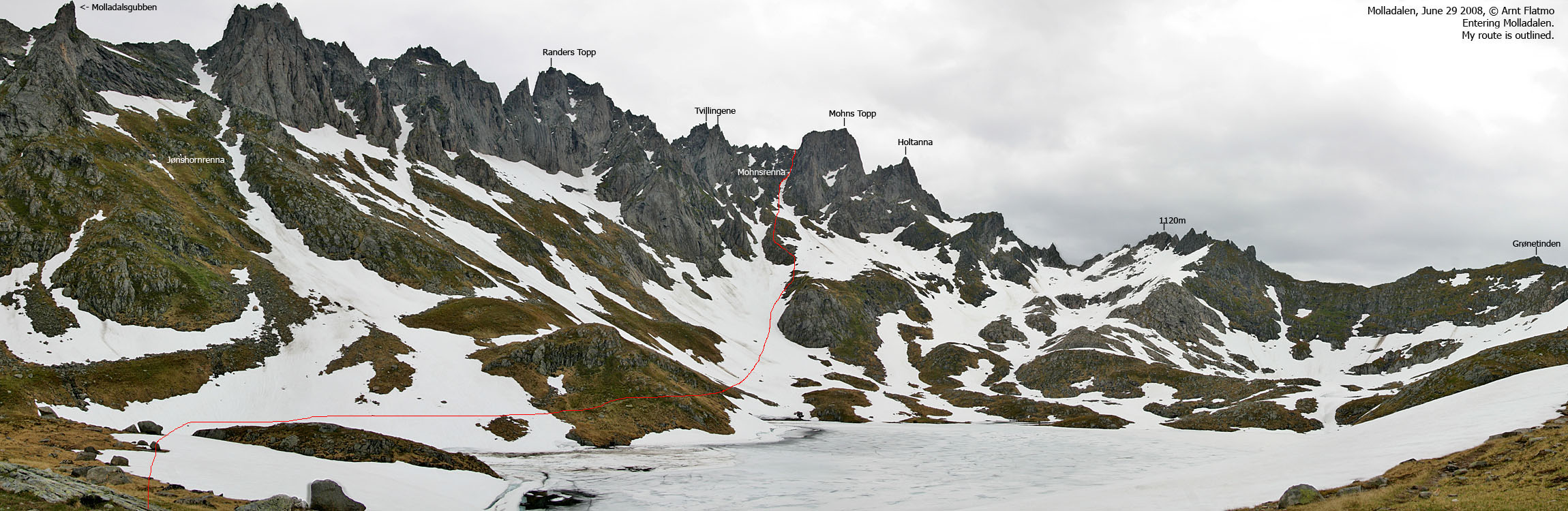
While Randers Topp and Mohns Topp are normally reached via the Mohnsrenna couloir from Molladalen, Randers Topp is also a popular skiing top (spring), reached via Inste Årsnesdalen valley (from Hjørundfjorden). The ascent of Randers Topp via Mohnsrenna involves crossing the glacier on top of Inste Årsnesdalen valley. Some choose to (at their own risk) cross this glacier alone. Randers Topp is an easy top to reach via Mohnsrenna (YDS 2+).
Mohns Topp is also reached via Mohnsrenna. The ascent involves scrambling a few airy sections along the summit ridge. Some would appreciate the use of a rope along this ridge. More experienced hikers will just enjoy this YDS 3 route.

Mohns Topp

|
|
|
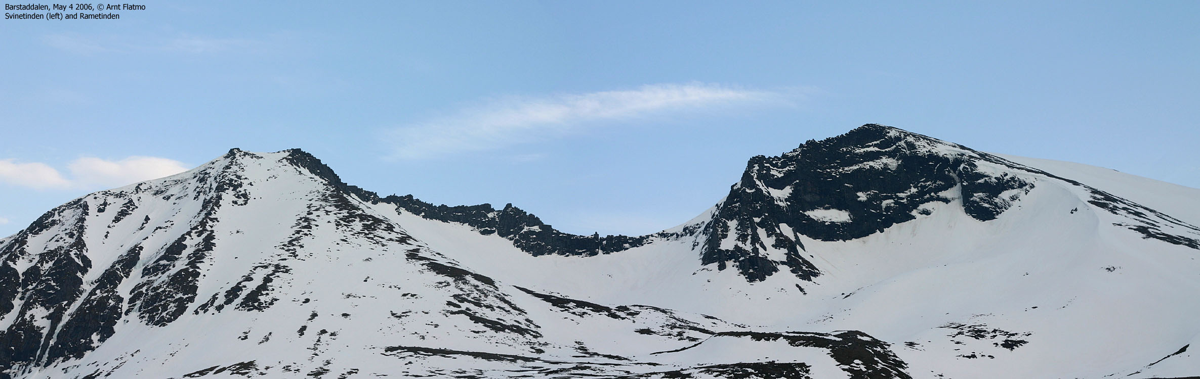
Svinetinden (Swine peak (!)) connects to the higher Molladalstindane peaks via Rametinden. The peak can easily (short distance) be reached from the Festøykollen/Jønshornet trailhead in Barstaddalen. The summit is a bit airy, and those without a head for heights may settle for the lower viewpoint. 100m to the northeast.
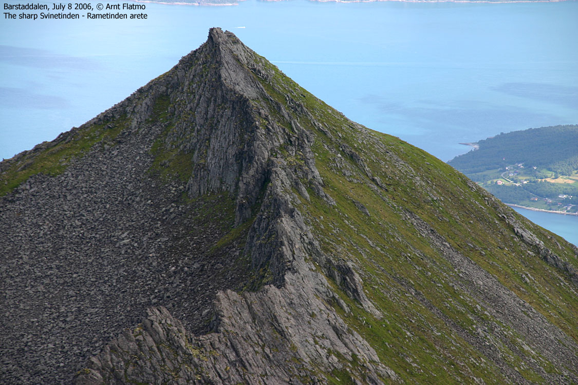
Svinetinden connects to the Rametinden peak via a sawtooth arete that falls in the category advanced mountaineering. Advanced - in the sense that one can certainly not just stroll across. There is far more to it. It should also be noted that Svinetinden should not be confused with Svinetindane - two tops just southwest of Molladalstindane.
While Svinetinden can be accessed from Hjørundfjorden (east), the normal approach is from Barstaddalen (west). Allow 2,5-3 hours for the ascent, and prepare for a short, but airy summit ridge, which requires easy scrambling to get onto.

Molladalstindane
(Click for larger image)
The big reward for climbing these mountains, are the views. Hjørundfjorden and the surrounding peaks is always a fantastic view, but the coastal view and the massive Kolåshalvøya mountain region are also impressive. But foremost, you will be "taken" by the spectactular Molladalstindane and the insane drops towards Hjørundfjorden.
Jønshornet (Norge 1:50,000: 1419m, Økonomisk Kartverk: -, UTM 32 V 361847 6912352) has a primary factor of 449m towards the higher parent mountain Kolåstinden (1432m). The defining saddle is SOMEWHERE along the high ridge to Kolåstinden. Ref. Norge 1:50,000, there are several point where 980m is the lowest contour; 1120m to Grønetinden, Grønetinden to Svinetinden 1132m and Romedalstinden to Kolåstinden. As one saddle has to be nominated, the pass between Svinetinden S and Grønetinden has been chosen (UTM 32 V 361365 6910716). The defining saddle height has been interpolated to 970m.
Rametinden (Norge 1:50,000: 1198m, Økonomisk Kartverk: -, UTM 32 V 361128 6913435) has a primary factor of 108m towards the higher parent mountain Jønshornet (1419m). The defining saddle (approx. UTM 32 V 361326 6913103) is found in the pass between the two mountains. Ref. Norge 1:50,000, the saddle is within the range 1080-1100m, interpolated to 1090m.
Svinetinden (Norge 1:50,000: 1092m, Økonomisk Kartverk: 1091,60m, UTM 32 V 361727 6914350) has a primary factor of 102m towards the higher parent Rametinden (1198m). The defining saddle (approx. 32 V 361395 6914008) is found between Svinetinden and Rametinden. Ref. the Norge 1:50,000 map (20m contours), the saddle is within the range 980-1000m, interpolated to 990m.
GPS measurement ranged from 1093 to 1107m on Svinetinden, and averaged to 1103m over a 5-minute period. This was surprisingly high, compared to the map height, which should be trusted until proven otherwise.
Randers Topp (Norge 1:50,000: , Økonomisk Kartverk: -, Other sources: 1414m) UTM 32 V 362248 6912003) has a primary factor of 144m towards the higher parent mountain Jønshornet (1419m). The defining saddle (approx. UTM 32 V 362081 6912059) is found down in a distinct gap between two mountains. Ref. Norge 1:50,000, the saddle is within the range 1260-1280m, interpolated to 1270m. The contours in this area should not necessarily be trusted.
Personal GPS measurement read 1418m on Randers Topp, averaged over a 5-minute period with an error margin between 3 and 4 meters. On a GPS map, there is a 1420m contour on Randers Topp, but the actual GPS summit waypoint is not within this contour. As such, the contour has been disregarded on this site.
Mohns Topp (Norge 1:50,000: , Økonomisk Kartverk: -, westcoastpeaks: 1359m) UTM 32 V 362438 6911479) has a primary factor of 84m towards the higher parent mountain Randers Topp (1414m). The defining saddle (approx. UTM 32 V 362383 6911841) is found down in a distinct saddle between two mountains. Ref. Norge 1:50,000, the saddle is within the range 1260-1280m, but instead of interpolating to 1270m, personal GPS information has been used; Measured on snow, the saddle is approx. 1280m, and the interpolation has been set to 1275m.GPS measurement read 1360m on Mohns Topp, averaged over a 5-minute period with an error margin between 2 and 3 meters. As there is no 1360m contour on the map, the suggested height was set 1m lower.
Bladet: GPS waypoint on top of Bladet read 1305m (no averaging) with an error margin of 5-6m. It is reasonable to expect Bladet to be around 1300m.
Per July 2006, the Garmin GPS map shows contours up to 1480m(!), and so does the corresponding 1:50,000 map from Statens Kartverk. These GPS waypoints were taken without average samples, and should not be regarded as *precise*, but they might give an indication where the contour errors are.

Map of the north ridge

Averaged over 10 minutes (on the ground), the GPS reported 1420m on Jønshornet and 1201m on Rametinden. The GPS error margin was reported to be 2-3m.
It is reasonable to assume that there are inaccurate contours on Randers Topp, Mohns Topp and Slingsbys Topp, but this will be verified (and documented) when these tops are visited.
Google's interactive map. You can zoom, pan and click on the markers.
|
|
|
Notes: Class ratings are in reference to YDS. Click here for more information.
The trails described below are not necessarily the *easiest* trails to this mountain.
Jønshornrenna
(Click for larger image)
|
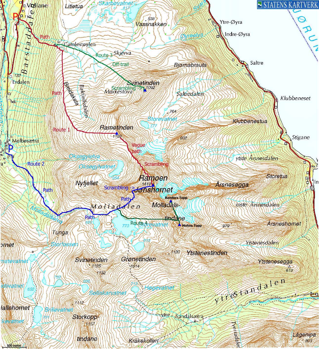
Routes 1&2: Barstaddalen - Jønshornet - Molladalen roundtrip (summer)
|
|
Access
(all distances are approx. distances)
From Ålesund, follow highway E39 towards Bergen/Volda to the ferry at Solavågen. Take the ferry over to Festøya. Turn right in the direction of Volda and follow the road 3,3Km. Turn left towards "Erdal". Follow this road 1,7Km (it turns to gravel after 550m) until you cross a river. Parking is found south of the river, while the trail begins just north of the river.
If you want to hike from the upper Barstaddalen trailhead, you can continue driving 2,8Km southbound. Turn left in the road junction after 1,2Km.

The route
Ascent via Rametinden:
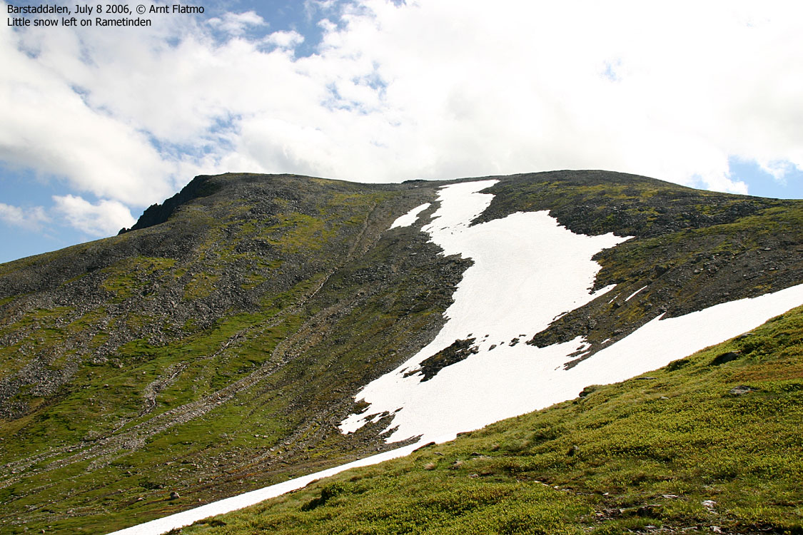
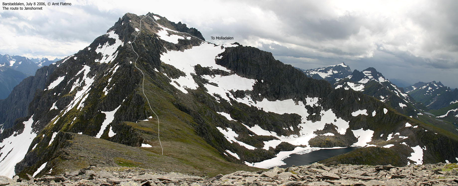
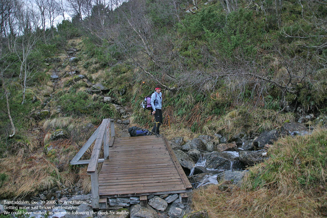
From the trailhead, follow the trail to Gamlestøylen. After two stream crossings, you cross a river over a bridge and head up the dark forest before the light comes back to you near Gamlestøylen. Just before the bridge by Gamlestøylen, the trail forks. Follow the rightmost path upwards. One path will lead you to the west side of Breidaksla ridge. Don't go here. Instead, stay in center of the broad ridge towards Rametinden. The path fades when you run into rocky terrain, but it is still easy to hike here. Visit the summit cairn on Rametinden before proceeding towards Jønshornet.
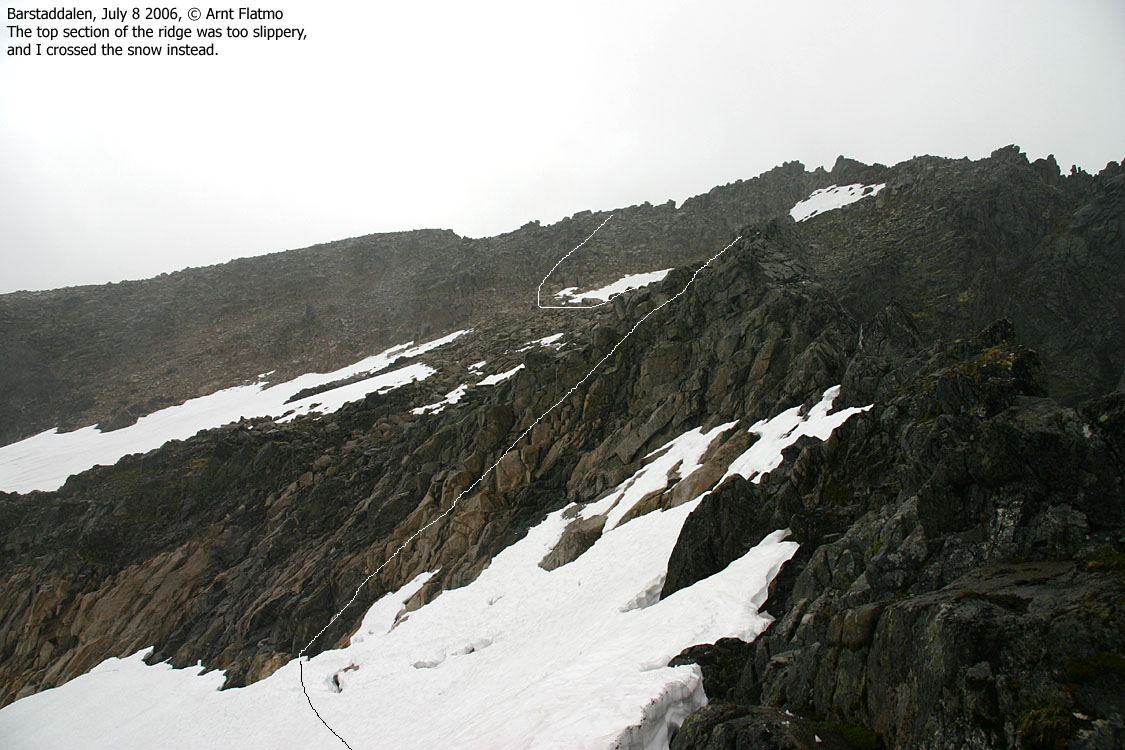
Head down to the Jønshornet - Rametinden saddle and follow cairns and a vague track across LARGE boulder. Eventually, you will run into a section that has a fixed rope (per July 2006). Either use the rope or scramble to the left and top out above the rope (YDS class 3). From this point on, you have the option to scramble along the edge or follow faint tracks further down to your right (a safe route). Enter Jønshornet summit by climbing through a hole or by climbing outside to the left.
Be careful on the summit section if the rock is wet.
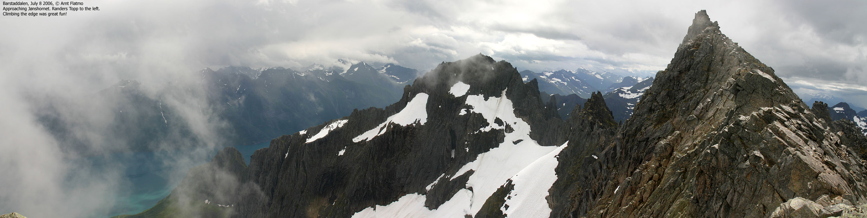
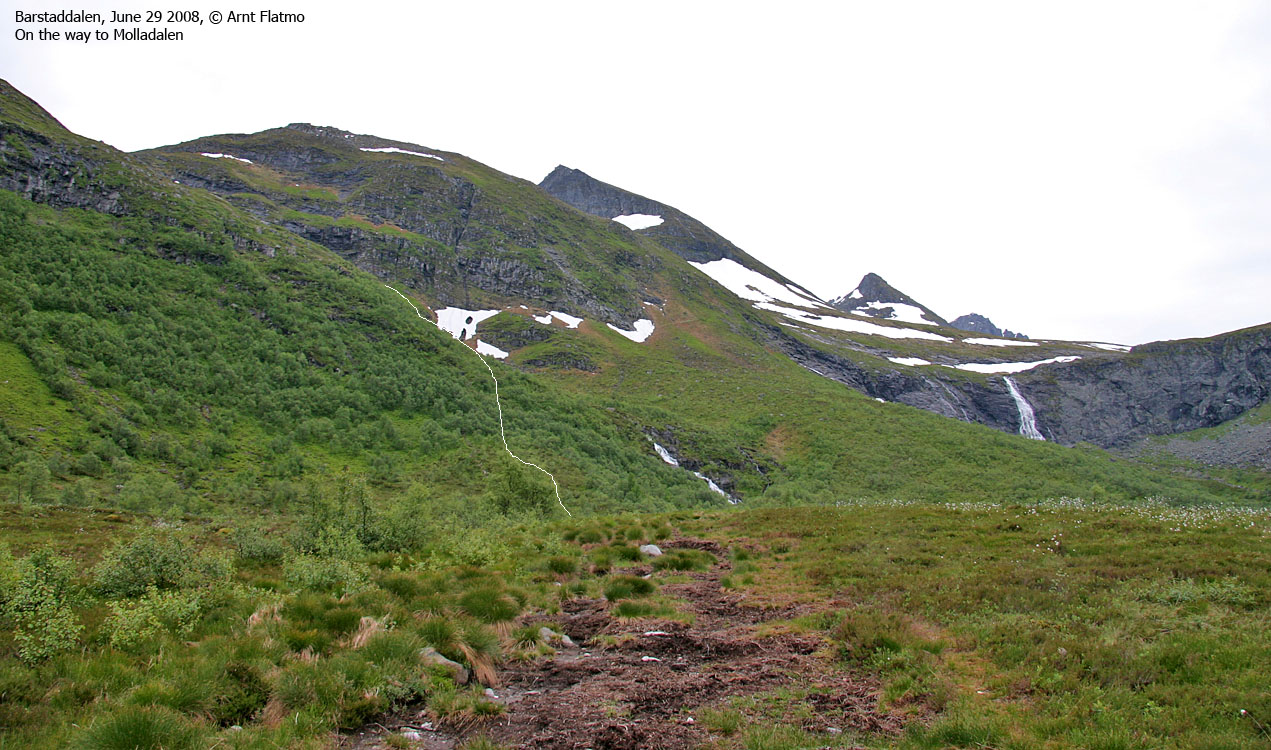
Descent via Molladalen:
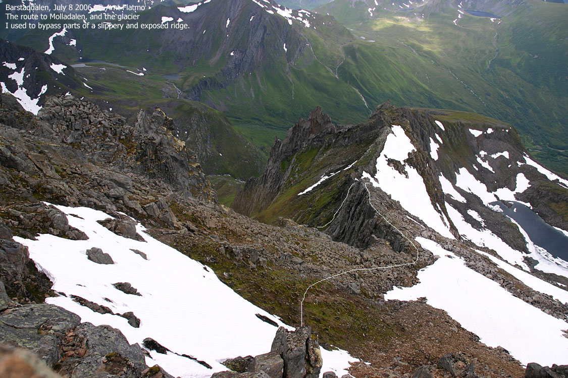
Descend westbound to a distinct, narrow ridge that leads to Nyfjellet. Half-way across the ridge, turn left and descend into Jønshornrenna. Take the time to find a route across the ridge that you are comfortable with. A second possibility is to descend onto the glacier above Lake Oksegylvatnet and bypass the most narrow and exposed part of the ridge.
The route down Jønshornrenna has a visible path that crosses a stream approx. half-way down. There is loose gravel, and you should make sure you don't send rocks (even small ones) down the couloir. This may be fatal for people below you.
Once you reach Lake Storevatnet, turn right and head down a side-valley of Barstaddalen. Along this route, you will pass an exposed point, secured by wire. You can bypass this section by staying higher up, which is also "technically" easier. Continue down to the upper Barstaddalen trailhead and walk on road the remaining approx. 3Km down to the Gamlestøylen trailhead. Make sure you turn right in the road fork on your way down Barstaddalen.


Route 3: Barstaddalen - Svinetinden (summer/autumn)
|
|
Access
(all distances are approx. distances)
From Ålesund, follow highway E39 towards Bergen/Volda to the ferry at Solavågen. Take the ferry over to Festøya. Turn right in the direction of Volda and follow the road 3,3Km. Turn left towards "Erdal". Follow this road 1,7Km (it turns to gravel after 550m) until you cross a river. Parking is found south of the river, while the trail begins just north of the river. This is the same trailhead as for Jønshornet and Festøykollen.

The route
Follow the signed path (Jønshornet, Gamlestøylen, Romestrandshornet) upwards. You cross the river on a bridge at approx. 170m. Head up a well-worn trail in the forest and top out near Gamlestøylen (approx. 430m). There is a trail fork just before Gamlestøylen. Stay left here, and cross the river (again) on a bridge before you reach Gamlestøylen cabins.
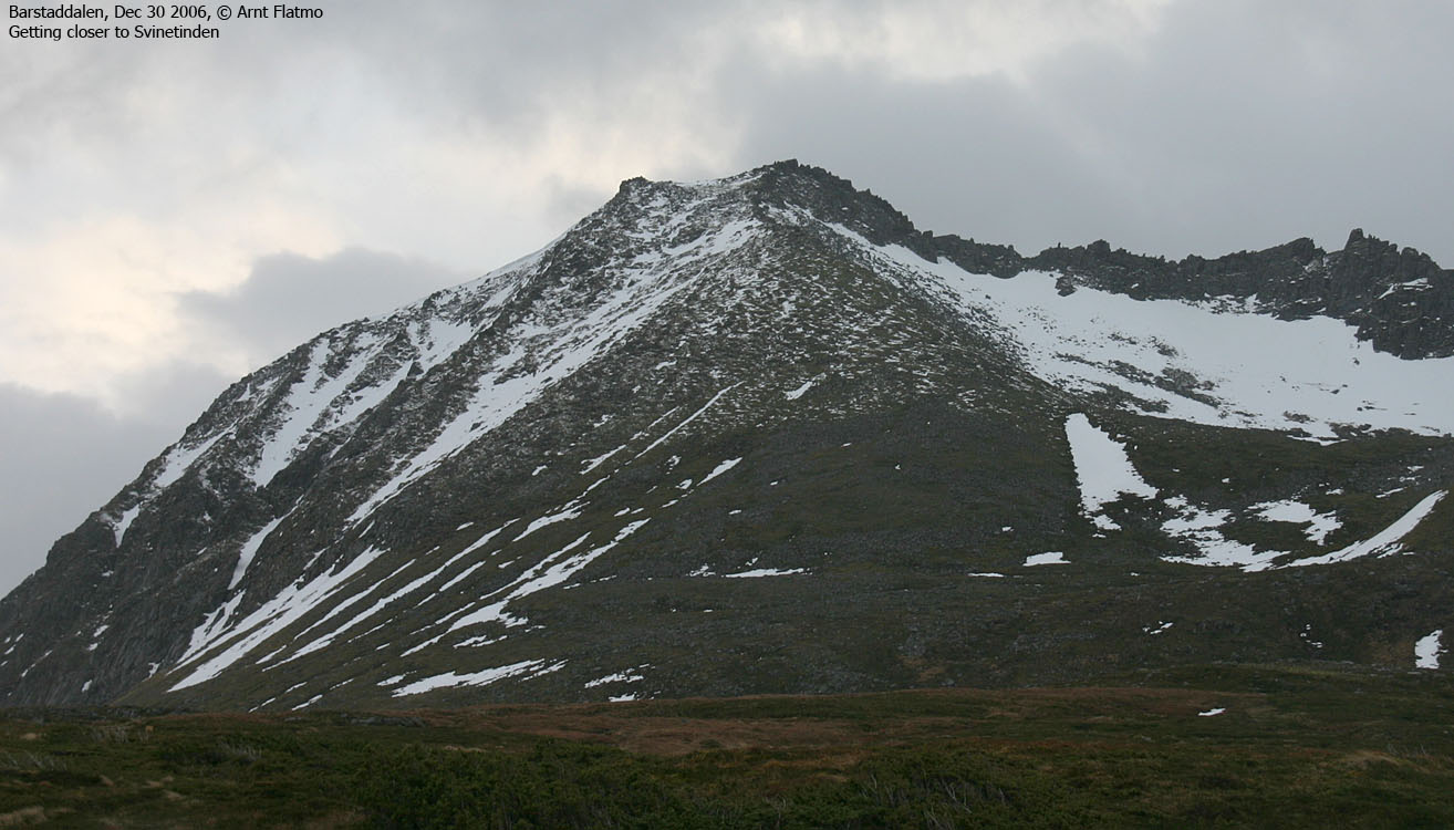
Follow the path towards Festøykollen until you reach a crossing stream. Turn right and leave the path. A vague path runs along the stream upwards, but it vanishes. Head off-trail, aiming for Svinetinden's west ridge.
Ascend Svinetinden where you see fit. The terrain is quite easy, if you stay away from the boulder sections. The terrain gets gradually steeper, and when you reach the summit ridge, some easy scrambling is needed in order to get onto the ridge. The summit ridge is airy, but the summit (a tiny cairn) is only meters away.
In winter, expect far more serious conditions. The hillside will require ice-axe and crampons on hard snow. Handholds and footholds that are used for summer scrambling on the summit ridge will be gone, and cornices may turn the summit ridge into a quite sharp ridge.
Route 4: Barstaddalen - Randers/Mohns Topp (summer/autumn)
|
|
Access
(all distances are approx. distances)
From Ålesund, follow highway E39 towards Bergen/Volda to the ferry at Solavågen. Take the ferry over to Festøya. Turn right in the direction of Volda and follow the road 3,8Km to Barstadvika. Turn left towards when you see the "Hyttegrend" sign (white). Follow this road 4,3Km to the Barstaddalen trailhead. After 2,7Km you pass Erdal road junction and after 3,4Km you pay toll at a self-serviced toll booth (Melbø Sætreveg).

The route
Molladalen:
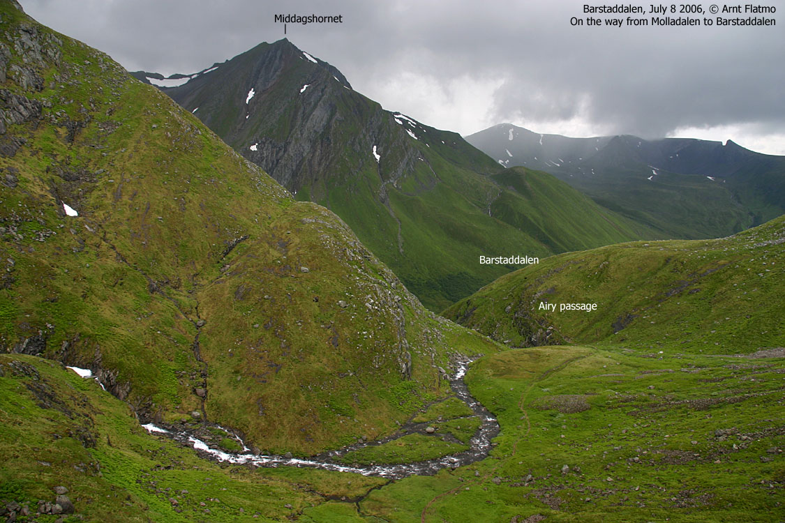
Locate the information sign by the (limited and rough) parking. The path to Molladalen begins here. The path runs southwest to Tunga, where the trail forks. Turn left towards Molladalen (the right goes to Romedalen via Storfossen waterfall). Follow a ridge along the river from Storevatnet. An exposed section is secured by a chain. Continue up to Storevatnet, where you follow the path on the north side of the lake.
Mohnsrenna:
Locate the Mohnsrenna (YDS 2+ or 3) couloir, which takes you up to the ridge between Mohns Topp and Randers Topp. A path runs up the left-hand side of the couloir. A few sections can be awkward on the way down. There may be snow in this couloir well into July, so bring an ice-axe if you need to walk on snow in the couloir. Be aware of loose rock!
Mohns Topp:
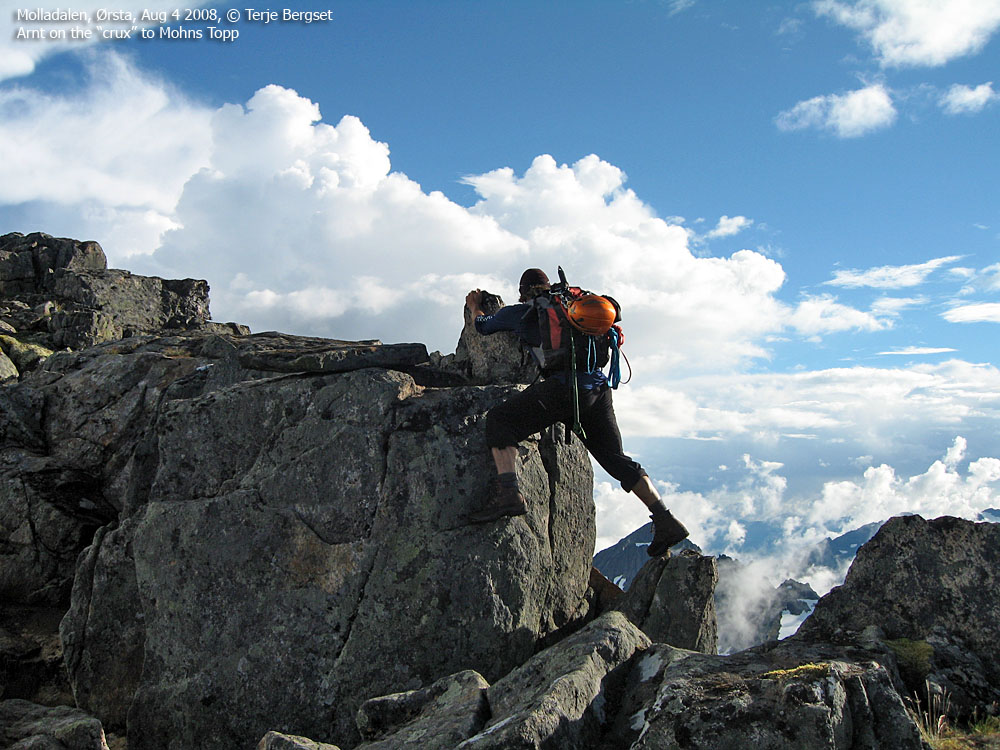
Once on the ridge, turn right and ascend Mohns Topp. Getting onto the summit ridge involves crossing an airy "bridge". Excercise caution upon descent. Proceed up to the ridge, where you'll run into the "crux" (the hardest point). A gap presents two options; sneak around the (airy) corner to the left, or climb up a rock along the south face (one move, YDS 3). In order to climb up, you may need to put your foot on a rock on the very edge. Upon return, consider returning around "the corner", where the use of arms is somewhat easier. Cross another narrow section before you reach the small summit cairn on Mohns Topp.
Randers Topp:
Return to the top of Mohnsrenna. Consider stopping by Bladet down on your right. Proceed along the top of the glacier towards Randers Topp. A faint track (YDS 2) can be followed on the left-hand side. Randers Topp is marked by a small cairn. Descend your ascent route.
 westcoastpeaks.com
Other Møre & Romsdal mountains
Other Norwegian mountains
westcoastpeaks.com
Other Møre & Romsdal mountains
Other Norwegian mountains


