
|

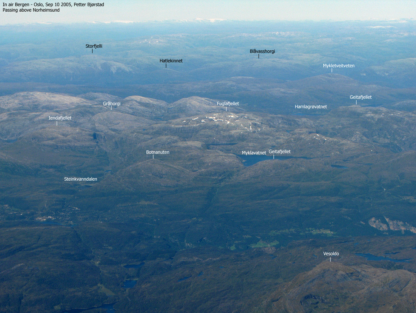
Iendafjellet seen from Fuglafjellet(No Javascript) |
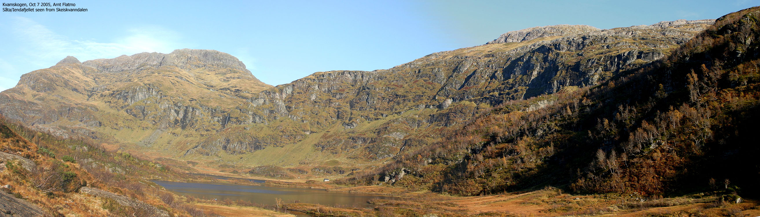
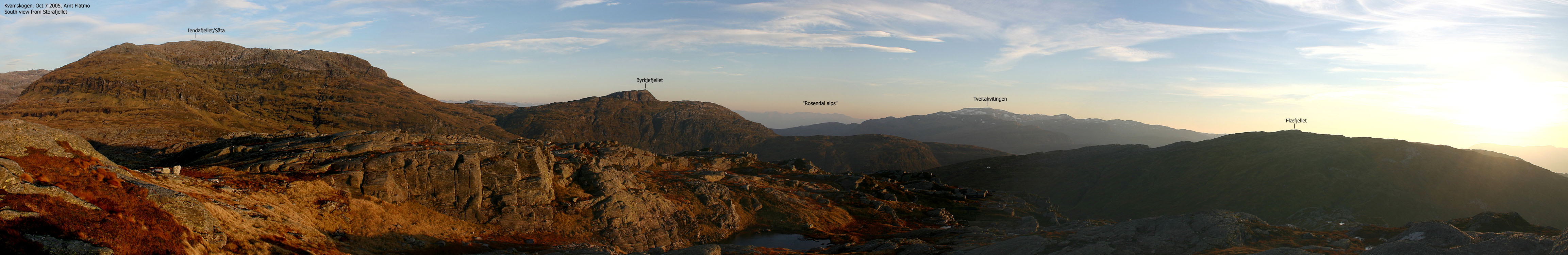
Iendafjellet is the 3rd highest of the Kvamskogen mountains. Kvamskogen is the primary recreation area for the Bergen region, only less than one hour drive from Norway's 2nd largest city. Fuglafjellet (1334m) is the highest, while Tveitakvitingen is the 2nd highest. Iendafjellet can be reached from Steinkvanndalen, Skeiskvanndalen and via the ridge from Byrkjefjellet. This page will describe access from Steinkvanndalen via the Gråurdi pass. I plan to do a hike up Skeiskvanndalen, up the west side of Iendafjellet, then down the ridge to Byrkjefjellet before descending back to Skeiskvanndalen. This is probably the most exciting route (partly off-trail) to this mountain.
"Iendafjellet" is an unusual name of a mountain. In the book "Kvamskogen" by Svein Oldervoll Aadland, the author says the name could be based on "iend" (Sogn) or "jiende" (Voss) which means a corn straw that has just come up. "Iendafjell" is only used in Kvam kommune. Samnanger kommune refers to this mountain as "Såta" (the haystack). This is lack of imagination. Not only will you find another Såta on the way to Tveitakvitingen, but the name is downright boring. Iendafjellet is a truly distinct mountain when viewed from several angles.
I have heard some saying that "Iendafjell" means a mountain "in the end" of something. A valley, for example. The mountain is located at the end of Steinkvanndalen valley, but so does also Fuglafjellet.
You have an unprecedented view towards Tveitakvitingen and Fuglafjellet. The Bergsdalen mountains towards the north lie before your feet, and you have a tremendous western panorama of Bergen peninsula and Nordhordland mountains. Go visit this mountain. The route from Steinkvanndalen will take you up to 1000m on trail. The remaining 250-260m runs over rocky, but fairly easy terrain. No exposure. No difficulties.
Iendafjellet (M711: 1260m Ø.K: 1260,74m) has a primary factor of 267m towards the higher Fuglafjellet (1334m). The saddle is found in Gråurdi pass between the two mountains. Ref. Økonomisk Kartverk (5m contours), you cross the 995m contours on the high route, but not 990m. The saddle height is interpolated to 993m. Despite the decimals, I have chosen to stay with 1260m, which is the M711 map height.
Notes: Class ratings are in reference to YDS. Click here for more information.
The trails described below are not necessarily the *easiest* trails to this mountain.
|
Steinkvanndalen - Iendafjellet (summer/autumn)
|
|
From Bergen, follow highway E16 towards Oslo. At the highway E16/RV7 junction at Trengereid, turn right onto highway 7. Follow highway 7 over Gullbotn, down to Samnangerfjorden and through two tunnels before the road climbs up to Kvamskogen.
Approx. 38,6Km from the highway E16/RV580 junction at Indre Arna, you will see the NAF Camping on your right hand side. Stop here and ask for the key to Steinkvanndalen. There is a deposit for the key (NOK 100,- per June 2001) and the key rent is NOK 30,- (per June 2001). You may call +47 5655 3131 in advance to find out if the road is open for traffic. It normally opens when the road has "settled" after spring and stays open until late autumn.
Once the key has been retrieved, continue approx. 1,9Km. Turn left towards a Bed & Breakfast building on your left hand side. Turn immediately left onto a gravel road that leads to Steinkvanndalen. A gate blocks the road early on. Open and close the gate with the rented key. Proceed all the way to øvra Kvanndalsvatnet (5Km from highway 7). Make sure you turn left when you reach Steinkvanndalsvatnet, the first lake in this valley. The road up the valley can be rough in places, but you can drive a small passenger car on this road.
Follow the river north (5 minutes) until you reach a bridge. There is a hut on the other side of the river. Cross the bridge, and locate a trail next to the hut. The trail is "T" marked all the way to the top of Gråurdi pass. Up through the pass you cross a "forest" of huge rocks. Do not lose the trail, or you're in for rough scrambling. Note: there is another visible trail *before* you cross the bridge. This trail does not seem to lead anywhere.
At the top of the pass, turn west (left) where you see fit. The remaining part to the summit is off-trail. Hike where you feel it is natural. The only way is up. The summit is marked by a proper cairn.
|
Trip Report Sep 29 2001See the Fuglafjellet page for a trip report.
Pictures from the Sep 29 2001 hike
Move cursor to read notes, and click on the images to see full version.
No Javascript:
|


No Javascript:
1 2 3 4 5 6 7 8 9 10 11 12 13 14 15 16 17 18 19 20 21 22
 Other hordaland mountains
Other Kvam K. mountains
westcoastpeaks.com
Other hordaland mountains
Other Kvam K. mountains
westcoastpeaks.com


