
Norwegian Mountains, Møre og RomsdalHornet, 695m
|
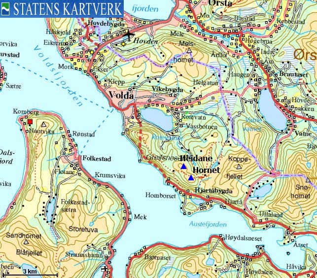
| Fylke/Kommune : | Møre og Romsdal/Volda | ||||
| Maps : | 1119-II Volda (Statens Kartverk, Norge 1:50 000) | ||||
| Primary factor : |
Hornet: 182m Heidane: 51m |
||||
| Hiked : | Mar 2009 | ||||
| See also : |
| ||||
| See also : | Other Volda mountains |

Hornet seen from Instehornet
(Click for larger image)
Hornet (the Horn) is a nice mountain above Volda, located between Rotsethornet and Koppefjellet. Hornet is more of a big lump, rather than a horn, but as long as the views are good and the trip is good, the shape doesn't really matter. Hornet offers a superb panorama towards the tops surrounding Voldsfjorden - Eidskyrkja and Matøskja massifs in particular.
This page will describe a round trip across Hornet and Heidane. The route begins at Lake Rotevatnet and runs via lakes Horndalsvatnet and Daletjørna (name not on the map). This is not classic skiing terrain, but the route can certainly be skied. Half the route runs along good forest roads. You'll also be following mountain paths, and there will be an off-trail leg as you cross Heidane.
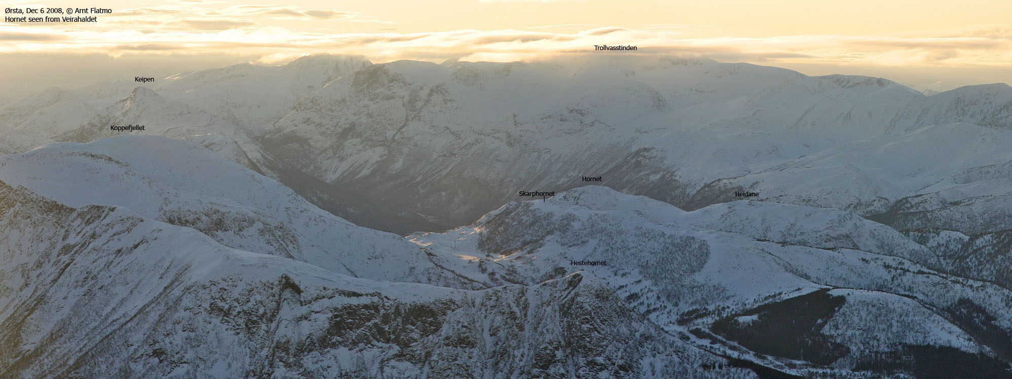
Hornet seen from Veirahaldet
(Click for larger image)
Hornet (Norge 1:50,000: 693m, Økonomisk Kartverk: highest contour is 695m, UTM 32 V 351353 6889906) has a primary factor of 182m towards the higher parent Skarphornet (698m). The defining saddle (approx. UTM 32 V 351669 6890001) is found in the pass between these two tops. Ref. Økonomisk Kartverk (5m contours), the saddle is within the range 510-515m, interpolated to 513m.
GPS measurement read 699m (on the ground), averaged over a 5-minute period (error margin +/- 0,9m).
Heidane (Norge 1:50,000: 648m, Økonomisk Kartverk: 649m, UTM 32 V 350955 6890368) has a primary factor of 51m towards the higher parent Hornet (695m). The defining saddle (approx. UTM 32 V 351076 6890156) is found in the pass ("Skaret") between these two tops. Ref. Økonomisk Kartverk (5m contours), the saddle is within the range 595-600m, interpolated to 598m.
GPS measurement read 647m (on the ground), averaged over a 3-minute period (error margin +/- 5,1m).
Google's interactive map. You can zoom, pan and click on the markers.
|
|
|
|
Route 1: Rotevatnet - Hornet - Heidane (spring)
|
|
Access
(all distances are approx. distances)
The nearest bigger city is Ålesund. From Ålesund, follow highway E39 towards Bergen/Volda to the ferry at Solavågen. Take the ferry over to Festøy, turn right at Festøy and follow E39 towards Ørsta (38,3Km). At the highway RV655/E39 junction in Ørsta, keep following E39 (Volda) for 9Km until you have the ferry harbor in Volda on your right-hand side.
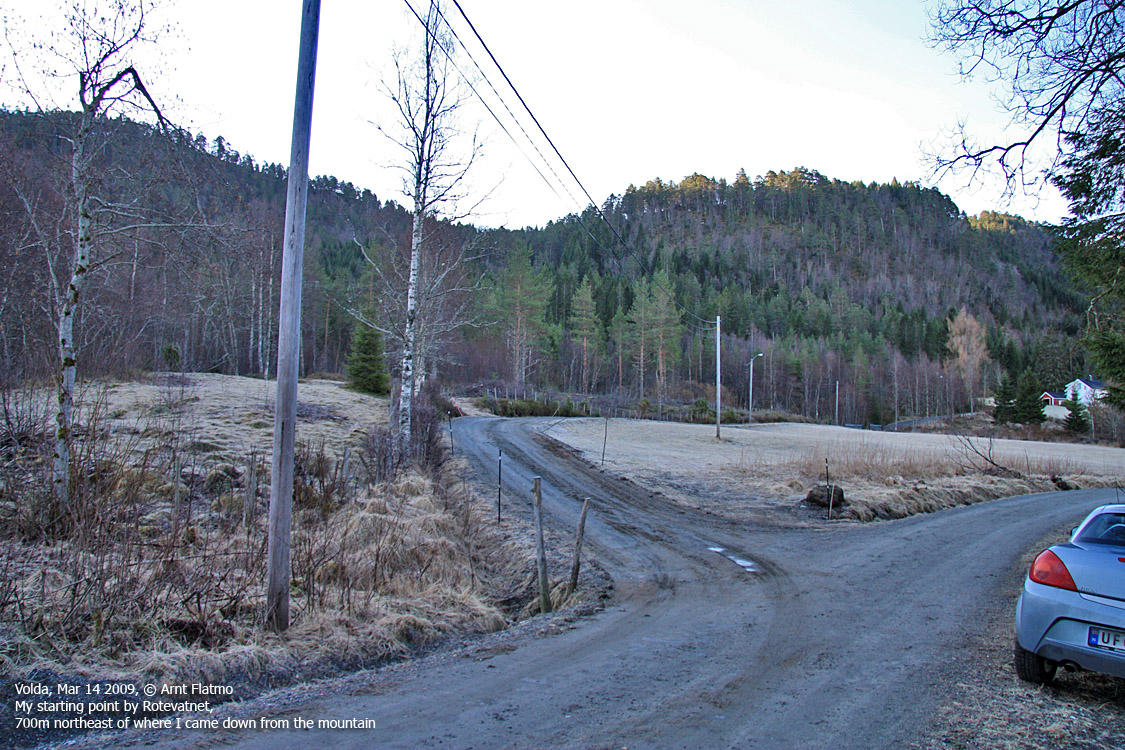
Drive 750m along RV651 through the village centre and turn left at the Andaneset junction (signposted). Drive 800m to a roundabout. Take the 2nd exit (go straight ahead and don't turn right towards Fyrde). You're now on the road to Krøvelseidet and Åmdalen. Drive 1,8km on this road and turn right towards Vassbotnen. Follow this road 1,5km down to the east end of Rotsetvatnet. You see a road on your left-hand side leading to a house. Find parking along the road you're on.
The main forest road up to Horndalsvatnet is 700m down the road. According to this round trip suggestion, you'll be coming down that way.
The route

The route from Horndalsvatnet
(Click for larger image)
Hornet & ascent:
Follow the road 100m in the direction of the house, then turn left and follow a forest path upwards. The path stays east of - and close to (30-40m) the stream from Horndalsvatnet. Above 180m elevation, the path can be hard to see, so stick close to the stream in order to locate the bridge at 210m that takes you onto the main forest road.
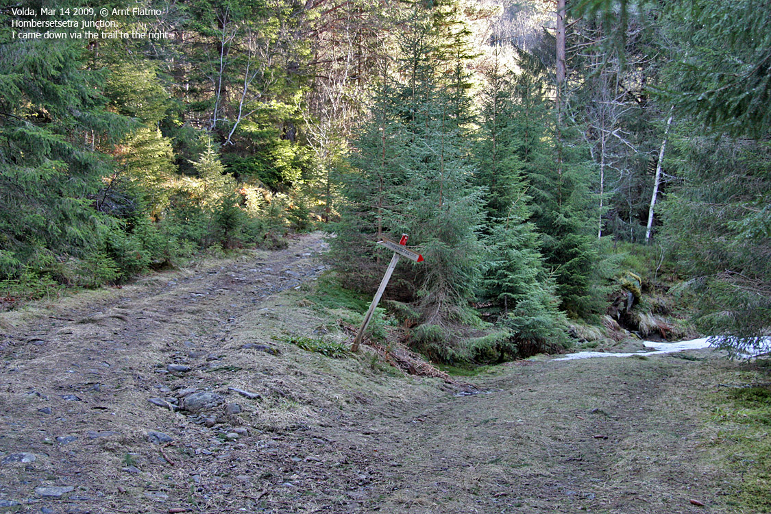
Follow the forest road upwards. Go straight ahead at all junctions (Rotsethotnet, Homborsetsetra and at a junction that is not signposted). The forest road ends by Lake Horndalsvatnet (see picture above). Cross the drain from this lake and locate a vague path that runs through the forest, close to the lake. It can be difficult to find this path in the beginning.
In spring, there may be ice on the lake, and if you consider the ice to be safe, walk on the lake instead. At the south end of the lake, aim for a couloir which leads up to the ridge above you. According to the map, there is a path here. If there is snow, and the snow is hard, you will be better off with an ice-axe and crampons. The steep section isn't very long - just the part where the yellow line bends on the above picture.
Once on the ridge, pass a small lake and ascend Hornet via the southeast ridge. You'll pass a cairn 90m southeast of the high point, which is not marked.
Heidane & descent:
From Hornet, head westbound 100m to a trig. point. Continue (off-trail) northwest towards Heidane. When you reach the 648m map point, you'll see a large rock 45m to the north. This rock seem to be almost equally high as the high point. Go there, just in case..
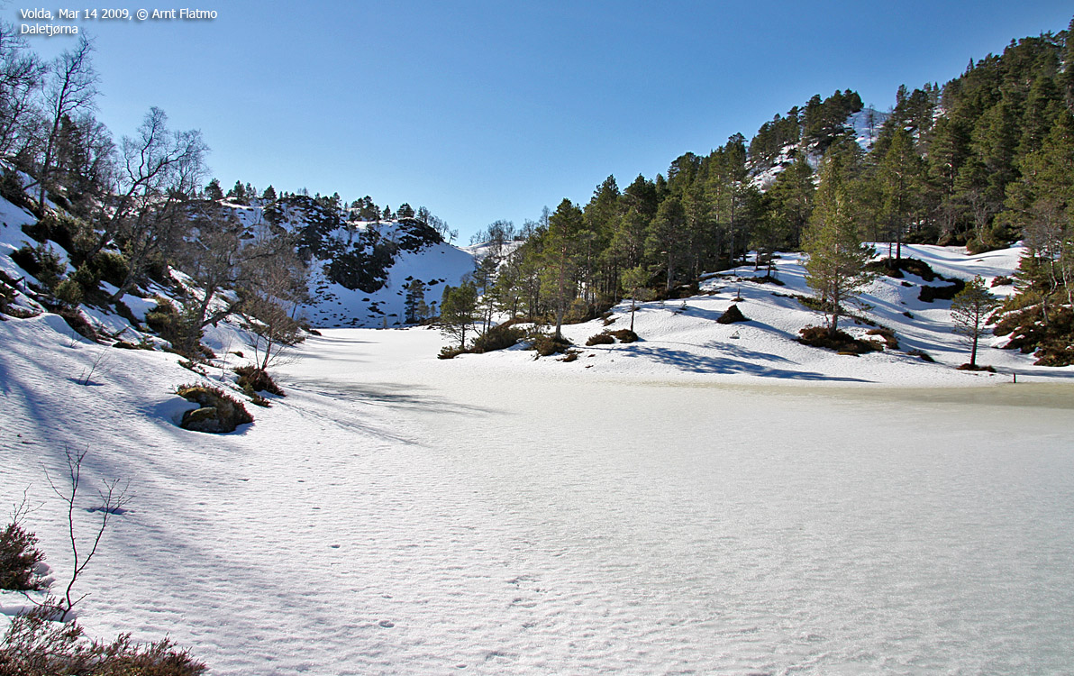
You can now head towards Homborsetra in the west, find the path that continues towards Rotsethornet and descend to Lake Daletjørna. Or - you could just take a short-cut directly down to the lake. The terrain is steep, but there are several ways to descend safely from Heidane.
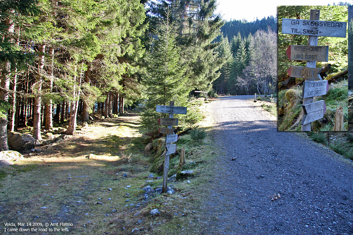
From Daletjørna, find the valley path on the south side of the stream. At approx. 350m elevation, the path crosses the stream - just below the Løypingskaret signpost. The path merges with a forest road and you'll join your ascent route at the "Homborsetra" junction.
Follow the main forest road all the way down to Rotsetvatnet, and then the road back to your starting point.
 westcoastpeaks.com
Other Møre & Romsdal mountains
Other Norwegian mountains
westcoastpeaks.com
Other Møre & Romsdal mountains
Other Norwegian mountains


