
Norwegian Mountains, Møre og Romsdal
|
| Fylke/Kommune : | Møre og Romsdal/Vestnes & Ørskog | ||||||||
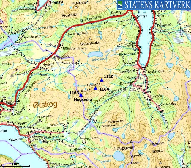
| Maps : |
1220-II Vestnes (Statens Kartverk, Norge 1:50 000)
1219-I Vestnes (Statens Kartverk, Norge 1:50 000) |
||||||||
| Primary factor : | 630m | ||||||||
| Hiked : | July 2008 | ||||||||
| See also : |
| ||||||||
| See also : | Other Rauma mountains |

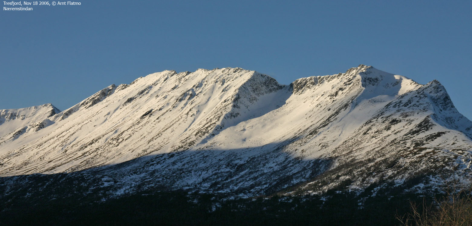
Sunset on Høgsvora
(Click for larger image)
Næremstindan is a large massif situated between Ørskogfjellet and Vaksvikfjellet on Nordre Sunnmøre. The massif has two high points; point 1163m (Høgsvora) and point 1164m on Næremstindan. This site will however use 1169m as the high point for Næremstindan. This point is 172m northeast of the map point 1164m, and based on personal observations, obviously higher than the map point. For clarity; on pictures on this site, Næremstindan refers to the mountain ridge east of Høgsvora. While Næremstindan belong to the municipality of Vestnes, Høgsvora is shared between Vestnes and Ørskog.
Høgsvora is a very popular mountain, especially in winter. The shortest route to the top runs from Vaksvikfjellet, but you can also ski from Ørskogfjellet. Starting from Vaksvikfjellet, you have two options; a) the south ridge, or b) up the long hill (the "trade route") west of the south ridge.
The south ridge is trivial in summer, and less so in winter. Cornices will determine the difficulty. The sharper the ridge, the more exposed it gets. In winter, the ridge is a bit airy, but under normal conditions, you can ski up this ridge. On any given nice Sunday, few people choose this variation. This page describes a round trip which includes both routes described above.
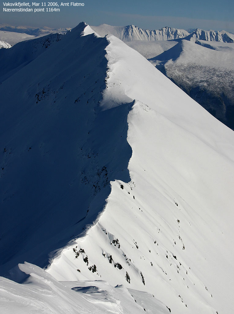
Næremstindan seen from Høgsvora
(Click for larger image)
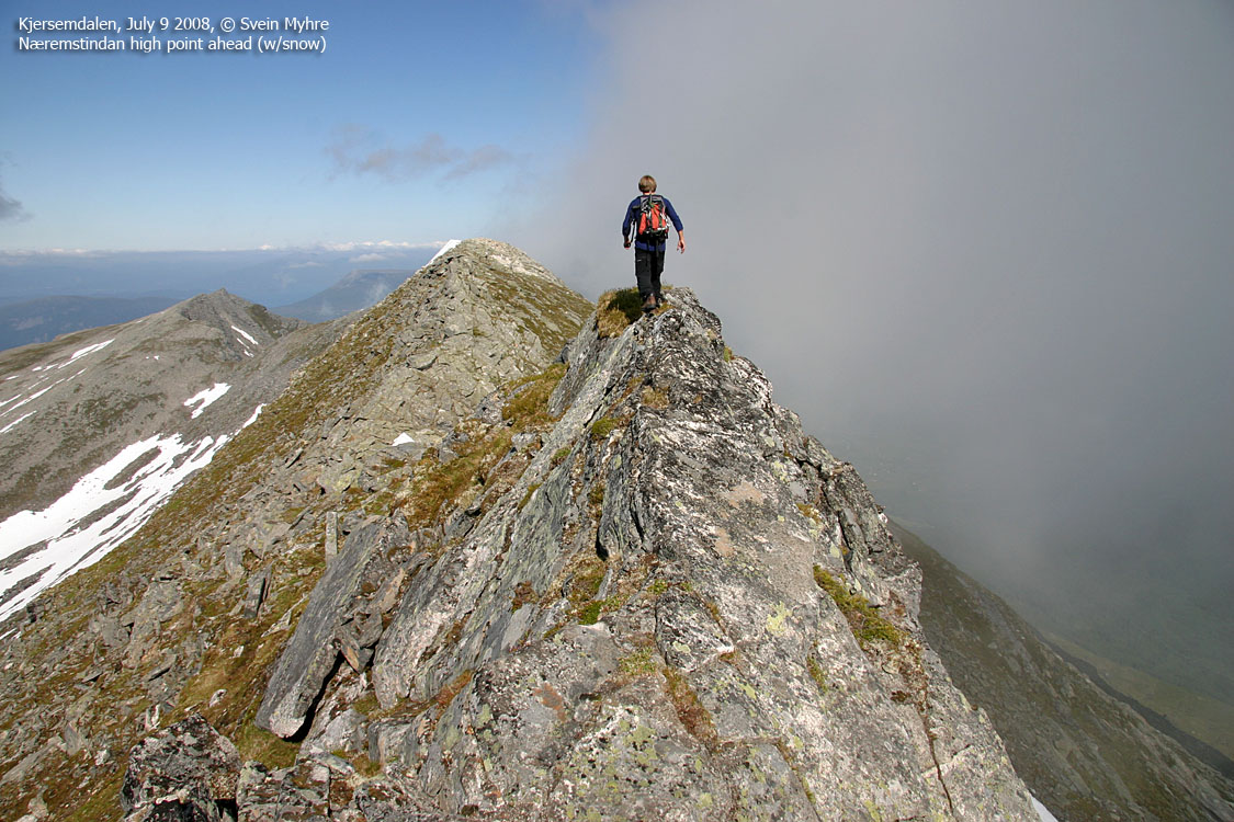
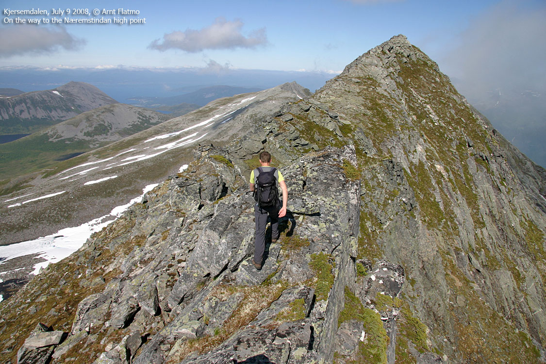
Næremstindan's high point can be reached rather easily. Although a small section is a bit airy, the scrambling is easy and the mountain should be considered easy. This page will describe how to get to the high point on the easiest route.
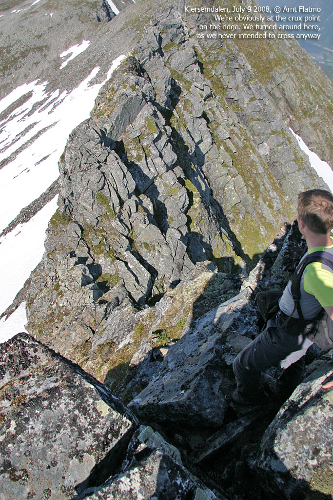
The Næremstindan traverse is a classic traverse (on skis or on foot) from Sørsylte (Tresfjord) to Kvanndalen (Ørskogfjellet or Vaksvikfjellet). The traverse involve short pitches of (easy) climbing, at least between Næremstindan's north top (1110m) and the map point 1164m, and longer pitches of scrambling. The ridge from Næremstindan to Høgsvora may also be considered as challenging, possibly depending on the choice of ascent route to Høgsvora. This site hopes to present this traverse in not too long.
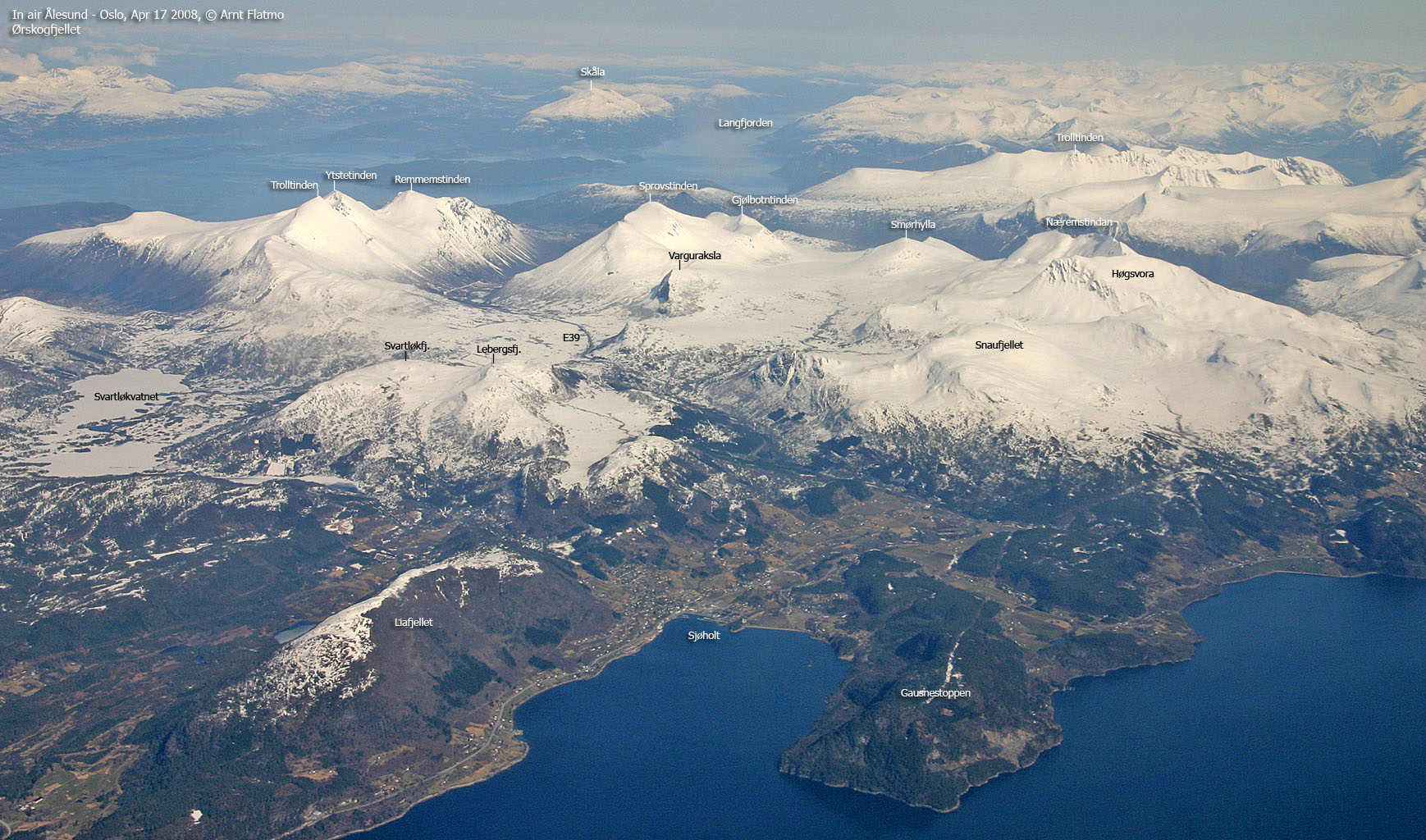
Høgsvora/Næremstindan seen from the air
(Click for larger image)
Høgsvora (M711: 1163m, Økonomisk Kartverk: 1163,33m, UTM 32 V 397321 6930681) has a primary factor of 133m towards the higher parent mountain Næremstindan (1164m/1169m). The defining saddle (approx. UTM 32 V 397770 6930883) is found on the ridge connecting the two tops. Ref. the 1:50,000 map (20m contours), the saddle is within the range 1020m-1040m, interpolated to 1030m.
Næremstindan (M711: 1164m, Økonomisk Kartverk: 1164m, westcoastpeaks: 1169m, UTM 32 V 398714 6931390) has a primary factor of 630m towards the higher parent mountain Sprovstinden (1194m). The defining saddle (approx. UTM 32 V 400022 6934922) is found just east of Lake Jutevatnet. Ref. Økonomisk Kartverk (4m contours), the saddle is defined through a fixed point - 539m.
On Næremstindan's high point, GPS measurement read 1171m, averaged over 10 minutes, and with an error margin of 1,5m. The track log (no movement) recorded 1172m over the same period. The suggested height is assumed to be approx. 1169m, as there is no 1170m cairn on Økonomisk Kartverk. It must howere be noted that the faith in Økonomisk Kartverk on this mountain is not strong.
Measurement on map point 1164m was not equally thorough. A waypoint recorded 1168m, and the track log (both directions) ranged from 1168 to 1172m. The "decision" that map point 1164m is not the high point was based on visual observations. Besides, no cairn (or any other marker) was found near the map point, but one was found on the (assumed) high point. Økonomisk Kartverk does not have an official trigonometric point (with decimals) at map point 1164m, so one could wish for this mountain ridge is measured again.
Google's interactive map. You can zoom, pan and click on the markers.
|
|

Google maps (Click on image) |
Notes: Class ratings are in reference to YDS. Click here for more information.
The trails described below are not necessarily the *easiest* trails to this mountain.
|
Route 1: Vaksvikfjellet - Høgsvora (winter roundtrip)
|
|
Access
All distances are approx.
From Ålesund, follow highway E136->E39 towards Åndalsnes. From the E136/E39/Olsvika roundabout near Breivka, follow E39 approx. 28,1Km to the "Geiranger/Stordal" junction in Sjøholt. Turn right onto highway 650 (Geiranger/Stordal) and follow this road 7,2-7,3Km. Turn left towards "Vaksvikfjellet" and drive 3,9-4Km up to the Vaksvikfjellet parking. There is a fee (self-served fee box) at the parking area. In crowded winter days, people park their cars along the road.
The route
Chances are that someone has broken trail before you. Follow the road up towards Sollisætra and leave the road at approx. 350m elevation. Stay left of Midtelva river and head into Kvanndalen.
Aim for the south ridge. The ridge is broad in the beginning, and narrows as you go along. Cornices will determine how exposed this ridge is. In any case, head for heights is required here.
The summit is marked by a large cairn. The descent route allows for some fun skiing if the snow conditions are good. It is a bit steep down from the summit, and you may choose to walk down 20 vertical meters before putting the skis back on. The slopes west of the south ridge are gentle. Back in Kvanndalen, descend on your ascent route.
|
Route 2: Kjersemdalen - Næremstindan (summer)
|
|
Access
All distances are approx.
From Ålesund, follow highway E136->E39 towards Åndalsnes. From the E136/E39/Olsvika roundabout near Breivka, follow E39 approx. 28,1Km to the "Geiranger/Stordal" junction in Sjøholt. Turn right onto highway 650 (Geiranger/Stordal) and follow this road 7,2-7,3Km.
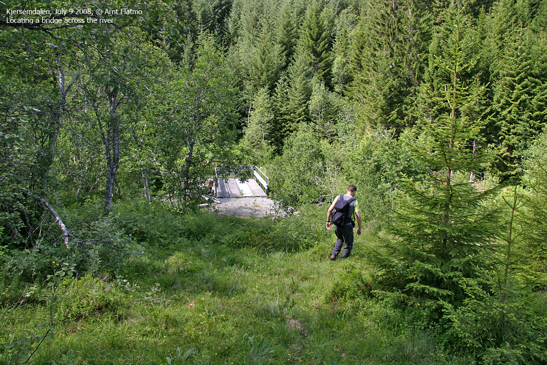
Turn left towards "Vaksvikfjellet" and drive 9,5Km. You're now on the way down towards Tresfjord, and approx. 1,8Km past the first Kjersemsetra sign (also signed Kvitnykjen). Locate a bridge across the river (barely seen from the road) and then park alongside the road.
Næremstindan
(Click for larger image)
The route
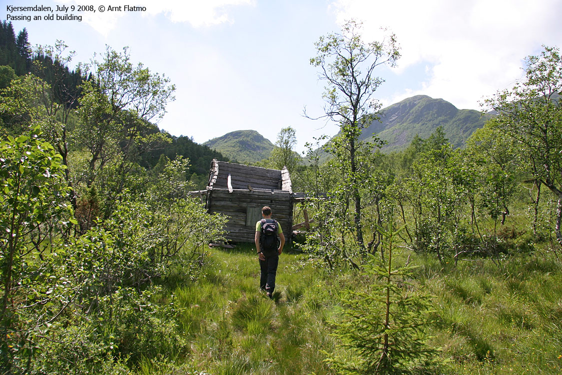
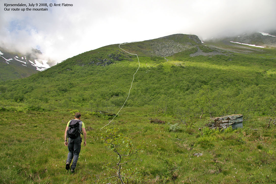
Cross the river on the bridge. Turn left and follow a faint tractor road 100m to the ruins of an old building. Head into the spruce forest (mind the branches!) or trade the forest route with boggy ground to the left. Aim for the ridge east of Storbotnen. In the upcoming birch forest, you might stumble onto a faint path that makes the ascent easier. In summer, the overall forest ascent can be slightly annoying until you get above it. Once on the ridge, you'll pass a boulder section before you gain the Høgsvora-Næremstindan ridge.
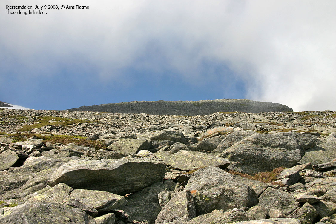
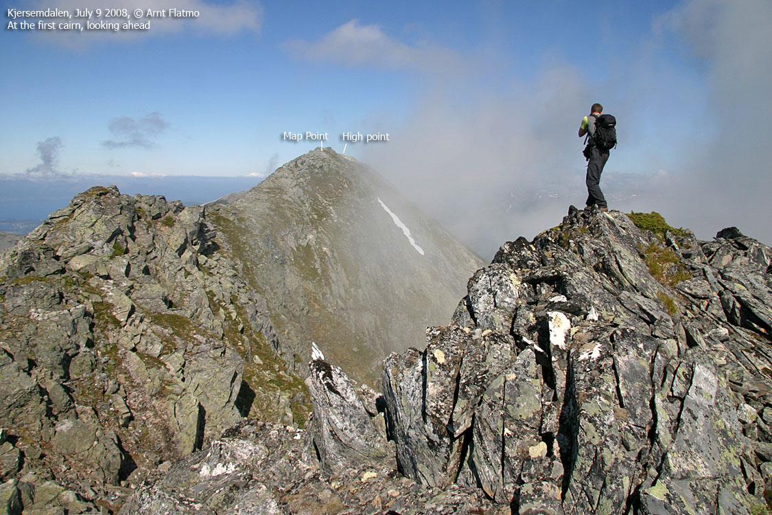
Proceed on easy terrain up the first top (UTM 32 V 398333 6931149, approx. 1150m), where you'll find a proper cairn. You'll now have a good overview of the ridge ahead (and the high point in the background).
Descend slightly from this top and continue along the ridge, which overall is wide enough for comfort. Where the ridge may seem narrow, just pass on the left-hand side.
Pass the map point 1164m (UTM 32 V 398571 6931309 - in the real world, this point is 20m east of the map point, and probably slightly higher than 1164m). Proceed 170m to the high point at UTM 32 V 398714 6931390, approx. 1169m. In July '08, a medium-sized cairn was built on top of the existing rocks that marked this point.
You may still continue 270m along the ridge before the terrain gets more challenging. If you're planning a traverse, considering going north to south.
 westcoastpeaks.com
Other Møre & Romsdal mountains
Other Norwegian mountains
westcoastpeaks.com
Other Møre & Romsdal mountains
Other Norwegian mountains

