
|

Høgenakken (center) seen from Sukkertoppen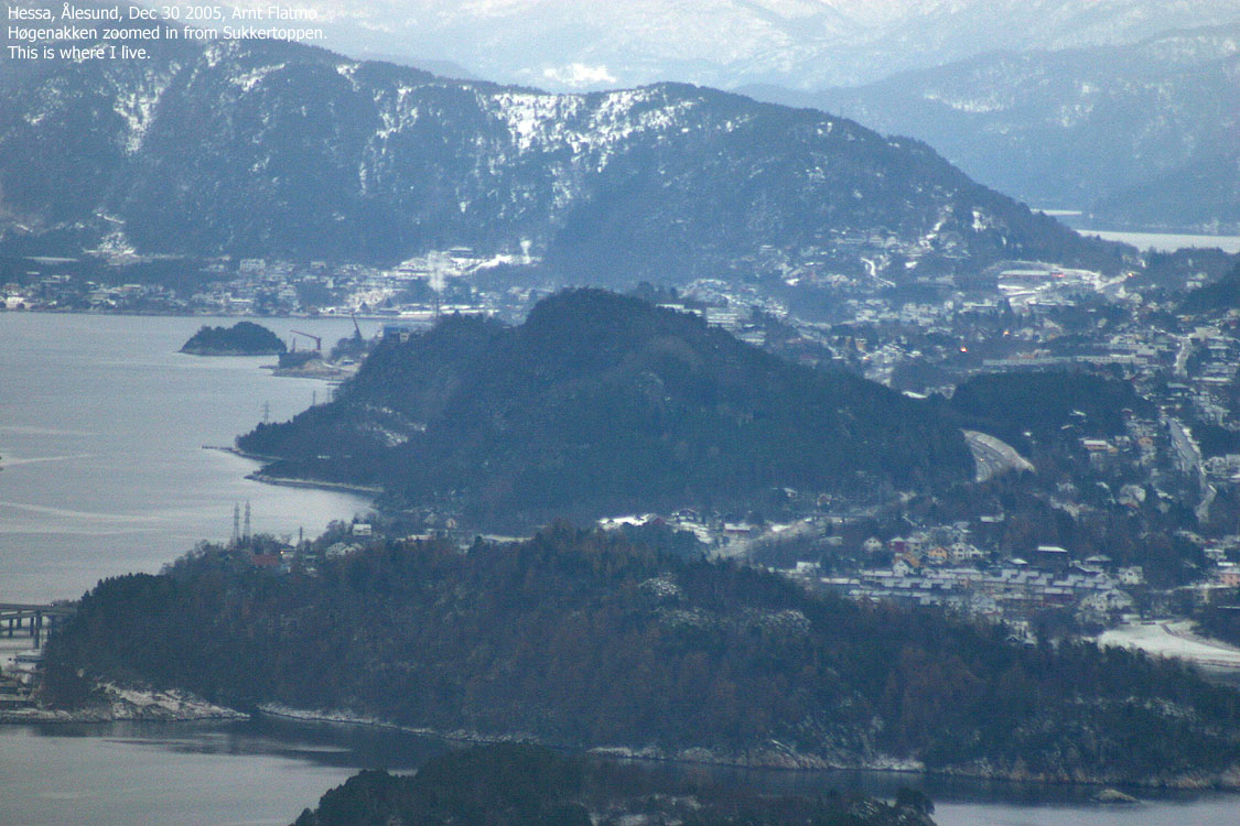
|
Høgenakken/Lerstadnakken is a minor forest hill, but is the closest viewpoint to my home outside the city of Ålesund, and the views are quite good. This is a popular hill. The summit is marked by a trig. point, and there is a visitor register in a mailbox on top. Close to 40 people had visited this hill the first day of January 2006, and a group of people celebrated the new year up here the night before.
Høgenakken (Norge 1:50,000: 130m, Økonomisk Kartverk: 129.83m, UTM 32 V 359600 6929468) has a primary factor of 87m towards the higher parent mountain Middagstua (244m). The defining saddle (approx. UTM 32 V 363659 6929188) is found just east of Moa, near Holssletta. Ref. Økonomisk Kartverk (5m contours), the saddle is within the contours 40-45m, interpolated to 43m.
There is some uncertainty regarding the contours in this area. They are difficult to trace due to many roads and ØK contours that don't quite match up. 58m points are found 12 times at different locations and elevations around Plantasjen. This is clearly wrong.
Notes: Class ratings are in reference to YDS. Click here for more information.
The trails described below are not necessarily the *easiest* trails to this mountain.
|
Gåseidnes bru - Høgenakken (all seasons)
|
|
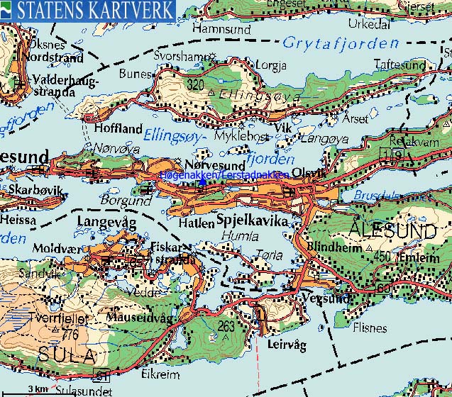
Access
From Ålesund, follow highway E39/E136 towards Bergen/Åndalsnes. Just after crossing Nørvesundet strait, turn right towards "Gåseid". Then turn left onto the road towards Gåseid and Hatlane. After roughly 1Km, you see a Shell gas station on your left-hand side. Turn left here and drive approx. 370m before you turn left onto a narrow, paved road by a rack of mailboxes. Follow this road across "Gåseidet Bru" (the bridge across the highway) and park in a sharp upcoming left-turn.
The route
The trail begins just before the sharp left-turn and you pass a large house on your right-hand side. The trail continues into the forest and you enter Høgenakken's west ridge. When you reach a 4-way trail junction (you see the sign "Velkommen til Fjellheim"), go straight ahead (east).
150m later, you reach another trail junction. Continue straight ahead (east) and the trail will take you all the way to the top of Høgenakken. Descend your ascent route.

 westcoastpeaks.com
Other Møre & Romsdal mountains
Other Norwegian mountains
westcoastpeaks.com
Other Møre & Romsdal mountains
Other Norwegian mountains

