
For Information, maps, trailhead and route descriptions, click HERE.
The will to go to the mountains came late this Sunday morning. I took the ferry to Festøya, without any clue about where I would end up. While driving along Vartdalsfjorden, I started thinking about Levandehornet, but when I saw the snowdrift on Bergehornet, I was discouraged on behalf of my four-legged hiking mate "Troll". I am not enjoying my trip when the little guy is trembling from the cold wind, inside the backpack.
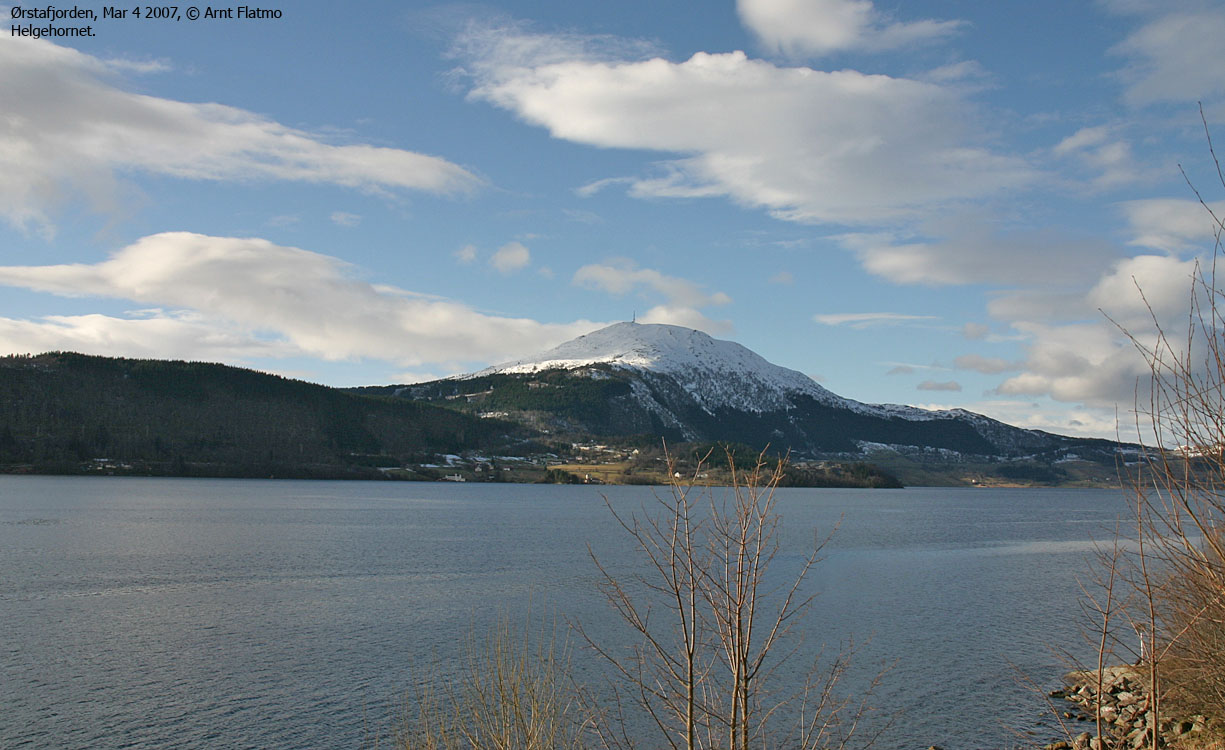
Approaching Ørsta, I decided to visit Helgehornet. I had been wanting to visit this top for a long time, so why not just do it now. I drove a little back and forth along Lake Hovdevatnet, trying to decide which route I should follow. My choice fell on the forest road, where my chances of exercising the dog, seemed greater.
We left the trailhead 12:15PM. The snow-free road was a bit "disturbing", but I was able to ski on the side of the road, while the dog walked the road. Around the next turn, there was plenty of snow, and thanks to footprints, the dog was able to walk almost to the end of the forest road.
I enjoyed the forest skiing part. It wasn't the optimal skiing terrain - to the left of this bush and to the right of the next one, etc., but it was still enjoyable. The cold wind wasn't notable (yet) and the sun was shining. All in all, a very nice day.
I passed a couple of hikers on snowshoes. Their progress was slow, and I have a strong feeling about them never reaching the top. As the hillside got steeper, I let Troll out of the backpack. The snow was hard enough to carry his weight, and I had a good laugh, watching his .. serious .. efforts to "summit" this mountain.
We reached the top 13:30PM, and it was quite chilly up there. I had to put on two jackets before I reached the "comfort zone". The summit building provided shelter from the wind, so the dog was quite comfortable while I took my pictures. It struck me what a brilliant viewpoint this was, the modest elevation taken into consideration. In many ways, Helgehornet reminded me about Ulriken in Bergen, and I wouldn't mind living at the foothills of a mountain such as this.
After 10-15 minutes at the top, we began our descent. Troll descended Helgehornet with great "passion", well aware of the comfortable passenger seat at the mountain foothills. That said, he certainly seem to enjoy descents on snowy mountains. Except for a short pitch in the forest, Troll walked all the way back to the trailhead, which we reached 14:30PM. Another FINE trip in the Ørsta/Volda region had come to its end.
To Helgehornet trailhead
The two first pictures are taken from Solavågen, NOT Festøya


To Helgehornet


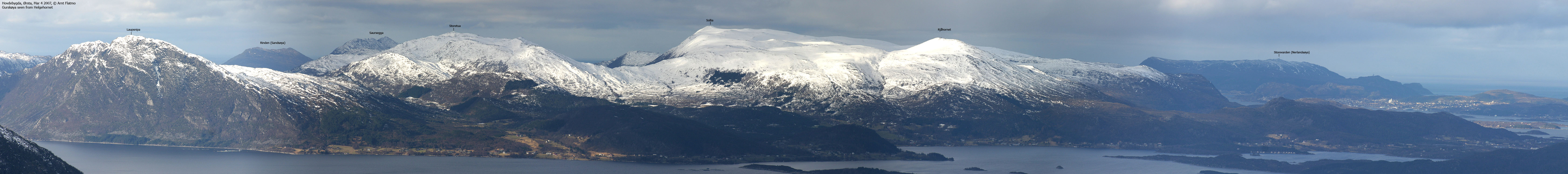
Wide-angle view from Helgehornet

50mm views from Helgehornet, 2 parts


Zoom views from Helgehornet


Descent


No Javascript:
1 2 3 4 5 6 7 8 9 10 11 12 13 14 15 16 17 18 19 20 21 22 23 24 25
 westcoastpeaks.com
Other Møre & Romsdal mountains
Other Norwegian mountains
westcoastpeaks.com
Other Møre & Romsdal mountains
Other Norwegian mountains