
|

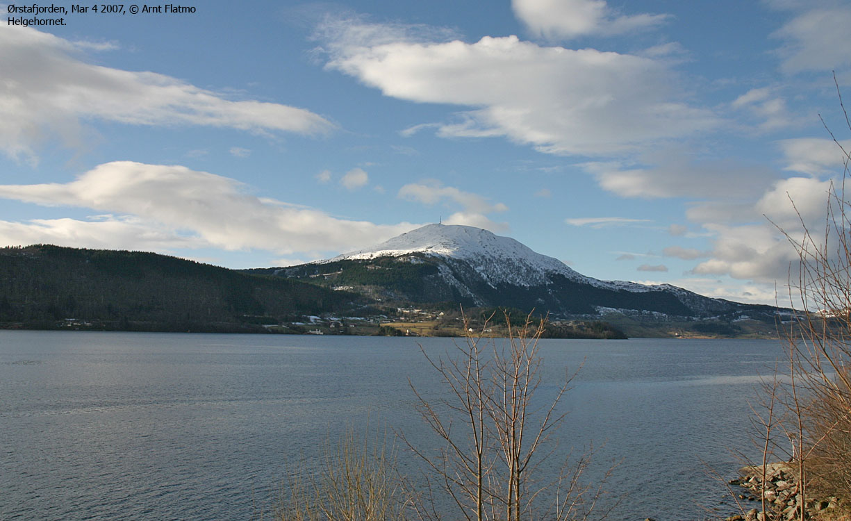
Helgehornet is a frequently visited top located along the Ørsta/Volda kommune border, although the actual summit belongs to Volda kommune. Through its location near the Ørstafjorden - Voldsfjorden - Vartdalsfjorden - Rovdefjorden "junction", excellent views are offered. Even Slogen (east of Hjørundfjorden) can, in all its splender, be enjoyed from Helgehornet.
A popular mountain often result in numerous trails and paths. The most used routes run from the east side, near Lake Hovdevatnet. Many prefer to start by the shooting range near Kleiva, while others follow various paths that fork from a forest road further northeast. This web-page describes access on skis from this forest road.
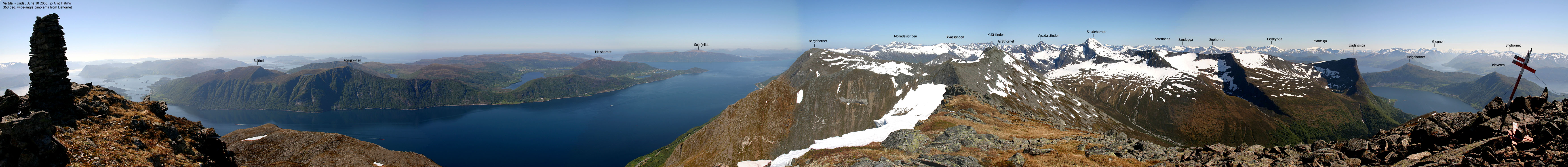
A quick search on the internet for "Helgehornet" and "web kamera" (webcam) will point you to the webcams on Helgehornet. The summit is "cluttered" by a large antenna, a building and various obstacles that make a 360 degree panorama very difficult to capture. However, these man-made features do not necessarily reduce the good feeling of being on this nice top, and with the great views.


Helgehornet (Norge 1:50,000: 623m, Økonomisk Kartverk: 622,56m, UTM 32 V 343994 6898894) has a primary factor of 545m, towards the higher parent Melshornet (807m). The saddle (approx. UTM 32 V 346389 6897069) is found along E39 near Furene. Ref. Økonomisk Kartverk (5m contours), the saddle is within the range 75-80m, interpolated to 78m.
Google's interactive map. You can zoom, pan and click on the markers.
Notes: Class ratings are in reference to YDS. Click here for more information.
The trails described below are not necessarily the *easiest* trails to this mountain.
|
Hovdevatnet - Helgehornet (winter, on skis)
|
|

Access
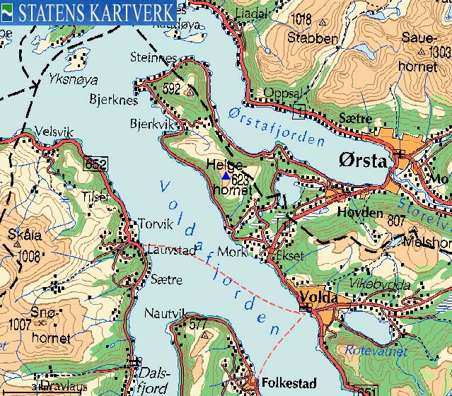
From Ålesund, follow highway E39 towards Bergen/Volda to the ferry at Solavågen. Take the ferry over to Festøya. Turn right in the direction of Ørsta/Volda. Follow highway E39 approx. 35,5Km to the main junction in Ørsta.
From this junction, follow E39 (Volda) 3Km and turn right towards Steinnes. Follow Ytrehovdsvegen road 1,5Km until the road forks and becomes gravel roads. Turn right in this fork, and proceed 1,4Km along the north shore of Hovdevatnet. Next is a junction - turn left and drive southbound 400m until you see a forest road on your right-hand side, signed "Helgehornet".
You may find parking 200-300m up this forest road. Alternatively, park in the junction, without blocking for other traffic.


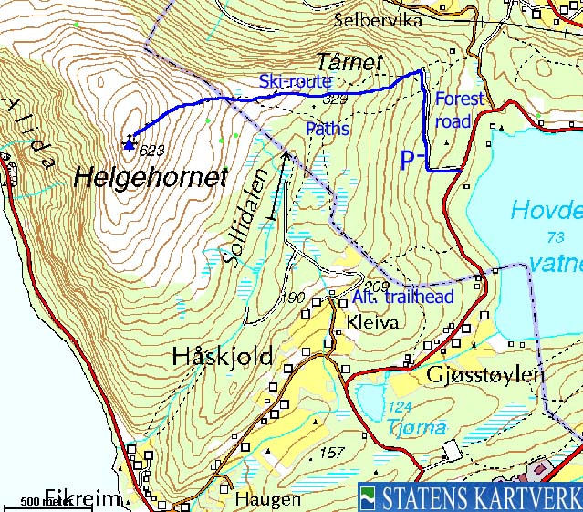
The route
Follow the forest road upwards. First northbound, then a long pitch to the southwest. Now, the forest road forks (230m elev.). Turn right and head northbound. After 150m, you see the "Helgehornet" trailsign. Proceed 100m northbound and follow a natural skiing route in the forest. After a short while, you pass the "Tårnet" antenna. From here on, and to above the tree-line, pick a route that works for you.
Gradually gain Helgehornet's east ridge and pick the best route up to the top. The upper 100 vertical meters are steeper than the rest. In case of hard snow/ice, crampons could be useful. Under normal snow conditions, you can easily ski to the top. Descend your ascent route.
 westcoastpeaks.com
Other Møre & Romsdal mountains
Other Norwegian mountains
westcoastpeaks.com
Other Møre & Romsdal mountains
Other Norwegian mountains

