
Back to the main Hausdalshorga page.

(No Javascript) |

(No Javascript) |
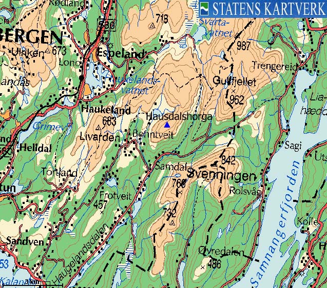
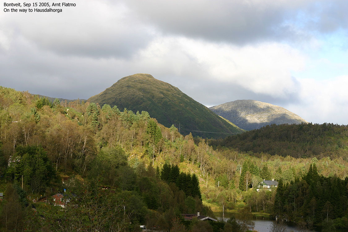
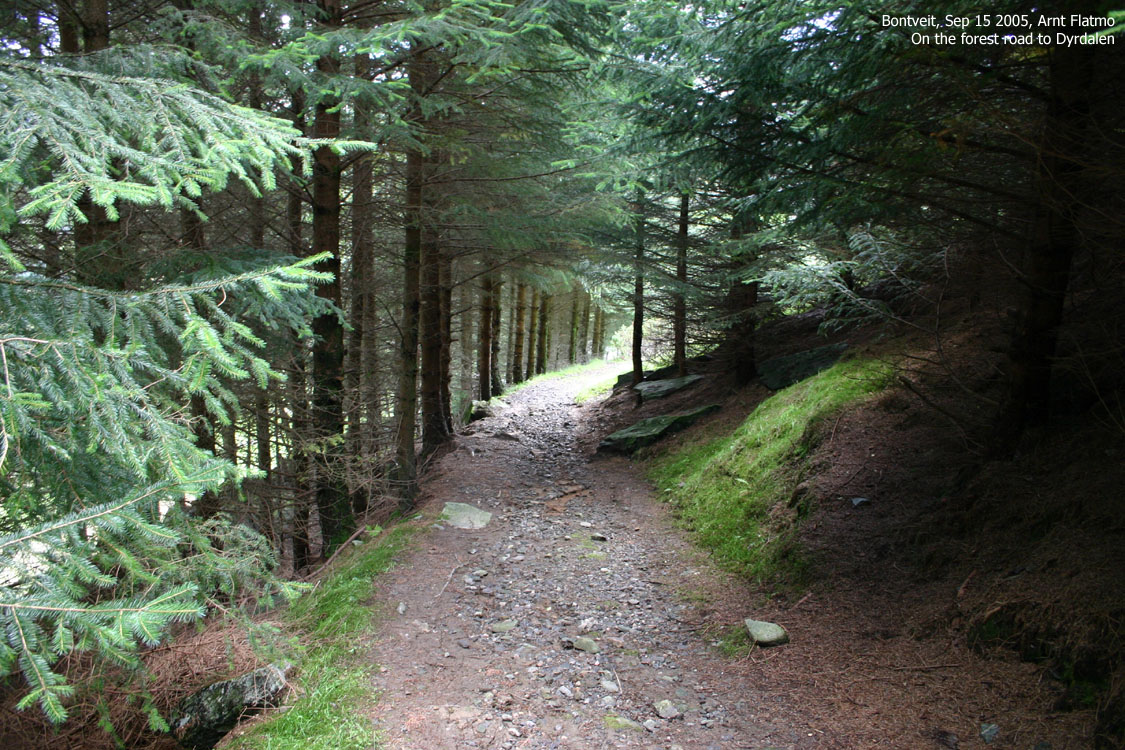
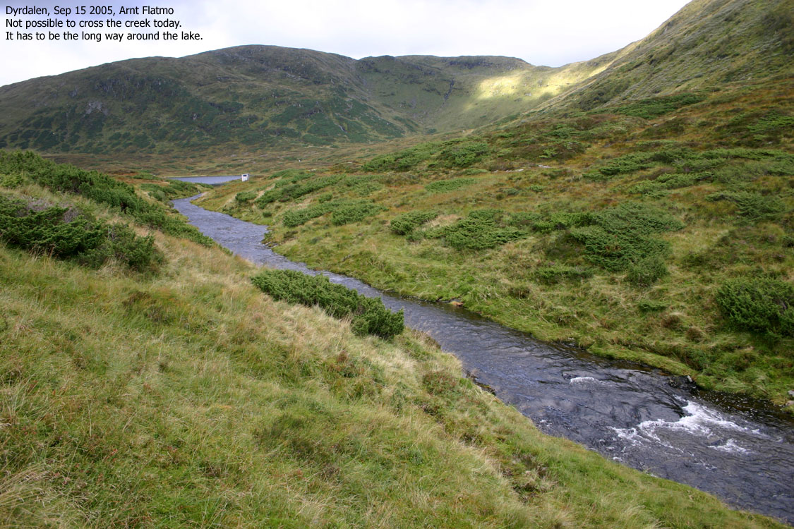
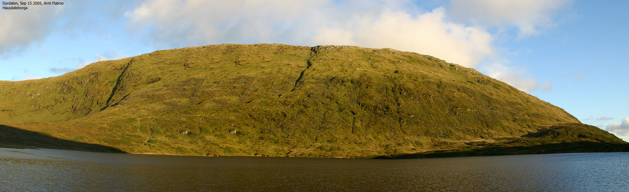
It was evident that it would start raining later this afternoon, but there would be sufficient time for a nice evening hike. I chose to visit Hausdalshorga, one of my favorite Bergen mountains. The plan was to ascend my descent route from Mar 1 2003, but due to the massive rainfall the recent days, I suspected that crossing the river from Dyrdalsvatnet could be difficult.
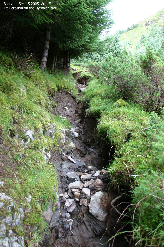
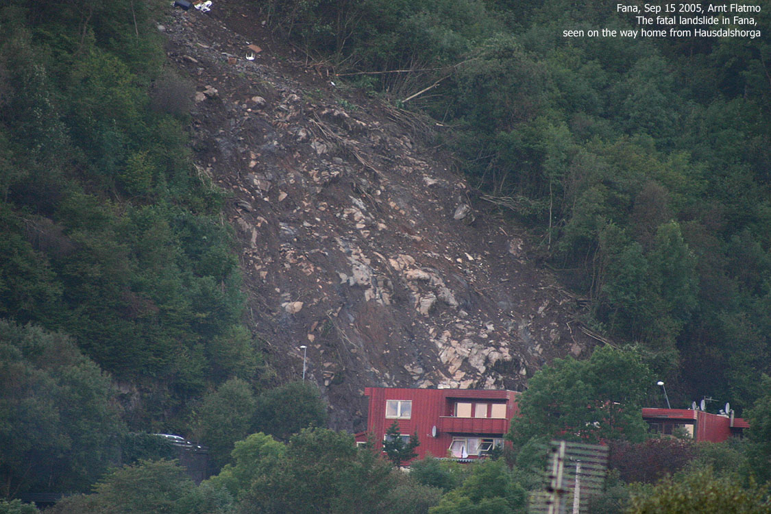
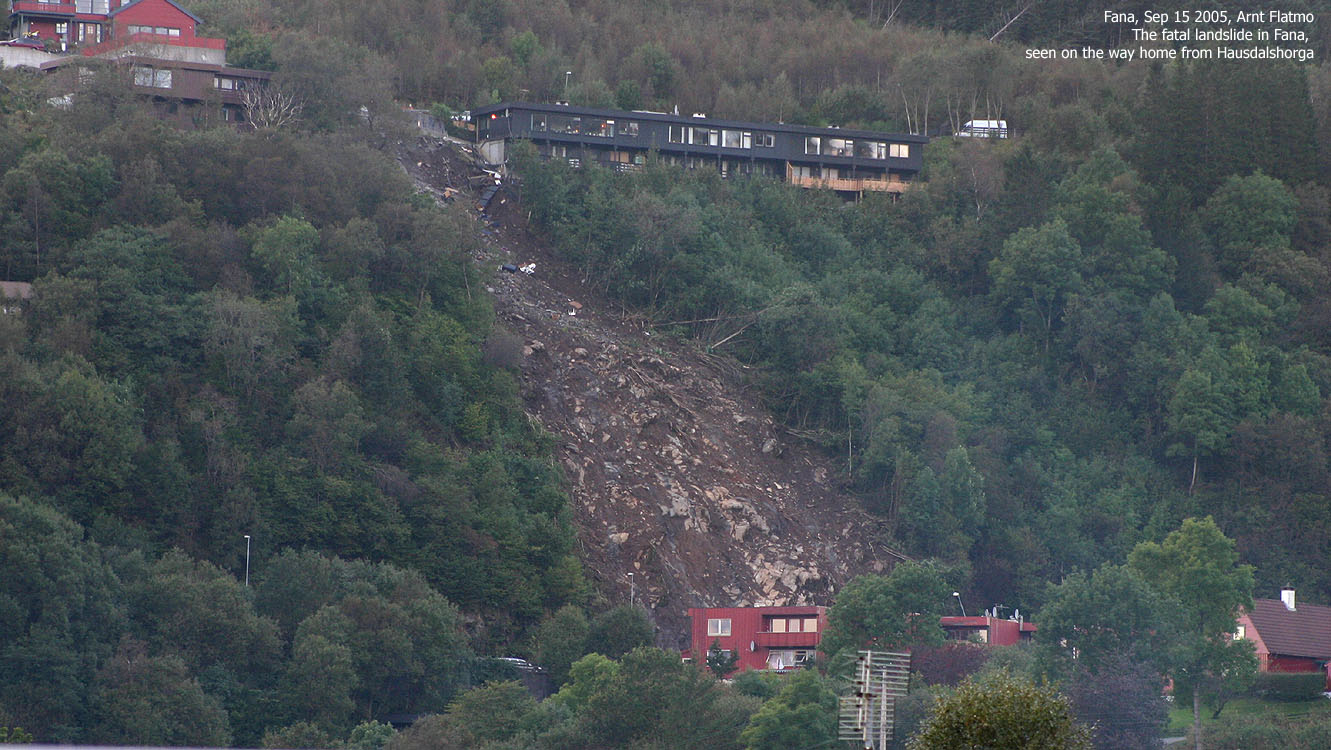
Across Smøråsfjellet, I witnessed the results of the landslide that had such a tragic outcome for a number of people, and fatal for two of them. During the evening of the 13th Sep. and until the next morning, the storm "Kristin" brought 156,5mm of rain down on Bergen. This was the highest amount of rain registered in Bergen during 24 hours - ever. The record from 1917 had been beaten by 24,5mm.
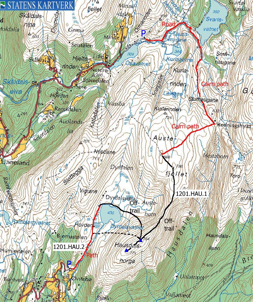
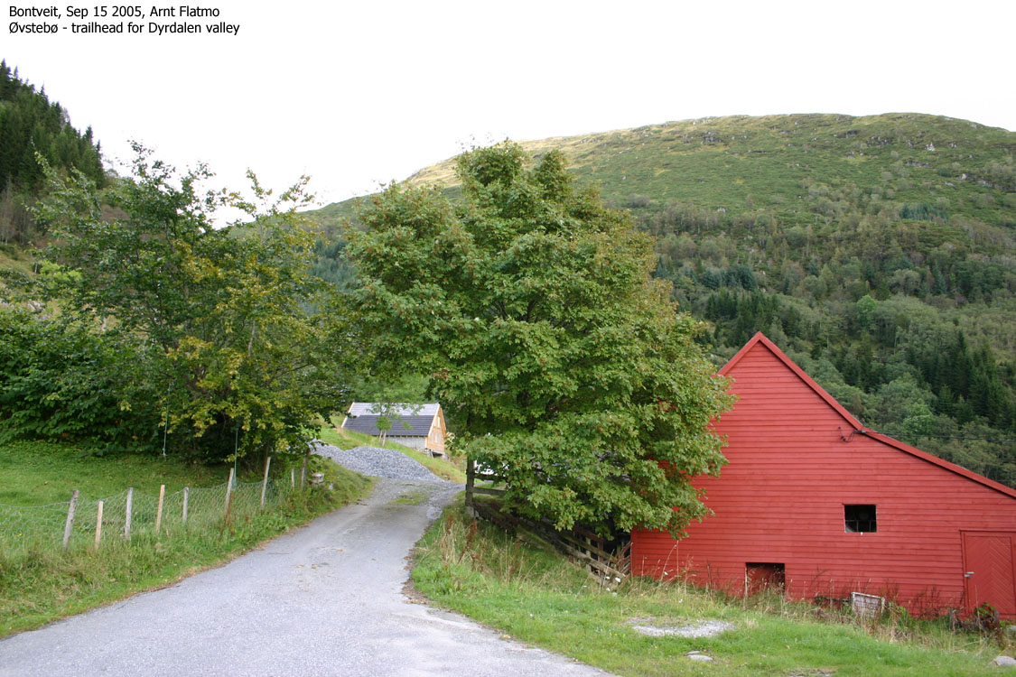
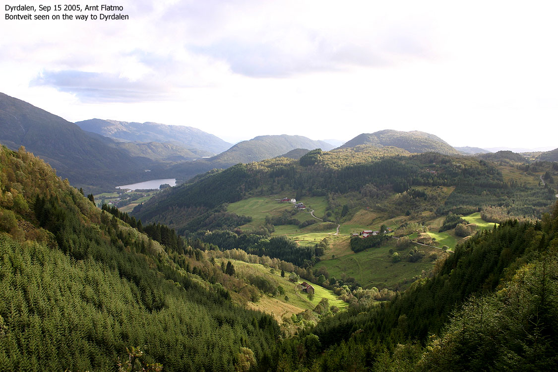
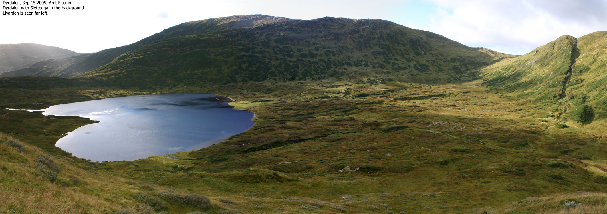
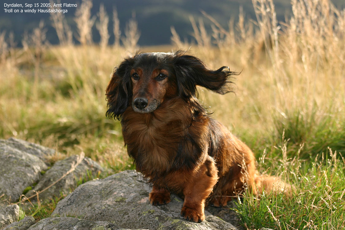
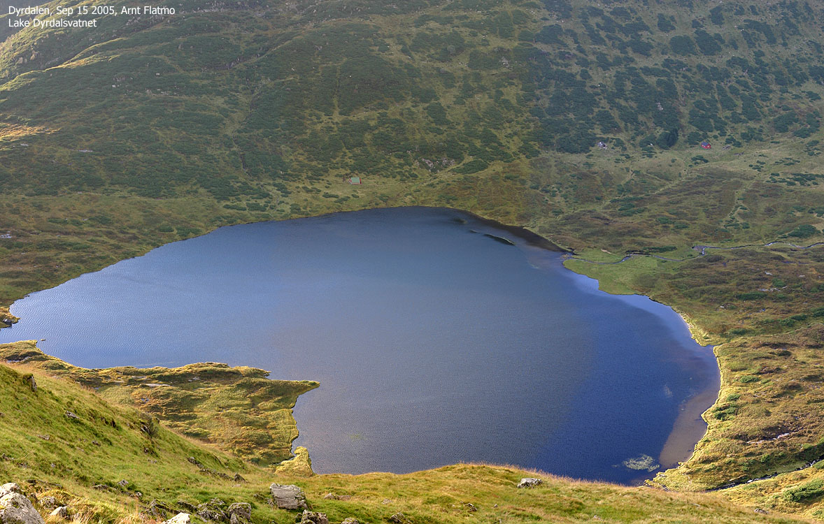
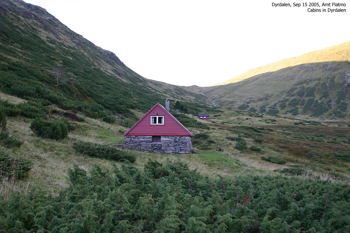
The erosion was very much visible on my way towards Dyrdalen. Large parts of the trail had simply been washed away. As I had anticipated, there was no way I could cross the river from Dyrdalsvatnet, and had to walk around the lake. My small dachshund "Troll" was enjoying the nice valley from the back-pack, which he entered already at the trailhead. I headed towards Austebotn, as I had always wondered if it was possible to directly ascend the Austefjellet - Hausdalshorga saddle from there. I saw a couple of good routes and concluded that the ascent wasn't as steep as I had thought it was. I made a mental note to give this route a try in winter.
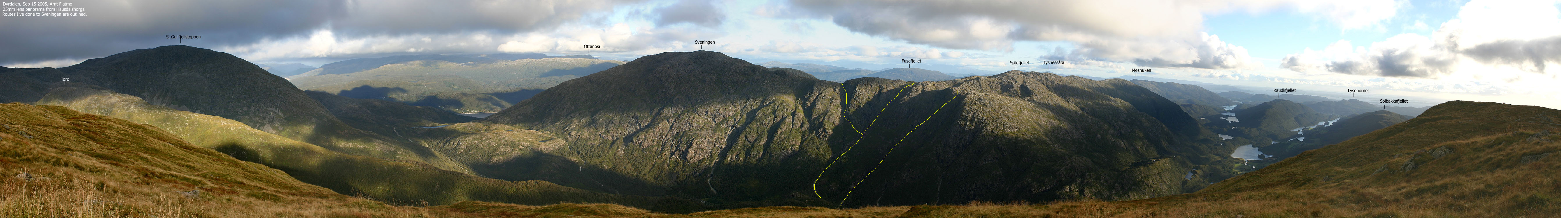
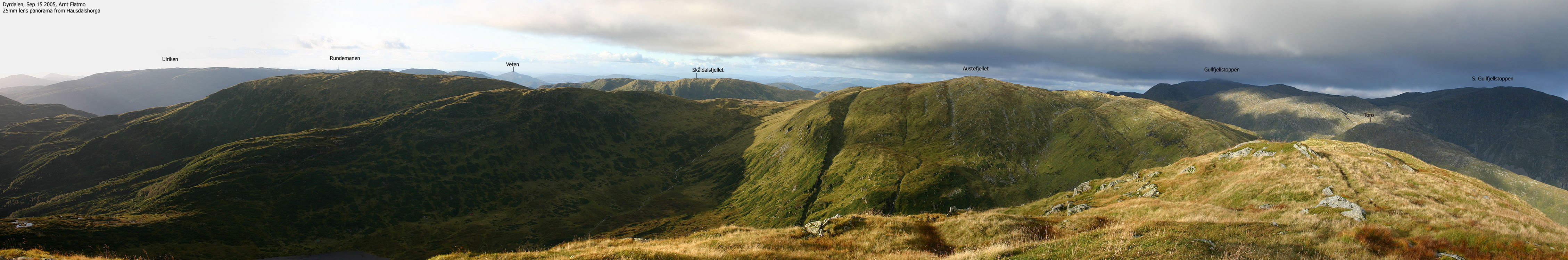
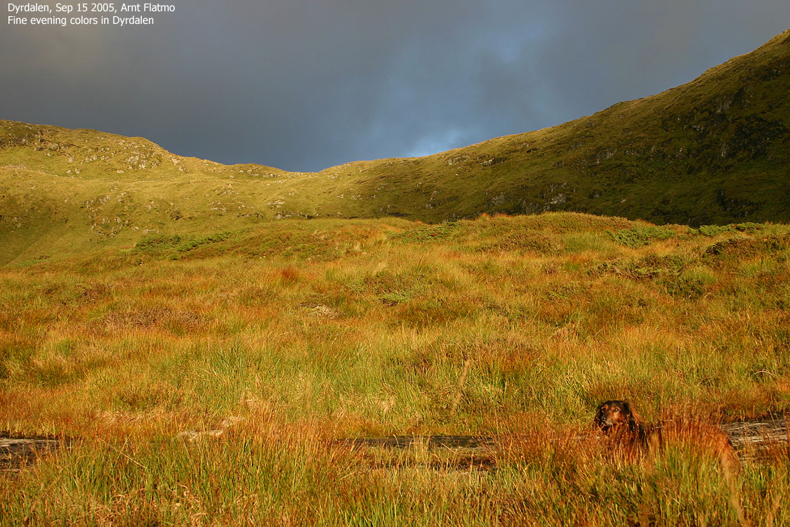
I proceeded up the slopes towards Hausdalshorga, and arrived the top 18:20PM, 1h:25m after I left the trailhead. The evening colors were beautiful, and I enjoyed every minute on top until I surrendered to a cold wind. I gave Troll the serious look and told him that he would be walking all the way down. He seemed to get the message and did a phenomenal job in the high grass down the mountain. Most of the sheep in Dyrdalen kept an observing eye on the two strange figures that was walking on their turf.
We arrived the trailhead 19:40PM and just as I left Øvstebø, it started to rain.
To the mountain


Views from the top


Descent


No Javascript:
1 2 3 4 5 6 7 8 9 10 11 12 13 14 15 16 17 18 19 20 21 22 23 24 25 26 27 28 29
 Other hordaland mountains
Hausdalshorga
Other Bergen K. mountains
westcoastpeaks.com
Other hordaland mountains
Hausdalshorga
Other Bergen K. mountains
westcoastpeaks.com