
|

Handfjellsaata seen from the ferry(No Javascript) |
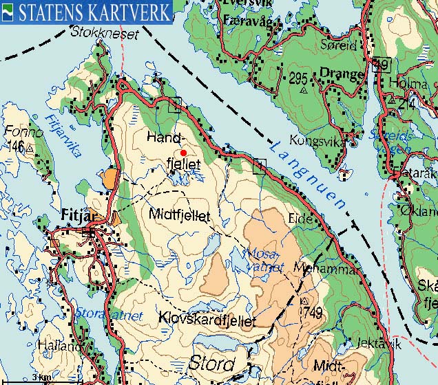
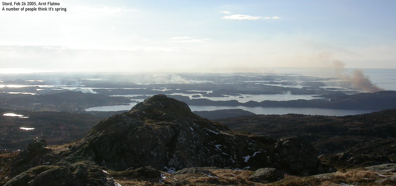
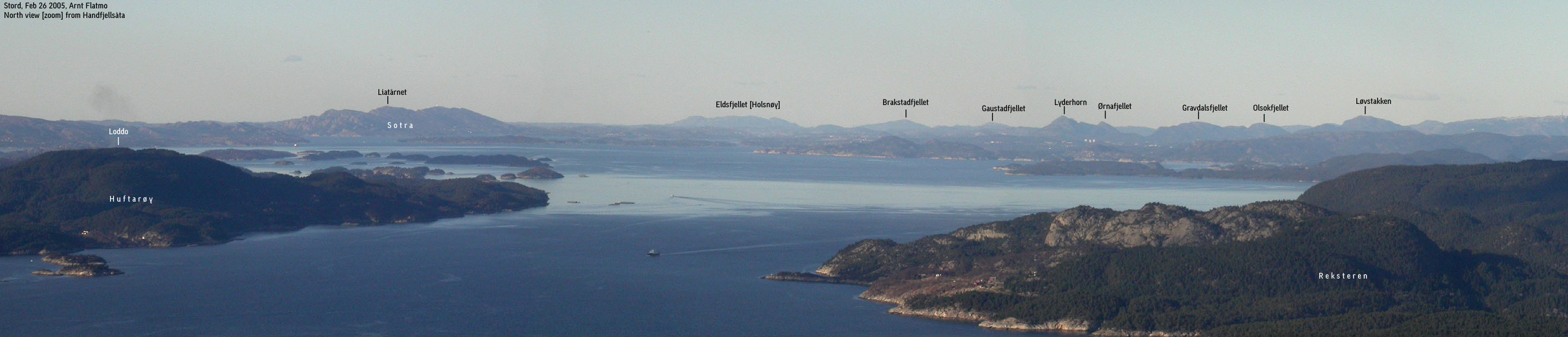
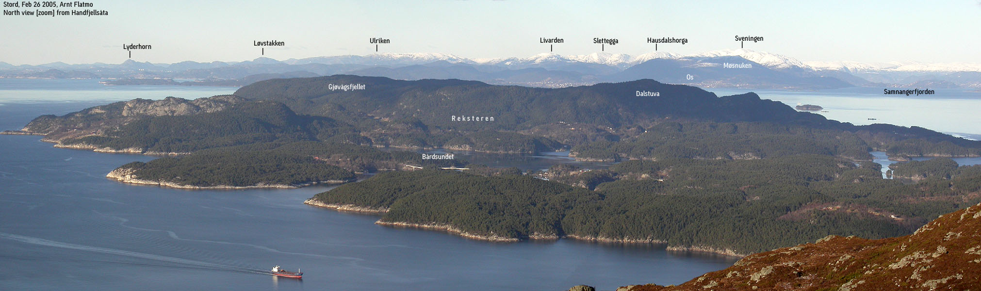
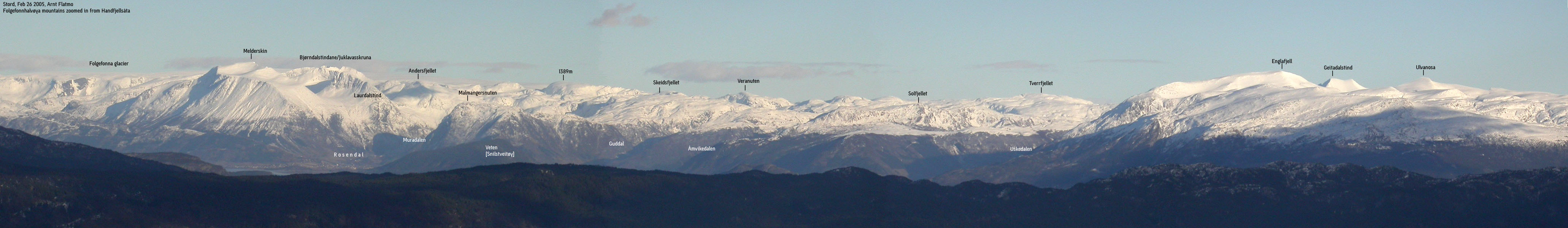
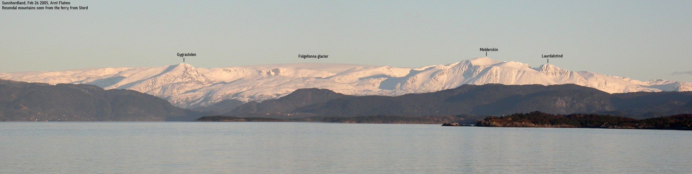
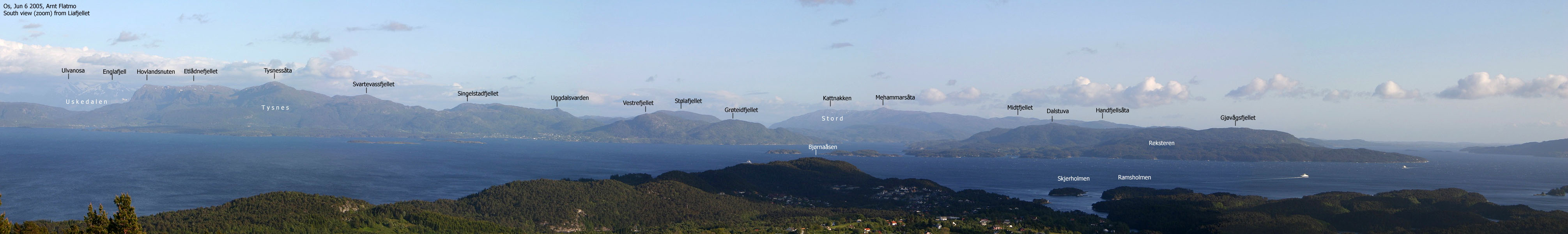
Despite its moderate height and primary factor, Handfjellsåta on Stord island offers superb views! Handfjellsåta is the northernmost mountain on the island, and lets you take in the views towards Austevoll, the Bergen mountains, Os and Tysnes. Further behind, you see the Gullfjellet, Kvamskogen, Fusa, Rosendal and Uskedalen mountains. The south views on the island are blocked by Midtfjellet, but you can see the top of Mehammarsåta, the highest point on the island.
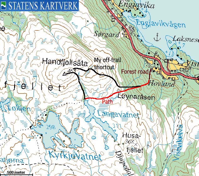
The route description on this web-page is best suited for those who do not necessarily depend on a trail. A forest road will start you off in the right direction, followed by a vague forest path. In the end, I recommend that you just set a direct course towards the top. The terrain is easy and the direction should be obvious. There are of course other trails to this mountain, but the one described on this page is most likely the shortest and fastest route to the top.
Handfjellsåta (M711: 465m, Ø.K: 464,50m) has a primary factor of 152m towards the higher Midtfjellet (500m) The saddle is found E of lake Langavatnet. Ref. Økonomisk Kartverk (5m contours), you cross the 315m contours on the high route, but not 310m. The saddle height has been interpolated to 313m.
Notes: Class ratings are in reference to YDS. Click here for more information.
The trails described below are not necessarily the *easiest* trails to this mountain.
|
Hwy E39 - Handfjellsåta (summer/autumn)
|
|
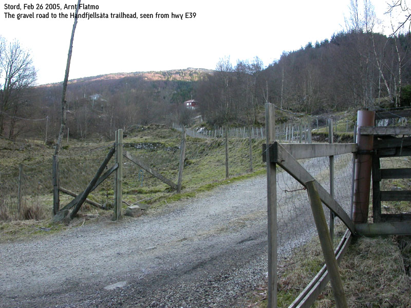
From Bergen, follow highway E39 southbound towards Halhjem (outside Os). The distance is approx. 23,5Km from the RV580/E16 junction at Nesttun to Halhjem. Take the ferry to Sandvikvågen on Stord. Drive up a hill (approx. 600m) and in the E39/Fitjar junction, continue straight ahead on E39 for 4,1Km (from the junction)
Turn right onto a gravel road, which may be blocked by a gate. Open the gate and drive up to the nearest junction near road end. The junction provides parking for one car, and you're just far enough away from the houses to avoid having to ask for permission.
From the junction, follow the road up to the right. The road ends after 50m. Turn right onto a forest road. Follow this forest road until it ends. Locate a path that climbs up to your right, with the spruce forest to your left. This path leads all the way to lake Langavatnet. At the north end of the lake, follow a distinct valley up towards Handfjellsåta.
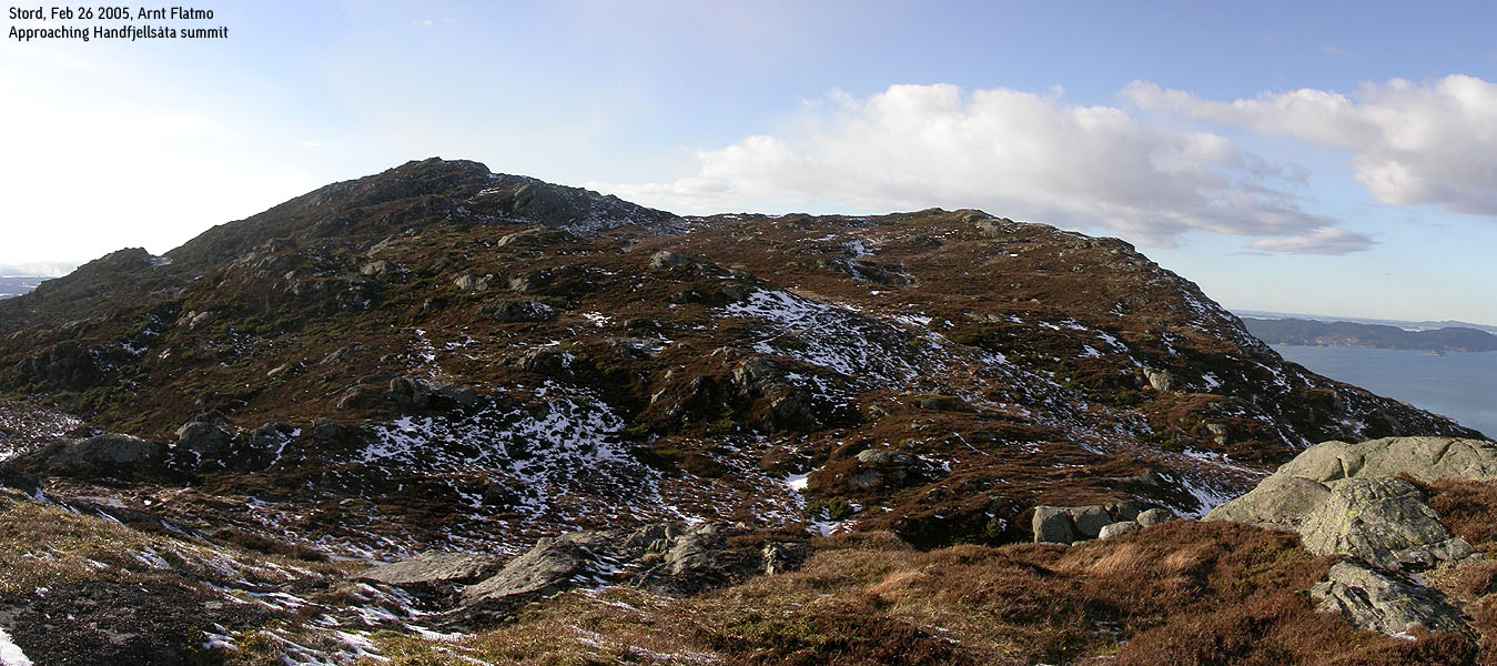
My variation was to leave the path early on, and maintain a direct, northwest course up the birch forest. The terrain is easy enough. Once out of the forest at 300m elevation, follow the ridge all the way to the summit. Note that you will have to descend a bit over some humps along the ridge.
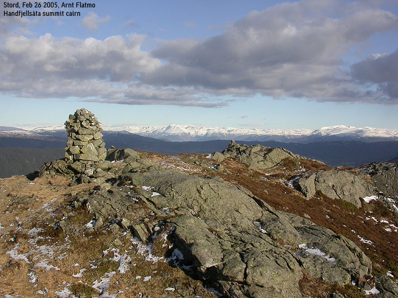
The summit is marked by a proper cairn.
|
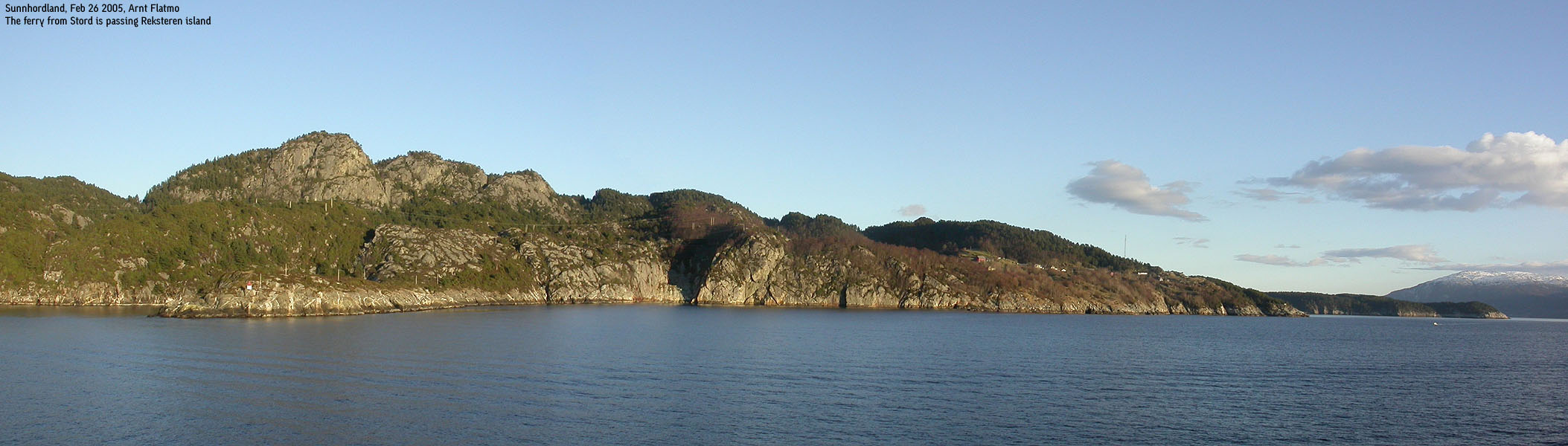
Trip report Feb 26 2005I was on my way to this mountain after hiking Melsåta. I had only one more (independent) mountain to do in Fitjar. No big feat in itself, as there are only three. But still, another kommune was soon to be "ticked off" I wasn't interested in a long approach to this mountain, and looked for the shortest possible route. This had to be from Hovland, on the east side of the mountain. I drove up to the nearest house and asked for trail info. I was sent to the neighbour, and he just pointed up the forest. On my many hikes, I've run into this situation on several occasions. They just point towards the mountain. "It's there", they say. And who am I to argue... I let the dog stay in the car while I headed up a gravel road to the uppermost cabin. The time was now 14:45PM, and it was 1h:45m since I was standing on top of Melsåta. I found a new forest road that would slightly reduce the amount of forest fight. At the end of the forest (tractor) road, I had a feeling I was on some kind of path, but wasn't quite sure. I didn't spend time wondering about this, and just aimed for the top. Heading up the birch forest wasn't cumbersome at all. Above the forest, I got the east ridge in clear view, and kept a direct line up the ridge. This involved minor scrambling, which is easy to avoid by simply bypassing the obstacles. I had a tremendous view towards the Rosendal mountains along this ridge, and as the weather was much better than earlier in the day, I had a great time on my way up the mountain. The digital camera was running warm after numerous panoramas of the Rosendal and Uskedalen mountains. After going over some humps on the ridge, I was standing on the top 15:35PM. I was impressed with the views from this - fairly - low top. I took a final round of pictures, knowing these would be the only pictures I would use on the web page. I then headed back down, and was back at the car 16:05PM. Troll was sleeping and seemed only moderately happy about being brought back to the real life. After a change of clothes, I drove Sandvikvågen, and the ferry came in at the same time. Excellent timing. A good day in the mountains, and Fitjar could be "ticked off" the list.
Pictures from the Feb 26 2005 hike
Move cursor to read notes, and click on the images to see full version.
No Javascript: 1 2 3 4 5 6 7 8 9 10 11 12 13 14
|

No Javascript:
Other hordaland mountains
 Other Fitjar K. mountains
westcoastpeaks.com
Other Fitjar K. mountains
westcoastpeaks.com


